Fernweh: Home
ExploreGuideDestinationsMy tripsMy trip
de|en
All Places & RegionsRound tripsNight trains in EuropeAll highlightsAbout FernwehFAQPrivacy PolicyImprint
Download on the App StoreGet it on Google Play
ExploreGuideDestinationsMy tripsMy trip
    • Places in the region
    • Culture
    • Getting around
    • Nearby
    Nationalpark Henri Pittier und Choroní

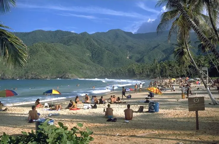
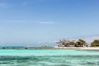
    “Beach choroni venezuela” by Matthias Scholz / Wikimedia Commons / CC BY-SA 3.0, mod.

    Venezuela

    Nationalpark Henri Pittier und Choroní

    Region

    For this area, the FCDO advises against travel unless it is essential. Check the FCDO travel advice, linked on the country page, before planning.

    by Felix Gillen

    1. Home
    2. Destinations
    3. Venezuela
    4. Nationalpark Henri Pittier und Choroní
    For this area, the FCDO advises against travel unless it is essential. Check the FCDO travel advice, linked on the country page, before planning.Henri Pittier National Park in Aragua state was established in 1937 as Venezuela's first national park and covers around 1,078 km², from the cloud forests of the coastal range down to the Caribbean. With around 580 recorded bird species, it is regarded as one of the richest birding areas in the country.Roads cross the mountains from Maracay to the coast: to Choroní with its colonial village and the fishing village of Puerto Colombia, and to Bahía de Cata.
    Venezuela travel guideRound trips in VenezuelaPlan a trip with Nationalpark Henri Pittier und Choroní

    Contents

    • Places in the region
    • Culture
    • Getting around
    • Nearby

    Sights in Nationalpark Henri Pittier und Choroní

    Discover the most important sights and attractions

    Point of Interest

    Bay of Cata

    The bay west of Choroní is known for its fine sand and clear, calm waters. It is located approximately 58 km from Maracay on the road via El Limón and Ocumare de la Costa.
    Open in Google Maps
    Attraction

    Rancho Grande Biological Station

    The research station of the Universidad Central de Venezuela is located at around 1,100 m in the park's cloud forest, where research has been conducted since 1940. Nearby, the Portachuelo Pass, at 1,136 m, serves as a migration corridor for birds and insects.
    Open in Google Maps
    Beach

    Playa Grande and Puerto Colombia

    At fishing village Puerto Colombia, the coast's tourist hub, lies the palm-fringed main beach. From its promenade, boats go to secluded coves like Chuao and Cepe. Old colonial Choroní, with cobbled streets and Santa Clara de Asís Church on Plaza Bolívar, is just inland.
    Open in Google Maps

    Cacao and drums

    Fiesta de San JuanOn the evening of 23 June the feast of San Juan Bautista begins with drums and processions, particularly lively in Choroní in Aragua. The San Juan festive cycle has been on UNESCO's Intangible Cultural Heritage list since 2021.Cacao from ChuaoThe coastal village of Chuao in the park is known for its cacao; boats run there from Puerto Colombia.

    Getting there and around

    Check the FCDO travel advice for this area before planning.Over the mountains to the coastMaracay to Choroní: around 50 km of winding mountain road through the cloud forest, about 2 hours.Maracay to Bahía de Cata: around 58 km via the road through El Limón and Ocumare.On the spotFrom the waterfront in Puerto Colombia, boats run to bays such as Chuao and Cepe that cannot be reached by road.

    Nearby

    Caracas

    Caracas

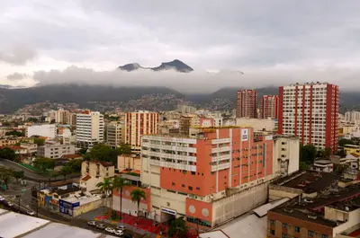
    For this area, the FCDO advises against travel unless it is essential. Check the FCDO travel advice, linked on the country page, before planning.Venezuela's capital lies at around 900 m in a valley between the Caribbean coast and the Ávila massif. Of particular interest to travellers are Carlos Raúl Villanueva's Ciudad Universitaria, a UNESCO World Heritage Site since 2000, and the old town around Plaza Bolívar with the house where Simón Bolívar was born.The earthquakes of 24 June 2026 damaged several historic buildings in Caracas, including the cathedral, the Panteón Nacional and parts of the university city; the cable car up the Ávila has been out of service since then. Check what is open before you visit.

    Joaquim Pacheco·Pexels

    Morrocoy National Park

    For this area, the FCDO advises against travel unless it is essential. Check the FCDO travel advice, linked on the country page, before planning.Morrocoy National Park on the Caribbean coast of Falcón state has protected cays, mangroves and coral reefs since 1974. It is about four hours by car from Caracas, which makes it the classic beach destination on the mainland.The gateways are Tucacas and Chichiriviche, from where boats run to cays such as Cayo Sombrero and Cayo Sal. Since February 2026 visitors have had to register via an app.
    Los Roques

    Los Roques

    For this area, the FCDO advises against travel unless it is essential. Check the FCDO travel advice, linked on the country page, before planning.The Los Roques archipelago lies in the Caribbean around 130 km off the coast north of Caracas and has been a national park since 1972. Dozens of islands and cays with white sand, lagoons and coral reefs make it a destination for swimming, snorkelling and sailing.The only permanently inhabited island is Gran Roque, with the airstrip, guesthouses and the village; boats take you to the other islands. Since 1996 the archipelago has also been listed as a Ramsar wetland of international importance.

    Fuka jaz·Pexels

    The South: Salt Pans and Lac Bay

    The South: Salt Pans and Lac Bay

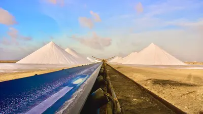
    Bonaire's flat south is characterized by salt pans. Along the coast stand small stone huts from the mid-19th century, where enslaved salt workers were housed. On the east coast lies the shallow Lac Bay with Sorobon Beach, known to windsurfers.

    Pascal Ingelrest·Pexels

    Kralendijk

    Kralendijk

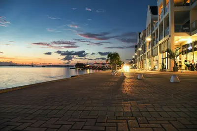
    Kralendijk is Bonaire's capital and is located on the sheltered west coast, opposite the uninhabited island of Klein Bonaire. Most of the island's restaurants, dive shops, and stores are found here.From the shore, water taxis depart for Klein Bonaire; the crossing takes about ten minutes. The marine park's dive sites along the coast are recognizable by yellow stones at the roadside.

    Steve Phillips·Unsplash

    Your next steps

    Nationalpark Henri Pittier und Choroní is in Venezuela. Ways to carry on from here.

    • More in Venezuela

      Highlights, areas, routes and the best time to travel for all of Venezuela.

      Venezuela travel guide
    • Round trips in Venezuela

      Ready-made routes through Venezuela, with stops, nights and a map.

      See the routes
    • Plan a trip with Nationalpark Henri Pittier und Choroní

      The Guide asks about season, length and who is coming, and suggests a trip with Nationalpark Henri Pittier und Choroní.

      Plan the trip
    Sources & method

    • Photos: Wikimedia Commons. Each photo carries its credit.
    • Place data such as addresses and ratings comes from Google Maps.
    • The content is based on web research from public, traceable sources. How the content is made · The role of AI