Fernweh: Home
ExploreGuideDestinationsMy tripsMy trip
de|en
All Places & RegionsRound tripsNight trains in EuropeAll highlightsAbout FernwehFAQPrivacy PolicyImprint
Download on the App StoreGet it on Google Play
ExploreGuideDestinationsMy tripsMy trip
    Chachapoyas and Kuélap

    Draceane / Wikimedia Commons / CC BY-SA 4.0, mod.

    Peru

    Chachapoyas and Kuélap

    RegionCulture

    The Northern Highlands around Chachapoyas is home to the Chachapoya culture, with its fortress Kuélap at about 3,000 m above the Utcubamba Valley.

    by Felix Gillen

    1. Home
    2. Destinations
    3. Peru
    4. Chachapoyas and Kuélap
    The Northern Highlands around Chachapoyas is home to the Chachapoya culture, with its fortress Kuélap at about 3,000 m above the Utcubamba Valley. Also found are rock tombs like the Karajía Sarcophagi and the Gocta Waterfall in the mountain forests. Chachapoyas, founded by the Spanish in 1538, is the base for excursions into the region.
    Peru travel guideRound trips in PeruPlan a trip with Chachapoyas and Kuélap

    More places in Chachapoyas and Kuélap

    Kuélap

    JYB Devot·CC BY-SA 4.0

    Kuélap

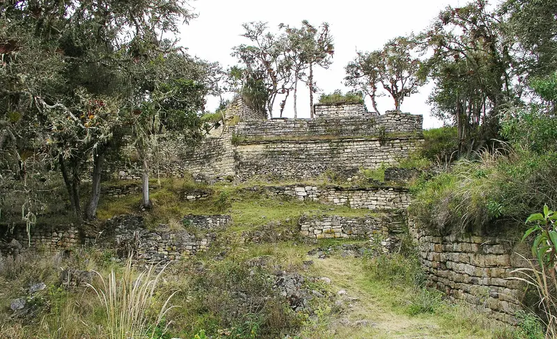
    Kuélap is a fortress of the Chachapoya culture at around 3,000 m above the Utcubamba Valley. Behind walls up to around 20 m high stand more than 450 round stone houses, some with geometric friezes. The starting point is Chachapoyas, from where you can also reach the Gocta Waterfall and the sarcophagi of Karajía.

    Sights in Chachapoyas and Kuélap

    Discover the most important sights and attractions

    Attraction

    Sarcophagi of Karajía

    The up to 2.50 m high sarcophagi of the Chachapoya stand in a row on a difficult-to-access rock ledge in the Luya District.
    Open in Google Maps
    Gocta Waterfall

    Jaimruiz / Wikimedia Commons / CC BY-SA 4.0, mod.

    Attraction

    Gocta Waterfall

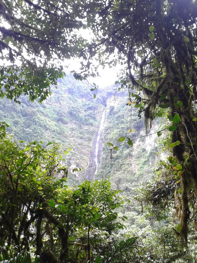
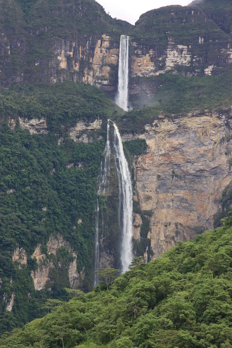
    The waterfall between Cocachimba and San Pablo de Valera in the Bongará province plunges 771 m in two stages. It only became internationally known in 2006 through German researcher Stefan Ziemendorf. To reach the base of the waterfall, you hike more than 6 km.
    Open in Google Maps

    Nearby

    North Coast (Trujillo)

    North Coast (Trujillo)

    On the north coast around Trujillo were the centers of two great pre-Inca cultures: The Moche built here the Huacas del Sol y de la Luna, the Chimú their capital Chan Chan, the largest adobe city in the Americas. The fishing village of Huanchaco, with its reed boats and surf waves, is just a few kilometers away. For Trujillo and parts of the region, a state of emergency is temporarily in effect; please note the current travel advisories from the Foreign Office before your trip.

    Maria Camila Castaño·Pexels

    Trujillo

    Trujillo

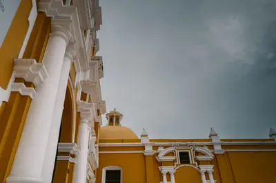
    Trujillo, the capital of the La Libertad region, was founded in 1534 and named after Francisco Pizarro's hometown in Extremadura. The city center features a grid of streets with colorful colonial houses and wrought-iron window grilles surrounding the Plaza de Armas with its cathedral.Most visitors come for the archaeological sites on the outskirts of the city: Chan Chan, the Chimú capital, and the temple pyramids Huaca del Sol and Huaca de la Luna of the Moche. In the nearby seaside town of Huanchaco, fishermen still go out to sea in traditional reed boats, the Caballitos de Totora, while the waves attract surfers.The Federal Foreign Office reports a current state of emergency in Trujillo. Check the current situation there before traveling.

    Joshuan Barboza·Pexels

    Chan Chan

    Chan Chan

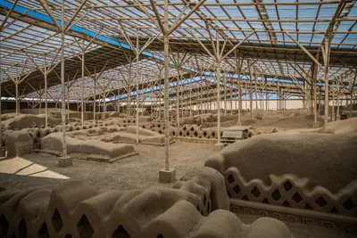
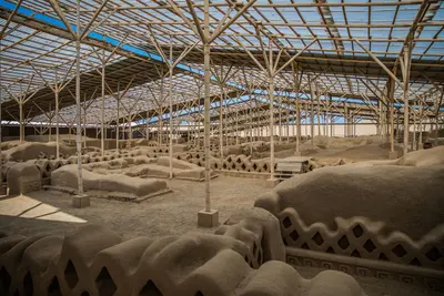
    Chan Chan was the capital of the Chimú Empire, which dominated Peru's northern coast until the Inca conquered it around 1470. The city on the outskirts of Trujillo covered approximately 20 square kilometers and is considered the largest adobe city in the Americas. Its core consists of walled palace compounds with courtyards, storerooms, and walls into which reliefs of fish, birds, and geometric patterns are sculpted.UNESCO inscribed Chan Chan on its World Heritage List in 1986 and simultaneously placed it on the List of World Heritage in Danger, because rain and wind attack the adobe. Visitors can primarily explore the restored Tschudi (Nik An) palace complex and the museum at the entrance.

    Maria Camila Castaño·Pexels

    Huascarán National Park

    Huascarán National Park

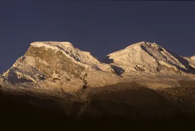
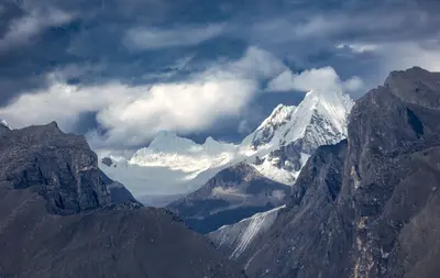
    Huascarán National Park encompasses almost the entire Cordillera Blanca: glaciers, hundreds of high-altitude lakes, and Huascarán, Peru's highest mountain at 6,768 meters. The park was founded in 1975, has been a biosphere reserve since 1977, and a UNESCO World Heritage site since 1985.Laguna 69: the most famous day hike, a turquoise glacial lake at around 4,600 meters. The starting point is Cebollapampa, and the round trip takes about six to seven hours.Lagunas de Llanganuco: two lakes at around 3,850 meters on the way to Laguna 69, also a stop for day trips from Huaraz.Laguna Churup above Huaraz is suitable as an acclimatization hike.You need a ticket for the park, available as a day, three-day, or month pass. Camping is not allowed at Laguna 69.

    Maurice Chédel·public domain

    Huaraz and Cordillera Blanca

    Huaraz and Cordillera Blanca

    In the Ancash region of northern Peru rises the Cordillera Blanca, the world's highest tropical mountain range. Nearly the entire massif belongs to Huascarán National Park, a UNESCO World Heritage site since 1985, named after Huascarán, Peru's highest peak at 6,768 meters. The city of Huaraz is the starting point for day hikes, trekking tours, and mountaineering.

    Marek Piwnicki·Pexels

    Your next steps

    Chachapoyas and Kuélap is in Peru. Ways to carry on from here.

    • More in Peru

      Highlights, areas, routes and the best time to travel for all of Peru.

      Peru travel guide
    • Round trips in Peru

      Ready-made routes through Peru, with stops, nights and a map.

      See the routes
    • Plan a trip with Chachapoyas and Kuélap

      The Guide asks about season, length and who is coming, and suggests a trip with Chachapoyas and Kuélap.

      Plan the trip
    Sources & method

    • Photos: Wikimedia Commons. Each photo carries its credit.
    • Place data such as addresses and ratings comes from Google Maps.
    • The content is based on web research from public, traceable sources. How the content is made · The role of AI