ExploreTravel GuidesPlan a trip
    de|en
    All Places & RegionsAbout FernwehFAQPrivacy PolicyImprint
    ExploreTravel GuidesPlan a trip
    • Neighborhoods & highlights
    • Eat & drink
    • Culture
    • Nightlife
    • Getting around
    • Accommodation
    • Plan trip
    • Nearby
    Koblenz

    Germany

    Koblenz

    CityUNESCO

    Koblenz liegt dort, wo die Mosel in den Rhein mündet, und ist das nördliche Tor zum UNESCO-Welterbe Oberes Mittelrheintal.

    1. Home
    2. Destinations
    3. Germany
    4. Middle Rhine
    5. Koblenz
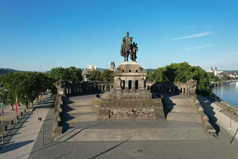
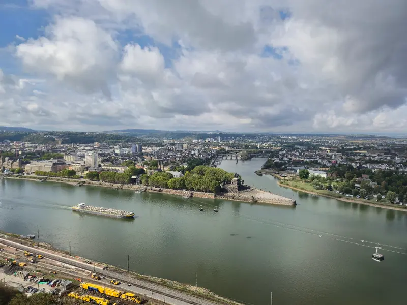
    Koblenz liegt dort, wo die Mosel in den Rhein mündet, und ist das nördliche Tor zum UNESCO-Welterbe Oberes Mittelrheintal. Die rund 114.000 Einwohner zählende Stadt geht auf ein römisches Kastell zurück, dessen Name „apud confluentes“, bei den Zusammenfließenden, im heutigen Stadtnamen steckt.Am Deutschen Eck steht das Reiterstandbild Kaiser Wilhelms I. über dem Zusammenfluss, gegenüber thront auf dem Felsen die Festung Ehrenbreitstein, eine der größten erhaltenen Festungsanlagen Europas. Eine Seilbahn verbindet beide Ufer. Dazwischen liegt eine kompakte Altstadt mit romanischen Kirchen, kleinen Plätzen und Weinstuben, von der aus du Burgen am Rhein und Ausflüge an die Mosel gut erreichst.
    With around 114,000 inhabitants, Koblenz is the largest city on the Middle Rhine and can be easily explored on foot. The Old Town is situated at the confluence of the Rhine and Moselle, extending from Görresplatz via Münzplatz and Florinsmarkt to Deutsches Eck. Along the Rhine, the 3.5-kilometer-long Rheinanlagen promenade stretches southwards; on the opposite bank lie the Ehrenbreitstein district and the fortress, which you can reach by cable car. For a first visit, one to two days are sufficient, but more time is worthwhile as a base for excursions into the Middle Rhine Valley and to the Moselle.

    Sights in Koblenz

    Discover the most important sights and attractions

    German Corner
    Attraction

    1German Corner

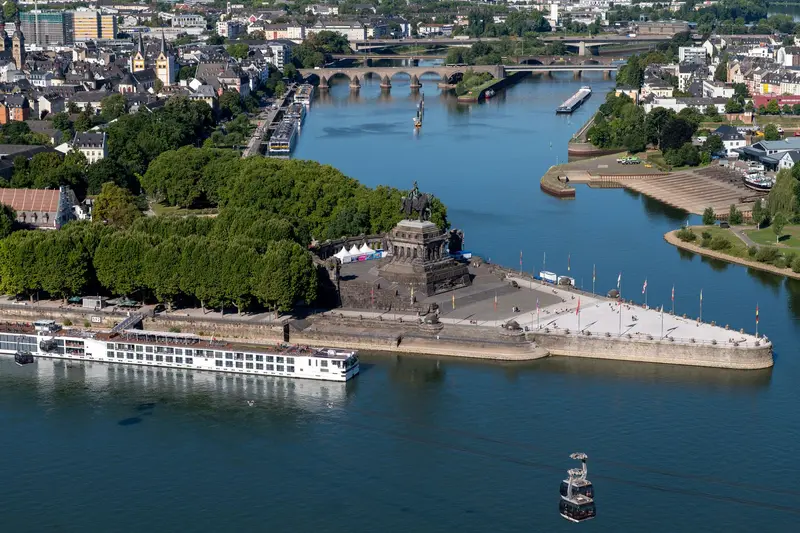
    Headland at the confluence of the Rhine and Moselle, named after the Teutonic Order settling here in the 13th century. The 37-meter-high Kaiser Wilhelm Monument was inaugurated in 1897, its equestrian statue destroyed in 1945 and re-erected as a replica in 1993. From the top, you see Ehrenbreitstein Fortress.
    Open in Google Maps
    Ehrenbreitstein Fortress
    Park

    2Ehrenbreitstein Fortress

    The Prussians built the fortress between 1817 and 1828 on the rock opposite the Deutsches Eck, ranking it among Europe's largest preserved fortress complexes. In four exhibition buildings, the Landesmuseum Koblenz showcases archaeology, photography, wine culture, as well as economic and cultural history. In 2026, it is open daily until November 1st, from 10 AM to 6 PM. Adults pay 10 Euros, or 21.90 Euros for a combi-ticket including the cable car.
    Open in Google Maps
    Basilica St. Kastor
    Church

    3Basilica St. Kastor

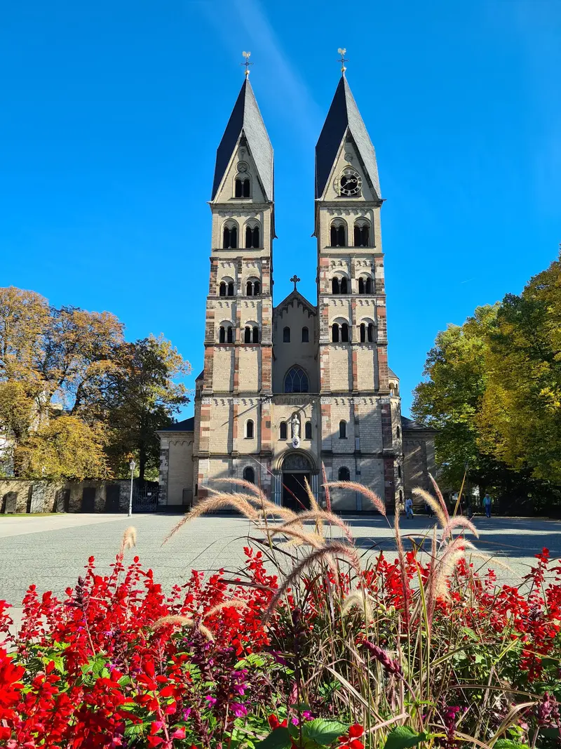
    The oldest church in Koblenz stands near the Deutsches Eck and preserves Romanesque architecture, with its origins dating back to the 9th century. Right next door is the valley station of the cable car to the fortress.
    Open in Google Maps
    Cable Car Koblenz
    Attraction

    4Cable Car Koblenz

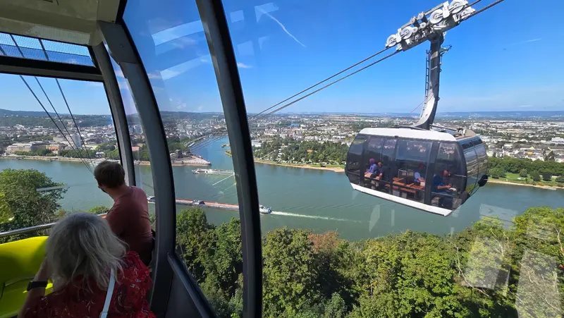
    Since 2011, cabins soar from the Rhine Embankments by St. Castor over the Rhine to Ehrenbreitstein Fortress, ascending 112 meters. From above, you'll see the Rhine and Moselle confluence; Cabin 17 has a glass floor. The cable car operates 2026 from March 16 to November 1.
    Open in Google Maps
    Liebfrauenkirche
    Church

    5Liebfrauenkirche

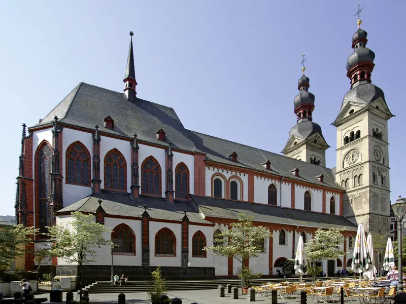
    The church with its onion domes defines the silhouette of the old town and has been a spiritual center of the city since the Middle Ages. From Münzplatz, the painted Kunstgässchen leads directly to it.
    Open in Google Maps
    Florin Market
    Historic Landmark

    6Florin Market

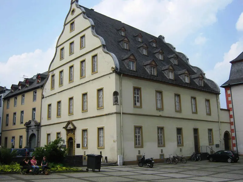
    On the square stands the Gothic Merchants' and Dance House from 1419, whose clock is adorned by the “Augenroller,” a figure believed to represent the robber baron Johann Lutter von Kobern. Opposite stands the Romanesque Florinskirche, above whose baptismal font a cannonball commemorates the city's destruction in 1688.
    Open in Google Maps

    Restaurants in Koblenz

    1

    Old Brewhouse

    Traditional restaurant in the Old Town with German cuisine like Schnitzel and sausages and draft beer. Very popular with guests, a reservation is recommended during peak hours.
    Show on Google Maps
    2

    Project Vegan

    Vegetarian-vegan restaurant in Kastorstraße, just a few steps from St. Kastor and the Rhein.
    Show on Google Maps
    3

    60 seconds to Naples

    Pizzeria in Entenpfuhl right in the middle of the Old Town, also for takeout. An uncomplicated address for a break between the sights.
    Show on Google Maps

    History and Culture

    Romans, Prince-Electors and PrussiansUnder Augustus, a Roman fort, the “castellum apud Confluentes,” was built at the confluence. In 1018, Koblenz came under the control of the Church of Trier, whose archbishops governed the city until the French Revolution. The last Prince-Elector, Clemens Wenzeslaus, moved into the new Electoral Palace on the Rhine in 1786 but fled from French troops as early as 1794. After the French period, Koblenz became the administrative seat of the Prussian Rhineland, and the Prussians developed Ehrenbreitstein into today's fortress between 1817 and 1828.Destruction and ReconstructionDuring the Second World War, 87 percent of the city was destroyed. The equestrian statue at Deutsches Eck, unveiled in 1897, fell victim to a grenade hit in March 1945. In 1953, Federal President Theodor Heuss declared the empty plinth a memorial to German unity, and in 1993, a replica of the figure returned. In 2011, Koblenz hosted the first Federal Horticultural Show in Rhineland-Palatinate, and since then, the cable car has connected the old town with the fortress.The SchängelThe name Schängel originated during the French period from “Jean,” dialectally “Schang,” and was initially meant disparagingly. Today, it is an honorary title for native Koblenzers. The Schängel Fountain in the courtyard of the City Hall, inaugurated in 1941, depicts a boy who spits water every few minutes, and you can even encounter the figure on manhole covers.

    Nightlife

    1

    Pressure chamber

    Old Town cellar bar featuring Industrial and Gothic DJ nights, concerts, and a wide selection of absinthe.
    Show on Google Maps
    2

    M's Gastwerk

    Wine and cocktail bar in the Old Town, Unterm Stern, with a lounge atmosphere. Perfect for an evening glass of wine.
    Show on Google Maps
    3

    Cuvée DIEHLs Lounge

    Lounge bar with beer garden on the Rheinsteig bank in Ehrenbreitstein, with views over the Rhine to the Old Town.
    Show on Google Maps

    Getting There and Around

    Getting ThereTrain: Koblenz Central Station is on the Rhine railway line. Bonn is about half an hour away, Cologne or Mainz just under an hour. Regional trains run along both Rhine banks and the Moselle to Trier. Some local trains also stop at Koblenz-Stadtmitte, closer to the Old Town and Rhine.Plane: The most convenient airports are Frankfurt am Main, with direct trains taking around one and a half hours, and Cologne/Bonn.In the CityOn Foot: The Old Town, Rhine promenades, and Deutsches Eck are all close to each other.Cable Car: The cable car starts at the Rhine promenades near St. Castor's Basilica and ascends 112 meters to the fortress. In 2026, it operates from March 16 to November 1, Sundays to Thursdays from 10 AM to 7 PM, Fridays until 11 PM, and Saturdays until 10 PM. Cabin 17 has a glass floor. Alternatively, an accessible inclined elevator takes you up from the Ehrenbreitstein district.Boat: At the Konrad-Adenauer-Ufer, excursion boats of the Köln-Düsseldorfer company depart, offering panoramic cruises and tours towards Loreley, among others.

    Accommodations in Koblenz

    Find perfect stay in Koblenz

    Booking.com* (Affiliate link)
    Search Hotels
    Agoda* (Affiliate link)
    Search Hotels
    Airbnb
    Vacation Rentals

    * Affiliate link: if you book through it, we earn a small commission. The price stays the same for you.

    Campgrounds in Koblenz

    Find perfect campground in Koblenz

    Search via Google Maps
    Campgrounds nearby (15km)
    Camping.info
    Find Campgrounds
    Park4Night
    RV Parks & Camping

    Plan your trip to Koblenz

    Save places, build a route and plan your city trip, all in one place.

    1. 1
      1234

      Round trip

      12 days · 4 stops

      Saved

      Pick a route

      Pick a ready-made one or save places and plan your own.

      Open bookmarks
    2. 2

      Trip to Koblenz

      Live
      • 1German Corner3 days
      • 2Ehrenbreitstein Fortress4 days
      • 3Basilica St. Kastor5 days
      Budget

      Plan your trip

      The planner sorts stops, days and budget. Plan together in real time.

      Start trip planning
    3. 3
      9:41 No signal
      Available offline

      Use it on the road

      Download the guide to your phone and use it on site, even offline.

    Nearby

    Marksburg

    Marksburg

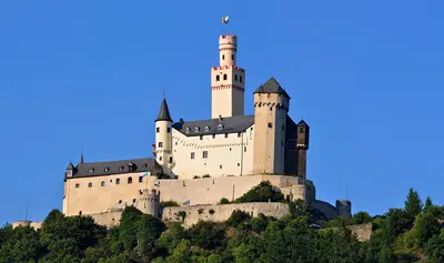
    The Marksburg, above Braubach, south of Koblenz, is considered the only never-destroyed hilltop castle on the Middle Rhine. Construction of the keep began in the 12th century; the castle has been inhabited for over 700 years, and its buildings from the 13th to 15th centuries have been preserved.Today, it is the seat of the German Castles Association. In 2026, it will be open daily from April 3 to October 31, from 10 AM to 5 PM. A visit gives you a vivid impression of how a medieval castle was built and fortified.
    Boppard

    Boppard

    Boppard is situated on a large bend of the Rhine, about 20 kilometers south of Koblenz, and has a population of just over 15,000. Within the town, remains of the Roman fort Bodobrica are preserved, considered one of the best-preserved forts north of the Alps. Its southern part is freely accessible as an archaeological park.On the market square stands the two-towered Romanesque Church of St. Severus, while the Electoral Castle houses the town museum. From April to October, a chairlift takes you from Mühltal up to the Vierseenblick, where the mountains conceal the river so it appears like four lakes, and to Gedeonseck, offering views of the vineyards of the Bopparder Hamm.
    Middle Rhine

    Middle Rhine

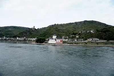
    Zwischen Bingen und Koblenz zwängt sich der Rhein durch ein enges Schiefertal zwischen Hunsrück und Taunus. Auf diesem Abschnitt, dem Oberen Mittelrheintal, reihen sich rund 40 Burgen, Schlösser und Festungen, Weinbergterrassen und kleine Städte mit Stadtmauern wie Bacharach und Oberwesel. Seit 2002 ist das Tal UNESCO-Welterbe.Am engsten wird es an der Loreley bei St. Goarshausen. Zwischen Mainz und Koblenz gibt es keine Straßenbrücke, über den Fluss bringen dich Fähren. Bei extremem Niedrigwasser, wie im August 2026, kann der Fähr- und Schiffsverkehr eingestellt werden, prüfe dann vorab die aktuellen Fahrpläne. Auf beiden Ufern fahren Züge, und der Rheinsteig führt rechtsrheinisch über die Höhen. Im Norden, an der Mündung der Mosel, liegt Koblenz als größte Stadt der Region.
    Maria Laach & Lake Laach

    Maria Laach & Lake Laach

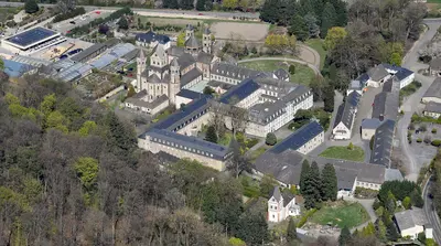
    On the southwest shore of Lake Laach stands the Benedictine Abbey of Maria Laach, founded in 1093 by Count Palatine Heinrich II. von Laach and his wife Adelheid. The Romanesque abbey church was consecrated in 1156; its narthex, known as the "Paradies" (Paradise), is considered the last surviving example of its kind north of the Alps. Today, the monastery includes a book and art shop, a large nursery, and an art smithy.Lake Laach itself is approximately 3.3 square kilometers in size, up to 51 meters deep, and is considered Central Europe's only water-filled caldera. It was formed during a volcanic eruption approximately 13,000 years ago. On its southeastern shore, carbon dioxide still rises today from so-called mofettes. Since 1935, the lake and its surroundings have been under nature protection.
    Burg Eltz

    Burg Eltz

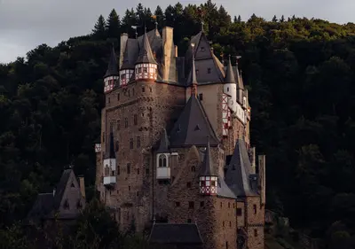
    Eltz Castle stands on a roughly 70-meter high rock spur in a loop of the Elz River, nestled between the Moselle, Eifel, and Maifeld regions. It originated in the 12th century, was never seriously destroyed, and still belongs to the same family, now in its 33rd generation. Many recognize its image from the former 500 D-Mark banknote.From the parking lot near Wierschem, it's about a 10-minute walk, or you can take the shuttle bus. Hikers can reach the castle via the Traumpfad Eltzer Burgpanorama trail. The guided tour shows the interiors of the Rübenach and Rodendorf houses; the ticket includes the Treasury. It is open seasonally from April to early November.