Fernweh: Home
ExploreGuideDestinationsMy tripsMy trip
de|en
All Places & RegionsRound tripsNight trains in EuropeAll highlightsAbout FernwehFAQPrivacy PolicyImprint
Download on the App StoreGet it on Google Play
ExploreGuideDestinationsMy tripsMy trip
    • Places & highlights
    • Recommendations
    • Eat & drink
    • Food culture
    • Culture
    • Getting around
    • Accommodation
    • Round trips
    • Nearby
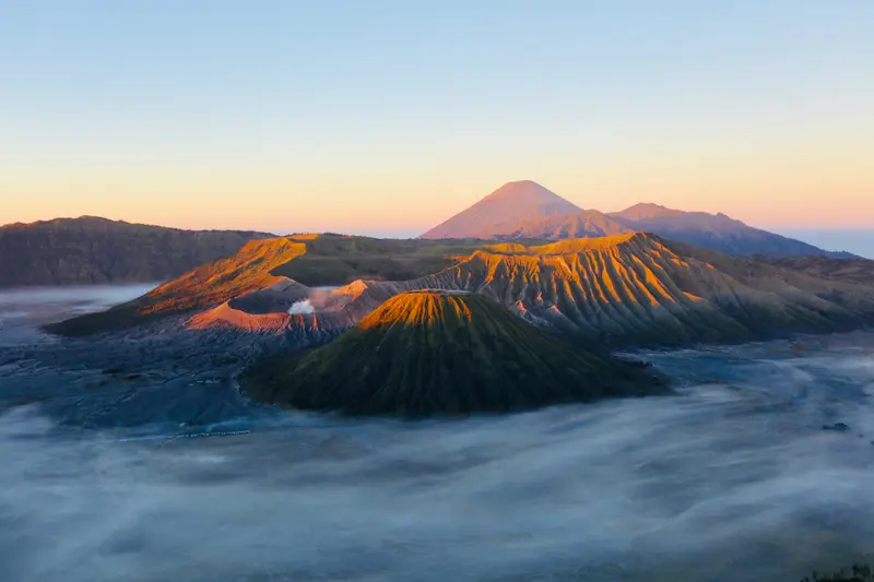
    Bromo Tengger Semeru National Park

    Photo by Lim Jia Le on Pexels

    Indonesia

    Bromo Tengger Semeru National Park

    National ParkCulture

    The National Park encompasses the Tengger Caldera with the smoking Bromo, a vast sea of sand, and Semeru, at 3,676 m Java's highest mountain. The sunrise over the caldera is one of Indonesia's most famous views.

    by Felix Gillen

    1. Home
    2. Destinations
    3. Indonesia
    4. East Java
    5. Bromo Tengger Semeru National Park
    The National Park encompasses the Tengger Caldera with the smoking Bromo, a vast sea of sand, and Semeru, at 3,676 m Java's highest mountain. The sunrise over the caldera is one of Indonesia's most famous views.
    Indonesia travel guideSee the round tripPlan a trip with Bromo Tengger Semeru National Park

    Contents

    • Places & highlights
    • Recommendations
    • Eat & drink
    • Food culture
    • Culture
    • Getting around
    • Accommodation
    • Round trips
    • Nearby

    Sights in Bromo Tengger Semeru National Park

    Discover the most important sights and attractions

    Temple

    1Pura Luhur Poten

    Tengger Hindu Temple in the Sand Sea at the foot of Bromo, starting point for the ascent to the crater.
    Open in Google Maps
    Penanjakan

    Photo by Kevin Zhang on Unsplash

    Attraction

    2Penanjakan

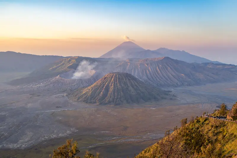
    Viewpoint on the rim of the Tengger Caldera at around 2,770 meters, from which you look out at Bromo, Batok, and Semeru in the background at sunrise. Below you lies the Sea of Sand, from which the 2,329-meter-high Bromo rises; many visitors initially mistake the prominent Batok in front of it for Bromo. Most visitors arrive via jeep tours that depart in the middle of the night; the platforms at the highest viewpoint, Penanjakan 1, are then crowded, while King Kong Hill is located a little lower. Come early, as the viewpoint fills up from around four o'clock; you'll find quieter spots on paths away from the platforms or at the Seruni Viewpoint, and by six o'clock the crowds thin out again. Dress warmly; with 0-10 degrees Celsius and wind, you'll need a jacket, hat, and gloves.
    Open in Google Maps
    Attraction

    3Bukit Teletubbies

    Green, rolling hills south of the caldera, especially vibrant during the rainy season. A regular stop on jeep tours.
    Open in Google Maps
    Attraction

    4Pasir Berbisik

    Part of the Sand Sea, whose name means 'whispering sand', after the sound of the wind over the volcanic sand.
    Open in Google Maps

    Restaurants in Bromo Tengger Semeru National Park

    Food & Beverages

    Warungs in Cemoro Lawang

    Simple local spots with Nasi Goreng, Mie, and hot tea for before and after sunrise.

    Tengger Potatoes and Vegetables

    On the steep slopes, the Tengger grow potatoes, cabbage, and leeks, which you can get in the Dorfwarungs.

    Spirit

    The Tengger in the villages around the caldera practice their own form of Hinduism. At the foot of Bromo stands the temple Pura Luhur Poten. During the annual Yadnya Kasada festival, they ascend to the crater and throw offerings like vegetables and chickens into it.

    Getting There and Around

    Getting ThereVia Probolinggo: From Surabaya, approximately 2 hours to Probolinggo, then about 1.5 hours by minibus to Cemoro Lawang on the caldera rim. Minibuses operate during the day.From Malang: Jeep tours via Tumpang take 2 to 2.5 hours. From Cemoro Lawang to Malang is about 2 hours.Bromo and Ijen: Many combine both on a two- to three-day tour between Surabaya or Malang and Banyuwangi.Tickets and Rules (As of Autumn 2026)Online only: Tickets are exclusively available via the national park's official booking portal (bromotenggersemeru.id); nothing is sold at the gates. The name on the ticket must match your ID.Price: For foreign visitors, most recently around 255,000 IDR; check the current amount on the portal.Quota: A maximum of about 2,750 visitors per day across all access points (Cemoro Lawang, Wonokitri, Jemplang, Coban Trisula, Senduro).Fires: In 2026, the park was repeatedly closed during the dry season due to forest and savannah fires, from August 8 to 20 and September 12 to 19. Due to another fire, the Penanjakan sunrise viewpoint, including Bukit Kedaluh, was also temporarily closed from October 17, 2026. Open fires, campfires, and discarded cigarettes are prohibited.Volcano: On November 5, 2026, Mount Bromo emitted an ash column of approximately 500 meters; authorities advise against approaching the crater within one kilometer (as of November 6, 2026). Before your trip, check the national park's official channels and the current alert level at magma.vsi.esdm.go.id.Inside the ParkWithin the caldera, you can get around by jeep, horse, or on foot. Temperatures can drop close to 0 °C at night.

    Accommodations in Bromo Tengger Semeru National Park

    Find perfect stay in Bromo Tengger Semeru National Park

    Booking.com* (Affiliate link)
    Search Hotels
    Agoda* (Affiliate link)
    Search Hotels
    Airbnb
    Vacation Rentals

    * Affiliate link: if you book through it, we earn a small commission. The price stays the same for you.

    Round trips with Bromo Tengger Semeru National Park

    Java and Bali: Temples, Volcanoes and Rice Terraces

    Java and Bali: Temples, Volcanoes and Rice Terraces

    The route covers Yogyakarta (Borobudur, Prambanan), East Java's Bromo and Ijen volcanoes, and on Bali, Ubud, Sidemen, Amed, Nusa Lembongan, Uluwatu. Long-distance trains run between Yogyakarta and East Java. For Ijen, overnight in Banyuwangi; ferry from Ketapang crosses to Gilimanuk in about an hour. For Bali, a car with driver is most convenient.

    21 Days
    8 stops
    Open jaw

    Lim Jia Le·Pexels

    Nearby

    East Java

    East Java

    East Java stretches from Surabaya to the Bali Strait. Most visitors come for the volcanoes: Bromo in the Tengger Massif, Semeru, Java's highest peak, and Ijen with its turquoise crater lake.

    Unsplash

    Malang

    Malang

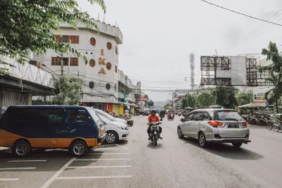
    Malang is located at an altitude of around 450m in the highlands of East Java, and is cooler than Surabaya. Colonial streetscapes, many students, and its proximity to Bromo make the city a popular stopover.

    Tamba Budiarsana·Pexels

    Surabaya

    Surabaya

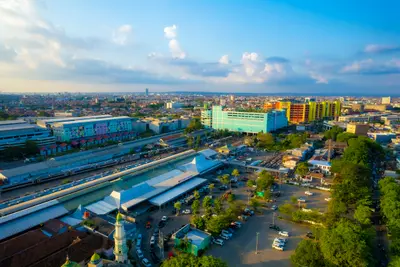
    Surabaya is the capital of East Java and, after Jakarta, Indonesia's second-largest city. The port city is primarily a transport hub, but it also boasts an old Arab quarter, colonial buildings, and a unique local cuisine.

    Unsplash

    Madura

    Madura

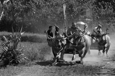
    Madura lies northeast of Surabaya and is accessible via the Suramadu Bridge. The dry, flat island is known for bull races, salt fields, Batik in vibrant colors, and its Sate cuisine, which is widespread throughout Indonesia.

    pierre matile·Pexels

    Ijen

    Ijen

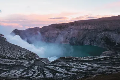
    The Ijen volcano in East Java harbors a turquoise, highly acidic crater lake. At night, blue flames from burning sulfur gases glow on the crater floor, by day, workers carry sulfur chunks from the crater.

    Ronald Pang·Pexels

    Your next steps

    Bromo Tengger Semeru National Park is in Indonesia. Ways to carry on from here.

    • More in Indonesia

      Highlights, areas, routes and the best time to travel for all of Indonesia.

      Indonesia travel guide
    • Round trips with Bromo Tengger Semeru National Park

      One route passes through Bromo Tengger Semeru National Park, with stops, nights and a map.

      See the round trip
    • Plan a trip with Bromo Tengger Semeru National Park

      The Guide asks about season, length and who is coming, and suggests a trip with Bromo Tengger Semeru National Park.

      Plan the trip
    Sources & method

    • Photos: Unsplash, Pexels. Each photo carries its credit.
    • Place data such as addresses and ratings comes from Google Maps.
    • The content is based on web research from public, traceable sources. How the content is made · The role of AI