Fernweh: Home
ExploreGuideDestinationsMy tripsMy trip
de|en
All Places & RegionsRound tripsNight trains in EuropeAll highlightsAbout FernwehFAQPrivacy PolicyImprint
Download on the App StoreGet it on Google Play
ExploreGuideDestinationsMy tripsMy trip
    • Places & highlights
    • Eat & drink
    • Food culture
    • Culture
    • Getting around
    • Accommodation
    • Round trips
    • Nearby
    Rinjani National Park

    Photo: Unsplash

    Indonesia

    Rinjani National Park

    National Park

    Gunung Rinjani, at 3,726 meters, is Indonesia's second-highest volcano and dominates northern Lombok. Its caldera contains the crescent-shaped crater lake Segara Anak, along with the young, active cone Barujari.

    by Felix Gillen

    1. Home
    2. Destinations
    3. Indonesia
    4. Lombok and the Gili Islands
    5. Rinjani National Park
    Gunung Rinjani, at 3,726 meters, is Indonesia's second-highest volcano and dominates northern Lombok. Its caldera contains the crescent-shaped crater lake Segara Anak, along with the young, active cone Barujari. Multi-day treks to the crater rim and summit are among Southeast Asia's most famous mountain tours.
    Indonesia travel guideSee the round tripPlan a trip with Rinjani National Park

    Contents

    • Places & highlights
    • Eat & drink
    • Food culture
    • Culture
    • Getting around
    • Accommodation
    • Round trips
    • Nearby

    Sights in Rinjani National Park

    Discover the most important sights and attractions

    Sendang Gile Waterfall

    Cath1406 / Wikimedia Commons / CC BY-SA 4.0, mod.

    Attraction

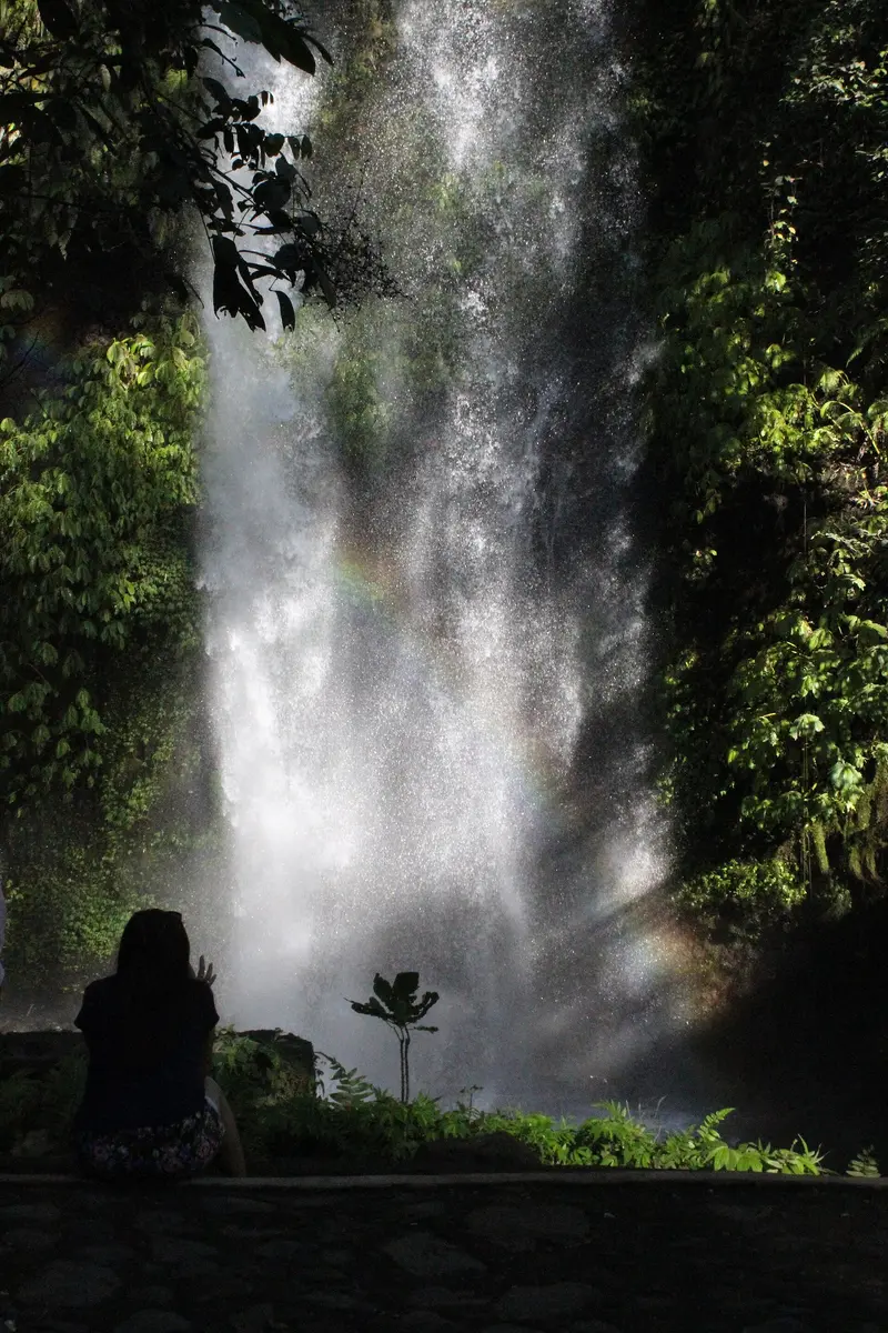
    1Sendang Gile Waterfall

    Two-tiered waterfall at the edge of Senaru, reachable in minutes via stairs through the forest.
    Open in Google Maps
    Tiu Kelep Waterfall

    “Tiu Kelep” by Jordy Meow / Wikimedia Commons / CC BY 3.0, mod.

    Attraction

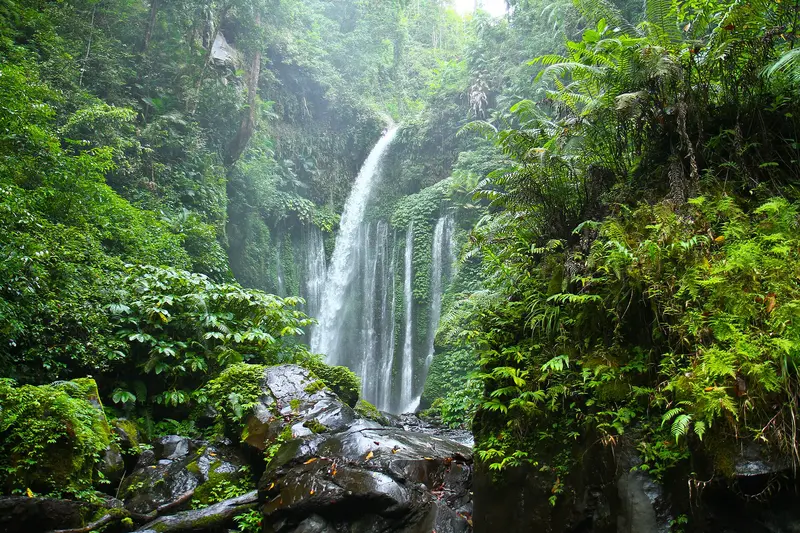
    2Tiu Kelep Waterfall

    Wide waterfall above Sendang Gile, which plunges into a basin. The trail crosses irrigation channels and through a stream; a local guide is advisable.
    Open in Google Maps
    Bukit Pergasingan

    Ricko rullyarto / Wikimedia Commons / CC BY-SA 4.0, mod.
    Attraction

    3Bukit Pergasingan

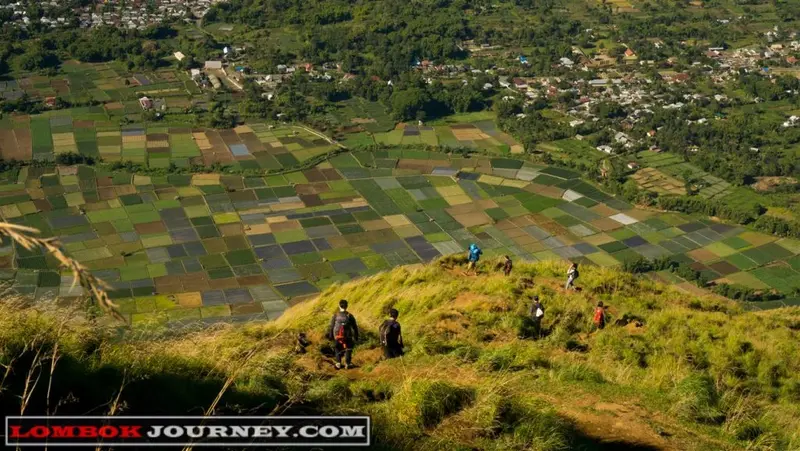
    Hill on the edge of Sembalun, with views over the patchwork of fields in the high valley and to Rinjani. The steep path takes two to three hours; simple campsites are at the top.
    Open in Google Maps
    Segara Anak Crater Lake

    Giovari max / Wikimedia Commons / CC BY-SA 4.0, mod.
    4Segara Anak Crater Lake

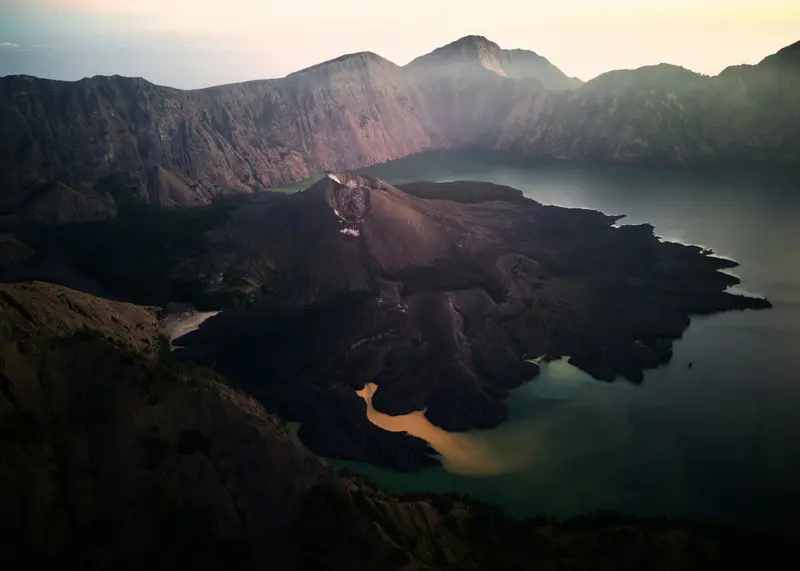
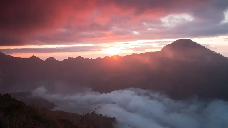
    A crescent-shaped lake in the Rinjani caldera, situated at an altitude of approximately 2,000 meters, from which the active cone Barujari rises. The caldera was formed in 1257 during the eruption of the ancestral volcano Samalas; Barujari later grew up in the east, giving the lake its crescent shape. The lake is sacred to the Sasak people and Balinese Hindus, with pilgrimage ceremonies held here annually. Hot springs, where trekkers can spend the night, are located on its shores. It is only accessible via multi-day tours with a guide and porters; registration is done through the eRinjani portal, and solo treks are prohibited. From January to March, the trekking routes are usually closed due to the rainy season.
    Open in Google Maps

    Restaurants in Rinjani National Park

    Food and Drink

    Food on the Mountain

    On treks, porters cook simple dishes like Nasi Goreng, noodle soup, and pancakes. Water is carried along or filtered at springs.

    Sembalun

    In the high valley, strawberries, potatoes, and garlic grow, and small warungs serve local coffee.

    Holy Mountain

    Nature and SignificanceFor the Sasak people and Balinese Hindus, Rinjani is a sacred mountain. Pilgrims ascend to the crater lake Segara Anak to make offerings and bathe in the hot springs on its shores. The protected area covers approximately 41,000 hectares of mountain forest, grassland, and volcanic landscape, and has been part of the UNESCO Geopark Rinjani-Lombok since 2018.The volcano is active. The Barujari cone in the crater lake last erupted in 2015 and 2016; the park is fully or partially closed during increased activity. On the northern slope lies the village of Senaru with its waterfalls and Wetu-Telu traditions, while in the east, the high valley of Sembalun features vegetable and strawberry fields.

    Trekking and Travel

    Getting ThereFrom Lombok Airport: About 2.5 hours to Sembalun and 3 hours to Senaru with a driver.Between the trailheads: Senaru and Sembalun are about a 45-minute drive apart. Most operators arrange the transfer.Planning Your TrekCurrent status: After a forest fire from 22 September 2026, the Senaru trail reopened on 3 October 2026, and online booking via eRinjani resumed. The Sembalun, Senaru, Timbanuh, Tetebatu and Aik Berik access points are open; the Torean trail remains closed (as of early October 2026). Check eRinjani for the latest status.Trailheads: Senaru in the north (forest ascent to the crater rim) and Sembalun in the east (open grassland, shortest route to the summit). Many tours go up from Sembalun and down to Senaru.Duration: Crater rim in two days; with the lake and summit three to four days. The summit push starts around 2 am on loose scree.Rules: Treks only with a registered operator, a certified guide and porters; registration via the park's eRinjani system. Since October 2025, insurance that also covers helicopter evacuation is mandatory, and there is a health and fitness check the day before. The park rates Rinjani in its highest difficulty grade and expects experience on easier mountains.Season: The routes close for several months each year in the main rainy season, in 2026 from 1 January to the end of March. Check current closures before you go.Volcano: Rinjani is an active volcano. Current alert levels are published by Indonesia's volcanology agency on MAGMA Indonesia (magma.esdm.go.id); for safety advice see the FCDO travel advice.With children: The multi-day treks are demanding. Families can visit the Sendang Gile and Tiu Kelep waterfalls near Senaru instead.Gear: Warm clothing, a headlamp and sturdy shoes. At the crater rim, night temperatures can drop below 5°C.

    Accommodations in Rinjani National Park

    Find perfect stay in Rinjani National Park

    Booking.com* (Affiliate link)
    Search Hotels
    Agoda* (Affiliate link)
    Search Hotels
    Airbnb
    Vacation Rentals

    * Affiliate link: if you book through it, we earn a small commission. The price stays the same for you.

    Round trips with Rinjani National Park

    Bali, Gili Islands and Lombok

    Bali, Gili Islands and Lombok

    The route connects the cultural hub of Ubud and the tranquil Sidemen Valley in East Bali with the car-free Gili Islands and Lombok, featuring Rinjani and its southern bays. From Padang Bai in East Bali, fast boats travel to the Gilis in approximately 1.5 to 2 hours; tickets are available online. An island-hopping ferry operates twice daily between the three Gilis. To reach Lombok, you cross from the Gili harbor to Bangsal; public boats depart once enough passengers are on board, but rarely after 4 PM. On Lombok, traveling with a car and driver is recommended. From Bangsal harbor, it's about 1.5 hours to the airport and half an hour from there to Kuta. Those wishing to skip the Gilis can take the car ferry from Padang Bai to Lembar, a journey of four to five hours. Tickets for this are only available online.

    15 Days
    5 stops
    Open jaw

    Niklas Weiss·Unsplash

    Nearby

    Lombok and the Gili Islands

    Lombok and the Gili Islands

    Lombok, east of Bali beyond the Lombok Strait, is much quieter than its neighbor. To the north, Mount Rinjani reaches 3,726m; bays and surf beaches line the south; and the three car-free Gili Islands lie off the northwest coast.

    Unsplash

    Gili Air

    Gili Air

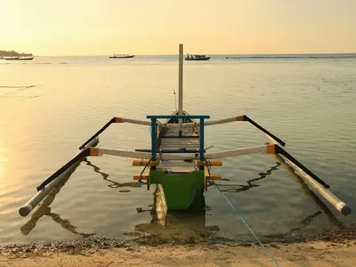
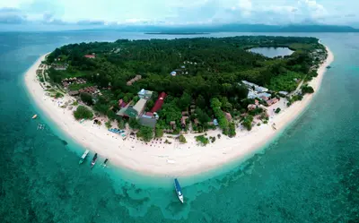
    Gili Air, nearest to Lombok, blends Meno's tranquility with diverse cafes, dive schools, and accommodations. White beaches and reefs off the east coast make it a prime snorkeling spot, free of cars and motorbikes.

    Unsplash

    Mataram

    Mataram

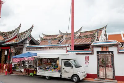
    Mataram is the capital of West Nusa Tenggara province and has merged with Ampenan, Cakranegara, and Sweta to form one city. Mosques, Balinese temples, markets, and Ayam Taliwang eateries showcase Lombok's daily life away from the beaches.

    Ravish Maqsood·Pexels

    Gili Meno

    Gili Meno

    Gili Meno is the smallest and quietest of the three Gili Islands, approximately two kilometers long and one kilometer wide. You can walk around it in one and a half to two hours along white beaches; a small salt lake lies behind mangroves in the west. In the evenings, there's hardly any music, but clear views of Rinjani and Agung.

    Unsplash

    Senggigi

    Senggigi

    Senggigi on the west coast was Lombok's first beach resort. Hotels and restaurants line a string of bays with light to dark sand, and north of there, a scenic road winds through coconut groves, offering views of the Gili Islands and Agung on Bali.

    ROMAN ODINTSOV·Pexels

    Your next steps

    Rinjani National Park is in Indonesia. Ways to carry on from here.

    • More in Indonesia

      Highlights, areas, routes and the best time to travel for all of Indonesia.

      Indonesia travel guide
    • Round trips with Rinjani National Park

      One route passes through Rinjani National Park, with stops, nights and a map.

      See the round trip
    • Plan a trip with Rinjani National Park

      The Guide asks about season, length and who is coming, and suggests a trip with Rinjani National Park.

      Plan the trip
    Sources & method

    • Photos: Wikimedia Commons, Unsplash. Each photo carries its credit.
    • Place data such as addresses and ratings comes from Google Maps.
    • The content is based on web research from public, traceable sources. How the content is made · The role of AI