Fernweh: Home
    ExploreTravel GuidesPlan a tripMy tripLast visited
    de|en
    All Places & RegionsAll highlightsAbout FernwehFAQPrivacy PolicyImprint
    ExploreTravel GuidesPlan a tripMy tripLast visited
    Cape Reinga

    New Zealand

    Cape Reinga

    LandmarkCulture

    Cape Reinga, known in Māori as Te Rerenga Wairua, is located at the northwestern tip of the North Island. According to Māori tradition, this is where the spirits of the deceased depart the land.

    by Felix Gillen

    1. Home
    2. Destinations
    3. New Zealand
    4. Northland
    5. Cape Reinga
    Cape Reinga, known in Māori as Te Rerenga Wairua, is located at the northwestern tip of the North Island. According to Māori tradition, this is where the spirits of the deceased depart the land. From the lighthouse, you can see the Tasman Sea and the Pacific Ocean meet.

    Sehenswürdigkeiten

    Discover the most important sights and attractions

    Lighthouse Cape Reinga

    1Lighthouse Cape Reinga

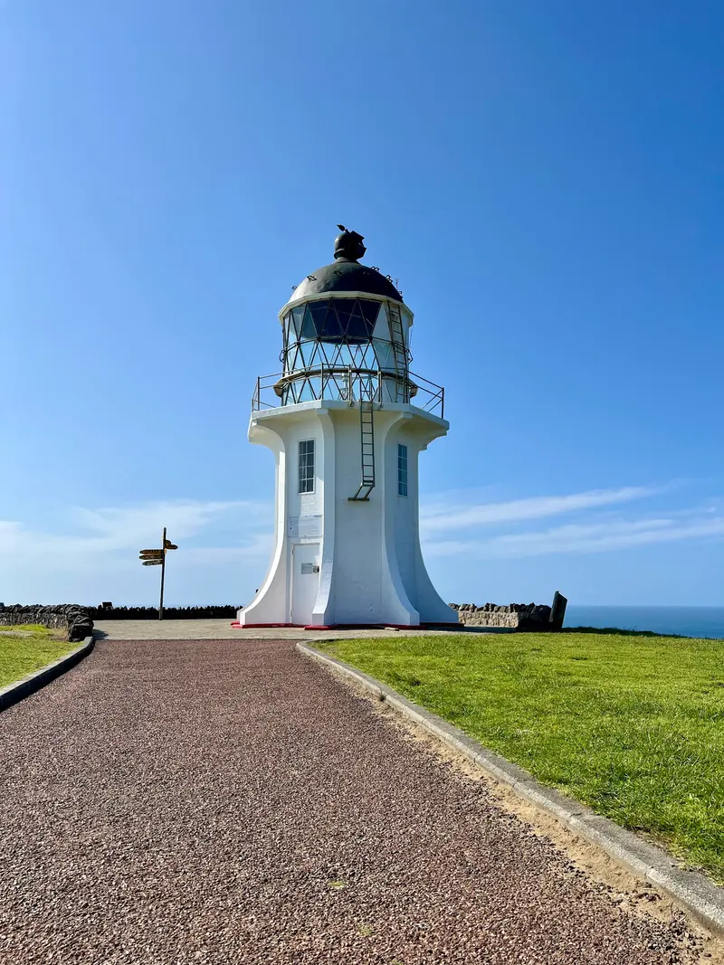
    Lighthouse from 1941 at New Zealand's northwestern tip, not accessible. From the car park, a paved path leads down in about 20 minutes, with information panels along the way explaining the site's significance for the Māori. Below, the Tasman Sea and Pacific Ocean meet.
    Open in Google Maps
    Tapotupotu Beach

    2Tapotupotu Beach

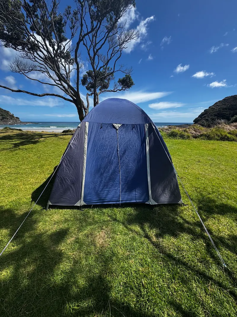
    Protected bay east of the cape with a sandy beach and a simple DOC campsite. The currents can be strong.
    Open in Google Maps
    Te Paki Sand Dunes
    Attraction

    3Te Paki Sand Dunes

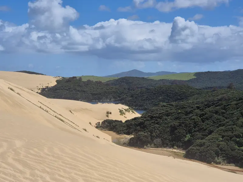
    High sand dunes at Te Paki Stream, just before the Cape. Boards for sandboarding are rented on-site.
    Open in Google Maps

    Restaurants in Cape Reinga

    Spirit

    The Cape is a sacred place for Māori. Please do not eat and drink at the Cape itself, as the information signs request. The path to the lighthouse explains the history of the place in English and Te Reo Māori.

    Exploring Locally

    The cape is at the end of State Highway 1, 100km north of Kaitaia. The road is fully paved; few fuel stations or shops exist on the last stretch. Day tours depart Kaitaia and the Bay of Islands. Rental agreements usually forbid driving a rental car on Ninety Mile Beach.

    Accommodations in Cape Reinga

    Find perfect stay in Cape Reinga

    Booking.com* (Affiliate link)
    Search Hotels
    Agoda* (Affiliate link)
    Search Hotels
    Airbnb
    Vacation Rentals

    * Affiliate link: if you book through it, we earn a small commission. The price stays the same for you.

    Nearby

    Hokianga Harbour

    Hokianga Harbour

    Hokianga Harbour is a long, branched sea inlet on Northland's west coast. Golden sand dunes tower on the north shore of the harbour entrance, while the small towns of Opononi and Omapere lie on the south shore. A few kilometres south, the Waipoua Forest begins, home to the country's largest Kauri trees.
    Kerikeri

    Kerikeri

    Kerikeri is a small town in the north of the Bay of Islands, surrounded by fruit orchards and vineyards. At the Kerikeri Basin stand the Kemp House and the Stone Store, the country's oldest surviving European buildings. A walking trail leads from here along the river to the Rainbow Falls.
    Waitangi

    Waitangi

    Waitangi lies just north of Paihia, across a small bridge. Representatives of the British Crown and Māori chiefs signed the Treaty of Waitangi here in 1840. The Treaty Grounds with museums, a meeting house and war canoe, are Northland's primary historical site.
    Bay of Islands

    Bay of Islands

    The Bay of Islands is a sprawling bay on the east coast of Northland with around 140 islands. Paihia is the departure point for boat tours; historic Russell lies opposite, and the Waitangi Treaty Grounds are right next door.
    Paihia

    Paihia

    Paihia is the main tourist hub of the Bay of Islands, a small town on a long waterfront road featuring beaches, motels, and restaurants. From the Wharf, boat tours, dolphin trips, and the ferry to Russell set off. The Waitangi Treaty Grounds are reachable on foot via the bridge to the north.

    Sources & method

    • Photos: Pexels, Google Maps. Each photo carries its credit.
    • Place data such as addresses and ratings comes from Google Maps.
    • The content is based on web research from public, traceable sources. How the content is made · The role of AI