Fernweh: Home
    ExploreTravel GuidesPlan a tripMy tripLast visited
    de|en
    All Places & RegionsAll highlightsAbout FernwehFAQPrivacy PolicyImprint
    ExploreTravel GuidesPlan a tripMy tripLast visited
    • Neighborhoods & highlights
    • Eat & drink
    • Food culture
    • Culture
    • Nightlife
    • Getting around
    • Accommodation
    • Plan trip
    • Nearby
    Koh Phi Phi Islands

    Thailand

    Koh Phi Phi Islands

    City

    The Phi Phi Islands are located between Phuket and Krabi. The largest are the inhabited Phi Phi Don and the uninhabited Phi Phi Leh, both part of the Hat Noppharat Thara-Mu Ko Phi Phi National Park.

    by Felix Gillen

    1. Home
    2. Destinations
    3. Thailand
    4. Andamanensee-Küste
    5. Koh Phi Phi Islands
    The Phi Phi Islands are located between Phuket and Krabi. The largest are the inhabited Phi Phi Don and the uninhabited Phi Phi Leh, both part of the Hat Noppharat Thara-Mu Ko Phi Phi National Park. Limestone cliffs drop almost vertically into the sea here, with narrow sandy coves nestled between them.All ferries reach Phi Phi Don at Tonsai Pier. The village, situated on a flat land bridge between two bays, is car-free; you travel on foot or by longtail boat. From the village, steps lead to viewpoints above the double bay; quieter beaches like Long Beach are located further southeast.On Phi Phi Leh lies Maya Bay, which was closed for years due to overuse and is now accessible with restrictions: swimming in the bay is prohibited, and it remains closed every year from August to September. In the evenings, nightlife centers on Loh Dalum Bay, featuring beach bars and fire shows. High season runs from November to April.

    Sights in Koh Phi Phi Islands

    Discover the most important sights and attractions

    Pi Leh Bay

    1Pi Leh Bay

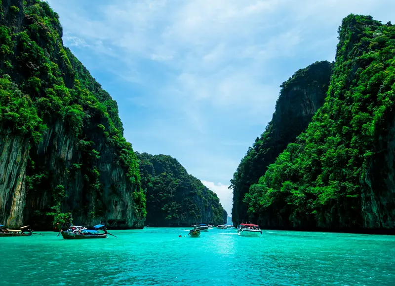
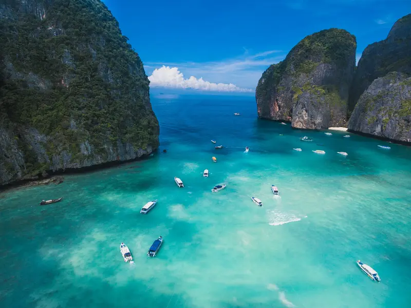
    A lagoon almost completely enclosed by steep limestone cliffs on the east side of Koh Phi Phi Leh. The water is shallow and turquoise; there is no beach. Longtail and speedboats stop for swimming and snorkeling; during peak season, multiple boats are in the bay simultaneously. Early morning and late afternoon are quieter. Access is part of the National Park; an entrance fee applies.
    Open in Google Maps
    Viewpoints over the Isthmus

    2Viewpoints over the Isthmus

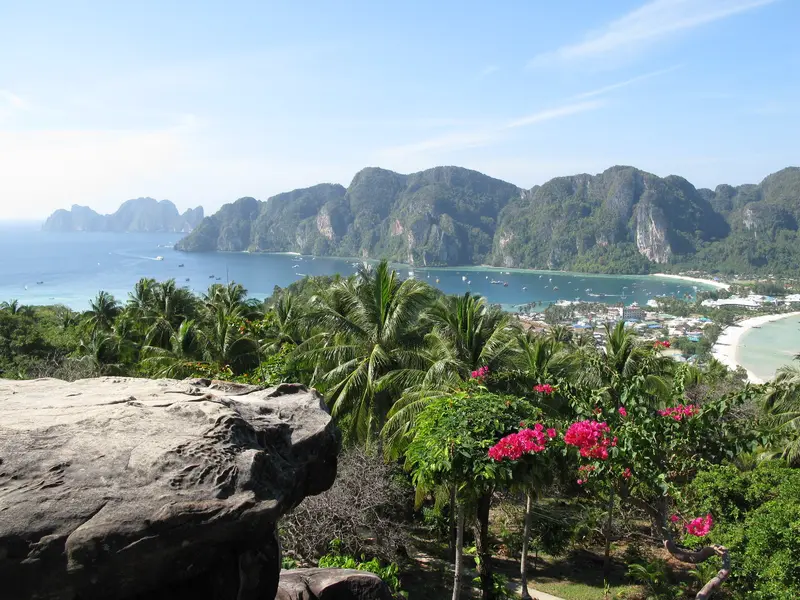
    From the village, steep stairs with a handrail lead up the hill, from which you overlook the narrow isthmus between Tonsai Bay and Loh Dalum Bay. There are three viewpoints: You reach Point 1 in 10 to 20 minutes, Point 2 in another 10 to 15, and Point 3 via a side path. For Points 1 and 2, 50 Baht were recently charged; for Point 3, an additional 20 Baht. Shade is scarce.
    Open in Google Maps
    Viking Cave

    3Viking Cave

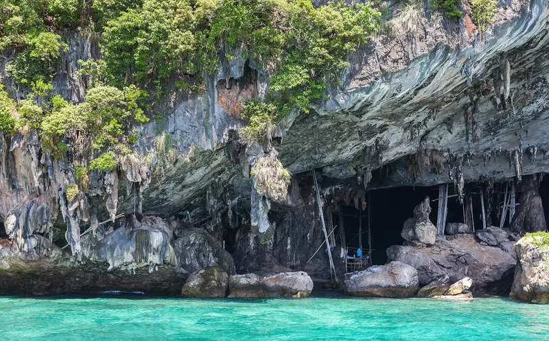
    The cave on Koh Phi Phi Leh lies beneath an overhanging cliff face. Collectors climb bamboo scaffolding and ropes to reach the nests of swiftlets on the walls and ceiling, which are sold for bird's nest soup. The cave owes its English name to wall drawings of various ships, including one resembling a Viking ship; they presumably originate from sailors who sought shelter here. Entry is not permitted; boats only pass by slowly.
    Open in Google Maps
    Long Beach (Hat Yao)

    4Long Beach (Hat Yao)

    The beach is about 1.5 km southeast of Tonsai. It's a 30-minute walk via a mostly paved, rocky path, or 10-15 minutes by longtail boat. From the shore, you can snorkel in clear water with a sandy bottom. It's much quieter than Tonsai, offering views of Koh Phi Phi Leh.
    Open in Google Maps
    Maya Bay

    5Maya Bay

    Koh Phi Phi Leh's west bay, famed from 'The Beach', was closed for years due to reef damage. Now accessible under strict rules: no boat anchoring, no swimming, and knee-deep water entry only. Visitor numbers are limited; the beach closes annually from August 1 to September 30. The 400 Baht national park fee is usually included in tour prices.
    Open in Google Maps
    Bamboo Island (Koh Pai)

    6Bamboo Island (Koh Pai)

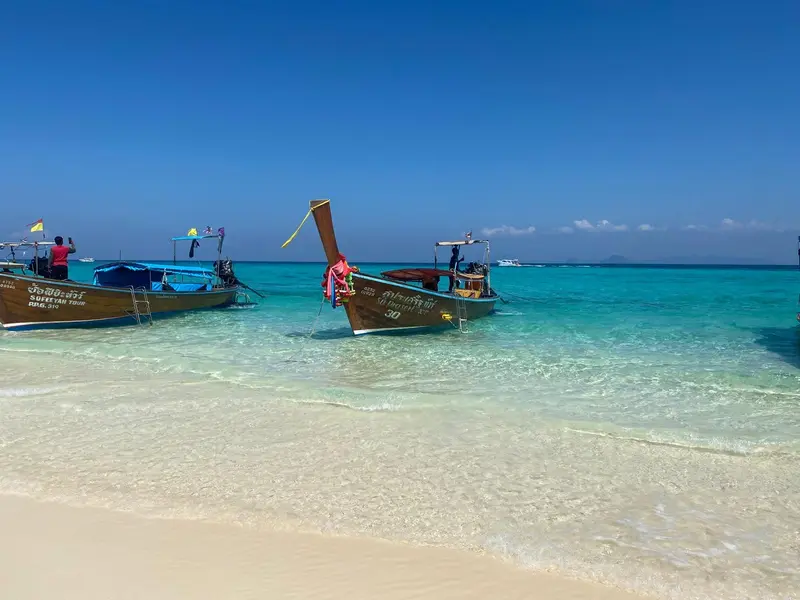
    Small, flat island about five kilometers north of the Phi Phi Islands, with a white sand beach and shallow, clear water for snorkeling. There are no accommodations and no restaurants, only a National Park administration post. The island is part of the National Park; the fee is 400 Baht and is included in the price of many tours.
    Open in Google Maps

    Essen & Trinken

    1

    Saep Sadoet (Isan cuisine and Udon noodle soups)

    Restaurant in Ko Phi Phi Don PQRG+873.
    Show on Google Maps
    2

    TIGER KING PHI PHI

    Restaurant in 125 157 Tambon Ao Nang.
    Show on Google Maps
    3

    ACQUA Restaurant Phi Phi

    Stylishes Restaurant mit thailändischen und europäischen Klassikern, legerem Flair und Sitzplätzen im Freien.
    Show on Google Maps
    4

    The Mango Garden

    Café in 73.
    Show on Google Maps

    Eating and Drinking

    In Tonsai stehen thailändische Küchen, Fischgrills und internationale Karten dicht beieinander, ausgerichtet auf ein wechselndes Publikum. Günstiger und lokaler wird es in den Gassen abseits der Hauptachse, wo auch das Inselpersonal isst. Frischer Fisch kommt vom Festland oder von den Booten der Insel und wird an den Grills in Auslagen auf Eis präsentiert. Weil alle Zutaten per Boot kommen, liegen die Preise über dem Festlandniveau.

    Seafood from the Grill

    Barracuda, snapper, squid, prawns, and spiny lobsters, chosen by weight from the grill stalls' displays and grilled over charcoal. Accompanied by rice, papaya salad, and a spicy seafood sauce.

    Pad Thai from street stall

    Fried rice noodles with egg, tofu or prawns, sprouts and peanuts, made fresh in a pan at several Tonsai stalls. One of the few affordable options on the island.

    Som Tam

    Papaya salad, pounded in a mortar with lime, fish sauce, chilli and peanuts. The southern version quickly gets very spicy; the heat can be adjusted when ordering.

    Tom Yam Soup with Seafood

    Roti and banana pancakes

    Evenings at mobile stalls in the alleys: thin griddle flatbread, filled with banana, egg, or chocolate. The savory version with curry dip is available mornings in Muslim kitchens.

    Fruits and Shakes

    Mango, pineapple, watermelon, and passion fruit are cut at stalls or freshly blended into a shake. For shakes, it's worth checking if the ice comes from packaged cubes.

    Culture and History

    Tsunami and ReconstructionThe tsunami of December 26, 2004, struck the barely two-meter-high Tonsai isthmus, destroying approximately 70 percent of the buildings on Phi Phi Don. The area was rebuilt in the following years. Part of the island's population is Muslim; modest clothing is appropriate outside the village center.The Beach and its ConsequencesThe film The Beach, released in 2000, was partly filmed in Maya Bay and triggered a large influx of visitors. After years of overcrowding, the bay was closed, and the reef recovered. Since its reopening, visitor limits, a swimming ban in the bay, and an annual closure from August to September are in effect.

    Nightlife

    Bars in the alleys of Tonsai

    Between Pier and Loh Dalum is a network of narrow, car-free alleys with small bars, live music bars, and sports bars. Things here start earlier and are quieter than the beach, and it's easier to chat. The alleys are well lit and lively even after midnight.
    Show on Google Maps

    Getting there and around

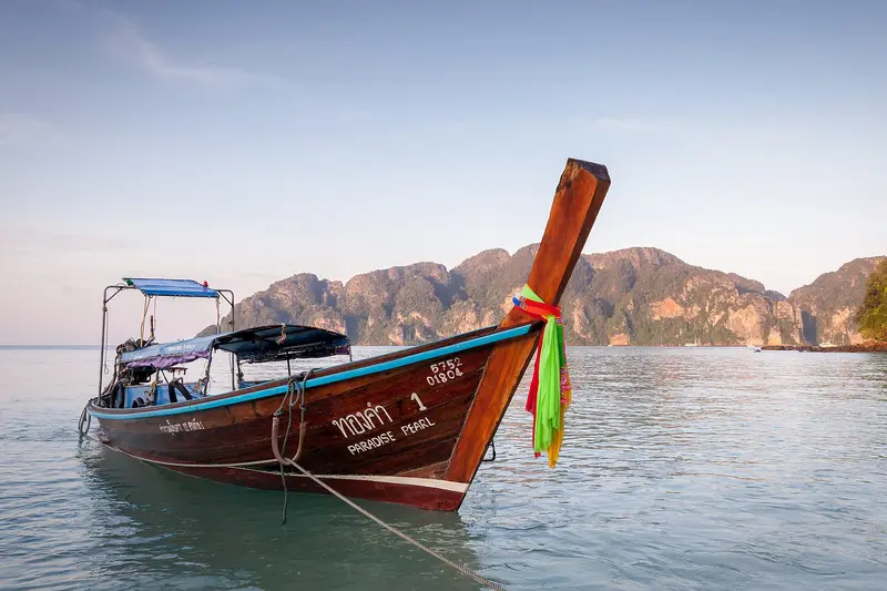
    Getting TherePhi Phi has no airport and no road connection. Ferries depart from Phuket, Krabi and Ao Nang; during high season, also from Koh Lanta and Railay. The crossing takes about one to two hours, depending on the departure point and boat. All boats dock at Tonsai Pier, where a small visitor fee is collected. Connections are suspended during the rainy season.On the IslandOn Foot: Tonsai and the isthmus are easily explored on foot; Long Beach is about a 30-minute walk away.Longtail Boats: connect to bays without land access; agree on the price before the trip, as it gets more expensive after sunset.Hiking Trails: Steep stairs lead to the viewpoints; they can be slippery after rain.Handcarts: transport luggage from the pier to your accommodation.

    Accommodations in Koh Phi Phi Islands

    Find perfect stay in Koh Phi Phi Islands

    Booking.com* (Affiliate link)
    Search Hotels
    Agoda* (Affiliate link)
    Search Hotels
    Airbnb
    Vacation Rentals

    * Affiliate link: if you book through it, we earn a small commission. The price stays the same for you.

    Plan your trip to Koh Phi Phi Islands

    Save places, build a route and plan your city trip, all in one place.

    1. 1
      Sunrise over alpine peaks and a sea of clouds
      1234

      Round trip

      12 days · 4 stops

      Saved

      Pick a route

      Pick a ready-made one or save places and plan your own.

      Open bookmarks
    2. 2

      Trip to Koh Phi Phi Islands

      Live
      • 1Pi Leh Bay3 days
      • 2Viewpoints over the Isthmus4 days
      • 3Viking Cave5 days
      Budget

      Plan your trip

      The planner sorts stops, days and budget. Plan together in real time.

      Start trip planning
    3. 3
      9:41 No signal
      Koh Phi Phi Islands
      Available offline

      Use it on the road

      Download the guide to your phone and use it on site, even offline.

    Nearby

    Railay Beach

    Railay Beach

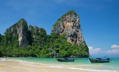
    Railay is a peninsula in Krabi Province, between Krabi Town and Ao Nang, with steep limestone cliffs cutting it off from the mainland. No road leads here: you arrive by longtail boat from Ao Nang (around 15 minutes) or from the Krabi coast; departures depend on wind and sea conditions.The peninsula has several sides: Railay West (wide sandy beach, promenade, boat pier), Railay East (mangrove bay, not for swimming, but cheaper accommodation), and Phra Nang Beach (south, under overhanging rocks, famous cave shrine). North of this is Tonsai, the climbers' and backpackers' quarter.Railay is one of Asia's most renowned sport climbing areas, boasting over 700 bolted routes. Local schools rent equipment and offer courses for beginners.A steep, rope-secured path leads to the viewpoint and the Sa Phra Nang lagoon; it's slippery after rain, so sturdy shoes are required. Macaques live on the beaches, deliberately grabbing bags and edibles.

    Koh Yao Noi

    Koh Yao Noi is located in Phang Nga Bay between Phuket and Krabi, offering views of limestone karsts rising from the shallow waters. Its name translates to "small long island." To its south lies the larger sister island, Koh Yao Yai.The island is predominantly Muslim and thrives on fishing, rubber cultivation, and rice farming. It features villages, a ring road, mosques, and a number of resorts and homestays, but no nightlife. You'll mostly get around by scooter.The beaches on the east coast are very shallow, and the tidal range is significant. At low tide, the sea recedes considerably. The beaches are only suitable for swimming around high tide; plan according to the tide calendar.Nonetheless, the island is an excellent base for kayak and boat tours to the bay's rocky islands. As the population lives conservatively, swimwear is inappropriate outside of beach and pool areas.
    Ao Nang

    Ao Nang

    Ao Nang is the main beach resort in Krabi province and a departure point for boat tours into the Andaman Sea. From its long sandy beach, you can gaze at offshore limestone islands, while longtail boats take you to Railay and Phra Nang beaches, which are only accessible by water. Popular options include the Four Islands Tour, featuring Phra Nang Cave Beach, Chicken Island, Tup, and Poda, as well as excursions to the Hong Islands. Boat tours are most reliable from November to April.
    Koh Lanta

    Koh Lanta

    Koh Lanta, part of Krabi Province, is larger and more tranquil than most Andaman Sea islands. Its main island, Lanta Yai, is elongated: beaches line the west coast, forested hills rise inland, and a single main road connects north and south.The beaches vary distinctly. In the north lie Klong Dao and Phra Ae, featuring shallow water and the densest infrastructure. Further south, Klong Khong, Klong Nin, and Kantiang Bay become quieter and rockier. The Mu Ko Lanta National Park, complete with a lighthouse, hiking trail, and macaques, adjoins the southern tip.On the east coast lies Lanta Old Town, a village of stilt houses built over the water, where the island's Chinese-Muslim trading history is evident; nearby live families of the Urak Lawoi, the original sea nomads. The island is reached by ferry from Krabi and Phuket, and via a land connection over Koh Lanta Noi. The season runs from November to April; during the rainy season, many accommodations and restaurants close.
    Krabi

    Krabi

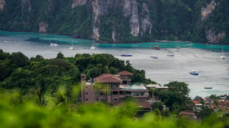
    Krabi Town is the administrative hub of the province and, for many travelers, primarily the gateway to the islands of the Andaman Sea. The town is situated on the Krabi River amidst mangroves and limestone cliffs, revealing authentic Thai daily life that the surrounding beach resorts rarely offer, most vividly at its night markets. Staying here for a night or two offers more affordable accommodation, easy access to Wat Tham Suea and the mangrove canals, and a convenient base for excursions to Ao Nang, Railay, and the islands.

    Sources & method

    • Photos: Wikimedia Commons, Unsplash. Each photo carries its credit.
    • The content is based on web research from public, traceable sources. How the content is made · The role of AI