Fernweh: Home
ExploreGuideDestinationsMy tripsMy trip
de|en
All Places & RegionsRound tripsNight trains in EuropeAll highlightsAbout FernwehFAQPrivacy PolicyImprint
Download on the App StoreGet it on Google Play
ExploreGuideDestinationsMy tripsMy trip
    • Neighborhoods & highlights
    • Tours
    • Eat & drink
    • Culture
    • Getting around
    • Accommodation
    • Plan trip
    • Round trips
    • Nearby
    Sainte-Anne

    Christelle EL JAMALI / Wikimedia Commons / CC BY-SA 4.0, mod.

    Martinique

    Sainte-Anne

    City

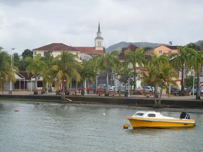
    Sainte-Anne, in the far south of Martinique, is, per the Tourist Office, the island's most touristy municipality. You come for its 22 kilometers of sandy coastline, notably the three-kilometer-long Grande Anse des Salines.

    by Felix Gillen

    1. Home
    2. Destinations
    3. Martinique
    4. South: Sainte-Anne, Les Salines and Le Diamant
    5. Sainte-Anne
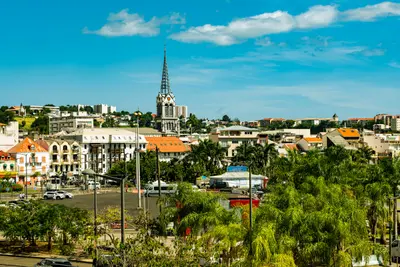
    Sainte-Anne, in the far south of Martinique, is, per the Tourist Office, the island's most touristy municipality. You come for its 22 kilometers of sandy coastline, notably the three-kilometer-long Grande Anse des Salines.In the village, the Église Notre-Dame stands as one of the island's oldest churches; a first chapel existed here in 1690. Behind the church, a Way of the Cross leads up the hill. To the east lie the beaches at Cap Chevalier and the coastal hiking trail Trace des Caps.
    Martinique travel guideSee the round tripPlan a trip with Sainte-Anne

    Contents

    • Neighborhoods & highlights
    • Tours
    • Eat & drink
    • Culture
    • Getting around
    • Accommodation
    • Round trips
    • Nearby

    Sights in Sainte-Anne

    Discover the most important sights and attractions

    Beach

    1Grande Anse des Salines

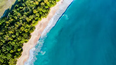
    The beach at Sainte-Anne, on the island's southern tip, boasts white sand, turquoise waters, and a coconut palm grove, with views to St. Lucia. It belongs to the Site classé des Salines, protecting some 2,273 ha of coast, lagoon, and savanna since 2013. From the car park, the path traverses the shadeless Savane des Pétrifications, an almost desert-like area.

    Open in Google Maps

    Tours & experiences in Sainte-Anne

    Search tours for Sainte-Anne on GetYourGuide* (Affiliate link)On GetYourGuide, with reviews from other travellers

    * Affiliate link: if you book through it, we earn a small commission. The price stays the same for you.

    Restaurants in Sainte-Anne

    Sunny South and Yoles rondes

    Peninsula in the SouthThe area is very dry and often sunny when the rest of the island is cloudy. The Grande Anse des Salines is a golden sand arc on the southeastern tip.Tour des Yoles rondesThe traditional sailing boats Yoles rondes compete every summer in a race around the island; in 2026, Sainte-Anne was the start and finish for the 40th edition from July 26 to August 2.

    Traveling on the Peninsula

    HikingIn the morning, it's worth exploring the Trace des Caps, the peninsula's coastal path (Lonely Planet).BeachThe Grande Anse des Salines is located on the island's southeast tip; plan for a half to a full day at the beach.

    Accommodations in Sainte-Anne

    Find perfect stay in Sainte-Anne

    Booking.com* (Affiliate link)
    Search Hotels
    Agoda* (Affiliate link)
    Search Hotels
    Airbnb
    Vacation Rentals

    * Affiliate link: if you book through it, we earn a small commission. The price stays the same for you.

    Plan your trip to Sainte-Anne

    Save places, build a route and plan your city trip, all in one place.

    1. 1
      Sunrise over alpine peaks and a sea of clouds
      1234

      Round trip

      12 days · 4 stops

      Saved

      Pick a route

      Pick a ready-made one or save places and plan your own.

      Open bookmarks
    2. 2

      Trip to Sainte-Anne

      Live
      • 1Grande Anse des Salines3 days
      Budget

      Plan your trip

      The planner sorts stops, days and budget. Plan together in real time.

      Start trip planning
    3. 3
      9:41 No signal
      Sainte-Anne
      Available offline

      Christelle EL JAMALI / Wikimedia Commons / CC BY-SA 4.0, mod.

      Use it on the road

      Download the guide to your phone and use it on site, even offline.

    Round trips with Sainte-Anne

    Martinique in Nine Days: From the South to the Volcano

    Martinique in Nine Days: From the South to the Volcano

    The tour begins at Fort-de-France Bay, leads to the southern beaches, and ends in the north at the foot of Montagne Pelée. It combines beach days with history and rainforest.

    10 Days
    3 stops

    Patrice78500·CC BY-SA 4.0

    Nearby

    South: Sainte-Anne, Les Salines and Le Diamant

    South: Sainte-Anne, Les Salines and Le Diamant

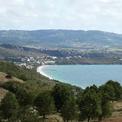
    The south of Martinique is drier and sunnier than the north and the island's most popular beach destination. You come for the Grande Anse des Salines near Sainte-Anne, the Rocher du Diamant off Le Diamant and the history surrounding Les Trois-Îlets, the birthplace of Empress Joséphine.Near Sainte-Anne, the Site classé des Salines has protected some 2,273 ha of coast, lagoon and savanna since 2013, beyond which begins the reddish Savane des Pétrifications. Further west, the approximately 175 m high Rocher du Diamant rises from the sea, opposite which stands the Mémorial Cap 110. Les Trois-Îlets on the Bay of Fort-de-France can also be reached by Navette from the capital.

    Mickaël BRUNO·CC BY-SA 4.0

    Le Diamant

    Le Diamant

    Le Diamant is a seaside resort on the Caribbean coast in the southwest of Martinique, on the Route des Anses. You come for the 175-meter-high Diamond Rock, which rises from the sea about four kilometers off the beach, for the approximately three-kilometer-long Grande Anse du Diamant, and for the Mémorial Cap 110.Above the town rises Morne Larcher, known as "la femme couchée" because of its shape.

    Lechatsylvestre·CC BY-SA 4.0

    Les Trois-Îlets

    Les Trois-Îlets

    Les Trois-Îlets lies in the southwest on the Bay of Fort-de-France and is connected to the capital by ferry in about 20 minutes. You come for the birthplace of Empress Joséphine, the Village de la Poterie, and the beaches and hotels of Anse Mitan and Pointe du Bout.The commune takes its name from three islets in the bay and has been independent since 1849. It includes the town center, Anse Mitan, the marina at Pointe du Bout, and Anse à l'Âne.

    Patrice78500·CC BY-SA 4.0

    Les Anses-d'Arlet

    Les Anses-d'Arlet

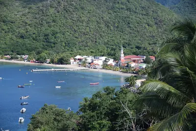
    This community on the southwest coast is sheltered between the Mornes, off the main roads. Its most famous landmark is the small Saint-Henri church right by the sea, extending from the jetty.In the clear, calm water, according to Lonely Planet, you can spot turtles, octopuses, and moray eels just a few meters from the shore. The community includes the bays Grande Anse, Anse Dufour, and Anse Noire.

    AronMSzabo·CC BY-SA 4.0

    Fort-de-France

    Fort-de-France

    Fort-de-France is the capital of Martinique and is located on the west coast at the northern end of the bay of the same name, near the airport in Le Lamentin. You come for the iron cathedral Saint-Louis, the Bibliothèque Schœlcher from the Paris World's Fair of 1889, and as a starting point for the Jardin de Balata and the bay of Les Trois-Îlets.With around 75,500 inhabitants, Fort-de-France is the island's largest municipality. In 1692, the colonial capital was moved here from Saint-Pierre; the city has borne its current name since 1807, and after the volcanic eruption of 1902, it finally became the central hub. In the compact center, the library, cathedral, and the green space La Savane are close together, while Fort Saint-Louis rises on the waterfront.

    Wil ZAID·Unsplash

    Your next steps

    Sainte-Anne is in Martinique. Ways to carry on from here.

    • More in Martinique

      Highlights, areas, routes and the best time to travel for all of Martinique.

      Martinique travel guide
    • Round trips with Sainte-Anne

      One route passes through Sainte-Anne, with stops, nights and a map.

      See the round trip

    Sources & method

    • Photos: Wikimedia Commons. Each photo carries its credit.
    • Place data such as addresses and ratings comes from Google Maps.
    • The content is based on web research from public, traceable sources. How the content is made · The role of AI