Fernweh: Home
ExploreGuideDestinationsMy tripsMy trip
de|en
All Places & RegionsRound tripsNight trains in EuropeAll highlightsAbout FernwehFAQPrivacy PolicyImprint
Download on the App StoreGet it on Google Play
ExploreGuideDestinationsMy tripsMy trip
    • Places in the region
    • Culture
    • Getting around
    • Round trips
    • Nearby
    South: Sainte-Anne, Les Salines and Le Diamant

    Mickaël BRUNO / Wikimedia Commons / CC BY-SA 4.0, mod.

    Martinique

    South: Sainte-Anne, Les Salines and Le Diamant

    Region

    The south of Martinique is drier and sunnier than the north and the island's most popular beach destination.

    by Felix Gillen

    1. Home
    2. Destinations
    3. Martinique
    4. South: Sainte-Anne, Les Salines and Le Diamant
    The south of Martinique is drier and sunnier than the north and the island's most popular beach destination. You come for the Grande Anse des Salines near Sainte-Anne, the Rocher du Diamant off Le Diamant and the history surrounding Les Trois-Îlets, the birthplace of Empress Joséphine.Near Sainte-Anne, the Site classé des Salines has protected some 2,273 ha of coast, lagoon and savanna since 2013, beyond which begins the reddish Savane des Pétrifications. Further west, the approximately 175 m high Rocher du Diamant rises from the sea, opposite which stands the Mémorial Cap 110. Les Trois-Îlets on the Bay of Fort-de-France can also be reached by Navette from the capital.
    Martinique travel guideSee 2 round tripsPlan a trip with South: Sainte-Anne, Les Salines and Le Diamant

    Contents

    • Places in the region
    • Culture
    • Getting around
    • Round trips
    • Nearby
    Les Trois-Îlets

    Patrice78500 / Wikimedia Commons / CC BY-SA 4.0, mod.

    Place 1 of 4

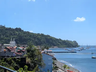
    Les Trois-Îlets

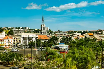
    Les Trois-Îlets lies in the southwest on the Bay of Fort-de-France and is connected to the capital by ferry in about 20 minutes.

    Discover
    Le Diamant

    Lechatsylvestre / Wikimedia Commons / CC BY-SA 4.0, mod.

    Place 2 of 4

    Le Diamant

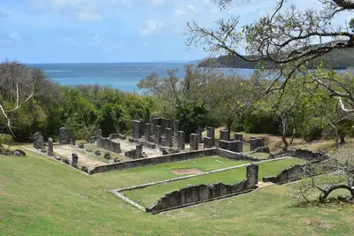
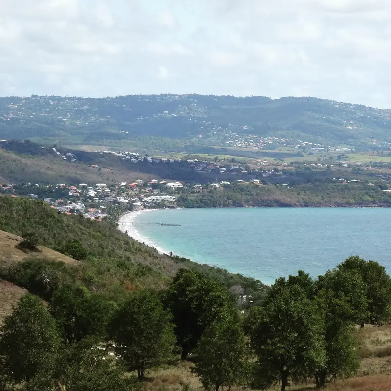
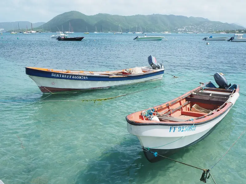
    Le Diamant is a seaside resort on the Caribbean coast in the southwest of Martinique, on the Route des Anses.

    Discover
    Sainte-Anne

    Christelle EL JAMALI / Wikimedia Commons / CC BY-SA 4.0, mod.

    Place 3 of 4

    Sainte-Anne

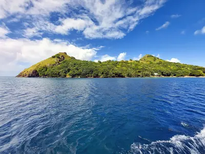
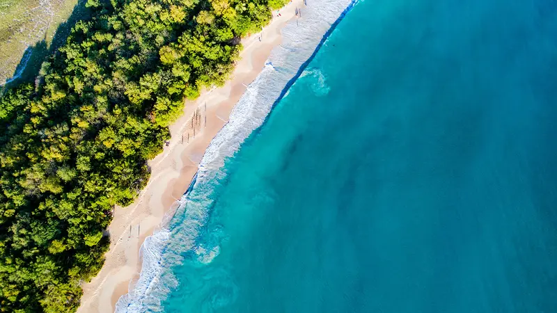
    Sainte-Anne, in the far south of Martinique, is, per the Tourist Office, the island's most touristy municipality. You come for its 22 kilometers of sandy coastline, notably the three-kilometer-long Grande Anse des Salines.

    Discover
    Les Anses-d'Arlet

    AronMSzabo / Wikimedia Commons / CC BY-SA 4.0, mod.

    Place 4 of 4

    Les Anses-d'Arlet

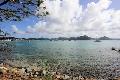
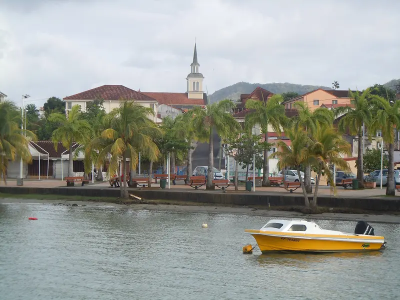
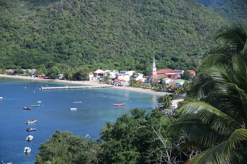
    This community on the southwest coast is sheltered between the Mornes, off the main roads. Its most famous landmark is the small Saint-Henri church right by the sea, extending from the jetty.

    Discover

    Sights in South: Sainte-Anne, Les Salines and Le Diamant

    Discover the most important sights and attractions

    Historic Landmark

    Habitation Clément

    The former sugarcane plantation on the Domaine de l'Acajou in Le François is the ancestral home of the Clément rum brand. Visitors can explore the 18th-century Creole mansion, where the Clément family resided from 1887 to 1986, the old distillery with an exhibition on rum production, the aging cellars, and a 16-hectare park featuring over 300 tropical plants and a sculpture garden. The mansion and outbuildings have been classified as historical monuments since 1996, and the park holds the 'Jardin remarquable' label.Open: daily, house and exhibitions 9 AM to 6:30 PM
    Open in Google Maps

    Remembrance and Empress Joséphine

    Remembering SlaveryThe Mémorial Cap 110 was created in 1998 for the 150th anniversary of slavery's abolition, commemorating a slave ship that sank off the coast in 1830.Birthplace of an EmpressJoséphine de Beauharnais was born in 1763 at the Domaine de la Pagerie in Les Trois-Îlets, later to become Napoleon's wife. Remains of the sugar factory are preserved; a small museum displays objects from her life.

    Car, Shuttle and Hiking Trail

    Getting HereLes Trois-Îlets and Anse Mitan are accessible by shuttle from Fort-de-France. A car is required for Sainte-Anne, Le Diamant, and Les Salines.On FootFrom Grande Anse des Salines, a path leads through the Savane des Pétrifications, about 4 to 5 km, easy but almost without shade. Stay clear of the cliff edge at Pointe d'Enfer and bring plenty of water.

    Round trips through this region

    Martinique in Nine Days: From the South to the Volcano

    Martinique in Nine Days: From the South to the Volcano

    The tour begins at Fort-de-France Bay, leads to the southern beaches, and ends in the north at the foot of Montagne Pelée. It combines beach days with history and rainforest.

    10 Days
    3 stops

    Patrice78500·CC BY-SA 4.0

    Island Hopping by Ferry: Martinique between Dominica and St. Lucia

    Island Hopping by Ferry: Martinique between Dominica and St. Lucia

    The third leg of island-hopping Guadeloupe, Dominica, Martinique, and St. Lucia by regular ferry. On Martinique, you'll stay in Les Trois-Îlets, opposite Fort-de-France, and reach the capital with the Navettes across the bay. From here, you'll visit the south with Le Diamant and Sainte-Anne, and in the north, Saint-Pierre at the foot of Montagne Pelée.

    6 Days
    3 stops
    Open jaw

    Patrice78500·CC BY-SA 4.0

    Nearby

    Fort-de-France

    Fort-de-France

    Fort-de-France is the capital of Martinique and is located on the west coast at the northern end of the bay of the same name, near the airport in Le Lamentin. You come for the iron cathedral Saint-Louis, the Bibliothèque Schœlcher from the Paris World's Fair of 1889, and as a starting point for the Jardin de Balata and the bay of Les Trois-Îlets.With around 75,500 inhabitants, Fort-de-France is the island's largest municipality. In 1692, the colonial capital was moved here from Saint-Pierre; the city has borne its current name since 1807, and after the volcanic eruption of 1902, it finally became the central hub. In the compact center, the library, cathedral, and the green space La Savane are close together, while Fort Saint-Louis rises on the waterfront.

    Wil ZAID·Unsplash

    Peninsula of La Caravelle

    Peninsula of La Caravelle

    The approximately 12 km long La Caravelle peninsula juts into the ocean near La Trinité on the Atlantic coast. You come for its hiking trails through dry forest and mangroves, the ruins of Château Dubuc, and views of the island's rugged Atlantic side.La Caravelle, with the Sainte-Anne peninsula, is one of Martinique's oldest landforms. Since 1976, its tip has been a national nature reserve managed by the Parc naturel régional, encompassing savannas, dry forest, mangroves, and coastal vegetation in a compact area. The fishing village Tartane lies at the entrance; at D2's end, two marked hiking trails begin near Château Dubuc.

    Bastenbas·CC BY-SA 4.0

    Pigeon Island National Landmark

    Pigeon Island National Landmark

    Pigeon Island is a former island at the northwest tip of St. Lucia, now connected to Gros Islet by a causeway. The Saint Lucia National Trust manages the approximately 44-acre site with the ruins of the British naval base, Fort Rodney, Signal Peak, and two swimming beaches.From here, the British monitored the French fleet on Martinique in the 18th century, which contributed to their victory in the Battle of the Saintes in 1782.

    P. Hughes·CC BY-SA 4.0

    Rodney Bay and Gros Islet

    Rodney Bay and Gros Islet

    Rodney Bay in the north is St. Lucia's tourist hub, featuring a marina, restaurants, and Reduit Beach. Right next door is the fishing village of Gros Islet, where every Friday evening the Street Party with music and barbecue stalls brings together locals, sailors, and travelers.In December, the Marina is the finish line for the Atlantic Rally for Cruisers; Pigeon Island, with its fort, is located at the end of the causeway behind Gros Islet.

    Paul Harrison·CC BY-SA 4.0

    Saint-Pierre

    Saint-Pierre

    Saint-Pierre is located on the northwest coast north of Fort-de-France at the foot of Montagne Pelée. Until 1902, it was the island's economic and cultural center, the "Petit Paris" of the Antilles. You come for the ruins left by the volcanic eruption of May 8, 1902, and for the Mémorial that documents the catastrophe.The town was founded in 1635 by Belain d'Esnambuc as the first permanent French settlement on Martinique. The glowing cloud killed almost the entire population. Today, Saint-Pierre holds the "Ville d'art et d'histoire" label.

    Concord·CC BY-SA 4.0

    Your next steps

    South: Sainte-Anne, Les Salines and Le Diamant is in Martinique. Ways to carry on from here.

    • More in Martinique

      Highlights, areas, routes and the best time to travel for all of Martinique.

      Martinique travel guide
    • Round trips with South: Sainte-Anne, Les Salines and Le Diamant

      2 routes pass through South: Sainte-Anne, Les Salines and Le Diamant, with stops, nights and a map.

      See 2 round trips
    • Plan a trip with South: Sainte-Anne, Les Salines and Le Diamant

      The Guide asks about season, length and who is coming, and suggests a trip with South: Sainte-Anne, Les Salines and Le Diamant.

      Plan the trip

    Sources & method

    • Photos: Wikimedia Commons. Each photo carries its credit.
    • Place data such as addresses and ratings comes from Google Maps.
    • The content is based on web research from public, traceable sources. How the content is made · The role of AI