Fernweh: Home
ExploreGuideDestinationsMy tripsMy trip
de|en
All Places & RegionsRound tripsNight trains in EuropeAll highlightsAbout FernwehFAQPrivacy PolicyImprint
Download on the App StoreGet it on Google Play
ExploreGuideDestinationsMy tripsMy trip
    • Places in the region
    • Culture
    • Getting around
    • Nearby
    Peninsula of La Caravelle

    Bastenbas / Wikimedia Commons / CC BY-SA 4.0, mod.

    Martinique

    Peninsula of La Caravelle

    Region

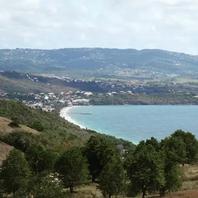
    The approximately 12 km long La Caravelle peninsula juts into the ocean near La Trinité on the Atlantic coast.

    by Felix Gillen

    1. Home
    2. Destinations
    3. Martinique
    4. Peninsula of La Caravelle
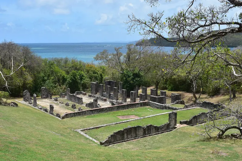
    The approximately 12 km long La Caravelle peninsula juts into the ocean near La Trinité on the Atlantic coast. You come for its hiking trails through dry forest and mangroves, the ruins of Château Dubuc, and views of the island's rugged Atlantic side.La Caravelle, with the Sainte-Anne peninsula, is one of Martinique's oldest landforms. Since 1976, its tip has been a national nature reserve managed by the Parc naturel régional, encompassing savannas, dry forest, mangroves, and coastal vegetation in a compact area. The fishing village Tartane lies at the entrance; at D2's end, two marked hiking trails begin near Château Dubuc.
    Martinique travel guideRound trips in MartiniquePlan a trip with Peninsula of La Caravelle

    Contents

    • Places in the region
    • Culture
    • Getting around
    • Nearby

    Sights in Peninsula of La Caravelle

    Discover the most important sights and attractions

    Castle

    Château Dubuc

    The ruins of a ca. 1725 sugar plantation at the peninsula's end were acquired and restored by the Parc naturel régional in 1974, becoming a Monument historique in 1992. With an audioguide, explore the manor house, horse mill, boiling house, cisterns, and dungeon remains; a small museum displays excavation finds. Open daily from 9 AM to 4:30 PM, adults pay €8.
    Open in Google Maps
    Attraction

    Sentier de la Caravelle & Lighthouse

    Two marked loops start at Château Dubuc in the nature reserve: The short trail (2.5 km, about 1.5 hours, easy) leads through dry forest and the mangrove of Baie du Trésor, while the long one (7 km, 3.5 to 4 hours) also passes the lighthouse and several Atlantic coast coves. Around 80 bird species live in the protected area, including tropicbirds and frigatebirds.
    Open in Google Maps

    Plantation and Smuggling

    The Dubuc FamilyChâteau Dubuc is tied to the Dubuc family, landowners in La Trinité since 1671. A large sugar plantation, worked by many enslaved people, arose around 1725; warehouse and dungeon remains hint at smuggling and slave trade. The estate was abandoned after a 1766 hurricane.ConservationThe protected area dates from 1976 and is part of the Parc naturel régional. It hosts over 150 typical plant species of the Lesser Antilles.

    Via La Trinité to Tartane

    DirectionsFrom Fort-de-France, take the N1 to La Trinité and continue on the D2 to Tartane. From La Trinité, it's about 15 to 20 minutes. There is a car park at the entrance to the protected area near Château Dubuc.HikingStart early, there is little shade on the long trail. Bring water and sun protection and stay on the marked trails.

    Nearby

    Fort-de-France

    Fort-de-France

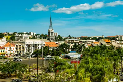
    Fort-de-France is the capital of Martinique and is located on the west coast at the northern end of the bay of the same name, near the airport in Le Lamentin. You come for the iron cathedral Saint-Louis, the Bibliothèque Schœlcher from the Paris World's Fair of 1889, and as a starting point for the Jardin de Balata and the bay of Les Trois-Îlets.With around 75,500 inhabitants, Fort-de-France is the island's largest municipality. In 1692, the colonial capital was moved here from Saint-Pierre; the city has borne its current name since 1807, and after the volcanic eruption of 1902, it finally became the central hub. In the compact center, the library, cathedral, and the green space La Savane are close together, while Fort Saint-Louis rises on the waterfront.
    Wil ZAID·Unsplash

    Les Trois-Îlets

    Les Trois-Îlets

    Les Trois-Îlets lies in the southwest on the Bay of Fort-de-France and is connected to the capital by ferry in about 20 minutes. You come for the birthplace of Empress Joséphine, the Village de la Poterie, and the beaches and hotels of Anse Mitan and Pointe du Bout.The commune takes its name from three islets in the bay and has been independent since 1849. It includes the town center, Anse Mitan, the marina at Pointe du Bout, and Anse à l'Âne.

    Patrice78500·CC BY-SA 4.0

    Saint-Pierre

    Saint-Pierre

    Saint-Pierre is located on the northwest coast north of Fort-de-France at the foot of Montagne Pelée. Until 1902, it was the island's economic and cultural center, the "Petit Paris" of the Antilles. You come for the ruins left by the volcanic eruption of May 8, 1902, and for the Mémorial that documents the catastrophe.The town was founded in 1635 by Belain d'Esnambuc as the first permanent French settlement on Martinique. The glowing cloud killed almost the entire population. Today, Saint-Pierre holds the "Ville d'art et d'histoire" label.

    Concord·CC BY-SA 4.0

    North Island: Saint-Pierre and Montagne Pelée

    North Island: Saint-Pierre and Montagne Pelée

    Northern Martinique is mountainous and densely forested, dominated by the 1,397 m high Montagne Pelée. You come for the ruins of Saint-Pierre, which the volcano destroyed on May 8, 1902, for the hike up the volcano, and for the rainforest that extends to the sea at Anse Couleuvre.Founded in 1635, Saint-Pierre was the island's most important city until 1902; today, nearly 4,000 people live among the ruins, and the city holds the 'Ville d'art et d'histoire' label. Since 2023, the volcanoes and forests of Montagne Pelée and the Pitons du Nord have been a UNESCO World Heritage site. The coastal road leads via Le Prêcheur to Anse Couleuvre, where it ends.

    Zinneke·CC BY-SA 4.0

    Le Diamant

    Le Diamant

    Le Diamant is a seaside resort on the Caribbean coast in the southwest of Martinique, on the Route des Anses. You come for the 175-meter-high Diamond Rock, which rises from the sea about four kilometers off the beach, for the approximately three-kilometer-long Grande Anse du Diamant, and for the Mémorial Cap 110.Above the town rises Morne Larcher, known as "la femme couchée" because of its shape.

    Lechatsylvestre·CC BY-SA 4.0

    Your next steps

    Peninsula of La Caravelle is in Martinique. Ways to carry on from here.

    • More in Martinique

      Highlights, areas, routes and the best time to travel for all of Martinique.

      Martinique travel guide
    • Round trips in Martinique

      Ready-made routes through Martinique, with stops, nights and a map.

      See the routes
    • Plan a trip with Peninsula of La Caravelle

      The Guide asks about season, length and who is coming, and suggests a trip with Peninsula of La Caravelle.

      Plan the trip

    Sources & method

    • Photos: Wikimedia Commons. Each photo carries its credit.
    • Place data such as addresses and ratings comes from Google Maps.
    • The content is based on web research from public, traceable sources. How the content is made · The role of AI