Fernweh: Home
ExploreGuideDestinationsMy tripsMy trip
de|en
All Places & RegionsRound tripsNight trains in EuropeAll highlightsAbout FernwehFAQPrivacy PolicyImprint
Download on the App StoreGet it on Google Play
ExploreGuideDestinationsMy tripsMy trip
    • Places in the region
    • Culture
    • Getting around
    • Round trips
    • Nearby
    North Island: Saint-Pierre and Montagne Pelée

    Zinneke / Wikimedia Commons / CC BY-SA 4.0, mod.

    Martinique

    North Island: Saint-Pierre and Montagne Pelée

    Region

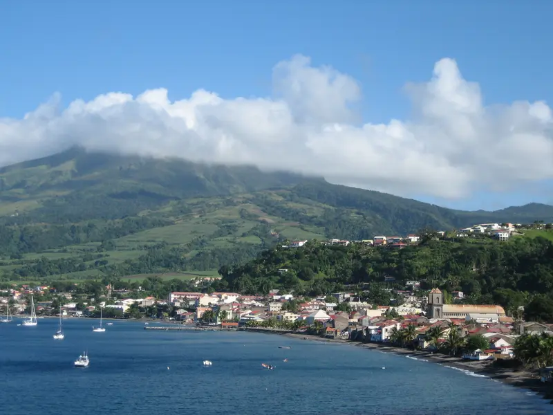
    Northern Martinique is mountainous and densely forested, dominated by the 1,397 m high Montagne Pelée.

    by Felix Gillen

    1. Home
    2. Destinations
    3. Martinique
    4. North Island: Saint-Pierre and Montagne Pelée
    Northern Martinique is mountainous and densely forested, dominated by the 1,397 m high Montagne Pelée. You come for the ruins of Saint-Pierre, which the volcano destroyed on May 8, 1902, for the hike up the volcano, and for the rainforest that extends to the sea at Anse Couleuvre.Founded in 1635, Saint-Pierre was the island's most important city until 1902; today, nearly 4,000 people live among the ruins, and the city holds the 'Ville d'art et d'histoire' label. Since 2023, the volcanoes and forests of Montagne Pelée and the Pitons du Nord have been a UNESCO World Heritage site. The coastal road leads via Le Prêcheur to Anse Couleuvre, where it ends.
    Martinique travel guideSee 2 round tripsPlan a trip with North Island: Saint-Pierre and Montagne Pelée

    Contents

    • Places in the region
    • Culture
    • Getting around
    • Round trips
    • Nearby

    More places in North Island: Saint-Pierre and Montagne Pelée

    Saint-Pierre

    Concord·CC BY-SA 4.0

    Saint-Pierre

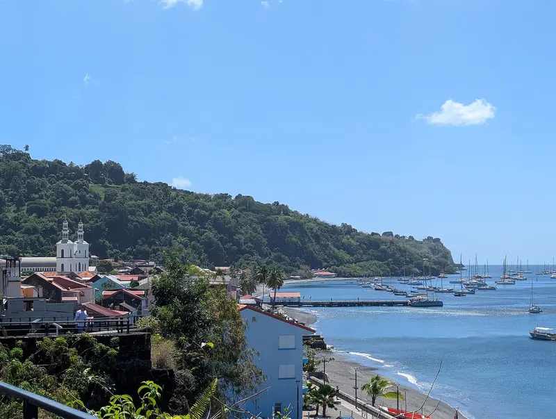
    Saint-Pierre is located on the northwest coast north of Fort-de-France at the foot of Montagne Pelée. Until 1902, it was the island's economic and cultural center, the "Petit Paris" of the Antilles. You come for the ruins left by the volcanic eruption of May 8, 1902, and for the Mémorial that documents the catastrophe.The town was founded in 1635 by Belain d'Esnambuc as the first permanent French settlement on Martinique. The glowing cloud killed almost the entire population. Today, Saint-Pierre holds the "Ville d'art et d'histoire" label.

    Sights in North Island: Saint-Pierre and Montagne Pelée

    Discover the most important sights and attractions

    Natural Feature

    Montagne Pelée

    Montagne Pelée, at 1,397 meters, is Martinique's highest mountain. Its eruption on May 8, 1902, destroyed Saint-Pierre and killed approximately 28,000 to 30,000 people; since 2023, it has been a UNESCO World Heritage site. The most famous ascent is the L'Aileron trail, starting at approximately 820 meters above Morne-Rouge, steep and slippery, taking about four and a half to five and a half hours round trip. The OVSM Volcano Observatory issued a Yellow alert level in August 2026; check current advisories before ascending.
    Open in Google Maps
    Point of Interest

    Depaz Distillery

    The rum distillery is located on Habitation La Montagne at the foot of Montagne Pelée. The tour through the park, production, and barrel storage is free; from February to June, you can observe the production during the harvest. Château Depaz is accessible for a fee with an audio guide.
    Open in Google Maps
    Attraction

    Anse Couleuvre

    The beach in Le Prêcheur is located at the end of coastal road D10, featuring dark volcanic sand, coconut palms, and forest extending to the sea. Snorkeling is popular around the rocky islet La Perle, but be aware of currents. From here, a hiking trail leads to Grand'Rivière.
    Open in Google Maps

    Life by the Volcano

    The Catastrophe of 1902The eruption of Montagne Pelée on May 8, 1902, profoundly shapes the region's memory. The Mémorial showcases found objects from the excavations and names approximately 7,500 identified victims. The story of Louis-Auguste Cyparis, who survived in his prison cell, is widely known.Rum at the VolcanoAt Habitation La Montagne, at the foot of the volcano, the Depaz distillery produces Rhum agricole, whose AOC Martinique has been protected since 1996.

    Car Travel to the North

    Getting ThereFrom Fort-de-France, you reach Saint-Pierre via the coastal road or the Route de la Trace with the Jardin de Balata through the mountains. In the north, roads are narrow, winding, and sometimes steep; the D10 to Le Prêcheur ends at Anse Couleuvre.Hiking the VolcanoThe L'Aileron trail to Montagne Pelée begins above Morne-Rouge. Beforehand, check the alert level with the OVSM Volcano Observatory and the weather; the summit is often shrouded in clouds. The Federal Foreign Office provides current safety information.

    Round trips through this region

    Martinique in Nine Days: From the South to the Volcano

    Martinique in Nine Days: From the South to the Volcano

    The tour begins at Fort-de-France Bay, leads to the southern beaches, and ends in the north at the foot of Montagne Pelée. It combines beach days with history and rainforest.

    10 Days
    3 stops

    Patrice78500·CC BY-SA 4.0

    Island Hopping by Ferry: Martinique between Dominica and St. Lucia

    Island Hopping by Ferry: Martinique between Dominica and St. Lucia

    The third leg of island-hopping Guadeloupe, Dominica, Martinique, and St. Lucia by regular ferry. On Martinique, you'll stay in Les Trois-Îlets, opposite Fort-de-France, and reach the capital with the Navettes across the bay. From here, you'll visit the south with Le Diamant and Sainte-Anne, and in the north, Saint-Pierre at the foot of Montagne Pelée.

    6 Days
    3 stops
    Open jaw

    Patrice78500·CC BY-SA 4.0

    Nearby

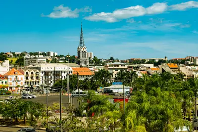
    Fort-de-France

    Fort-de-France

    Fort-de-France is the capital of Martinique and is located on the west coast at the northern end of the bay of the same name, near the airport in Le Lamentin. You come for the iron cathedral Saint-Louis, the Bibliothèque Schœlcher from the Paris World's Fair of 1889, and as a starting point for the Jardin de Balata and the bay of Les Trois-Îlets.With around 75,500 inhabitants, Fort-de-France is the island's largest municipality. In 1692, the colonial capital was moved here from Saint-Pierre; the city has borne its current name since 1807, and after the volcanic eruption of 1902, it finally became the central hub. In the compact center, the library, cathedral, and the green space La Savane are close together, while Fort Saint-Louis rises on the waterfront.

    Wil ZAID·Unsplash

    Les Trois-Îlets

    Les Trois-Îlets

    Les Trois-Îlets lies in the southwest on the Bay of Fort-de-France and is connected to the capital by ferry in about 20 minutes. You come for the birthplace of Empress Joséphine, the Village de la Poterie, and the beaches and hotels of Anse Mitan and Pointe du Bout.The commune takes its name from three islets in the bay and has been independent since 1849. It includes the town center, Anse Mitan, the marina at Pointe du Bout, and Anse à l'Âne.

    Patrice78500·CC BY-SA 4.0

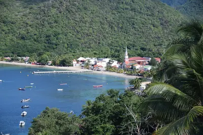
    Les Anses-d'Arlet

    Les Anses-d'Arlet

    This community on the southwest coast is sheltered between the Mornes, off the main roads. Its most famous landmark is the small Saint-Henri church right by the sea, extending from the jetty.In the clear, calm water, according to Lonely Planet, you can spot turtles, octopuses, and moray eels just a few meters from the shore. The community includes the bays Grande Anse, Anse Dufour, and Anse Noire.

    AronMSzabo·CC BY-SA 4.0

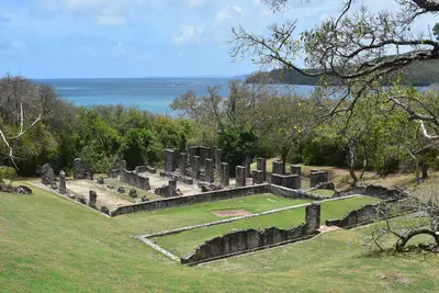
    Peninsula of La Caravelle

    Peninsula of La Caravelle

    The approximately 12 km long La Caravelle peninsula juts into the ocean near La Trinité on the Atlantic coast. You come for its hiking trails through dry forest and mangroves, the ruins of Château Dubuc, and views of the island's rugged Atlantic side.La Caravelle, with the Sainte-Anne peninsula, is one of Martinique's oldest landforms. Since 1976, its tip has been a national nature reserve managed by the Parc naturel régional, encompassing savannas, dry forest, mangroves, and coastal vegetation in a compact area. The fishing village Tartane lies at the entrance; at D2's end, two marked hiking trails begin near Château Dubuc.

    Bastenbas·CC BY-SA 4.0

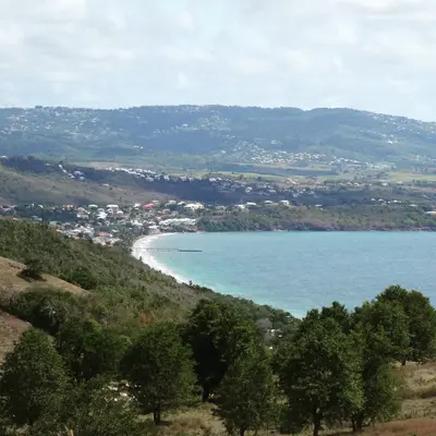
    Le Diamant

    Le Diamant

    Le Diamant is a seaside resort on the Caribbean coast in the southwest of Martinique, on the Route des Anses. You come for the 175-meter-high Diamond Rock, which rises from the sea about four kilometers off the beach, for the approximately three-kilometer-long Grande Anse du Diamant, and for the Mémorial Cap 110.Above the town rises Morne Larcher, known as "la femme couchée" because of its shape.

    Lechatsylvestre·CC BY-SA 4.0

    Your next steps

    North Island: Saint-Pierre and Montagne Pelée is in Martinique. Ways to carry on from here.

    • More in Martinique

      Highlights, areas, routes and the best time to travel for all of Martinique.

      Martinique travel guide
    • Round trips with North Island: Saint-Pierre and Montagne Pelée

      2 routes pass through North Island: Saint-Pierre and Montagne Pelée, with stops, nights and a map.

      See 2 round trips
    • Plan a trip with North Island: Saint-Pierre and Montagne Pelée

      The Guide asks about season, length and who is coming, and suggests a trip with North Island: Saint-Pierre and Montagne Pelée.

      Plan the trip

    Sources & method

    • Photos: Wikimedia Commons. Each photo carries its credit.
    • Place data such as addresses and ratings comes from Google Maps.
    • The content is based on web research from public, traceable sources. How the content is made · The role of AI