Fernweh: Home
ExploreGuideDestinationsMy tripsMy trip
de|en
All Places & RegionsRound tripsNight trains in EuropeAll highlightsAbout FernwehFAQPrivacy PolicyImprint
Download on the App StoreGet it on Google Play
ExploreGuideDestinationsMy tripsMy trip
    • Neighborhoods & highlights
    • Recommendations
    • Tours
    • Eat & drink
    • Culture
    • Getting around
    • Accommodation
    • Plan trip
    • Round trips
    • Nearby
    Karakol

    Nikolai Bulykin / Wikimedia Commons / CC BY-SA 4.0, mod.

    Kyrgyzstan

    Karakol

    City

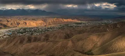
    Karakol at the eastern end of Issyk-Kul is the base for trekking in the Terskey Alatau: From here, you can reach Altyn Arashan with its hot springs, the glacier lake Ala-Kul, the Karakol Valley, and the red rocks of Jeti-Ögüz.

    by Felix Gillen

    1. Home
    2. Destinations
    3. Kyrgyzstan
    4. Issyk-Kul
    5. Karakol
    Karakol at the eastern end of Issyk-Kul is the base for trekking in the Terskey Alatau: From here, you can reach Altyn Arashan with its hot springs, the glacier lake Ala-Kul, the Karakol Valley, and the red rocks of Jeti-Ögüz. In the city itself, you'll find the wooden Dungan Mosque and the Holy Trinity Cathedral, while the animal market is a Sunday morning draw.The city was founded in 1869 as a Russian military outpost and was long called Prshevalsk, after the explorer Nikolai Prshevalsky, who died here in 1888.
    Kyrgyzstan travel guideSee the round tripPlan a trip with Karakol

    Contents

    • Neighborhoods & highlights
    • Recommendations
    • Tours
    • Eat & drink
    • Culture
    • Getting around
    • Accommodation
    • Round trips
    • Nearby

    Sights in Karakol

    Discover the most important sights and attractions

    Market

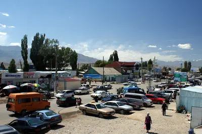
    1Sunday Animal Market

    Every Sunday from early morning, farmers north of the city trade sheep, goats, horses, and cattle; by 10 AM it's all over. You can get there by Marschrutka 102 or by taxi for about 70 to 100 Som. Admission is free.
    Open in Google Maps
    Holy Trinity Cathedral

    en:User:hux / Wikimedia Commons / public domain

    Church

    2Holy Trinity Cathedral

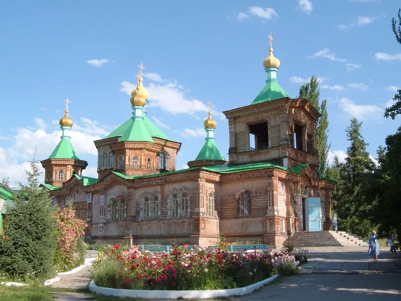
    The Russian Orthodox wooden cathedral was consecrated in 1895 after an earthquake destroyed its predecessor. In Soviet times, it served as a school, theater, dance hall, and coal storage; since 1991, it is again a church. Admission is free.
    Open in Google Maps
    Mosque

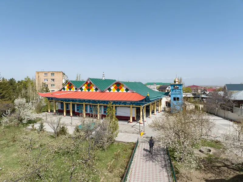
    3Dungans' Mosque

    The wooden mosque of the Dungan community was completed in 1910, designed by a Chinese master builder whose name is not recorded. It is said to have been built without a single nail. Admission is inexpensive; women are not always permitted inside.
    Open in Google Maps
    Park

    4Altyn Arashan

    This high valley with hot springs is located over 2,300 m in the mountains southeast of Karakol. From Ak-Suu village, it's 14 to 18 km depending on the spring, about 5 to 6 hours on foot; there's no public transport, only off-road 4WD vehicles or old military trucks drive the track. A border zone permit is not required.
    Open in Google Maps
    Attraction

    5Karakol Ski Resort

    The ski area is in Karakol Valley southeast of the city, slopes begin at around 3,000 m and higher. Season is roughly December to March.
    Open in Google Maps
    Natural Feature

    6Glacial Lake Ala-Kul

    At over 3,500 m, the glacier lake is the destination of the region's most famous trek: from Karakol Valley up to the lake, over Ala-Kul Pass at almost 3,900 m, and down to Altyn Arashan. Depending on the route, it's 45 to 55 km; optimal conditions are from July to mid-September. No permit is required, but the national park fee is.
    Open in Google Maps

    Tours & experiences in Karakol

    Search tours for Karakol on GetYourGuide* (Affiliate link)On GetYourGuide, with reviews from other travellers

    * Affiliate link: if you book through it, we earn a small commission. The price stays the same for you.

    Restaurants in Karakol

    1

    Cafe Zarina

    The cabin-style café on Toktogul Street serves Lagman and Shashlik; Lonely Planet and Wikivoyage list it.
    Show on Google Maps
    2

    Dastorkon

    Lonely Planet & Wikivoyage recommend the restaurant for local & Western cuisine, including horse & yak. English-speaking staff. Open approx. 11 AM – midnight.
    Show on Google Maps

    Culture and History

    Garrison Town and Explorer's HubKarakol was founded on July 1, 1869, as a Russian military outpost. After the death of the explorer Nikolai Przhevalsky, who died here in 1888, the city was called Przhevalsk from 1889 to 1921 and from 1939 to 1991. His tombstone with a bronze eagle from 1894 and a museum (opened 1957) are located near Pristan-Przhevalsk, north of the city.Dungans, Russians, and KyrgyzThe Dungan Wooden Mosque and the Orthodox Wooden Cathedral are only a few streets apart. Dungan cuisine defines the city: Ashlyan-Fu, the cold noodle soup, is eaten in its own alley at the small bazaar; dinners with Dungan families in the village of Yrdyk can be booked through the Visit Karakol Info Center.

    Arrival and Info

    ArrivalFrom Bishkek, it's about 400 km, mostly via the north shore of Issyk-Kul. Marshrutkas depart from around 7 AM from the new Bishkek bus station (the old western bus station closed in October 2024), travel time approximately 6 to 7 hours.The route via the south shore is more scenic, but the road is worse.Organizing TrekkingThe Visit Karakol Info Centre is the point of contact for maps, accommodation in the valleys, and border zone permits; permits for the Karkyra Valley, Inylchek Glacier, and Khan Tengri area require 10 to 15 working days.No permit is required for Ala-Kul, Altyn Arashan, and Jeti-Ögüz. At Karakol National Park's entrance, pay a fee (250-300 Som, depending on source); keep the receipt, it will be checked.Marschrutka 101 goes to the Ala-Kul trailhead in Karakol Valley; Bus 355 to Jeti-Ögüz.Hiking season in the uplands is roughly July to mid-September, ski season December to March.

    Accommodations in Karakol

    Find perfect stay in Karakol

    Booking.com* (Affiliate link)
    Search Hotels
    Agoda* (Affiliate link)
    Search Hotels
    Airbnb
    Vacation Rentals

    * Affiliate link: if you book through it, we earn a small commission. The price stays the same for you.

    Plan your trip to Karakol

    Save places, build a route and plan your city trip, all in one place.

    1. 1
      Sunrise over alpine peaks and a sea of clouds
      1234

      Round trip

      12 days · 4 stops

      Saved

      Pick a route

      Pick a ready-made one or save places and plan your own.

      Open bookmarks
    2. 2

      Trip to Karakol

      Live
      • 1Sunday Animal Market3 days
      • 2Holy Trinity Cathedral4 days
      • 3Dungans' Mosque5 days
      Budget

      Plan your trip

      The planner sorts stops, days and budget. Plan together in real time.

      Start trip planning
    3. 3
      9:41 No signal
      Karakol
      Available offline

      Nikolai Bulykin / Wikimedia Commons / CC BY-SA 4.0, mod.

      Use it on the road

      Download the guide to your phone and use it on site, even offline.

    Round trips with Karakol

    Issyk-Kul, Song-Kul and Tash Rabat in 13 days

    Issyk-Kul, Song-Kul and Tash Rabat in 13 days

    The classic summer circuit through northern and central Kyrgyzstan: capital and Ala-Archa, the north shore of Issyk-Kul, trekking days around Karakol, the quiet south shore, yurt nights at Song-Kul and the caravanserai Tash Rabat. Only advisable from mid-June to mid-September, when high altitudes are snow-free and yurt camps open. For Song-Kul and Tash Rabat, you'll need a driver with a 4x4 vehicle, which CBT offices can arrange.

    13 Days
    8 stops

    Arseniy Kotov·Pexels

    Nearby

    Jeti-Ögüz

    Jeti-Ögüz

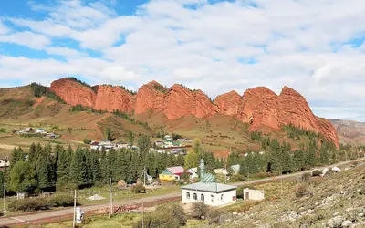
    Jeti-Ögüz, the “Seven Bulls”, is a series of red sandstone cliffs at the entrance to a mountain valley about 35 km west of Karakol, above a Soviet sanatorium. Viewed from the north, the same ridge is known as the “Broken Heart”; behind it, the valley opens up with meadows and hiking trails.

    Bernard Gagnon·CC0

    Issyk-Kul

    Issyk-Kul

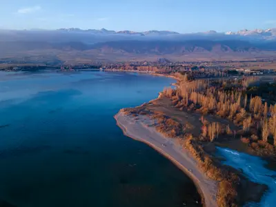
    Issyk-Kul, at 6,236 km², is Kyrgyzstan's largest lake: up to 668 m deep, situated at around 1,600 m altitude, and slightly salty, preventing it from freezing even in winter; only shallow bays may ice over. On the north shore, under the Kungey Alatau, are resorts like Cholpon-Ata with its petroglyph field; the trekking base Karakol at the eastern end; and on the quieter south shore, red canyons, yurt camps, and the Terskey Alatau valleys.

    Mike Dudin·Unsplash

    Cholpon-Ata

    Cholpon-Ata

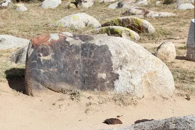
    Cholpon-Ata is the main town on the northern shore of Issyk-Kul and the lakeside holiday resort, with Soviet-era sanatoriums and bathing beaches. Above the town lies the Open-Air Museum of Petroglyphs, with thousands of rock carvings from the Bronze Age and Saka period, also home to the Ruch Ordo Cultural Center and the Regional Museum.

    Bgag·CC0

    Kotschkor

    Kotschkor

    Kotschkor is a small town at around 1,800 m, about a three-hour drive from Bishkek, and the gateway to Song-Kul. Here, you organize jeeps, horses, and yurts through the CBT office, and here is where the women's cooperative Altyn Kol, which produces and sells felt carpets (shyrdaks), is based.

    Kondephy·CC BY-SA 4.0

    Naryn

    Naryn

    Naryn is the capital of its namesake province, a sprawling town at around 2,040 m on both banks of the Naryn, a headstream of the Syr Darya. Travelers use it as a stopover on the way to Tash Rabat and the Torugart Pass; the CBT office arranges accommodation, drivers, and border zone permits.

    Pmelton87·CC BY-SA 4.0

    Your next steps

    Karakol is in Kyrgyzstan. Ways to carry on from here.

    • More in Kyrgyzstan

      Highlights, areas, routes and the best time to travel for all of Kyrgyzstan.

      Kyrgyzstan travel guide
    • Round trips with Karakol

      One route passes through Karakol, with stops, nights and a map.

      See the round trip

    Sources & method

    • Photos: Wikimedia Commons. Each photo carries its credit.
    • Place data such as addresses and ratings comes from Google Maps.
    • The content is based on web research from public, traceable sources. How the content is made · The role of AI