Fernweh: Home
    ExploreTravel GuidesPlan a tripMy tripLast visited
    de|en
    All Places & RegionsAll highlightsAbout FernwehFAQPrivacy PolicyImprint
    ExploreTravel GuidesPlan a tripMy tripLast visited
    • Neighborhoods & highlights
    • Eat & drink
    • Accommodation
    • Plan trip
    • Nearby
    Cafayate

    Argentina

    Cafayate

    City

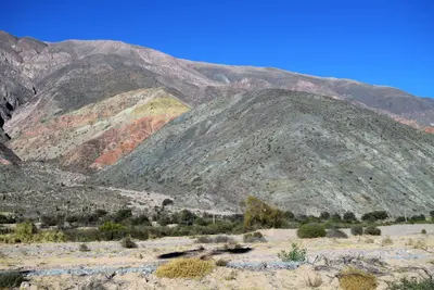
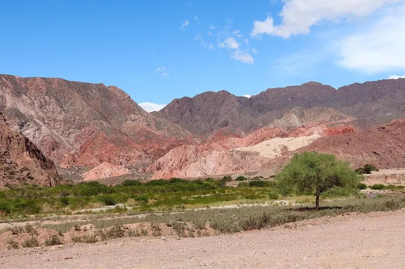
    Cafayate, situated at around 1,680 meters in the Valles Calchaquíes in the south of Salta province, is the hub of northern winemaking. Red mountains, vineyards, and a dry, sunny climate define its surroundings.

    by Felix Gillen

    1. Home
    2. Destinations
    3. Argentina
    4. Cafayate
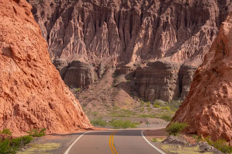
    Cafayate, situated at around 1,680 meters in the Valles Calchaquíes in the south of Salta province, is the hub of northern winemaking. Red mountains, vineyards, and a dry, sunny climate define its surroundings. The typical grape variety is the aromatic white wine Torrontés; many Bodegas around the town offer tours and tastings.Even the journey there is an experience: The paved Ruta Nacional 68 leads from Salta through the Quebrada de las Conchas with its red rock formations such as the Garganta del Diablo and the Anfiteatro, a rock gorge with remarkable acoustics. The approximately 190-kilometer journey takes about four hours, including photo stops. To the north, the unpaved Ruta 40 stretches to Cachi; it's best avoided during the rainy season.

    Sights in Cafayate

    Discover the most important sights and attractions

    Quebrada de las Conchas

    1Quebrada de las Conchas

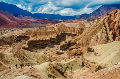
    The Ruta Nacional 68 between Salta and Cafayate leads through a valley whose red and orange rock walls have been shaped by wind and water over millions of years. The best-known stops are the Garganta del Diablo, a narrow rock gorge you enter via a short path, and the Anfiteatro, a natural rock amphitheater with impressive acoustics right by the road. In the afternoon, the colors glow most vibrantly.
    Open in Google Maps
    Wineries of Cafayate

    2Wineries of Cafayate

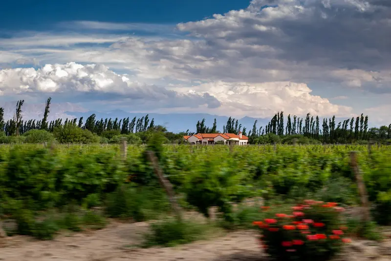
    High-altitude wineries like El Esteco, Piattelli, and El Porvenir dot the town's surroundings. Many offer tours/tastings, highlighting aromatic white Torrontés alongside Malbec, Cabernet Sauvignon, and Tannat. Don't miss the regional Torrontés ice cream in town.
    Open in Google Maps

    Restaurants in Cafayate

    Accommodations in Cafayate

    Find perfect stay in Cafayate

    Booking.com* (Affiliate link)
    Search Hotels
    Agoda* (Affiliate link)
    Search Hotels
    Airbnb
    Vacation Rentals

    * Affiliate link: if you book through it, we earn a small commission. The price stays the same for you.

    Plan your trip to Cafayate

    Save places, build a route and plan your city trip, all in one place.

    1. 1
      Sunrise over alpine peaks and a sea of clouds
      1234

      Round trip

      12 days · 4 stops

      Saved

      Pick a route

      Pick a ready-made one or save places and plan your own.

      Open bookmarks
    2. 2

      Trip to Cafayate

      Live
      • 1Quebrada de las Conchas3 days
      • 2Wineries of Cafayate4 days
      Budget

      Plan your trip

      The planner sorts stops, days and budget. Plan together in real time.

      Start trip planning
    3. 3
      9:41 No signal
      Cafayate
      Available offline

      Use it on the road

      Download the guide to your phone and use it on site, even offline.

    Nearby

    Salta

    Salta

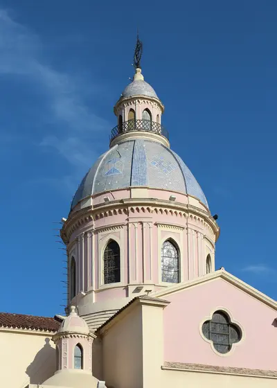
    Salta, known as “La Linda,” was founded in 1582 and is renowned for its Spanish colonial architecture. Situated at approximately 1,150 meters at the foot of Cerro San Bernardo, it serves as the most important starting point for tours to the Quebrada de Humahuaca, Cafayate, and the Salinas Grandes.The focal point is Plaza 9 de Julio, featuring the 18th-century Cathedral and Cabildo, which now houses a historical museum. Right next door, the Museo de Arqueología de Alta Montaña displays the Llullaillaco Mummies, three Inca children sacrificed over 500 years ago on an Andean peak. A cable car ascends Cerro San Bernardo, offering views over the city. In the evenings, you can enjoy folk music with Empanadas and Locro in the Peñas of Calle Balcarce.

    The Northwest of Argentina is a land of high valleys and colorful mountains. An Inca trade route once ran here, and Andean culture still shapes markets, music, and cuisine today. The starting point is the colonial city of Salta; from there, roads lead to the Quebrada de Humahuaca with its vibrant rock faces, up to the Salinas Grandes at around 3,450 meters, and south to the wine region around Cafayate.The most pleasant time to travel here is between May and September, when it is dry and sunny. Many destinations are well over 2,500 meters; plan time for acclimatization.

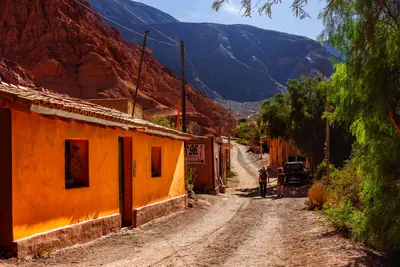
    This small village at the entrance to the Quebrada de Humahuaca is situated directly at the foot of the Cerro de los Siete Colores, the "Mountain of Seven Colors," one of Argentina's most famous photo opportunities. In the village square, vendors sell local handicrafts.The approximately three-kilometer-long Paseo de los Colorados leads around the colorful rocks; in the morning light, the colors appear particularly vibrant. Purmamarca is also a starting point for the drive over the Cuesta de Lipán to the Salinas Grandes and a popular place to experience the Carnival of the North.
    Salinas Grandes

    Salinas Grandes

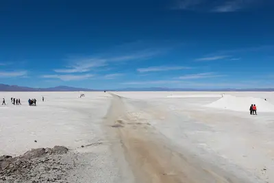
    The Salinas Grandes are an approximately 212-square-kilometer salt flat located at an average elevation of 3,450 meters on the border of the Jujuy and Salta provinces. This dazzling white expanse beneath a deep blue sky formed five to ten million years ago when saltwater evaporated in a basin. Salt is still extracted here today; you can see the rectangular pools where it is mined.From Purmamarca, it's 66 kilometers via Ruta Nacional 52, which winds its way up the Cuesta de Lipán in switchbacks to an elevation of 4,170 meters. Bring warm clothing, sunglasses, and headwear, drink plenty of water, and avoid alcohol beforehand to prevent altitude sickness.

    The Quebrada de Humahuaca is a roughly 155 km high valley in Jujuy Province, traversed by the Río Grande flowing north to south. Its rock walls glow red, ochre, yellow, and violet, due to exposed strata from many geological eras. For approx. 10,000 years, humans used the valley as a trade route, later also the Incas; in 2003, UNESCO declared the Quebrada a World Heritage cultural landscape.Along the road are strung small towns: Purmamarca with the Cerro de los Siete Colores, Maimará with the "Paleta del Pintor", Tilcara with the reconstructed pre-Hispanic mountain fortress Pucará, and Humahuaca at the northern end, from where you drive to the Serranía de Hornocal with its "14 Colors". The climate is dry and windy. The valley is high; allow time for acclimatization.

    Sources & method

    • Photos: Wikimedia Commons, Pexels. Each photo carries its credit.
    • The content is based on web research from public, traceable sources. How the content is made · The role of AI