Jakub Hałun / Wikimedia Commons / CC BY-SA 4.0, mod.
Round trip · Iceland
Ring Road: Iceland in ten days
by Felix Gillen
- 11 Days / 10 Nights
- Reykjavík → Akureyri
The classic clockwise circumnavigation of Iceland on the over 1,300 km long Ring Road, continuously paved since 2019: Golden Circle, South Coast with waterfalls and glacier lagoon, Eastfjords, Mývatn and Akureyri. Visit Iceland recommends a minimum of seven days for the Ring Road; ten days provide time for hikes and side trips.
At a glance
- Duration
- 11 Days / 10 Nights
- Stops
- 8 · Reykjavík → Akureyri
- Arrival
- Flight · Keflavík (KEF)
- Best Time to Go
- June to August
8 stops
Why This Route?
The Ring Road connects almost all of Iceland's major natural attractions on one route, without 4x4 and without Highland roads.
Hidden Gems
- Gljúfrabúi behind the rock at Seljalandsfoss
- Fjallsárlón west of Jökulsárlón
- Puffins in Borgarfjörður eystri (mid-April to mid-August)
- Detour to Snæfellsnes on the way back
Getting there and back
Round trip, returning to where you started
- Arrival
- Flight · Keflavík (KEF)The Flybus takes about 45 min from Keflavík Airport to Reykjavík; bus line 55, about 1 hr 20 min. For your tour, you'll need a rental car.
- Departure
- Flight · Keflavík (KEF)Back to Keflavík Airport via Reykjavík. Before driving across the Reykjanes Peninsula, check the current advisories on safetravel.is.
Itinerary
Reykjavík
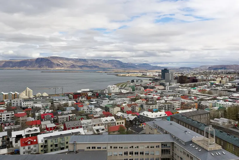
With around 139,000 inhabitants, Reykjavík is the capital of Iceland and the center of a capital region where nearly two-thirds of the population lives. Its landmark is the Hallgrímskirkja, built between 1945 and 1986; at the harbor stands the Harpa concert hall, completed in 2011, whose glass façade was created in collaboration with Ólafur Elíasson.The city center, encompassing the Laugavegur shopping street, the Old Harbor, and Tjörnin pond, is easily explored on foot. Reykjavík serves as the starting point for the Golden Circle and the South Coast.
Arrival, City center, Hallgrímskirkja, Harpa, Thermal bath.
9 Sights
4 Restaurants
Culture and Way of Life
Bathing CultureThe public thermal baths are a meeting point for families and neighbours; the largest is Laugardalslaug. Many baths offer hot pots in addition to swimming pools.Music and FestivalsIn August, the city celebrates Reykjavík Pride and the Culture Night Menningarnótt, on August 21st, 2027.The Iceland Airwaves music festival takes place in early November.The Harpa Concert Hall hosts concerts and events.Local HistoryAt the exhibition Reykjavík 871±2, you can see the remains of a 10th-century longhouse, where, according to tradition, Ingólfur Arnarson settled in 874 as the first settler.
Golden Circle
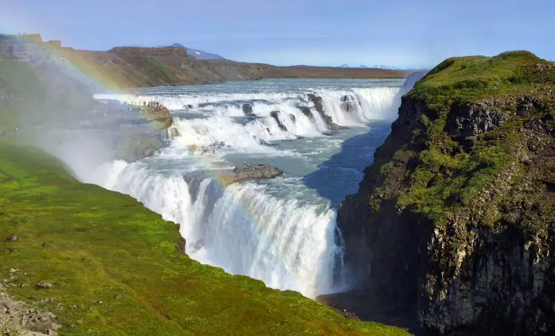
The Golden Circle is Iceland's most famous tour: From Reykjavík, it links Þingvellir National Park, the Haukadalur geothermal area with Geysir and Strokkur, and the two-tiered Gullfoss waterfall. This circuit is around 250-300 km long, depending on the route.In Þingvellir, the Althing first convened in 930. The National Park has been a UNESCO World Heritage site since 2004 and lies in the rift between the North American and Eurasian plates.
Reykjavík to Þingvellir about 47 km, continuing to Geysir and Gullfoss.
5 Sights
1 Restaurant
Vík í Mýrdal
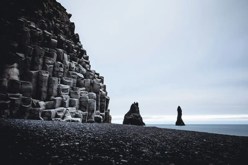
Vík is a village with around 300 inhabitants on the south coast, approximately 187 km from Reykjavík. The white church with a red roof on the hill above the village is considered the only building that would survive a major glacial flood from the Katla volcano.Nearby are the black sand beach Reynisfjara and the approximately 120-meter-high rock promontory Dyrhólaey with its lighthouse from 1927.
Seljalandsfoss, Skógafoss, Reynisfjara; Reykjavík to Vík, c. 187 km.
2 Sights
Skaftafell
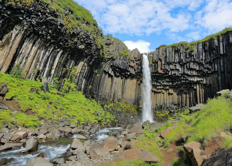
Skaftafell is part of Vatnajökull National Park on the south coast and a starting point for hikes, especially to Svartifoss. The approximately 20 m high waterfall plunges over a wall of dark basalt columns.
Fjaðrárgljúfur en route, hike to Svartifoss.
1 Sight
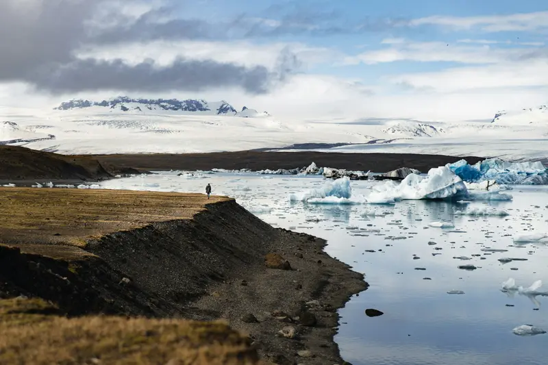
Jökulsárlón
Jökulsárlón is a glacial lagoon in southeast Iceland directly on the Ring Road, about 80 km before Höfn. The Breiðamerkursandur area has been part of Vatnajökull National Park since 2017; opposite is Fellsfjara beach, known as Diamond Beach, and further west the smaller Fjallsárlón lagoon.
Glacier Lagoon and Diamond Beach, overnight stay in the vicinity of Höfn.
3 Sights
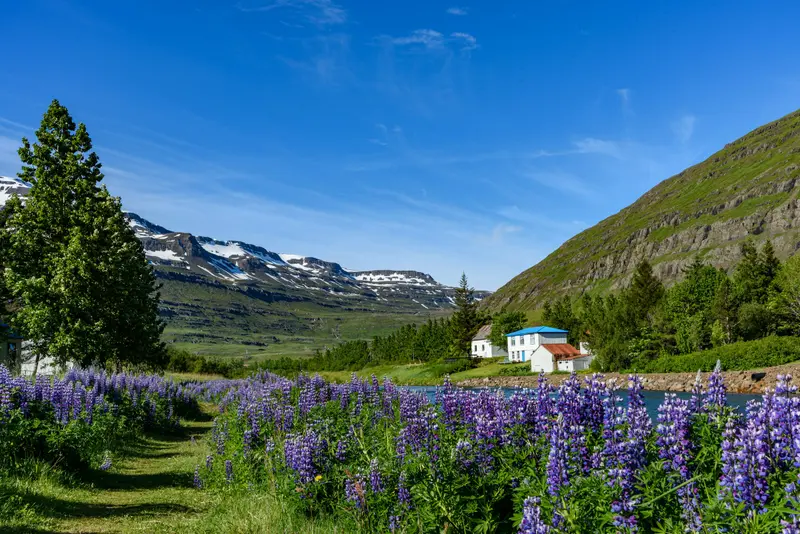
Eastfjords
The Eastfjords are a coast of narrow fjords and small towns between Borgarfjörður eystri in the north and Djúpivogur in the south. Egilsstaðir is the main Ring Road town; the Norröna ferry from Denmark docks in Seyðisfjörður.Inland lie the 128m-high Hengifoss and the basalt gorge Stuðlagil, which only dried up and was revealed with the construction of the Kárahnjúkar power plant.
Höfn to Egilsstaðir approx. 250 km; Seyðisfjörður or Hengifoss.
6 Sights
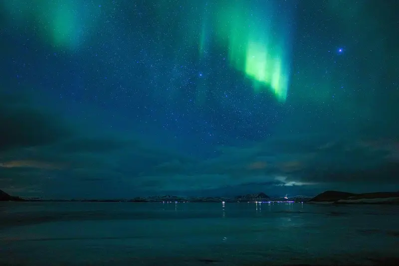
Mývatn
Around Lake Mývatn in North Iceland lie some of the country's most impressive volcanic landscapes: Pseudocraters at Skútustaðir, the lava formations of Dimmuborgir, the Hverfjall crater, the steaming mud pots of Hverir, and the Krafla area, where the so-called Krafla Fires erupted between 1975 and 1984.
Hverir, Krafla, Dimmuborgir; Side trip to Dettifoss.
6 Sights
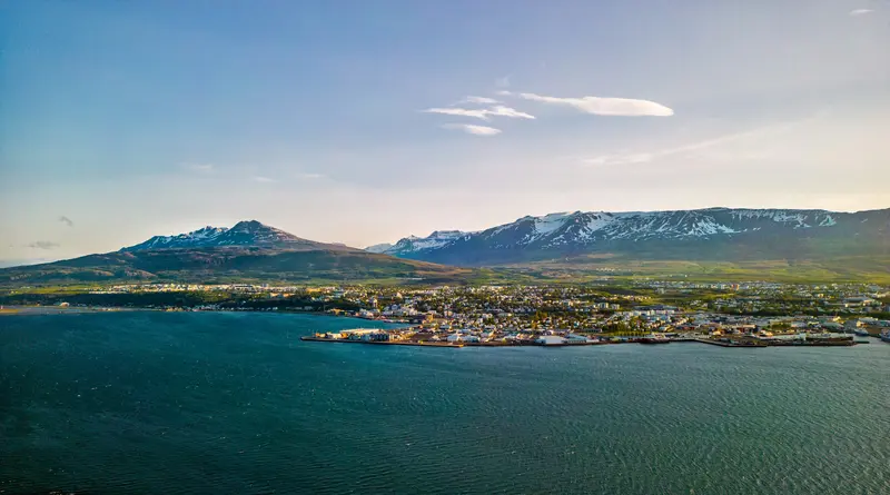
Akureyri
Akureyri ist mit rund 20.000 Einwohnern die größte Gemeinde außerhalb der Hauptstadtregion und das Zentrum Nordislands. Über der Innenstadt steht die 1940 erbaute Akureyrarkirkja, außerdem findest du den Botanischen Garten Lystigarðurinn, das Kulturhaus Hof und eine Fußgängerzone.Der Wasserfall Goðafoss liegt rund 35 km entfernt, der Mývatn rund 100 km.
On the way, Goðafoss; Egilsstaðir to Akureyri approx. 265 km.
2 Sights
2 Restaurants
Plan this route as your trip
All stops, trains and nights go into your trip planner. You adjust dates and places to stay afterwards.
This route is a suggestion from our research. Please check timetables, times in port, opening hours and prices before you book – what your tour operator or carrier says is what counts.
Fernweh is a free travel guide and trip planner: routes researched by people, taken over in one click, used day by day on the road. More about Fernweh
8 stops
Route Summary
Duration11 Days
Stops8 Places
TypeMixed