Fernweh: Home
ExploreGuideDestinationsMy tripsMy trip
de|en
All Places & RegionsRound tripsNight trains in EuropeAll highlightsAbout FernwehFAQPrivacy PolicyImprint
Download on the App StoreGet it on Google Play
ExploreGuideDestinationsMy tripsMy trip
    • Places & highlights
    • Tours
    • Eat & drink
    • Getting around
    • Accommodation
    • Round trips
    • Nearby
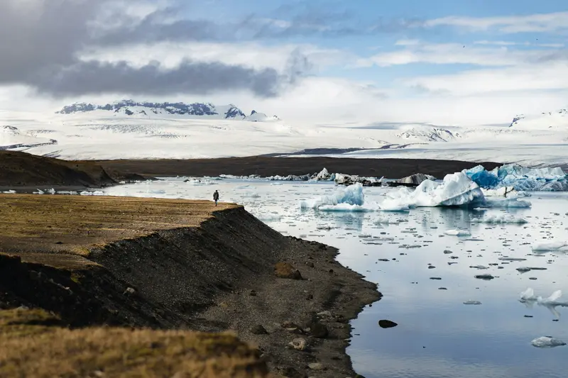
    Jökulsárlón

    Photo by Yvon Hoogers on Unsplash

    Iceland

    Jökulsárlón

    Point of Interest

    Jökulsárlón is a glacial lagoon in southeast Iceland directly on the Ring Road, about 80 km before Höfn.

    by Felix Gillen

    1. Home
    2. Destinations
    3. Iceland
    4. South Coast
    5. Jökulsárlón
    Jökulsárlón is a glacial lagoon in southeast Iceland directly on the Ring Road, about 80 km before Höfn. The Breiðamerkursandur area has been part of Vatnajökull National Park since 2017; opposite is Fellsfjara beach, known as Diamond Beach, and further west the smaller Fjallsárlón lagoon.
    Iceland travel guideSee the round tripPlan a trip with Jökulsárlón

    Contents

    • Places & highlights
    • Tours
    • Eat & drink
    • Getting around
    • Accommodation
    • Round trips
    • Nearby

    Sights in Jökulsárlón

    Discover the most important sights and attractions

    Attraction

    1Glacier Lagoon Jökulsárlón

    The lagoon is located directly on the Ring Road in the Breiðamerkursandur area, which has been part of Vatnajökull National Park since 2017. An area fee is charged at the barrier (cars up to five seats 1,110 ISK, valid until midnight).
    Open in Google Maps
    Beach

    2Diamond Beach (Fellsfjara)

    On Fellsfjara black beach, opposite the lagoon, ice chunks wash ashore, hence the name Diamond Beach. The B2 path there is about 1 km long.
    Open in Google Maps
    Attraction

    3Fjallsárlón

    Smaller glacial lagoon west of Jökulsárlón, also part of Vatnajökull National Park. Trail B4 runs along the lagoon for approximately 1.5 km, taking about 45 minutes.
    Open in Google Maps

    Tours & experiences in Jökulsárlón

    Search tours for Jökulsárlón on GetYourGuide* (Affiliate link)On GetYourGuide, with reviews from other travellers

    * Affiliate link: if you book through it, we earn a small commission. The price stays the same for you.

    Restaurants in Jökulsárlón

    Out & About Locally

    Getting There and FeeJökulsárlón is located directly on the Ring Road. As of June 1, 2023, the national park charges an area fee at the barrier: 1,110 ISK for cars up to five seats, valid until midnight.TrailsTo Diamond Beach (Fellsfjara), follow Trail B2, approximately 1 km.At Fjallsárlón, Trail B4 is approx. 1.5 km and takes about 45 minutes.AccommodationCamping is not allowed on Breiðamerkursandur.

    Accommodations in Jökulsárlón

    Find perfect stay in Jökulsárlón

    Booking.com* (Affiliate link)
    Search Hotels
    Agoda* (Affiliate link)
    Search Hotels
    Airbnb
    Vacation Rentals

    * Affiliate link: if you book through it, we earn a small commission. The price stays the same for you.

    Campgrounds in Jökulsárlón

    Find perfect campground in Jökulsárlón

    Search via Google Maps
    Campgrounds nearby (15km)
    Camping.info
    Find Campgrounds
    Park4Night
    RV Parks & Camping

    Round trips with Jökulsárlón

    Ring Road: Iceland in ten days

    Ring Road: Iceland in ten days

    The classic clockwise circumnavigation of Iceland on the over 1,300 km long Ring Road, continuously paved since 2019: Golden Circle, South Coast with waterfalls and glacier lagoon, Eastfjords, Mývatn and Akureyri. Visit Iceland recommends a minimum of seven days for the Ring Road; ten days provide time for hikes and side trips.

    11 Days
    8 stops

    Jakub Hałun·CC BY-SA 4.0

    Nearby

    Skaftafell

    Skaftafell

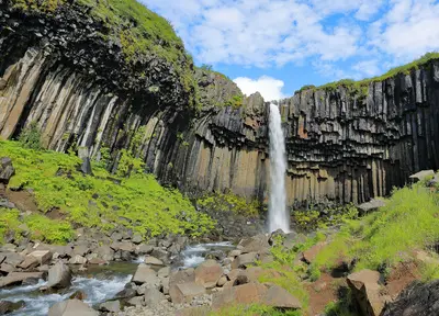
    Skaftafell is part of Vatnajökull National Park on the south coast and a starting point for hikes, especially to Svartifoss. The approximately 20 m high waterfall plunges over a wall of dark basalt columns.

    Martin Falbisoner·CC BY-SA 4.0

    Vík í Mýrdal

    Vík í Mýrdal

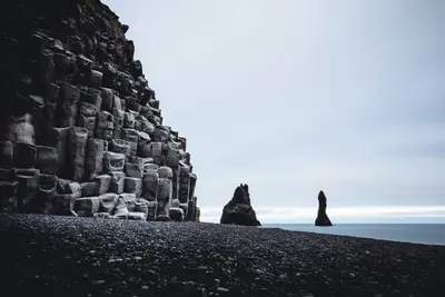
    Vík is a village with around 300 inhabitants on the south coast, approximately 187 km from Reykjavík. The white church with a red roof on the hill above the village is considered the only building that would survive a major glacial flood from the Katla volcano.Nearby are the black sand beach Reynisfjara and the approximately 120-meter-high rock promontory Dyrhólaey with its lighthouse from 1927.

    Denys Nevozhai·Unsplash

    East Fjords

    East Fjords

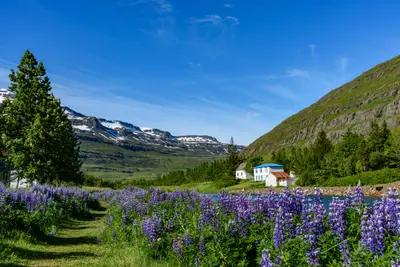
    The Eastfjords are a coast of narrow fjords and small towns between Borgarfjörður eystri in the north and Djúpivogur in the south. Egilsstaðir is the main Ring Road town; the Norröna ferry from Denmark docks in Seyðisfjörður.Inland lie the 128m-high Hengifoss and the basalt gorge Stuðlagil, which only dried up and was revealed with the construction of the Kárahnjúkar power plant.

    Joe deSousa·Unsplash

    South Coast

    South Coast

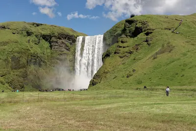
    Along the South Coast, lining the Ring Road, are the waterfalls Seljalandsfoss and Skógafoss, the black sand beach Reynisfjara near Vík, the Skaftafell section of Vatnajökull National Park, and the Jökulsárlón glacier lagoon. From Reykjavík to Vík, it's approximately 187 km or two and a half hours' drive.Many destinations are directly on the road and accessible via short paths; fees are charged at most parking lots.

    Jakub Hałun·CC BY 4.0

    Mývatn

    Mývatn

    Around Lake Mývatn in North Iceland lie some of the country's most impressive volcanic landscapes: Pseudocraters at Skútustaðir, the lava formations of Dimmuborgir, the Hverfjall crater, the steaming mud pots of Hverir, and the Krafla area, where the so-called Krafla Fires erupted between 1975 and 1984.

    Giles Laurent·CC BY-SA 4.0

    Your next steps

    Jökulsárlón is in Iceland. Ways to carry on from here.

    • More in Iceland

      Highlights, areas, routes and the best time to travel for all of Iceland.

      Iceland travel guide
    • Round trips with Jökulsárlón

      One route passes through Jökulsárlón, with stops, nights and a map.

      See the round trip
    • Plan a trip with Jökulsárlón

      The Guide asks about season, length and who is coming, and suggests a trip with Jökulsárlón.

      Plan the trip

    Sources & method

    • Photos: Unsplash. Each photo carries its credit.
    • Place data such as addresses and ratings comes from Google Maps.
    • The content is based on web research from public, traceable sources. How the content is made · The role of AI