Fernweh: Home
ExploreGuideDestinationsMy tripsMy trip
de|en
All Places & RegionsRound tripsNight trains in EuropeAll highlightsAbout FernwehFAQPrivacy PolicyImprint
Download on the App StoreGet it on Google Play
ExploreGuideDestinationsMy tripsMy trip
    • Places in the region
    • Getting around
    • Round trips
    • Nearby
    East Fjords

    Photo by Joe deSousa on Unsplash

    Iceland

    East Fjords

    Region

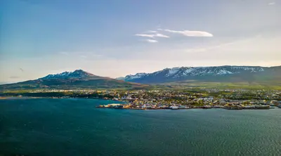
    The Eastfjords are a coast of narrow fjords and small towns between Borgarfjörður eystri in the north and Djúpivogur in the south. Egilsstaðir is the main Ring Road town; the Norröna ferry from Denmark docks in Seyðisfjörður.

    by Felix Gillen

    1. Home
    2. Destinations
    3. Iceland
    4. East Fjords
    The Eastfjords are a coast of narrow fjords and small towns between Borgarfjörður eystri in the north and Djúpivogur in the south. Egilsstaðir is the main Ring Road town; the Norröna ferry from Denmark docks in Seyðisfjörður.Inland lie the 128m-high Hengifoss and the basalt gorge Stuðlagil, which only dried up and was revealed with the construction of the Kárahnjúkar power plant.
    Iceland travel guideSee the round tripPlan a trip with East Fjords

    Contents

    • Places in the region
    • Getting around
    • Round trips
    • Nearby

    Sights in East Fjords

    Discover the most important sights and attractions

    Attraction

    Hafnarhólmi (Borgarfjörður eystri)

    On the cliff by the harbour of Borgarfjörður eystri, around 10,000 pairs of puffins breed, which you can observe up close from platforms. The season is mid-April to mid-August. The place is about 70 km from Egilsstaðir.
    Open in Google Maps
    Church

    Seyðisfjörður with Blue Church

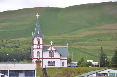
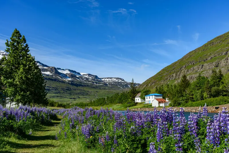
    In the fjord village of Seyðisfjörður, Rainbow Street Norðurgata, repainted annually since 2016, leads to the Blue Church, open in summer. The Norröna ferry from Denmark docks here too. In December 2020, landslides following record rain destroyed over ten buildings; no one was injured.
    Open in Google Maps
    Attraction

    Stuðlagil

    The Jökla River's basalt gorge in Jökuldalur Valley, made visible only by the Kárahnjúkar power plant draining it. From the west bank (parking at Grund), peer down via a steel staircase. On the east bank, a 5 km path (round trip, 1.5-2 hours) from Klaustursel reaches the water. From late summer, the water may be grey.
    Open in Google Maps
    Attraction

    Hengifoss

    According to the operator, a 128 m high waterfall about 35 km from Egilsstaðir. The path is 2.2 to 2.5 km long (round trip approx. 90 minutes); halfway, you pass Litlanesfoss with basalt columns.
    Open in Google Maps
    Attraction

    Eggin í Gleðivík

    Artwork by Sigurður Guðmundsson at Djúpivogur harbour: 34 replicas of bird eggs on old concrete plinths.
    Open in Google Maps
    Museum

    Petra's Rock Collection (Stöðvarfjörður)

    Petra Sveinsdóttir (1922-2012) began collecting stones in 1946 and opened her house and garden in Stöðvarfjörður to visitors in 1974.
    Open in Google Maps

    Exploring locally

    Getting ThereThe Ring Road passes through Egilsstaðir; it's about 250 km from Höfn and 265 km from Akureyri.The Norröna ferry from Hirtshals (Denmark) docks weekly in Seyðisfjörður from approximately March to November.The gravel road Öxi (939) is a summer shortcut between Djúpivogur and Egilsstaðir.ExcursionsBorgarfjörður eystri, home to puffins, is located about 70 km northeast of Egilsstaðir, Hengifoss is about 35 km away; Stuðlagil can be reached via Road 923 in Jökuldalur valley.WinterPasses in the east may be closed in winter; check umferdin.is and safetravel.is beforehand.

    Round trips through this region

    Ring Road: Iceland in ten days

    Ring Road: Iceland in ten days

    The classic clockwise circumnavigation of Iceland on the over 1,300 km long Ring Road, continuously paved since 2019: Golden Circle, South Coast with waterfalls and glacier lagoon, Eastfjords, Mývatn and Akureyri. Visit Iceland recommends a minimum of seven days for the Ring Road; ten days provide time for hikes and side trips.

    11 Days
    8 stops

    Jakub Hałun·CC BY-SA 4.0

    Nearby

    Mývatn

    Mývatn

    Around Lake Mývatn in North Iceland lie some of the country's most impressive volcanic landscapes: Pseudocraters at Skútustaðir, the lava formations of Dimmuborgir, the Hverfjall crater, the steaming mud pots of Hverir, and the Krafla area, where the so-called Krafla Fires erupted between 1975 and 1984.

    Giles Laurent·CC BY-SA 4.0

    N Iceland

    N Iceland

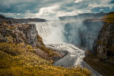
    North Iceland stretches from Akureyri, the largest community outside the Capital Region, past Goðafoss waterfall to the volcanically-formed Mývatn and the whale-watching hub of Húsavík. In the northeast, within Vatnajökull National Park, lie Dettifoss and the horseshoe-shaped canyon of Ásbyrgi.

    Richard Dorran·Unsplash

    Jökulsárlón

    Jökulsárlón

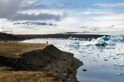
    Jökulsárlón is a glacial lagoon in southeast Iceland directly on the Ring Road, about 80 km before Höfn. The Breiðamerkursandur area has been part of Vatnajökull National Park since 2017; opposite is Fellsfjara beach, known as Diamond Beach, and further west the smaller Fjallsárlón lagoon.

    Yvon Hoogers·Unsplash

    Húsavík

    Húsavík

    Húsavík is a port town in North Iceland, famous for its whale watching tours. The Whale Museum houses the complete, 25 m long skeleton of a blue whale; the Húsavíkurkirkja church, built in 1907, is unusually large for Iceland.On the outskirts of town is the GeoSea bath, fed with geothermally heated seawater.

    Steven Lek·CC BY-SA 4.0

    Akureyri

    Akureyri

    Akureyri ist mit rund 20.000 Einwohnern die größte Gemeinde außerhalb der Hauptstadtregion und das Zentrum Nordislands. Über der Innenstadt steht die 1940 erbaute Akureyrarkirkja, außerdem findest du den Botanischen Garten Lystigarðurinn, das Kulturhaus Hof und eine Fußgängerzone.Der Wasserfall Goðafoss liegt rund 35 km entfernt, der Mývatn rund 100 km.

    Ed Wingate·Unsplash

    Your next steps

    East Fjords is in Iceland. Ways to carry on from here.

    • More in Iceland

      Highlights, areas, routes and the best time to travel for all of Iceland.

      Iceland travel guide
    • Round trips with East Fjords

      One route passes through East Fjords, with stops, nights and a map.

      See the round trip
    • Plan a trip with East Fjords

      The Guide asks about season, length and who is coming, and suggests a trip with East Fjords.

      Plan the trip

    Sources & method

    • Photos: Unsplash. Each photo carries its credit.
    • Place data such as addresses and ratings comes from Google Maps.
    • The content is based on web research from public, traceable sources. How the content is made · The role of AI