Round trip · Namibia
Namibia Classics Self-Drive: Dunes, Coast, and Etosha
by Felix Gillen
- 11 Days / 10 Nights
- Windhoek → Etosha National Park
This classic self-drive circuit connects the dunes at Sossusvlei, the coastal town of Swakopmund, the rock landscapes of Damaraland, and wildlife viewing in Etosha National Park. Stages take 5 to 7 hours, with a large part on gravel roads. Driving times are based on Rough Guides and Viatu, without photo stops.
At a glance
- Duration
- 11 Days / 10 Nights
- Stops
- 5 · Windhoek → Etosha National Park
- Arrival
- Flight · Windhoek Hosea Kutako (WDH)
- Best Time to Go
- May to October
5 stops
Why This Route?
The route covers Namibia's main landscapes in eleven days and doesn't require domestic flights. If you have more time, add the south with Fish River Canyon and Lüderitz.
Hidden Gems
- Elim Dune near Sesriem at sunset
- Welwitschia Drive east of Swakopmund
- Organ Pipes and Burnt Mountain near Twyfelfontein
- guided game drive before sunrise in Etosha
Getting there and back
Round trip, returning to where you started
- Arrival
- Flight · Windhoek Hosea Kutako (WDH)The airport is located approximately 45 km east of Windhoek. Most rental companies hand over the rental car at the airport or in the city. Discover Airlines flies daily from Frankfurt.
- Departure
- Flight · Windhoek Hosea Kutako (WDH)From Etosha (Namutoni) to Windhoek is about 540 km, allow 5.5 to 7 hours and do not drive at night.
Itinerary
Windhoek
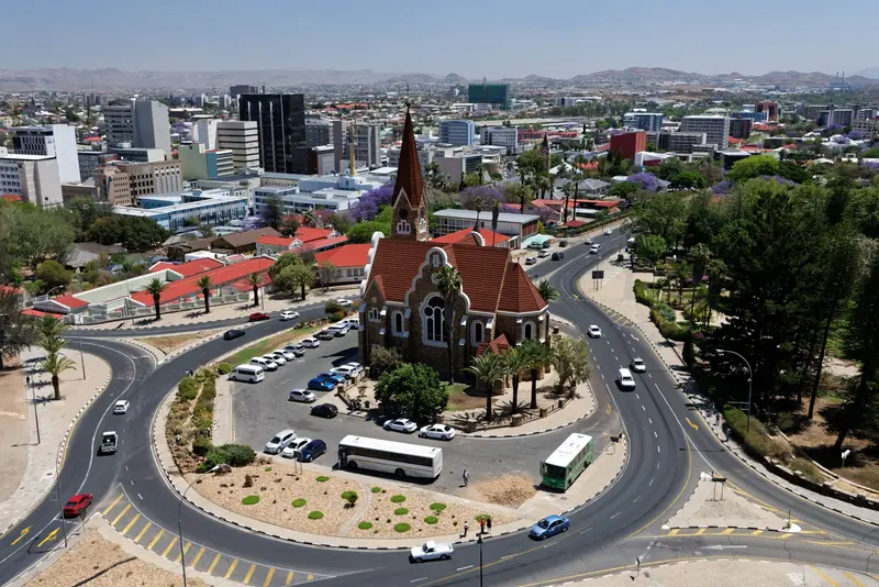
Windhoek is the capital of Namibia and lies at about 1,650 m in the central highlands. Christ Church and Tintenpalast recall the German colonial era; the Independence Memorial Museum recounts Namibia's journey to independence. For most travelers, the city is the start and end of their tour, with rental car pickup and initial shopping.
Arrival, car rental pick-up, Christ Church and Independence Memorial Museum.
7 Sights
3 Restaurants
Culture and History
Central Colonial BuildingsAround Robert Mugabe Avenue lie the most important buildings from the German colonial era: Christ Church, Tintenpalast, and Alte Feste. Directly next to them stands the Independence Memorial Museum, which tells this period from the perspective of the liberation struggle.KatuturaThe Katutura district emerged in the early 1960s. At the Single Quarters market, Kapana is grilled, Windhoek's typical street food.FestivalsIn March or April, the city celebrates the Windhoek Carnival (WIKA), and at the end of October, the Windhoek Oktoberfest, which has been held for over 60 years.
Sossusvlei and Namib-Naukluft Park
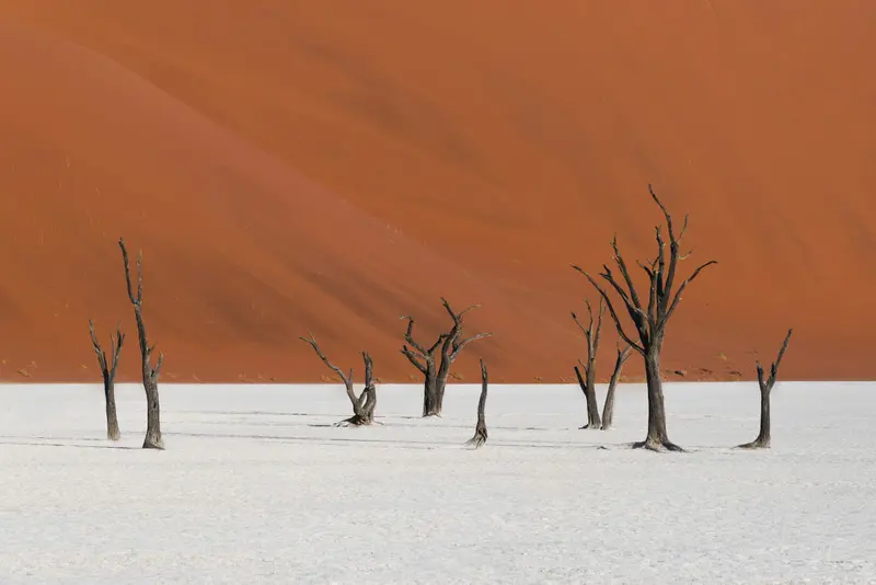
The red dunes around the salt and clay pans of Sossusvlei and Deadvlei are Namibia's most famous motif. Located in the Namib-Naukluft Park, the country's largest protected area (49,768 km²), they form part of the Namib Sand Sea, a UNESCO World Heritage site since 2013. The starting point is Sesriem, about 5 hours southwest of Windhoek, from there, an asphalt road leads through the dune valley.
Windhoek to Sesriem approx. 5 hrs. Early second morning to the Dune Valley for Deadvlei and Sossusvlei.
6 Sights
Nature and Landscape
Namib Sand SeaThe UNESCO inscribed the Namib Sand Sea as a World Heritage site in 2013, covering 3,077,700 ha. It is considered the world's only coastal desert with extensive dune fields shaped by fog.DeadvleiIn the white clay pan of Deadvlei stand camel thorn trees that died around 600 to 700 years ago, surrounded by red dunes like Big Daddy.NaukluftIn the mountainous part of the park, the Olive Trail (10 km, 4 to 5 hours) and the Waterkloof Trail (17 km, 6 to 7 hours) are available. For the multi-day Naukluft Trail, a medical certificate is required.
Swakopmund
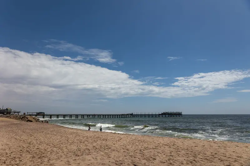
Founded in 1892, Swakopmund on the Atlantic coast is Namibia's most German-influenced town, featuring a lighthouse, Woermannhaus, and old railway station. It lies approximately 350 km west of Windhoek, where the Namib Desert meets the sea, and serves as the main hub for dune activities. The cold Benguela Current brings cool temperatures and frequent morning fog.
Sesriem to Swakopmund, approx. 350 km, 6 to 7 hours. Walvis Bay Lagoon and Welwitschia Drive as excursions.
6 Sights
4 Restaurants
Cityscape and History
Colonial ArchitectureSwakopmund was founded in 1892. The lighthouse, Woermannhaus with Damara Tower, and the old railway station from 1901 still define the town centre today.By the SeaThe first wooden pier (Jetty) was built from 1905, followed by a steel pier from 1914, at the end of which a restaurant is located today. The breakwater dates back to a harbour project from 1899.Desert at the City's EdgeThe Namib Desert begins around the city. Swakopmund is the main hub for activities in the dunes, such as sandboarding.
Damaraland and Twyfelfontein
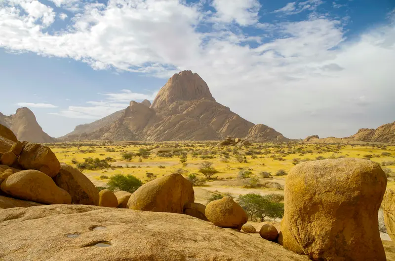
Damaraland zwischen Swakopmund und Etosha ist eine Landschaft aus Tafelbergen, Felskuppen und trockenen Flussbetten, in denen Wüstenelefanten leben. Hier liegen die Felsgravuren von Twyfelfontein, seit 2007 UNESCO-Welterbe, der Brandberg mit dem höchsten Gipfel Namibias und die markante Spitzkoppe. Viele Unterkünfte liegen in kommunalen Hegegebieten (Conservancies).
Swakopmund to Damaraland 5 to 6 hours. Rock engravings with guide, Burnt Mountain, Organ Pipes.
6 Sights
Geology, Rock Art and People
Rock ArtTwyfelfontein preserves around 2,000 engravings, while the Brandberg features the White Lady rock painting in Tsisab Gorge. Both are visited with local guides.GeologyThe Burnt Mountain and Organ Pipes formed when dolerite magma rose into slate; in the Petrified Forest, fossilized tree trunks lie exposed. The Vingerklip in the Ugab Terraces is a 35 m high rock pillar.Himba in KuneneFurther north, around Opuwo, live the Himba people. The Kaoko Information Centre in Opuwo is your first point of contact. Always ask permission before taking photos, and never offer sweets, money, or alcohol (Rough Guides).
Etosha National Park
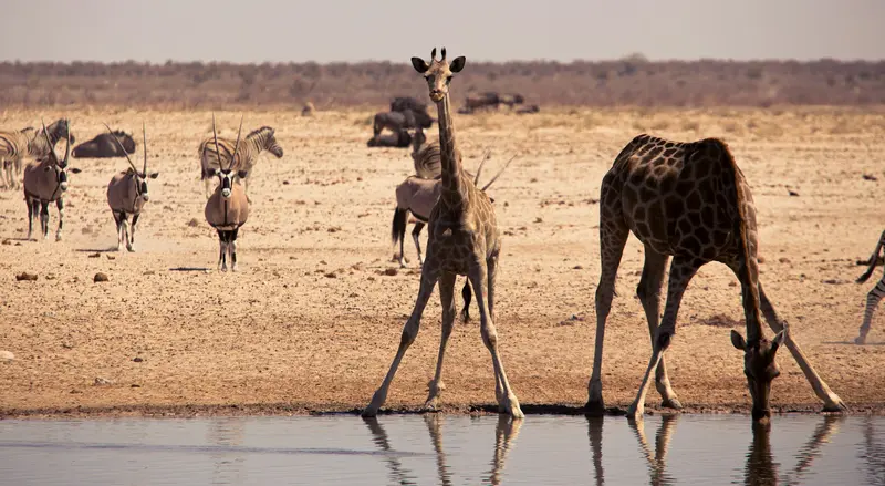
Etosha National Park in the north is Namibia's premier safari destination: Around the approximately 4,800 km² Etosha Salt Pan, the Ministry of Environment reports 114 mammal and over 400 bird species, including elephants, black rhinos, and lions. The Ministry states its area as 22,935 km², the area has been protected since 1907. The camps Okaukuejo, Halali, and Namutoni have floodlit waterholes.
Damaraland to Etosha 6 to 7 hours. Okaukuejo and Namutoni, return journey to Windhoek 5.5 to 7 hours.
3 Sights
Animal Watching
WaterholesAround 86 waterholes are spread across the park. During the dry season from May to October, animals gather there, offering the best time for observations. You can also visit the illuminated waterholes at the camps at night.Etosha PanThe salt pan, covering around 4,800 km², is considered Africa's largest and shapes the landscape with its white, flat expanse.Fort NamutoniThis white fort in the east of the park dates back to the German colonial era and has been a national monument since 1950.
Plan this route as your trip
All stops, trains and nights go into your trip planner. You adjust dates and places to stay afterwards.
This route is a suggestion from our research. Please check timetables, times in port, opening hours and prices before you book – what your tour operator or carrier says is what counts.
Fernweh is a free travel guide and trip planner: routes researched by people, taken over in one click, used day by day on the road. More about Fernweh
5 stops
Route Summary
Duration11 Days
Stops5 Places
TypeAdventure