Fernweh: Home
ExploreGuideDestinationsMy tripsMy trip
de|en
All Places & RegionsRound tripsNight trains in EuropeAll highlightsAbout FernwehFAQPrivacy PolicyImprint
Download on the App StoreGet it on Google Play
ExploreGuideDestinationsMy tripsMy trip
    • Places in the region
    • Culture
    • Getting around
    • Round trips
    • Nearby
    Damaraland and Twyfelfontein

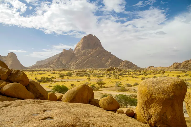
    Photo by m_oros on Unsplash

    Namibia

    Damaraland and Twyfelfontein

    Region

    Damaraland zwischen Swakopmund und Etosha ist eine Landschaft aus Tafelbergen, Felskuppen und trockenen Flussbetten, in denen Wüstenelefanten leben.

    by Felix Gillen

    1. Home
    2. Destinations
    3. Namibia
    4. Damaraland and Twyfelfontein
    Damaraland zwischen Swakopmund und Etosha ist eine Landschaft aus Tafelbergen, Felskuppen und trockenen Flussbetten, in denen Wüstenelefanten leben. Hier liegen die Felsgravuren von Twyfelfontein, seit 2007 UNESCO-Welterbe, der Brandberg mit dem höchsten Gipfel Namibias und die markante Spitzkoppe. Viele Unterkünfte liegen in kommunalen Hegegebieten (Conservancies).
    Namibia travel guideSee the round tripPlan a trip with Damaraland and Twyfelfontein

    Contents

    • Places in the region
    • Culture
    • Getting around
    • Round trips
    • Nearby

    Sights in Damaraland and Twyfelfontein

    Discover the most important sights and attractions
    Attraction

    Organ Pipes

    Near Burnt Mountain stand hexagonal dolerite columns, formed from cooled magma. Their shape resembles the pipes of an organ.
    Open in Google Maps
    Natural Feature

    Burned Mountain

    The dark hill near Twyfelfontein consists of shale, which rising dolerite magma heated to approximately 1,000 °C, hence its scorched appearance. It is located right next to the Organ Pipes.
    Open in Google Maps
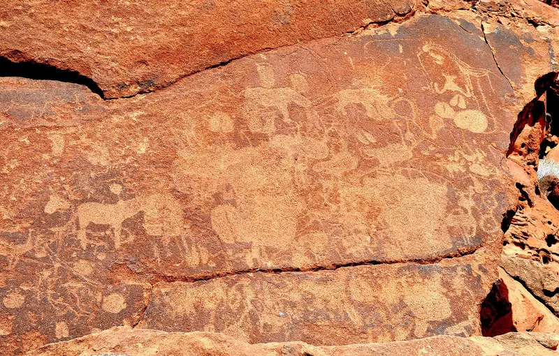
    Rock Engravings of Twyfelfontein (/Ui-//aes)

    Olga Ernst / Wikimedia Commons / CC BY-SA 4.0, mod.
    Rock Engravings of Twyfelfontein (/Ui-//aes)

    Here, approximately 2,000 engravings of animals, tracks, and symbols are etched into the sandstone; since 2007, Twyfelfontein has been a UNESCO World Heritage site and the country's first. Visits are only possible with a guided tour, with tours lasting 30, 60, or 80 minutes. The site is located approximately 70 km west of Khorixas.
    Open in Google Maps
    Natural Feature

    Brandberg

    The mountain massif with Königstein (2,573 m, according to the Ministry of Mines) is Namibia's highest peak. In Tsisab Gorge lies the White Lady rock painting, accessible via an approximately one-hour walk; Fodor's advises an early morning start.
    Open in Google Maps
    Attraction

    Petrified Forest

    On C39, some 42 km west of Khorixas, petrified tree trunks are exposed on the surface, with Welwitschias growing between them. The area has been a National Monument since 1950.
    Open in Google Maps
    Spitzkoppe

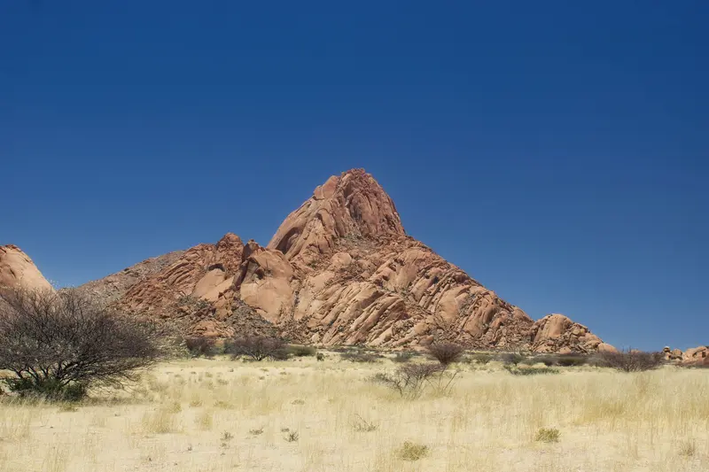
    Photo by Hub JACQU on Pexels

    Natural Feature

    Spitzkoppe

    The striking peak (1,728 m) in southern Damaraland rises steeply several hundred meters above the plain and is often called the 'Matterhorn of Africa'. Figures for its height above the plain vary, depending on the source, between approximately 610 and 700 m. Fodor's states an entrance fee of N$ 180.
    Open in Google Maps

    Geology, Rock Art and People

    Rock ArtTwyfelfontein preserves around 2,000 engravings, while the Brandberg features the White Lady rock painting in Tsisab Gorge. Both are visited with local guides.GeologyThe Burnt Mountain and Organ Pipes formed when dolerite magma rose into slate; in the Petrified Forest, fossilized tree trunks lie exposed. The Vingerklip in the Ugab Terraces is a 35 m high rock pillar.Himba in KuneneFurther north, around Opuwo, live the Himba people. The Kaoko Information Centre in Opuwo is your first point of contact. Always ask permission before taking photos, and never offer sweets, money, or alcohol (Rough Guides).

    Access & Practice

    Getting ThereFrom Swakopmund to Damaraland, allow 5 to 6 hours, mostly on gravel roads. Twyfelfontein is about 70 km west of Khorixas; the Petrified Forest is 42 km west of Khorixas on the C39. From Twyfelfontein, it's 82 km to Palmwag via the C39; you can refuel there.Desert ElephantsDuring the dry season, you're most likely to spot elephants at waterholes in the dry riverbeds. Keep your distance and stay in your vehicle.Onward to EtoshaFrom Damaraland to Etosha, allow approximately 6 to 7 hours (Rough Guides).

    Round trips through this region

    Namibia Classics Self-Drive: Dunes, Coast, and Etosha

    Namibia Classics Self-Drive: Dunes, Coast, and Etosha

    This classic self-drive circuit connects the dunes at Sossusvlei, the coastal town of Swakopmund, the rock landscapes of Damaraland, and wildlife viewing in Etosha National Park. Stages take 5 to 7 hours, with a large part on gravel roads. Driving times are based on Rough Guides and Viatu, without photo stops.

    11 Days
    5 stops

    Gu Bra·Pexels

    Nearby

    Skeleton Coast

    Skeleton Coast

    The Skeleton Coast in the northwest is a desert strip between the Atlantic and dunes, known for fog, shipwrecks, and solitude. The Skeleton Coast Park (16,390 km²) covers about 500 km from Ugab to Kunene and requires a booking or permit for entry. South of this is Cape Cross, home to the largest Cape fur seal breeding colony and replicas of the stone cross Diogo Cão erected here in 1486.

    Nicola Toscan·Pexels

    Swakopmund

    Swakopmund

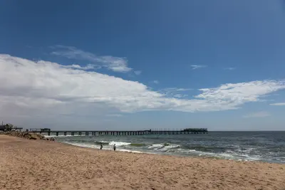
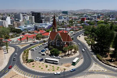
    Founded in 1892, Swakopmund on the Atlantic coast is Namibia's most German-influenced town, featuring a lighthouse, Woermannhaus, and old railway station. It lies approximately 350 km west of Windhoek, where the Namib Desert meets the sea, and serves as the main hub for dune activities. The cold Benguela Current brings cool temperatures and frequent morning fog.

    Jörg Hamel·Pexels

    Walvis Bay

    Walvis Bay

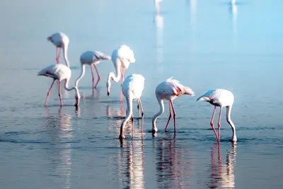
    The port city of Walvis Bay, south of Swakopmund, lies on a lagoon protected since 1995 as a Ramsar wetland, attracting tens of thousands of waterfowl, including large flamingo flocks. South of the city, the Namib begins; about 55 km away is Sandwich Harbour, where dunes drop directly into the sea.

    Nicola Toscan·Pexels

    Etosha National Park

    Etosha National Park

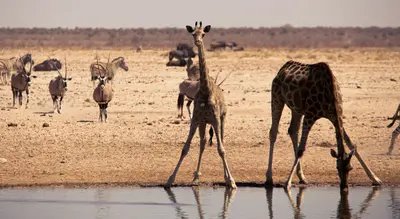
    Etosha National Park in the north is Namibia's premier safari destination: Around the approximately 4,800 km² Etosha Salt Pan, the Ministry of Environment reports 114 mammal and over 400 bird species, including elephants, black rhinos, and lions. The Ministry states its area as 22,935 km², the area has been protected since 1907. The camps Okaukuejo, Halali, and Namutoni have floodlit waterholes.

    Bernd Dittrich·Unsplash

    Waterberg Plateau Park

    Waterberg Plateau Park

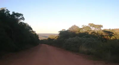
    The Waterberg Plateau is a sandstone massif about 50 km long, rising steeply from the plains north of Windhoek. Established in 1972, the 405 km² park offers overnight stays at Bernabé de la Bat rest camp, located at the cliff foot. The plateau is conveniently located as a stopover on the way from Windhoek to Etosha.

    JMK·CC BY-SA 4.0

    Your next steps

    Damaraland and Twyfelfontein is in Namibia. Ways to carry on from here.

    • More in Namibia

      Highlights, areas, routes and the best time to travel for all of Namibia.

      Namibia travel guide
    • Round trips with Damaraland and Twyfelfontein

      One route passes through Damaraland and Twyfelfontein, with stops, nights and a map.

      See the round trip
    • Plan a trip with Damaraland and Twyfelfontein

      The Guide asks about season, length and who is coming, and suggests a trip with Damaraland and Twyfelfontein.

      Plan the trip

    Sources & method

    • Photos: Wikimedia Commons, Unsplash, Pexels. Each photo carries its credit.
    • Place data such as addresses and ratings comes from Google Maps.
    • The content is based on web research from public, traceable sources. How the content is made · The role of AI