Fernweh: Home
ExploreGuideDestinationsMy tripsMy trip
de|en
All Places & RegionsRound tripsNight trains in EuropeAll highlightsAbout FernwehFAQPrivacy PolicyImprint
Download on the App StoreGet it on Google Play
ExploreGuideDestinationsMy tripsMy trip
    • Neighborhoods & highlights
    • Eat & drink
    • Getting around
    • Accommodation
    • Plan trip
    • Nearby
    Walvis Bay

    Photo by Nicola Toscan on Pexels

    Namibia

    Walvis Bay

    City

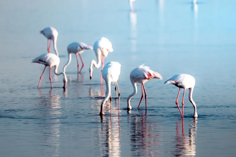
    The port city of Walvis Bay, south of Swakopmund, lies on a lagoon protected since 1995 as a Ramsar wetland, attracting tens of thousands of waterfowl, including large flamingo flocks.

    by Felix Gillen

    1. Home
    2. Destinations
    3. Namibia
    4. Walvis Bay
    The port city of Walvis Bay, south of Swakopmund, lies on a lagoon protected since 1995 as a Ramsar wetland, attracting tens of thousands of waterfowl, including large flamingo flocks. South of the city, the Namib begins; about 55 km away is Sandwich Harbour, where dunes drop directly into the sea.
    Namibia travel guideRound trips in NamibiaPlan a trip with Walvis Bay

    Contents

    • Neighborhoods & highlights
    • Eat & drink
    • Getting around
    • Accommodation
    • Nearby

    Sights in Walvis Bay

    Discover the most important sights and attractions

    Attraction

    1Dune 7

    The dune on the eastern outskirts is reachable from Walvis Bay in just a few minutes and offers a quick entry into the Namib if you don't have time for Sossusvlei. Reliable altitude information is not available.
    Open in Google Maps
    Point of Interest

    2Lagoon of Walvis Bay

    The lagoon has been protected since 1995 as a Ramsar wetland of international importance (12,600 ha). Here, 37,000-79,000 waterfowl rest, with large flamingo flocks visible from the coastal road.
    Open in Google Maps

    Restaurants in Walvis Bay

    1

    The Raft

    Restaurant on stilts in the lagoon with fish and seafood (Fodor's).
    Show on Google Maps

    Getting Here & Around

    Getting ThereYou can reach Walvis Bay from Windhoek via the B2, passing Swakopmund. The lagoon is on the southwestern outskirts; the shore road passes the bird flocks.Sandwich HarbourYou may only drive the roughly 55 km to Sandwich Harbour yourself with a high-clearance 4x4 and a permit from the Ministry of Environment, and only at low tide. Rough Guides recommends an organized tour.

    Accommodations in Walvis Bay

    Find perfect stay in Walvis Bay

    Booking.com* (Affiliate link)
    Search Hotels
    Agoda* (Affiliate link)
    Search Hotels
    Airbnb
    Vacation Rentals

    * Affiliate link: if you book through it, we earn a small commission. The price stays the same for you.

    Plan your trip to Walvis Bay

    Save places, build a route and plan your city trip, all in one place.

    1. 1
      Sunrise over alpine peaks and a sea of clouds
      1234

      Round trip

      12 days · 4 stops

      Saved

      Pick a route

      Pick a ready-made one or save places and plan your own.

      Open bookmarks
    2. 2

      Trip to Walvis Bay

      Live
      • 1Dune 73 days
      • 2Lagoon of Walvis Bay4 days
      Budget

      Plan your trip

      The planner sorts stops, days and budget. Plan together in real time.

      Start trip planning
    3. 3
      9:41 No signal
      Walvis Bay
      Available offline

      Photo by Nicola Toscan on Pexels

      Use it on the road

      Download the guide to your phone and use it on site, even offline.

    Nearby

    Swakopmund

    Swakopmund

    Founded in 1892, Swakopmund on the Atlantic coast is Namibia's most German-influenced town, featuring a lighthouse, Woermannhaus, and old railway station. It lies approximately 350 km west of Windhoek, where the Namib Desert meets the sea, and serves as the main hub for dune activities. The cold Benguela Current brings cool temperatures and frequent morning fog.

    Jörg Hamel·Pexels

    Sossusvlei and Namib-Naukluft Park

    Sossusvlei and Namib-Naukluft Park

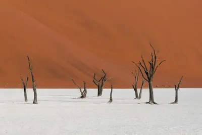
    The red dunes around the salt and clay pans of Sossusvlei and Deadvlei are Namibia's most famous motif. Located in the Namib-Naukluft Park, the country's largest protected area (49,768 km²), they form part of the Namib Sand Sea, a UNESCO World Heritage site since 2013. The starting point is Sesriem, about 5 hours southwest of Windhoek, from there, an asphalt road leads through the dune valley.

    Felipe Labate·Unsplash

    Damaraland and Twyfelfontein

    Damaraland and Twyfelfontein

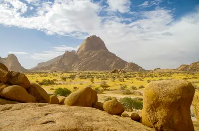
    Damaraland zwischen Swakopmund und Etosha ist eine Landschaft aus Tafelbergen, Felskuppen und trockenen Flussbetten, in denen Wüstenelefanten leben. Hier liegen die Felsgravuren von Twyfelfontein, seit 2007 UNESCO-Welterbe, der Brandberg mit dem höchsten Gipfel Namibias und die markante Spitzkoppe. Viele Unterkünfte liegen in kommunalen Hegegebieten (Conservancies).

    m_oros·Unsplash

    Windhoek

    Windhoek

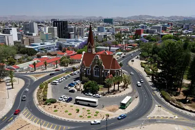
    Windhoek is the capital of Namibia and lies at about 1,650 m in the central highlands. Christ Church and Tintenpalast recall the German colonial era; the Independence Memorial Museum recounts Namibia's journey to independence. For most travelers, the city is the start and end of their tour, with rental car pickup and initial shopping.

    Gu Bra·Pexels

    Skeleton Coast

    Skeleton Coast

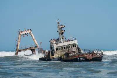
    The Skeleton Coast in the northwest is a desert strip between the Atlantic and dunes, known for fog, shipwrecks, and solitude. The Skeleton Coast Park (16,390 km²) covers about 500 km from Ugab to Kunene and requires a booking or permit for entry. South of this is Cape Cross, home to the largest Cape fur seal breeding colony and replicas of the stone cross Diogo Cão erected here in 1486.

    Nicola Toscan·Pexels

    Your next steps

    Walvis Bay is in Namibia. Ways to carry on from here.

    • More in Namibia

      Highlights, areas, routes and the best time to travel for all of Namibia.

      Namibia travel guide
    • Round trips in Namibia

      Ready-made routes through Namibia, with stops, nights and a map.

      See the routes

    Sources & method

    • Photos: Pexels. Each photo carries its credit.
    • Place data such as addresses and ratings comes from Google Maps.
    • The content is based on web research from public, traceable sources. How the content is made · The role of AI