Fernweh: Home
ExploreGuideDestinationsMy tripsMy trip
de|en
All Places & RegionsRound tripsNight trains in EuropeAll highlightsAbout FernwehFAQPrivacy PolicyImprint
Download on the App StoreGet it on Google Play
ExploreGuideDestinationsMy tripsMy trip
    • Tours
    • Eat & drink
    • Culture
    • Getting around
    • Accommodation
    • Nearby
    Waterberg Plateau Park

    JMK / Wikimedia Commons / CC BY-SA 4.0, mod.

    Namibia

    Waterberg Plateau Park

    Point of Interest

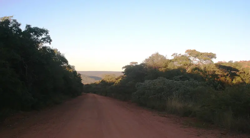
    The Waterberg Plateau is a sandstone massif about 50 km long, rising steeply from the plains north of Windhoek. Established in 1972, the 405 km² park offers overnight stays at Bernabé de la Bat rest camp, located at the cliff foot.

    by Felix Gillen

    1. Home
    2. Destinations
    3. Namibia
    4. Waterberg Plateau Park
    The Waterberg Plateau is a sandstone massif about 50 km long, rising steeply from the plains north of Windhoek. Established in 1972, the 405 km² park offers overnight stays at Bernabé de la Bat rest camp, located at the cliff foot. The plateau is conveniently located as a stopover on the way from Windhoek to Etosha.
    Namibia travel guideRound trips in NamibiaPlan a trip with Waterberg Plateau Park

    Contents

    • Tours
    • Eat & drink
    • Culture
    • Getting around
    • Accommodation
    • Nearby

    Tours & experiences in Waterberg Plateau Park

    Search tours for Waterberg Plateau Park on GetYourGuide* (Affiliate link)On GetYourGuide, with reviews from other travellers

    * Affiliate link: if you book through it, we earn a small commission. The price stays the same for you.

    Restaurants in Waterberg Plateau Park

    Nature and History

    The PlateauThe approximately 50 km long sandstone massif rises steeply above the plain; the park covers 405 km² and was established in 1972.Waterberg and HistoryIn 1904, the Battle of Waterberg took place between German troops and the Herero; afterwards, many Herero fled into the Omaheke Desert. These events are part of the Herero and Nama Genocide.

    Directions and Hiking

    Getting ThereThe park is located north of Windhoek and is ideal as a stopover on the way to Etosha. At Bernabé de la Bat Rest Camp, you can stay at the foot of the rock faces.HikingA 48 km unguided hiking trail on the plateau must be booked in advance.FeesWaterberg falls into the highest fee category: as of April 2026, N$ 280 per adult per day, plus vehicle fee.

    Accommodations in Waterberg Plateau Park

    Find perfect stay in Waterberg Plateau Park

    Booking.com* (Affiliate link)
    Search Hotels
    Agoda* (Affiliate link)
    Search Hotels
    Airbnb
    Vacation Rentals

    * Affiliate link: if you book through it, we earn a small commission. The price stays the same for you.

    Nearby
    Etosha National Park

    Etosha National Park

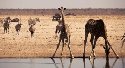
    Etosha National Park in the north is Namibia's premier safari destination: Around the approximately 4,800 km² Etosha Salt Pan, the Ministry of Environment reports 114 mammal and over 400 bird species, including elephants, black rhinos, and lions. The Ministry states its area as 22,935 km², the area has been protected since 1907. The camps Okaukuejo, Halali, and Namutoni have floodlit waterholes.

    Bernd Dittrich·Unsplash

    Windhoek

    Windhoek

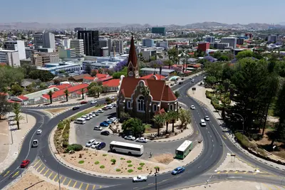
    Windhoek is the capital of Namibia and lies at about 1,650 m in the central highlands. Christ Church and Tintenpalast recall the German colonial era; the Independence Memorial Museum recounts Namibia's journey to independence. For most travelers, the city is the start and end of their tour, with rental car pickup and initial shopping.

    Gu Bra·Pexels

    Damaraland and Twyfelfontein

    Damaraland and Twyfelfontein

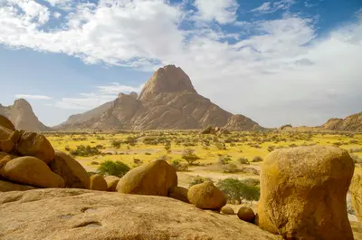
    Damaraland zwischen Swakopmund und Etosha ist eine Landschaft aus Tafelbergen, Felskuppen und trockenen Flussbetten, in denen Wüstenelefanten leben. Hier liegen die Felsgravuren von Twyfelfontein, seit 2007 UNESCO-Welterbe, der Brandberg mit dem höchsten Gipfel Namibias und die markante Spitzkoppe. Viele Unterkünfte liegen in kommunalen Hegegebieten (Conservancies).

    m_oros·Unsplash

    Swakopmund

    Swakopmund

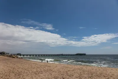
    Founded in 1892, Swakopmund on the Atlantic coast is Namibia's most German-influenced town, featuring a lighthouse, Woermannhaus, and old railway station. It lies approximately 350 km west of Windhoek, where the Namib Desert meets the sea, and serves as the main hub for dune activities. The cold Benguela Current brings cool temperatures and frequent morning fog.

    Jörg Hamel·Pexels

    Walvis Bay

    Walvis Bay

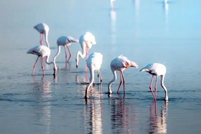
    The port city of Walvis Bay, south of Swakopmund, lies on a lagoon protected since 1995 as a Ramsar wetland, attracting tens of thousands of waterfowl, including large flamingo flocks. South of the city, the Namib begins; about 55 km away is Sandwich Harbour, where dunes drop directly into the sea.

    Nicola Toscan·Pexels

    Your next steps

    Waterberg Plateau Park is in Namibia. Ways to carry on from here.

    • More in Namibia

      Highlights, areas, routes and the best time to travel for all of Namibia.

      Namibia travel guide
    • Round trips in Namibia

      Ready-made routes through Namibia, with stops, nights and a map.

      See the routes
    • Plan a trip with Waterberg Plateau Park

      The Guide asks about season, length and who is coming, and suggests a trip with Waterberg Plateau Park.

      Plan the trip

    Sources & method

    • Photos: Wikimedia Commons. Each photo carries its credit.
    • The content is based on web research from public, traceable sources. How the content is made · The role of AI