Round trip · Vietnam
From the Highlands to the Sea: Da Lat and Nha Trang
by Felix Gillen
- 9 Days / 8 Nights
- Ho Chi Minh City → Nha Trang
The trip starts with two nights in Ho Chi Minh City, then climbs into the Central Highlands to Da Lat, which sits at about 1,500 meters (4,900 feet). You get there on a flight of about 50 minutes or a six- to eight-hour bus ride. From Da Lat, a three- to four-hour bus ride winds down the mountain roads to Nha Trang on the coast. You fly home from Cam Ranh, south of Nha Trang, where you can also extend the trip with a nonstop flight to Phu Quoc. The route thrives on the contrast between the cool mountain air, pine-covered hills and colonial villas of the highlands and the warm sea and offshore islands of the coast.
At a glance
- Duration
- 9 Days / 8 Nights
- Stops
- 3 · Ho Chi Minh City → Nha Trang
- Arrival
- Flight · Ho-Chi-Minh-Stadt (SGN)
- Departure
- Flight · Cam Ranh (CXR)
- Best Time to Go
- January to April: Da Lat is in its dry season, and from February the sea off Nha Trang is usually calm and clear
More on when to go
From May to October it rains often in Da Lat, and fog and landslides can slow traffic on the mountain roads. Nha Trang's rainy season runs from September to December, wettest in October and November, when storms can brush the coast and many dive shops take a break. For current advice, check the UK Foreign Office (FCDO) travel advice.
3 stops
Why This Route?
This route shows the south of the country away from the classic north-south trail, with only a few moves along the way. You combine the big city of Saigon, the former French hill station of Da Lat and the beach town of Nha Trang with its Cham towers of Po Nagar, all in just over a week.
Hidden Gems
- In Da Lat, ride the roughly 2.3-kilometer (1.4-mile) cable car from Robin Hill, which glides over pine forest for about twelve minutes to Truc Lam Monastery above Tuyen Lam Lake
- About 12 kilometers (7 miles) northwest of Da Lat, a jeep takes you up to 1,929-meter (6,330-foot) Radar Hill on Langbiang in about 15 minutes, while hiking to the summit takes around three hours
- For snorkeling at Hon Mun, Vietnam's first marine protected area, book a small tour with an early start, since the big group boats usually leave around 8 a.m.
Getting there and back
Open jaw: start and end are in different places
- Arrival
- Flight · Ho-Chi-Minh-Stadt (SGN)Long-haul flights land at Tan Son Nhat (SGN) or, once it is in operation, at the new Long Thanh Airport (LTH), about 40 kilometers (25 miles) east of the city; check your ticket to see where you arrive. From Tan Son Nhat it is about eight kilometers (5 miles) to the center, usually 25 to 45 minutes by taxi or Grab, or about 45 to 60 minutes on bus 109. Domestic flights, such as those to Da Lat, are expected to keep using Tan Son Nhat.
- Departure
- Flight · Cam Ranh (CXR)Cam Ranh Airport (CXR) is about 35 kilometers (22 miles) south of Nha Trang, a 40- to 50-minute drive. Nonstop flights from Cam Ranh mostly serve destinations within Asia, so for Europe or North America you usually connect in Ho Chi Minh City or Hanoi; in Ho Chi Minh City that can mean switching to Long Thanh, so allow plenty of time. To extend the trip, fly nonstop from Cam Ranh to Phu Quoc in about 1 hour 20 minutes; check the schedule, as the route is not served equally often all year.
Itinerary
Ho Chi Minh City
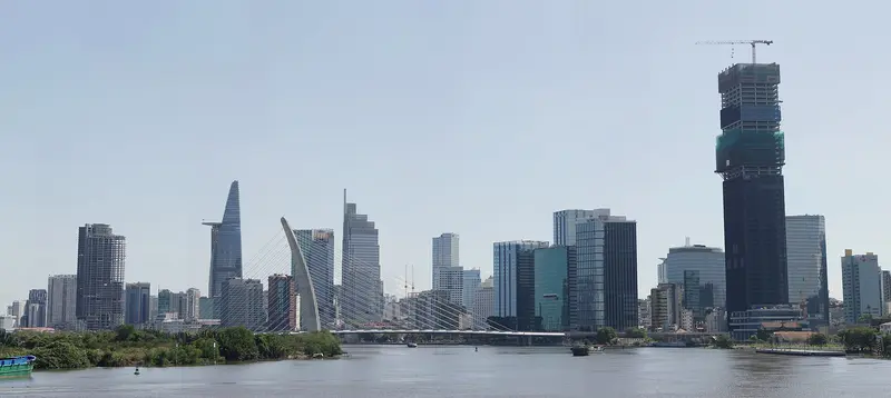
Ho Chi Minh City, still called Saigon by many, is Vietnam's largest city and the economic hub of the south. You'll come for its blend of French colonial architecture, war history, street food stalls on every corner, and a pace that will captivate you from the very first evening.As of July 1, 2025, there are no longer any districts in Vietnam; the city is divided into Wards (phường) and has simultaneously incorporated the former provinces of Bình Dương and Bà Rịa-Vũng Tàu. However, in daily life and on many signs, the old district names persist, which is why they are helpful for orientation.Former District 1: The city center, home to the grand avenue Đồng Khởi, the Opera House, Central Post Office, Cathedral, and Bến Thành Market. Today, it belongs to the Wards Sài Gòn, Bến Thành, Tân Định, and Cầu Ông Lãnh.Former District 3: Quieter streets with villas, cafés, and street food stalls, plus the War Remnants Museum. Today, these are the Wards Bàn Cờ, Xuân Hòa, and Nhiêu Lộc.Chợ Lớn: The historic Chinese quarter in former Districts 5 and 6, featuring assembly halls, temples, and the Bình Tây Market.Thảo Điền: On the other side of the Saigon River in former District 2, popular with expats, with cafés, restaurants, and a Metro Line 1 station. Today, it is part of Ward An Khánh.Two to three days are sufficient for the main sights. The city also serves as the usual starting point for tours into the Mekong Delta.
Arrive at Tan Son Nhat Airport, about eight kilometers (5 miles) from the center. Independence Palace, the War Remnants Museum and an evening in Cho Lon.
8 Sights
6 Restaurants
History and Culture
From Gia Định to Ho Chi Minh CityBefore Vietnamese settlers arrived, this was the Khmer settlement of Prey Nokor. In 1698, the Nguyễn Lords dispatched Nguyễn Hữu Cảnh, who established the administration of the Gia Định area. In 1859, France conquered the city, and from 1862, Saigon was the capital of the colony Cochinchina; the Cathedral, Central Post Office, and Opera House date from this period. On July 2, 1976, the National Assembly decided on the renaming to Thành phố Hồ Chí Minh, but the city center is still commonly called Sài Gòn today.Chợ Lớn and the Chinese CommunityWest of the city center lies Chợ Lớn, the district of Vietnam's largest Chinese community. Here stand assembly halls and temples like the Thiên Hậu Temple, and the Bình Tây Market remains a wholesale center to this day.Tết, Flower Street, and CoffeeFor Lunar New Year Tết, the Nguyễn Huệ pedestrian street becomes a flower street each year, already for the 23rd time in 2026. Tết falls on February 6, 2027; around the holidays, many shops and restaurants are closed, and public transport is fully booked. Coffee is an everyday essential: you drink iced coffee with condensed milk (cà phê sữa đá) at street stalls on low stools or in one of the many cafes.
Da Lat
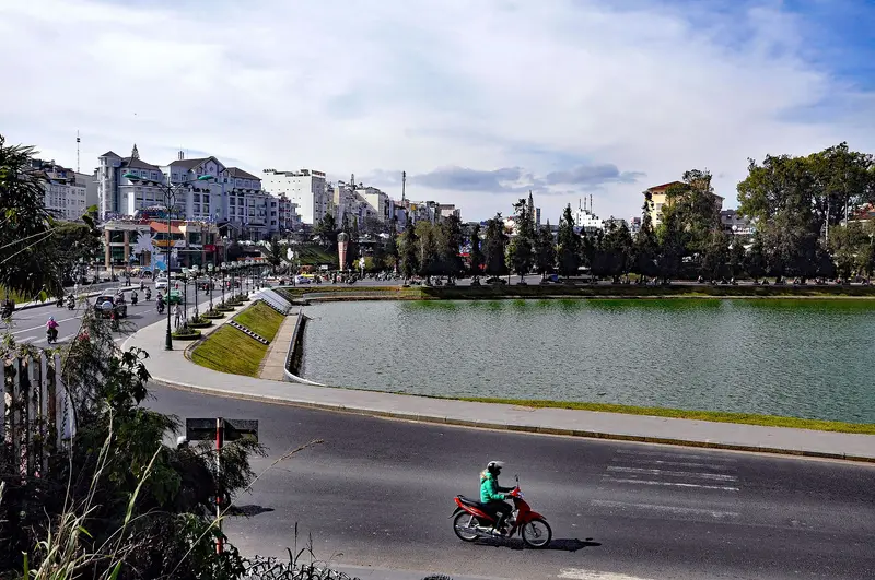
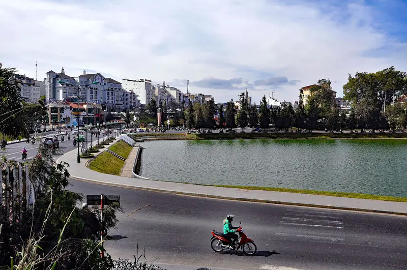
Đà Lạt sits at about 1,500 meters (4,900 ft) on the Lâm Viên Plateau in the Central Highlands and, with average temperatures between 14 and 23 °C (57 to 73 °F), is Vietnam's cool mountain retreat. The physician and scientist Alexandre Yersin explored the plateau in 1893, and soon afterwards the French built a hill station here: the first hotel opened in 1907, the urban planner Ernest Hébrard laid out the town, and Đà Lạt was officially founded in 1916.At its heart lies Xuân Hương Lake, created by the French in 1919 by damming the Cam Ly River. Around it, colonial-era villas, pine-covered hills and vegetable and flower fields spread across the slopes. The Art Deco railway station, the summer residence of the last emperor, Bảo Đại, and the warren-like Crazy House show how varied the city's architecture is. Since the 2025 administrative reform, Đà Lạt has been the seat of the enlarged Lâm Đồng province.The dry season runs from November to April; from May to October it rains often.
About a 50-minute flight to Lien Khuong, then a 40- to 50-minute drive into town, or six to eight hours by bus. A walk around Xuan Huong Lake, the 1938 Art Deco railway station and the Crazy House.
4 Sights
2 Restaurants
Culture and History
French Mountain StationFollowing Yersin's exploration, researchers requested Governor-General Paul Doumer to establish a mountain resort on the plateau. This spawned a city with villas, hotels, and schools. The 1938 Art Deco train station served as the terminus for the rack railway from Tháp Chàm, operating from 1933 until its wartime closure in the mid-1960s; it has been a protected national monument since 2001. Emperor Bảo Đại commissioned an Art Deco summer residence here between 1933 and 1938.Highland PeoplesLong before the French arrived, ethnic minorities inhabited the plateau. The Lâm-Đồng Museum displays crafts and tools of the Ma, K'Ho, and Churu people. In Lát village at the foot of Langbiang, you can experience the life of these mountain communities.FestivalsThis cool city celebrates its climate and agriculture: The calendar includes a Tea Culture Week, a Cherry Blossom Festival, and a Gong Festival.
Nha Trang
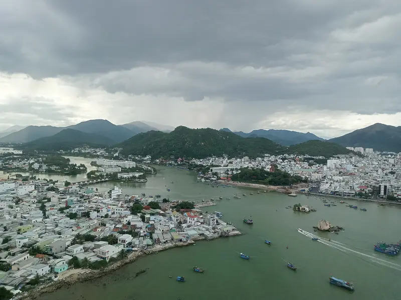
Nha Trang is the most famous beach city on Vietnam's south-central coast and was the capital of Khánh Hòa province until the administrative reform in 2025. The beach, promenade, and hotels line Trần Phú Boulevard, while off the coast are islands such as Hòn Tre, connected by a cable car, and the Hòn Mun marine protected area.Behind the beach scenery lies a long history. On a granite hill above the Cái River stand the Po Nagar Towers, which the Cham people built between the 7th and 13th centuries for the mother goddess Po Ina Nagar. The bacteriologist Alexandre Yersin lived and researched here; his former home is now a museum. At Cầu Đá port, the Oceanographic Institute, founded in 1922, showcases a large collection of marine animals.The rainy season here is shorter than in the rest of the country and falls between September and December.
About 140 kilometers (87 miles) and three to four hours by bus down winding mountain roads to the coast. The Cham towers of Po Nagar, Long Son Pagoda and a boat trip to the offshore islands.
4 Sights
3 Restaurants
Culture and History
The Cham HeritageLong before Nha Trang became a beach resort, the coast belonged to the Champa Kingdom. The Po Nagar Towers, situated on a granite hill above the Cái River, about two kilometers north of the city center, were built between the 7th and 13th centuries and are dedicated to the Mother Goddess Po Ina Nagar.Yersin and Marine ResearchThe physician and bacteriologist Alexandre Yersin lived in Nha Trang; his former home on the grounds of the Pasteur Institute has been a museum since 1997, displaying his instruments and letters. The Oceanographic Institute, founded in 1922 as Indochina's fisheries research station, houses more than 24,000 specimens of over 5,000 species.Buddhist Nha TrangThe Long Sơn Pagoda is also known as the Pagoda of the White Buddha: A staircase of about 150 steps leads past a reclining Buddha to the large white sitting figure on the hill.
Plan this route as your trip
All stops, trains and nights go into your trip planner. You adjust dates and places to stay afterwards.
This route is a suggestion from our research. Please check timetables, times in port, opening hours and prices before you book – what your tour operator or carrier says is what counts.
Fernweh is a free travel guide and trip planner: routes researched by people, taken over in one click, used day by day on the road. More about Fernweh
3 stops
Route Summary
Duration9 Days
Stops3 Places
TypeMixed