Fernweh: Home
ExploreGuideDestinationsMy tripsMy trip
de|en
All Places & RegionsRound tripsNight trains in EuropeAll highlightsAbout FernwehFAQPrivacy PolicyImprint
Download on the App StoreGet it on Google Play
ExploreGuideDestinationsMy tripsMy trip
    • Neighborhoods & highlights
    • Tours
    • Eat & drink
    • Culture
    • Getting around
    • Accommodation
    • Plan trip
    • Nearby
    Itaipú and Ciudad del Este

    Photo by João Saplak on Pexels

    Paraguay

    Itaipú and Ciudad del Este

    CityNature

    The UK Foreign, Commonwealth & Development Office (FCDO) urges particular caution in the departments bordering Brazil, including Alto Paraná with Ciudad del Este and Hernandarias, because of rising violent crime.

    by Felix Gillen

    1. Home
    2. Destinations
    3. Paraguay
    4. Itaipú and Ciudad del Este
    The UK Foreign, Commonwealth & Development Office (FCDO) urges particular caution in the departments bordering Brazil, including Alto Paraná with Ciudad del Este and Hernandarias, because of rising violent crime. Read the current FCDO travel advice before you travel here.Ciudad del Este lies in eastern Paraguay at the Friendship Bridge to Foz do Iguaçu in Brazil. North of the city, near Hernandarias, the Itaipú hydroelectric plant, operated jointly with Brazil, dams the Paraná River; the dam is 196 m high and almost 8 km long. The Saltos del Monday waterfalls are in neighbouring Presidente Franco. For the Iguaçu Falls on the Argentine and Brazilian side, see the Argentina and Brazil pages.
    Paraguay travel guideRound trips in ParaguayPlan a trip with Itaipú and Ciudad del Este

    Contents

    • Neighborhoods & highlights
    • Tours
    • Eat & drink
    • Culture
    • Getting around
    • Accommodation
    • Nearby

    Sights in Itaipú and Ciudad del Este

    Discover the most important sights and attractions

    Saltos del Monday

    Cverascuderi / Wikimedia Commons / CC BY-SA 4.0, mod.

    1Saltos del Monday

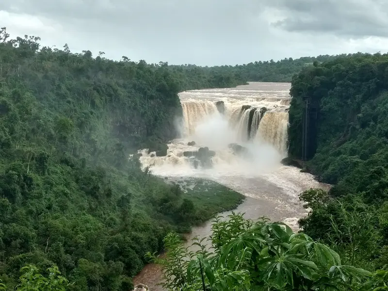
    The Río Monday waterfalls are located in Presidente Franco, about 10 km from Ciudad del Este. Lonely Planet counts them among Paraguay's highlights. A municipal park with viewpoints offers views of the falls.
    Open in Google Maps

    2Itaipú Hydropower Plant

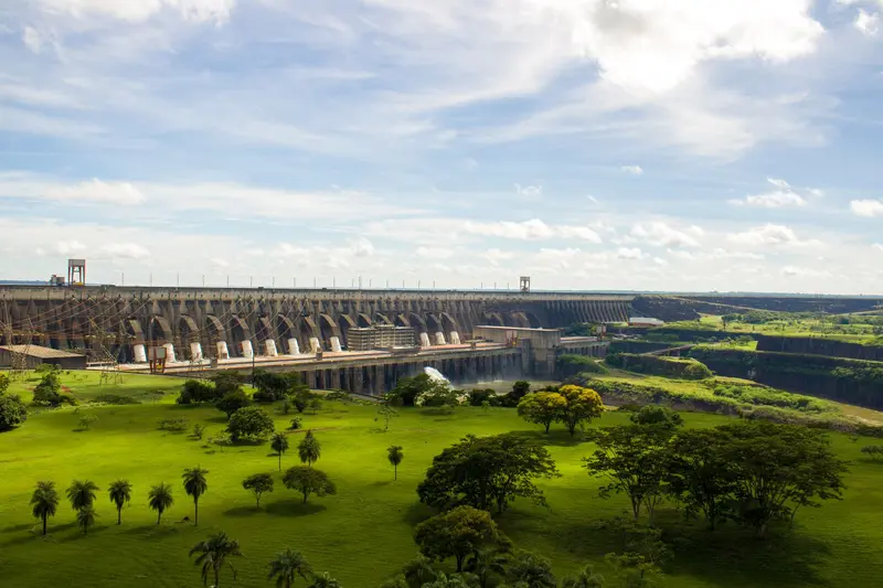
    Die 196 m hohe und 7.919 m lange Staumauer am Río Paraná ist ein gemeinsames Projekt von Paraguay und Brasilien; seit dem 5. Mai 1984 liefert sie Strom. Auf paraguayischer Seite sind die Besuchsprogramme ab dem Besucherzentrum in Hernandarias kostenlos, Ausländer brauchen ihren Reisepass. Freitags und samstags wird die Mauer abends angestrahlt.
    Open in Google Maps

    Tours & experiences in Itaipú and Ciudad del Este

    Search tours for Itaipú and Ciudad del Este on GetYourGuide* (Affiliate link)On GetYourGuide, with reviews from other travellers

    * Affiliate link: if you book through it, we earn a small commission. The price stays the same for you.

    Restaurants in Itaipú and Ciudad del Este

    Itaipú

    A Binational MegaprojectParaguay and Brazil signed a treaty for Itaipú in 1973; the first turbine generated power on May 5, 1984. The facility has 20 turbines with a total capacity of approximately 14,000 MW. Nearly all of Paraguay's electricity comes from hydropower.Visitor ProgramsOn the Paraguayan side, visitor programs are free: a 1.5-hour bus and film tour, a 2-hour special tour including an inside visit, and a technical tour (both by reservation), as well as the Iluminación Monumental, where the dam is illuminated on Friday and Saturday evenings. Also available are the Museo Tierra Guaraní and the Reserva Tatí Yupí.

    Arrival and Details

    Getting ThereAsunción and Ciudad del Este are 325 km apart. The Friendship Bridge to Foz do Iguaçu opened in 1965. When entering via this bridge, get your entry stamp yourself: According to the Foreign Office, vehicles are typically not stopped; you risk a fine without a stamp.Visiting ItaipúThe starting point is the Centro de Recepción de Visitas in Hernandarias. Foreigners need their passport, per Itaipú. Tours depart multiple times mornings and afternoons, Monday to Friday; for special and technical tours, book in advance.

    Accommodations in Itaipú and Ciudad del Este

    Find perfect stay in Itaipú and Ciudad del Este

    Booking.com* (Affiliate link)
    Search Hotels
    Agoda* (Affiliate link)
    Search Hotels
    Airbnb
    Vacation Rentals

    * Affiliate link: if you book through it, we earn a small commission. The price stays the same for you.

    Plan your trip to Itaipú and Ciudad del Este

    Save places, build a route and plan your city trip, all in one place.

    1. 1
      Sunrise over alpine peaks and a sea of clouds
      1234

      Round trip

      12 days · 4 stops

      Saved

      Pick a route

      Pick a ready-made one or save places and plan your own.

      Open bookmarks
    2. 2

      Trip to Itaipú and Ciudad del Este

      Live
      • 1Saltos del Monday3 days
      • 2Itaipú Hydropower Plant4 days
      Budget

      Plan your trip

      The planner sorts stops, days and budget. Plan together in real time.

      Start trip planning
    3. 3
      9:41 No signal
      Itaipú and Ciudad del Este
      Available offline

      Photo by João Saplak on Pexels

      Use it on the road

      Download the guide to your phone and use it on site, even offline.

    Nearby

    Puerto Iguazú

    Puerto Iguazú

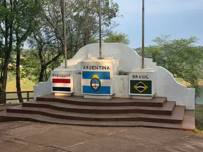
    Puerto Iguazú is the gateway to the waterfalls on the Argentinian side. This small town is located at the triple border, where the Río Iguazú flows into the Paraná, and Argentina, Brazil, and Paraguay meet. From the Hito Tres Fronteras viewpoint, you can gaze upon both neighboring countries.The national park is located about 17 kilometers outside; buses run regularly from the bus terminal. Cataratas del Iguazú Airport has connections to Buenos Aires and Córdoba. From here, the Brazilian side of the falls can also be visited; check Brazil's entry requirements for this. In July and over Easter, the town is particularly crowded due to Argentinian holidays.

    Horacio Cambeiro·CC BY 4.0

    Iguaçu Falls and Foz do Iguaçu

    Iguaçu Falls and Foz do Iguaçu

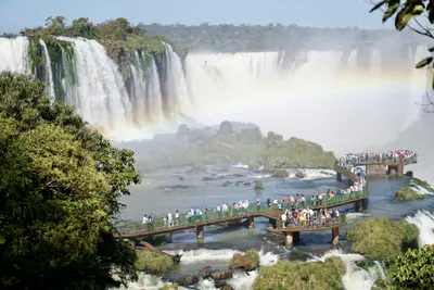
    The Iguaçu Falls, on the border with Argentina, are one of South America's great natural wonders: the Rio Iguaçu plunges up to 80 meters deep across a width of around 2.7 kilometers. The Brazilian national park, founded in 1939 and a UNESCO World Heritage site since 1986, is located in the far west of Paraná state. Because the larger part of the falls lies on the Argentinian side, Brazil primarily offers you the grand panorama, plus the walkway leading right up to the Garganta do Diabo.The city of Foz do Iguaçu is the starting point for the park, the Parque das Aves bird park, the Itaipu Dam, and the Triple Frontier with Argentina and Paraguay. For the Argentinian side (Iguazú), see the Argentina page.

    Sasha Lantukh·Unsplash

    Iguazú Falls

    Iguazú Falls

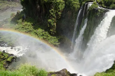
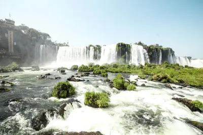
    Current Information (as of mid-November 2026): The boardwalk to Garganta del Diablo, the most powerful fall, was preventatively dismantled due to flood risk starting August 3, 2026. There is no set date for its reopening; reconstruction will take at least around 60 days after approval. The Sendero Macuco is also closed. Circuito Superior, Circuito Inferior, Sendero Verde, and the park train are open depending on water levels. Check the National Park for current status before your visit.The Iguazú Falls on the border with Brazil form an almost three-kilometer-wide cascade front, over which the Río Iguazú plunges up to around 80 meters. Depending on water levels, there are over 250 individual falls. The Argentine National Park was established in 1934 and has been a UNESCO World Heritage site since 1984.Within the park, boardwalks connect the Circuito Superior, running above the fall edges, and the Circuito Inferior, which leads visitors close to individual falls from below. The narrow-gauge train Tren Ecológico de la Selva runs every 30 minutes from the entrance to the stations. The name originates from the Guaraní language and means "big water."
    Tomas Anunziata·Pexels

    Northeast: Misiones and Iberá

    Northeast: Misiones and Iberá

    Argentina's subtropical northeast, between Paraguay and Brazil, is shaped by forests, red earth, and large rivers. The main destination is Iguazú Falls on the border with Brazil, visited from Puerto Iguazú. Further south in Misiones lie Jesuit reduction ruins, led by San Ignacio Miní, and in nearby Corrientes the Iberá Wetlands with caimans, capybaras, swamp deer.

    Pamela Licropani·Pexels

    Jesuit Reductions Trinidad and Jesús

    Jesuit Reductions Trinidad and Jesús

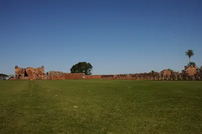
    The ruins of the Jesuit Reductions Santísima Trinidad de Paraná and Jesús de Tavarangüé in southern Paraguay have been a UNESCO World Heritage site since 1993. Trinidad is located approximately 28 km northeast of Encarnación and, according to UNESCO, is the best-preserved complex of mission villages, featuring a large 18th-century stone church. In Jesús, about 10 to 12 km away, the church with its cloverleaf arches remained unfinished when the Jesuits were expelled in 1767.

    Josep M. Gracia·CC BY-SA 4.0

    Your next steps

    Itaipú and Ciudad del Este is in Paraguay. Ways to carry on from here.

    • More in Paraguay

      Highlights, areas, routes and the best time to travel for all of Paraguay.

      Paraguay travel guide
    • Round trips in Paraguay

      Ready-made routes through Paraguay, with stops, nights and a map.

      See the routes

    Sources & method

    • Photos: Wikimedia Commons, Pexels. Each photo carries its credit.
    • The content is based on web research from public, traceable sources. How the content is made · The role of AI