Fernweh: Home
    ExploreTravel GuidesPlan a tripMy tripLast visited
    de|en
    All Places & RegionsAll highlightsAbout FernwehFAQPrivacy PolicyImprint
    ExploreTravel GuidesPlan a tripMy tripLast visited
    • Neighborhoods & highlights
    • Recommendations
    • Eat & drink
    • Accommodation
    • Plan trip
    • Nearby
    Puerto Iguazú
    Phillip Capper from Wellington, New Zealand / Wikimedia Commons / CC BY 2.0

    Argentina

    Puerto Iguazú

    City

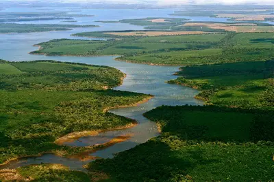
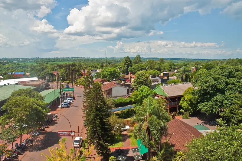
    Puerto Iguazú is the gateway to the waterfalls on the Argentinian side. This small town is located at the triple border, where the Río Iguazú flows into the Paraná, and Argentina, Brazil, and Paraguay meet.

    by Felix Gillen

    1. Home
    2. Destinations
    3. Argentina
    4. Northeast: Misiones and Iberá
    5. Puerto Iguazú
    Puerto Iguazú is the gateway to the waterfalls on the Argentinian side. This small town is located at the triple border, where the Río Iguazú flows into the Paraná, and Argentina, Brazil, and Paraguay meet. From the Hito Tres Fronteras viewpoint, you can gaze upon both neighboring countries.The national park is located about 17 kilometers outside; buses run regularly from the bus terminal. Cataratas del Iguazú Airport has connections to Buenos Aires and Córdoba. From here, the Brazilian side of the falls can also be visited; check Brazil's entry requirements for this. In July and over Easter, the town is particularly crowded due to Argentinian holidays.

    Sights in Puerto Iguazú

    Discover the most important sights and attractions

    Hito Tres Fronteras

    1Hito Tres Fronteras

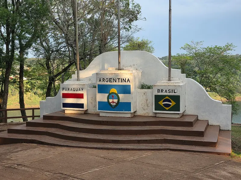
    At the end of Avenida Tres Fronteras, a border stone marks the point where the Río Iguazú meets the Paraná. From here, you look upon two neighboring countries at once: Paraguay opposite, Brazil to the right. It's about a 30-minute walk from the center; the place is especially beautiful at sunset.
    Open in Google Maps
    Güirá Oga

    2Güirá Oga

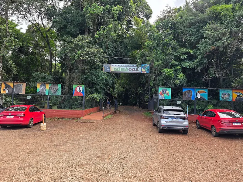
    The center, named after naturalist Andrés Giai and located in the subtropical forest, takes in injured, confiscated, or surrendered wild animals, cares for them, and breeds animals. On the approximately 19-hectare site, you'll get to know the region's fauna during a tour. It is situated on the road to the national park; the bus to the waterfalls stops in front of it upon request.
    Open in Google Maps

    Restaurants in Puerto Iguazú

    Accommodations in Puerto Iguazú

    Find perfect stay in Puerto Iguazú

    Booking.com* (Affiliate link)
    Search Hotels
    Agoda* (Affiliate link)
    Search Hotels
    Airbnb
    Vacation Rentals

    * Affiliate link: if you book through it, we earn a small commission. The price stays the same for you.

    Plan your trip to Puerto Iguazú

    Save places, build a route and plan your city trip, all in one place.

    1. 1
      Sunrise over alpine peaks and a sea of clouds
      1234

      Round trip

      12 days · 4 stops

      Saved

      Pick a route

      Pick a ready-made one or save places and plan your own.

      Open bookmarks
    2. 2

      Trip to Puerto Iguazú

      Live
      • 1Hito Tres Fronteras3 days
      • 2Güirá Oga4 days
      Budget

      Plan your trip

      The planner sorts stops, days and budget. Plan together in real time.

      Start trip planning
    3. 3
      9:41 No signal
      Puerto Iguazú
      Available offline

      Use it on the road

      Download the guide to your phone and use it on site, even offline.

    Nearby

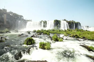
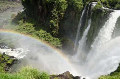
    The Iguazú Falls, on the border with Brazil, are among the largest waterfall systems on Earth: Spanning approximately 2.7 kilometers in width, the Río Iguazú plunges up to 82 meters deep in 150 to 300 individual cascades, depending on water levels. Around 80 percent of the falls are located on the Argentinian side, protected within the Parque Nacional Iguazú, which was founded in 1934 and has been a UNESCO World Heritage site since 1984.Within the park, walkways connect the Circuito Superior, offering panoramic views over the escarpment, and the Circuito Inferior, which leads closer to individual falls. The narrow-gauge railway, Tren Ecológico de la Selva, operates between the stations and is included in the admission fee. The name originates from the Guaraní language and means "big water."Current Notice (as of October 2026): The walkway to Garganta del Diablo, the most powerful fall, was preventatively dismantled due to exceptionally high water levels starting August 3, 2026. There is no set date for its reopening; Circuito Superior and Inferior remain open. Please check the National Park's official status before your visit.
    Northeast: Misiones and Iberá

    Northeast: Misiones and Iberá

    Argentina's subtropical northeast, between Paraguay and Brazil, is shaped by forests, red earth, and large rivers. The main destination is Iguazú Falls on the border with Brazil, visited from Puerto Iguazú. Further south in Misiones lie Jesuit reduction ruins, led by San Ignacio Miní, and in nearby Corrientes the Iberá Wetlands with caimans, capybaras, swamp deer.
    San Ignacio Miní

    San Ignacio Miní

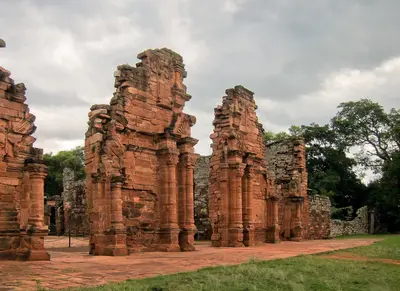
    The ruins of San Ignacio Miní, about 60 kilometers northeast of Posadas, are among Argentina's best-preserved Jesuit reductions. Here, Guaraní and Jesuit priests lived together until the order was expelled from the Spanish colonies in 1767. Mighty red sandstone walls with baroque architectural decoration, arranged around a large square with a church and Cabildo, remain.Since 1984, San Ignacio Miní, along with other reductions in Argentina and São Miguel in Brazil, has been part of the UNESCO World Heritage Site of the Jesuit Missions of the Guaraní. An exhibition room at the entrance explains its history; inquire locally about the evening light and sound show. From Puerto Iguazú, it's about 240 kilometers via Ruta Nacional 12.
    Esteros del Iberá

    Esteros del Iberá

    The Esteros del Iberá in Corrientes province are, after Brazil's Pantanal, among South America's largest freshwater wetlands. Lagoons, floating islands, and grasslands provide habitat for caimans, capybaras, swamp and pampas deer, howler monkeys, and over 350 bird species. For years, vanished species have been reintroduced here, including giant anteaters and jaguars; jaguars now roam freely through the park once again.The most important starting point is Colonia Carlos Pellegrini, a village of around 900 inhabitants on Laguna Iberá. From there, boats depart onto the lagoon, and short trails lead into the surrounding area. Access from Mercedes or Ituzaingó is partly via gravel roads; inquire about their condition beforehand.

    Palermo

    Palermo is Buenos Aires' largest barrio and is divided into several unofficial sub-districts. Palermo Soho and Palermo Hollywood are the entertainment and design districts with boutiques, cafés, bars, and street art; around Plaza Serrano (officially Plazoleta Julio Cortázar), a handicraft market takes place on weekends. Palermo Chico, in contrast, is a quiet, upscale residential area with villas and museums.To the east are the Bosques de Palermo, officially Parque Tres de Febrero, the city's largest green space, featuring lakes, a rose garden, a planetarium, a botanical garden, and a Japanese garden. Admission to the park, the Rosedal, and the Botanical Garden is free.
    Sources & method

    • Photos: Wikimedia Commons. Each photo carries its credit.
    • The content is based on web research from public, traceable sources. How the content is made · The role of AI