Fernweh: Home
    ExploreTravel GuidesPlan a tripMy tripLast visited
    de|en
    All Places & RegionsAll highlightsAbout FernwehFAQPrivacy PolicyImprint
    ExploreTravel GuidesPlan a tripMy tripLast visited
    • Neighborhoods & highlights
    • Recommendations
    • Walking tours
    • Eat & drink
    • Food culture
    • Culture
    • Nightlife
    • Getting around
    • Accommodation
    • Plan trip
    • Nearby
    Wanaka

    New Zealand

    Wanaka

    City

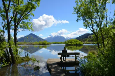
    Wanaka is located on the southern shore of Lake Wānaka, about an hour's drive north of Queenstown.

    by Felix Gillen

    1. Home
    2. Destinations
    3. New Zealand
    4. Otago
    5. Wanaka
    Wanaka is located on the southern shore of Lake Wānaka, about an hour's drive north of Queenstown. It is quieter than its neighbour and a gateway to Mount Aspiring National Park, the Roys Peak track, and the ski fields of Cardrona and Treble Cone.

    Sights in Wanaka

    Discover the most important sights and attractions

    That Wanaka Tree

    1That Wanaka Tree

    The lone willow in the shallow water at the west end of Roys Bay is Wanaka's most famous photo motif. Sunrise is the calmest time; from the centre, it's about a 15-minute walk along the shore.
    Open in Google Maps
    Roys Peak Track

    2Roys Peak Track

    The steep trail leads across pastures to the 1,578-meter-high Roys Peak, approximately 16 kilometers and five to seven hours return. The well-known viewpoint on the ridge lies just below the summit. From October 1st to November 10th, the track is closed due to lambing season.
    Open in Google Maps
    Puzzling World

    3Puzzling World

    The House of Illusions at the town entrance features crooked rooms, optical illusions, and a large outdoor wooden labyrinth. The leaning tower in front of the building is a popular photo spot. A visit typically takes one to two hours.
    Open in Google Maps
    Cardrona Alpine Resort

    4Cardrona Alpine Resort

    Whether you want to conquer the slopes in winter or race down mountain bike trails in summer, Cardrona Alpine Resort is a premier year-round destination. Just a short, scenic drive from Wanaka, this renowned resort offers you world-class facilities for skiers and snowboarders of all levels, as well as spectacular mountain biking tracks and scenic gondola rides in the warmer months. The breathtaking alpine landscape and crisp mountain air make every visit a refreshing experience, filled with adrenaline and unforgettable views.
    Open in Google Maps

    City walks in Wanaka

    Curated walking tours through the city's highlights, handpicked by experienced travel journalists.

    Wanaka's Charm on Foot: A Soulful Journey Along the Lakeshore

    Discover the idyllic beauty of Wanaka on this relaxed 2-hour walk. From the world-famous 'Wanaka Tree' to the busy town centre and the quiet marina, experience the highlights of this charming New Zealand town. Enjoy breathtaking views of the lake and the surrounding mountains.

    ~2 Std.
    Open in Google Maps
    Stops (6)

    Restaurants & Cafés

    1

    Kika

    Restaurant with modern European cuisine and sharing plates, crafted from Central Otago produce. Reservations advisable in the evenings.
    Show on Google Maps
    2

    Big Fig

    An eatery on the lakeside promenade where you build your plate at the counter with braised meat, salads, and vegetarian dishes. Simple and quick.
    Show on Google Maps
    3

    Federal Diner

    Cafe on Helwick Street for breakfast, brunch, and lunch with homemade baked goods. On weekends, lines form in the mornings.
    Show on Google Maps

    Food and Drinks in Wanaka

    For a small town, Wanaka has many good cafés and restaurants, most of them on Ardmore and Helwick Street.

    Pinot Noir by Lake

    Wineries like Rippon, directly on the lakeshore, offer tastings overlooking Lake Wānaka and the mountains.

    Craft Beer

    Wanaka is home to several small breweries, and you can find their beers in taprooms and bars across town.

    Summer Fruits

    From December to February, fruit stands between Wanaka and Cromwell sell fresh cherries and apricots.

    History and Character

    History and CharacterFor the Kāi Tahu, the lake and the valleys of Makarora and Matukituki were part of the routes to the West Coast Pounamu. European settlers arrived in the 1850s and 1860s as sheep farmers; the gold rush brushed the area, especially along the Cardrona River. For a long time, Wanaka remained a small holiday resort for families from Otago.Today, the town is a centre for mountain sports and boasts an active arts and café scene. Every second Easter, the Warbirds over Wanaka airshow takes place, and Lake Wānaka is a popular destination for sailors and paddlers.

    Nightlife

    1

    arc

    Cocktail and wine bar on Ardmore Street with small, tapas-style dishes, opposite the seafront promenade.
    Show on Google Maps
    2

    Treehouse Wānaka

    Wine bar with kitchen on Reece Crescent, slightly outside the center, popular for a quiet evening enjoying local wine.
    Show on Google Maps

    On the Road in Wanaka

    Exploring WanakaExplore the town centre and lakeside trails on foot or by bike; rentals are available along the lake promenade. For excursions into the valleys and to the ski areas, you'll need a car or a shuttle.To Queenstown: approx. one hour via the Crown Range or 1 hour 15 minutes via CromwellInterCity coaches connect Wanaka with Queenstown, Christchurch, and the West CoastThe road into Matukituki Valley to Raspberry Creek is a partially unsealed gravel track with fords

    Accommodations in Wanaka

    Find perfect stay in Wanaka

    Booking.com* (Affiliate link)
    Search Hotels
    Agoda* (Affiliate link)
    Search Hotels
    Airbnb
    Vacation Rentals

    * Affiliate link: if you book through it, we earn a small commission. The price stays the same for you.

    Plan your trip to Wanaka

    Save places, build a route and plan your city trip, all in one place.

    1. 1
      Sunrise over alpine peaks and a sea of clouds
      1234

      Round trip

      12 days · 4 stops

      Saved

      Pick a route

      Pick a ready-made one or save places and plan your own.

      Open bookmarks
    2. 2

      Trip to Wanaka

      Live
      • 1That Wanaka Tree3 days
      • 2Roys Peak Track4 days
      • 3Puzzling World5 days
      Budget

      Plan your trip

      The planner sorts stops, days and budget. Plan together in real time.

      Start trip planning
    3. 3
      9:41 No signal
      Wanaka
      Available offline

      Use it on the road

      Download the guide to your phone and use it on site, even offline.

    Nearby

    Arrowtown

    Arrowtown

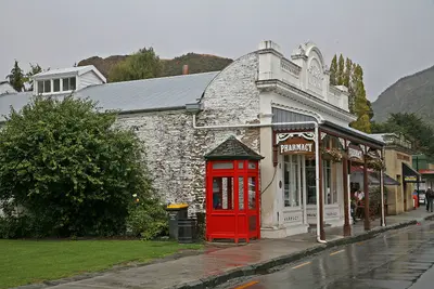
    Founded in 1862 during the gold rush on the Arrow River, Arrowtown has largely preserved its main street with wooden and stone houses from that era. The restored Chinese Settlement commemorates the Chinese gold miners, and in autumn, the valley's deciduous trees turn a brilliant yellow. Queenstown is located about 20 kilometers away.
    Central Otago

    Central Otago

    Central Otago is the dry highland in the South Island's interior, between Cromwell, Alexandra, and Clyde. Rugged schist hills, orchards, and vineyards shape the landscape, with gold rush traces dotting almost every valley.
    Queenstown

    Queenstown

    Queenstown lies on the northern shore of Lake Wakatipu, framed by the Remarkables and Ben Lomond. The small town is New Zealand's center for Bungy, jet boating, and skiing, but also serves as a base for Milford Sound, the Central Otago wine regions, and hikes on the Routeburn Track.
    Glenorchy

    Glenorchy

    Glenorchy is located at the northern end of Lake Wakatipu, a 45-minute drive from Queenstown, at the entrance to the Dart and Rees Valleys. The town is a starting point for the Routeburn Track and the backdrop for numerous film scenes, including from The Lord of the Rings trilogy.
    Milford Sound

    Milford Sound

    Milford Sound, called Piopiotahi in Māori, is New Zealand's best-known fjord and the only one in Fiordland that can be reached by road. Steep rock walls, the 1,692-meter-high Mitre Peak and waterfalls such as Stirling Falls shape the roughly 15-kilometer-long inlet.

    Sources & method

    • Photos: Pexels, Google Maps. Each photo carries its credit.
    • Place data such as addresses and ratings comes from Google Maps.
    • The content is based on web research from public, traceable sources. How the content is made · The role of AI