Fernweh: Home
ExploreGuideDestinationsMy tripsMy trip
de|en
All Places & RegionsRound tripsNight trains in EuropeAll highlightsAbout FernwehFAQPrivacy PolicyImprint
Download on the App StoreGet it on Google Play
ExploreGuideDestinationsMy tripsMy trip
    • Places & highlights
    • Eat & drink
    • Culture
    • Getting around
    • Accommodation
    • Nearby
    Vinicunca (Rainbow Mountain)

    Photo by Eddie Kiszka on Unsplash

    Peru

    Vinicunca (Rainbow Mountain)

    Point of Interest

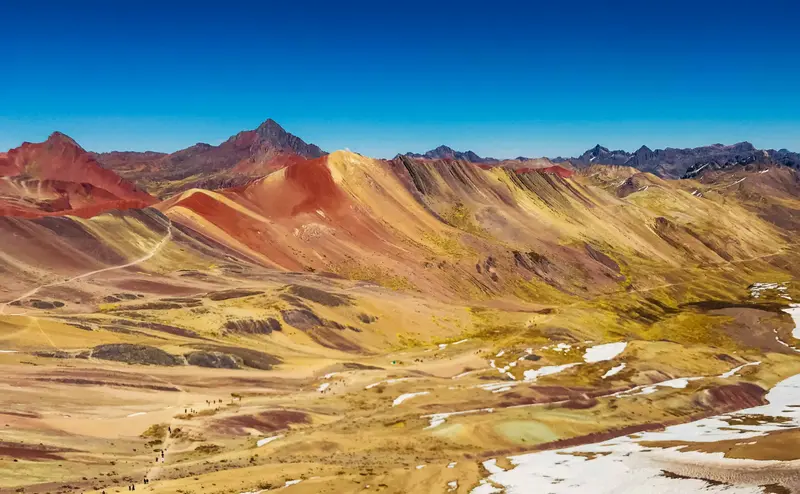
    Vinicunca (Montaña de Siete Colores) is a Cordillera Vilcanota mountain southeast of Cusco, its slopes glowing in red, ochre, and greenish stripes. The viewpoint at over 5,000 m overlooks glaciated Ausangate.

    by Felix Gillen

    1. Home
    2. Destinations
    3. Peru
    4. Cusco and Sacred Valley
    5. Vinicunca (Rainbow Mountain)
    Vinicunca (Montaña de Siete Colores) is a Cordillera Vilcanota mountain southeast of Cusco, its slopes glowing in red, ochre, and greenish stripes. The viewpoint at over 5,000 m overlooks glaciated Ausangate. The mountain long lay under ice and snow; it became known with glacial retreat and social media.
    Peru travel guideRound trips in PeruPlan a trip with Vinicunca (Rainbow Mountain)

    Contents

    • Places & highlights
    • Eat & drink
    • Culture
    • Getting around
    • Accommodation
    • Nearby

    Sights in Vinicunca (Rainbow Mountain)

    Discover the most important sights and attractions

    Attraction

    1Vinicunca (Mirador)

    The viewpoint on the ridge, over 5,000 m high, overlooks the mountain's striped slopes, with clear views reaching the glaciated Ausangate (6,384 m). From the Pampachari starting point, PromPerú states the hike is about three hours. The 30 Soles entrance fee for foreign guests is paid in Pampachari.
    Open in Google Maps

    Restaurants in Vinicunca (Rainbow Mountain)

    Genesis and Significance

    Colors from SedimentsThe color stripes formed over long geological periods from marine, lake, and river sediments; minerals, moisture, and oxidation colored them. For centuries, the mountain lay beneath glaciers and snow, which, according to PromPerú, have been receding since the early 1990s.Ausangate, the Sacred MountainVinicunca lies on the path to Ausangate, at 6,384 m, the highest mountain in the Cusco region. In the Andean worldview, it is an Apu, a protective mountain deity. Hikers on their way there first made Vinicunca known.

    Getting There and Hike

    Getting There from CuscoThe main route runs via Checacupe and Pitumarca to the trailhead at Pampachari. The drive takes around three hours, the final stretch on a very steep mountain road.Hike and AdmissionMain trail from Pampachari: according to PromPerú around three hours to the viewpoint at over 5,000 mAlternative route from Cusipata, starting at a higher altitudeAdmission for foreign visitors according to PromPerú: 30 soles, payable in PampachariFor current health and safety advice, including on altitude, check the FCDO travel advice.

    Accommodations in Vinicunca (Rainbow Mountain)

    Find perfect stay in Vinicunca (Rainbow Mountain)

    Booking.com* (Affiliate link)
    Search Hotels
    Agoda* (Affiliate link)
    Search Hotels
    Airbnb
    Vacation Rentals

    * Affiliate link: if you book through it, we earn a small commission. The price stays the same for you.

    Nearby

    Cusco

    Cusco

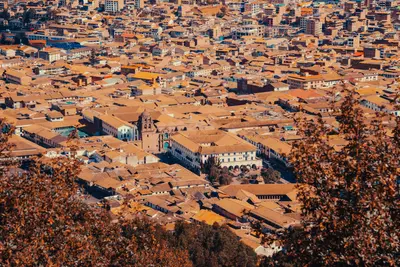
    Cusco was the capital of the Inca Empire and is today the starting point for almost every trip to Machu Picchu. Under Pachacútec, a planned city with religious and administrative areas was developed. The Spanish retained the layout, building their churches and palaces on the Inca walls. Since 1983, the city has been a UNESCO World Heritage site.The heart of the city is the Plaza de Armas, home to its cathedral and arcades. The Santo Domingo Convent stands on the Qorikancha, the Inca Sun Temple, whose walls are still visible. On Calle Hatun Rumiyoc sits the famous Twelve-Angled Stone, above which is the artisan quarter San Blas. The Mercado San Pedro is the city's most important market. Above the city lies the Inca site Sacsayhuamán with its mighty stone walls, setting for Inti Raymi on June 24.Cusco is at around 3,400 meters: Take it easy for the first few days.For Sacsayhuamán and the Inca sites in the Sacred Valley, you'll need the Boleto Turístico, available as a ten-day comprehensive ticket or partial tickets. Qorikancha and the Cathedral are not included.
    Marcelo Mora·Pexels

    Cusco and Sacred Valley

    Cusco and Sacred Valley

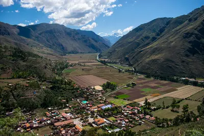
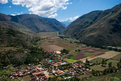
    The region around Cusco is the heartland of the Incas and Peru's most important travel destination. The former Inca capital, Cusco, is situated at around 3,500 meters, its center has been a UNESCO World Heritage site since 1983. Northwest lies the Sacred Valley of the Urubamba with the ruins and markets of Pisac, the Inca town of Ollantaytambo, and the terraces of Moray and Maras. At the end of the valley is Machu Picchu, accessible by train to Aguas Calientes.

    Marco Luigy·Pexels

    Sacred Valley of the Incas

    Sacred Valley of the Incas

    The Sacred Valley follows the Río Urubamba northwest of Cusco and was an important agricultural region for the Inca. The town of Pisac is located about 30 kilometers from Cusco, known for its handicraft market, especially on Sundays, and the terraces and temples of the Inca site on the mountain above the town.On the high plateau above the valley are the circular terraces of Moray, which the Inca presumably used for agricultural experiments, and the salt pans of Maras, where salt still evaporates from a spring today. At the western end of the valley lies Ollantaytambo, with the train station to Machu Picchu.Pisac, Ollantaytambo, Moray, and Chinchero are included in Cusco's Boleto Turístico.The valley lies lower than Cusco and is well-suited for the first days of acclimatization.

    Marco Luigy·Pexels

    Ollantaytambo

    Ollantaytambo

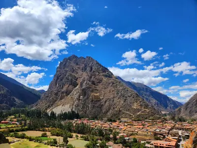
    Ollantaytambo is situated at approximately 2,800 meters at the western end of the Sacred Valley. The town is often referred to as a living Inca village: Its old town still follows the rectilinear street grid of the Inca, water flows through the alleys in stone channels, and many houses stand on Inca walls.Above the town rise the Inca terraces and temple complexes, which were expanded under Pachacútec. During the Spanish conquest, Ollantaytambo served as a fortress for Manco Inca. On the opposite slope lie ancient storage structures.From the station, PeruRail and Inca Rail run several times daily to Aguas Calientes; the journey takes about two hours.The Inca site is included in Cusco's Boleto Turístico.

    D-ART Photography·Pexels

    Machu Picchu

    Machu Picchu

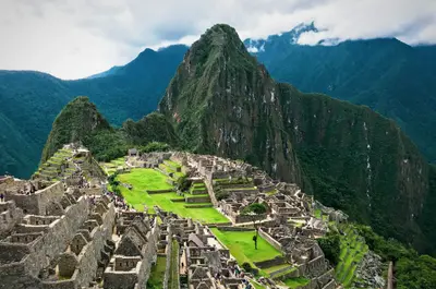
    Machu Picchu is the most famous Inca site and the reason why most travelers come to Peru. The complex is located at an altitude of about 2,430 meters on a mountain ridge between the peaks of Machu Picchu and Huayna Picchu, high above the Río Urubamba, approximately 80 kilometers northwest of Cusco. Most archaeologists consider it an estate of the Inca ruler Pachacútec, built around 1450. It remained hidden from the Spanish, gaining international recognition in 1911 through Hiram Bingham. Since 1983, it has been a UNESCO World Heritage site.Tickets: Admission is divided into three circuits with a total of ten routes and fixed entry times. The daily capacity is 4,500 visitors, increasing to 5,600 on designated high-season days. Tickets are sold online by the Ministry of Culture at tuboleto.cultura.pe. As of September 2026, reservations are no longer required; immediate payment is implemented. A small contingent for the following day is available on-site in Aguas Calientes. Book early for June to October.Getting there: By train from Cusco or Ollantaytambo to Aguas Calientes, then by bus or on foot via stairs up to the entrance.Inca Trail: The classic trail requires a permit obtained through a licensed tour operator and is typically closed for maintenance in February.

    Eddie Kiszka·Unsplash

    Your next steps

    Vinicunca (Rainbow Mountain) is in Peru. Ways to carry on from here.

    • More in Peru

      Highlights, areas, routes and the best time to travel for all of Peru.

      Peru travel guide
    • Round trips in Peru

      Ready-made routes through Peru, with stops, nights and a map.

      See the routes
    • Plan a trip with Vinicunca (Rainbow Mountain)

      The Guide asks about season, length and who is coming, and suggests a trip with Vinicunca (Rainbow Mountain).

      Plan the trip

    Sources & method

    • Photos: Unsplash. Each photo carries its credit.
    • Place data such as addresses and ratings comes from Google Maps.
    • The content is based on web research from public, traceable sources. How the content is made · The role of AI