Fernweh: Home
ExploreGuideDestinationsMy tripsMy trip
de|en
All Places & RegionsRound tripsNight trains in EuropeAll highlightsAbout FernwehFAQPrivacy PolicyImprint
Download on the App StoreGet it on Google Play
ExploreGuideDestinationsMy tripsMy trip
    • Neighborhoods & highlights
    • Eat & drink
    • Culture
    • Getting around
    • Accommodation
    • Plan trip
    • Nearby
    Kata and Karon

    HutheMeow / Wikimedia Commons / CC BY-SA 4.0, mod.

    Thailand

    Kata and Karon

    CityBeach

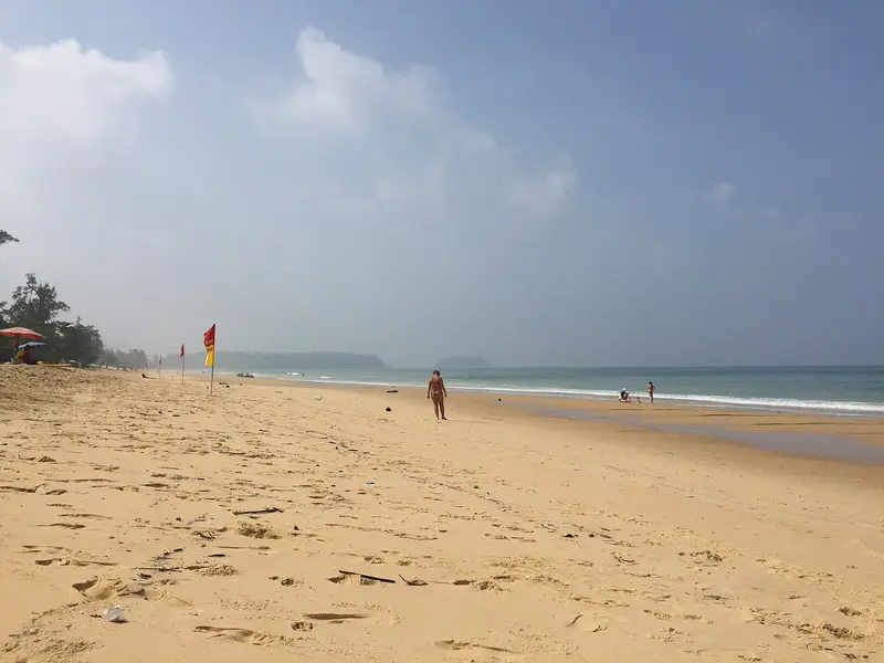
    Kata and Karon are two beach resorts on the west coast of Phuket, south of Patong. Karon Beach is approximately 3.5 kilometers long, wide, and quieter; the resort thrives mainly on beach life and has little nightlife.

    by Felix Gillen

    1. Home
    2. Destinations
    3. Thailand
    4. Phuket
    5. Kata and Karon
    Kata and Karon are two beach resorts on the west coast of Phuket, south of Patong. Karon Beach is approximately 3.5 kilometers long, wide, and quieter; the resort thrives mainly on beach life and has little nightlife. The crescent-shaped Kata Beach is about 1.5 kilometers long, with restaurants, shops, and bars within walking distance around the bay; surfing is popular here in the low season.To the south lies the small bay of Kata Noi. From Karon Viewpoint on the coastal road towards Nai Harn, you'll see all three beaches one after another. For swimming safety, especially during monsoon season, observe the advice from the German Federal Foreign Office and the warning flags on site.
    Thailand travel guideRound trips in ThailandPlan a trip with Kata and Karon

    Contents

    • Neighborhoods & highlights
    • Eat & drink
    • Culture
    • Getting around
    • Accommodation
    • Nearby

    Sights in Kata and Karon

    Discover the most important sights and attractions

    Attraction

    1Karon Viewpoint

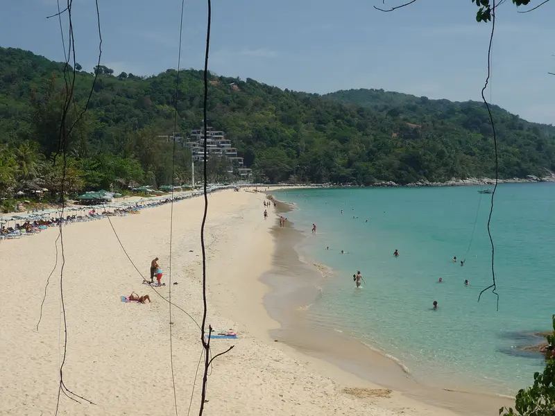
    The viewpoint is on the coastal road between Kata Noi and Nai Harn, about 3 kilometers south of Kata Beach. From here, you see Kata Noi below, beyond it Kata Beach with the small island Koh Poo, and in the distance, the long arc of Karon. Entry is free, and there's a large car park.
    Open in Google Maps
    Kata Beach

    ADwarf / Wikimedia Commons / public domain

    Beach

    2Kata Beach

    The approximately 1.5-kilometer-long, crescent-shaped beach with bright, fine sand is the heart of Kata. Restaurants, shops, and bars are within walking distance, and offshore, you'll see the small island Koh Poo. During the low season, Kata is a popular surf spot, offering board rentals and surf schools.
    Open in Google Maps
    Beach

    3Kata Noi Beach

    This small bay adjoins Kata Beach to the south and is quieter than its large neighbor. From Karon Viewpoint on the coastal road towards Nai Harn, you can see it from above, along with Kata and Karon. For swimming safety during monsoon season, pay attention to the warning flags on the beach.
    Open in Google Maps

    Restaurants in Kata and Karon

    1

    The Boathouse

    Restaurant directly on Kata Beach, serving Thai and Mediterranean cuisine, and considered by Lonely Planet one of Phuket's most prestigious restaurants. Multi-course menus are also available.
    Show on Google Maps
    2

    Kampong Kata Hill

    Thai seafood restaurant on the hill above Kata, reached via a long staircase. Lonely Planet describes two pavilions with teak and antiques and bay views.
    Show on Google Maps
    3

    Kata BBQ

    Inexpensive beach restaurant in southern Kata Yai offering Thai dishes and seafood. Lonely Planet highlights crab in yellow curry and Massaman curry.
    Show on Google Maps

    Beach Life in the Southwest

    Quieter than PatongKata and Karon thrive on beach tourism, with nightlife playing a smaller role than in Patong. The places are popular with families; in the low season, surfers come for the waves at Kata Beach. Above, on Nakkerd Hill, lies the Big Buddha, the most important landmark of the area.BehaviorSwimwear belongs on the beach, not in shops or restaurants.Cover shoulders and knees at the Big Buddha and in temples.Red flags on the beach mean no swimming, especially during monsoon season.

    Getting There & Around

    Getting ThereThe air-conditioned Phuket Smart Bus travels from the airport along the west coast via Patong to Karon and Kata and on to Rawai, costing 50 to 170 Baht depending on the route (as of TAT 2025).Taxis and Grab operate directly from the airport; confirm the price beforehand or check it in the app.Around TownKata and Karon are close to each other, so many places can be reached on foot.For short distances, use Tuk-Tuks and motorbike taxis; agree on the price before starting your journey.The winding coastal road to the south leads to Karon Viewpoint and Nai Harn; if renting a scooter, a motorbike license and helmet are mandatory.

    Accommodations in Kata and Karon

    Find perfect stay in Kata and Karon

    Booking.com* (Affiliate link)
    Search Hotels
    Agoda* (Affiliate link)
    Search Hotels
    Airbnb
    Vacation Rentals

    * Affiliate link: if you book through it, we earn a small commission. The price stays the same for you.

    Plan your trip to Kata and Karon

    Save places, build a route and plan your city trip, all in one place.

    1. 1
      Sunrise over alpine peaks and a sea of clouds
      1234

      Round trip

      12 days · 4 stops

      Saved

      Pick a route

      Pick a ready-made one or save places and plan your own.

      Open bookmarks
    2. 2

      Trip to Kata and Karon

      Live
      • 1Karon Viewpoint3 days
      • 2Kata Beach4 days
      • 3Kata Noi Beach5 days
      Budget

      Plan your trip

      The planner sorts stops, days and budget. Plan together in real time.

      Start trip planning
    3. 3
      9:41 No signal
      Kata and Karon
      Available offline

      HutheMeow / Wikimedia Commons / CC BY-SA 4.0, mod.

      Use it on the road

      Download the guide to your phone and use it on site, even offline.

    Nearby

    Patong

    Patong

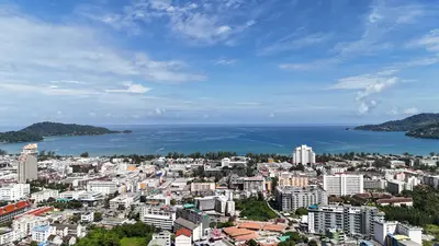
    Patong on the west coast is Phuket's largest and most developed beach resort. The approximately 2.8-kilometer-long beach attracted mainly European travelers from the late 1980s onwards, and since then, the town has been the island's hub for nightlife and shopping. Hotels, restaurants, and shops line up behind the beachfront promenade. Bangla Road, perpendicular to the beach, is a pedestrian zone in the evenings with bars and clubs open until the early morning hours. Those seeking peace are better off in Kata, Karon, or Nai Harn; those wanting infrastructure and nightlife will find it here. The 2004 tsunami severely damaged the coastal area, but the town has long since been rebuilt.

    Pimon Kumsri·Pexels

    Phuket Town (Old Town)

    Phuket Town (Old Town)

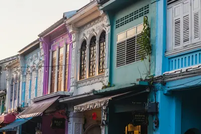
    The provincial capital in the southeast of the island is the cultural counterpoint to the beach resorts on the west coast. In the Old Town around Thalang Road, Phang Nga Road, Krabi Road, and Dibuk Road stand Sino-Portuguese shophouses, built by Hokkien-Chinese tin merchants and miners in the 19th century; many today house cafés, shops, small hotels, and museums. From the union of Hokkien immigrants and Siamese families, the Baba culture emerged with its own language, clothing, and cuisine. On Sunday evenings, Thalang Road transforms into the Lard Yai market, and the free electric bus Dragon Line makes a loop through the Old Town every 15 minutes.
    Sadiq Ahmad·Unsplash

    Andaman Sea Coast

    Andaman Sea Coast

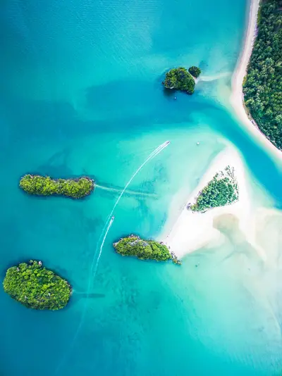
    The Andaman Coast forms the western side of the Thai peninsula. It is characterized by limestone karsts that rise from the sea and the plains, often dropping vertically, and are particularly dense in Phang Nga Bay.Off the coast lie the well-known island groups, from Phuket and the Phi Phi Islands to Koh Lanta and the far-flung Similan Islands. Several coastal sections and island groups are protected as national parks, home to some of the country's most renowned diving areas.The season is clearly defined: From approximately November to April is the dry season with calmer seas, while from May to October, the southwest monsoon brings waves and rain. During the monsoon months, many island businesses and some marine national parks close, and dangerous currents can form on some beaches. Pay attention to red flags and do not enter the water then. Current safety advice can be found at the German Federal Foreign Office.

    Unsplash

    Phuket

    Phuket

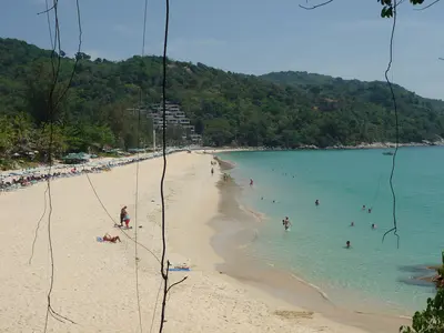
    Phuket, Thailand's largest island, is more than its famed beaches. Phuket Town's Old Town, with Sino-Portuguese shophouses, street art, and old cafes, recounts its tin mining past. In the south stand the Big Buddha on Nakkerd Hill and *Wat Chalong* temple; the west coast has bays from lively Patong to quieter Kata Noi and Nai Harn. Hokkien noodles, Moo Hong, seafood define the island's cuisine. Best travel time: November to February.

    ADwarf·public domain

    Koh Yao Noi

    Koh Yao Noi

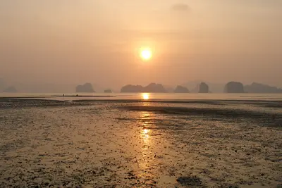
    Koh Yao Noi is located in Phang Nga Bay between Phuket and Krabi, offering views of limestone karsts rising from the shallow waters. Its name translates to "small long island." To its south lies the larger sister island, Koh Yao Yai.The island is predominantly Muslim and thrives on fishing, rubber cultivation, and rice farming. It features villages, a ring road, mosques, and a number of resorts and homestays, but no nightlife. You'll mostly get around by scooter.The beaches on the east coast are very shallow, and the tidal range is significant. At low tide, the sea recedes considerably. The beaches are only suitable for swimming around high tide; plan according to the tide calendar.Nonetheless, the island is an excellent base for kayak and boat tours to the bay's rocky islands. As the population lives conservatively, swimwear is inappropriate outside of beach and pool areas.

    Vyacheslav Argenberg·CC BY 4.0

    Your next steps

    Kata and Karon is in Thailand. Ways to carry on from here.

    • More in Thailand

      Highlights, areas, routes and the best time to travel for all of Thailand.

      Thailand travel guide
    • Round trips in Thailand

      Ready-made routes through Thailand, with stops, nights and a map.

      See the routes

    Sources & method

    • Photos: Wikimedia Commons. Each photo carries its credit.
    • Place data such as addresses and ratings comes from Google Maps.
    • The content is based on web research from public, traceable sources. How the content is made · The role of AI