Fernweh: Home
ExploreGuideDestinationsMy tripsMy trip
de|en
All Places & RegionsRound tripsNight trains in EuropeAll highlightsAbout FernwehFAQPrivacy PolicyImprint
Download on the App StoreGet it on Google Play
ExploreGuideDestinationsMy tripsMy trip
    • Neighborhoods & highlights
    • Eat & drink
    • Culture
    • Getting around
    • Accommodation
    • Plan trip
    • Nearby
    Le Tampon and Plaine des Cafres

    Rémih / Wikimedia Commons / CC BY-SA 4.0, mod.

    La Réunion

    Le Tampon and Plaine des Cafres

    City

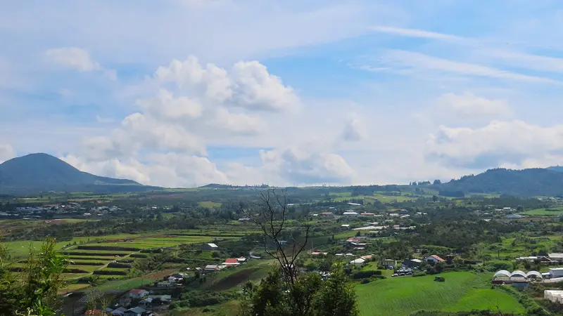
    Le Tampon is a town above Saint-Pierre, whose municipal area extends to the Plaine des Cafres and the Piton de la Fournaise.

    by Felix Gillen

    1. Home
    2. Destinations
    3. La Réunion
    4. Piton de la Fournaise
    5. Le Tampon and Plaine des Cafres
    Le Tampon is a town above Saint-Pierre, whose municipal area extends to the Plaine des Cafres and the Piton de la Fournaise. You drive here as a stopover on the Route du Volcan and for the view from the Belvédère de Bois Court of the village of Grand Bassin, which is only accessible on foot.The municipality has 81,964 inhabitants (2022). Its districts are partly named after the kilometer count from the sea, such as the Vingt-Troisième. On the high plateau lies Bourg-Murat with the Cité du Volcan and the volcano observatory.
    La Réunion travel guideRound trips in La RéunionPlan a trip with Le Tampon and Plaine des Cafres

    Contents

    • Neighborhoods & highlights
    • Eat & drink
    • Culture
    • Getting around
    • Accommodation
    • Nearby

    Sights in Le Tampon and Plaine des Cafres

    Discover the most important sights and attractions

    Attraction

    1Belvedere de Bois Court

    The triangular viewpoint juts out over the gorge of the Bras de la Plaine, offering views 600 to 700 meters deep down to the village of Grand Bassin and a waterfall. A glass platform may be closed on Mondays or in bad weather. For the car park, take the D70 at Vingt-Troisième, about 4 kilometers.

    Open in Google Maps

    2Grand Bassin

    The village is located where three streams meet and is only accessible on foot. Descent from Belvédère de Bois Court takes about 1.5 hours, ascent about 2.5 hours, with about 700m elevation. From the village, about 800 meters lead to a pool beneath a waterfall; gîtes for overnight stays.
    Open in Google Maps

    Restaurants in Le Tampon and Plaine des Cafres

    High Plateau and History

    Plaine des CafresDer Name geht auf entlaufene Sklaven zurück, die als „Cafres“ bezeichnet wurden und sich hier versteckten. Heute wird hier der größte Teil der Rinder der Insel gehalten, die Hochebene ist das Zentrum der Milchproduktion. Im Winter fällt die Temperatur nachts unter null Grad.Duftpflanzen und Bourg-MuratAb 1870 wurden hier Ylang-Ylang und Vetiver destilliert. Bourg-Murat an der Route du Volcan wurde von Auguste Murat gegründet und ist heute Sitz der Cité du Volcan und des Vulkanobservatoriums.

    Arrival and Exploring

    By CarThe RN3 leads from Le Tampon via Plaine des Cafres to Col de Bellevue (1,602 m) and further to Plaine des Palmistes. In Bourg-Murat, the Route du Volcan branches off. For Belvédère de Bois Court, take the D70 at Vingt-Troisième, about 4 kilometers to the parking lot.By BusThe Car Jaune line S2 runs from Saint-Benoît via Plaines to Le Tampon; S3 and S6 connect Le Tampon with Saint-Joseph. Timetables on carjaune.re.

    Accommodations in Le Tampon and Plaine des Cafres

    Find perfect stay in Le Tampon and Plaine des Cafres

    Booking.com* (Affiliate link)
    Search Hotels
    Agoda* (Affiliate link)
    Search Hotels
    Airbnb
    Vacation Rentals

    * Affiliate link: if you book through it, we earn a small commission. The price stays the same for you.

    Plan your trip to Le Tampon and Plaine des Cafres

    Save places, build a route and plan your city trip, all in one place.

    1. 1
      Sunrise over alpine peaks and a sea of clouds
      1234

      Round trip

      12 days · 4 stops

      Saved

      Pick a route

      Pick a ready-made one or save places and plan your own.

      Open bookmarks
    2. 2

      Trip to Le Tampon and Plaine des Cafres

      Live
      • 1Belvedere de Bois Court3 days
      • 2Grand Bassin4 days
      Budget

      Plan your trip

      The planner sorts stops, days and budget. Plan together in real time.

      Start trip planning
    3. 3
      9:41 No signal
      Le Tampon and Plaine des Cafres
      Available offline

      Rémih / Wikimedia Commons / CC BY-SA 4.0, mod.

      Use it on the road

      Download the guide to your phone and use it on site, even offline.

    Nearby

    Entre-Deux

    Entre-Deux is a village in the Hauts north of Saint-Pierre, between the Bras de Cilaos and the Bras de la Plaine. You come here for the Creole wooden houses in the centre and for hikes up the Dimitile; from its summit, you gaze into the Cilaos cirque.The municipality, with 7,105 inhabitants (2021), spans from about 100 to over 1,800 metres. The two rivers long made the village difficult to access; today, a 150-metre-high bridge leads into it. Its motto is „Deux bras, un cœur“.
    Saint-Pierre

    Saint-Pierre

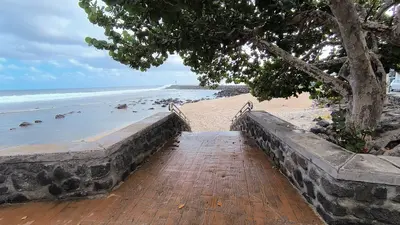
    Saint-Pierre is the largest city in the south of La Réunion and is considered the capital of the south; in 2022, it had 85,254 inhabitants. It was founded in 1735, and the small Pierrefonds airport is located near the city.Along the waterfront are the harbor, restaurants, bars, and a lagoon with a white sandy beach protected by a coral reef. Every Saturday morning, a market is held here, and every year in June, the Sakifo music festival. In the Terre Sainte quarter are narrow streets and Creole houses.

    Clémenceau Lauret·CC BY-SA 4.0

    Saint-Louis

    Saint-Louis

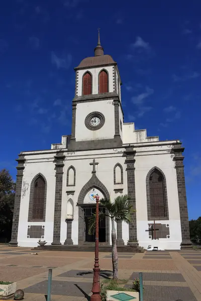
    Saint-Louis is a town on the south coast, west of Saint-Pierre, and the starting point of the road into the Cilaos cirque. You come here for the du Gol sugar factory, the island's largest church, and the Fenêtre des Makes viewpoint overlooking Cilaos.The municipality has 54,478 inhabitants (2022) and is located on the right bank of the Rivière Saint-Étienne. It originated from the Habitation du Gol, which Antoine Desforges-Boucher founded in 1719; in 1726 the Quartier Saint-Louis was established, and in 1815 it became a municipality.

    Clémenceau Lauret·CC BY 4.0

    South

    South

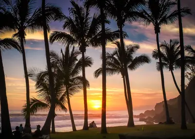
    The south of La Réunion stretches from Saint-Pierre, the region's largest town, via Petite-Île and Saint-Joseph to Saint-Philippe at the foot of Piton de la Fournaise. East of Saint-Pierre, the Sud sauvage, the wild south, begins with basalt cliffs, powerful surf, and lava flows.Saint-Pierre offers a supervised lagoon, one of the island's most famous markets, and the Saga du Rhum rum museum. Further east, you can swim in the rock pool of Grand Anse or in the pools of the Rivière Langevin, hike along Cap Méchant, and walk through Mare Longue, one of the last lowland rainforests of the Mascarenes.

    Paulina Kruminaite·CC BY-SA 4.0

    L'Étang-Salé

    L'Étang-Salé

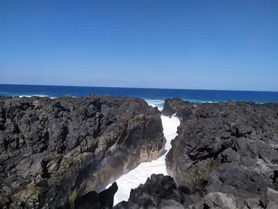
    L'Étang-Salé is a coastal community in the southwest of La Réunion, between Les Avirons and Saint-Louis. You come here for the black sand beach of L'Étang-Salé-les-Bains, the shady coastal forest, and the Gouffre, where the surf crashes into a rocky channel.The municipality, with 13,836 inhabitants (2021), consists of the seaside resort, the town center, and hamlets in the Hauts; its motto is „Entre mer et forêt“. At Bassin Pirogue, a reef protects a small lagoon area, while the open coast is exposed to strong surf.

    EmilieRaspail·CC BY-SA 4.0

    Your next steps

    Le Tampon and Plaine des Cafres is in La Réunion. Ways to carry on from here.

    • More in La Réunion

      Highlights, areas, routes and the best time to travel for all of La Réunion.

      La Réunion travel guide
    • Round trips in La Réunion

      Ready-made routes through La Réunion, with stops, nights and a map.

      See the routes

    Sources & method

    • Photos: Wikimedia Commons. Each photo carries its credit.
    • Place data such as addresses and ratings comes from Google Maps.
    • The content is based on web research from public, traceable sources. How the content is made · The role of AI