Fernweh: Home
ExploreGuideDestinationsMy tripsMy trip
de|en
All Places & RegionsRound tripsNight trains in EuropeAll highlightsAbout FernwehFAQPrivacy PolicyImprint
Download on the App StoreGet it on Google Play
ExploreGuideDestinationsMy tripsMy trip
    • Places in the region
    • Culture
    • Getting around
    • Nearby
    Piton de la Fournaise

    Photo by Oscar Brouchot on Unsplash

    La Réunion

    Piton de la Fournaise

    Region

    Piton de la Fournaise is the active shield volcano in the southeast of La Réunion, 2,632 meters high and accessible via the Route du Volcan from Bourg-Murat in the highlands above Saint-Pierre.

    by Felix Gillen

    1. Home
    2. Destinations
    3. La Réunion
    4. Piton de la Fournaise
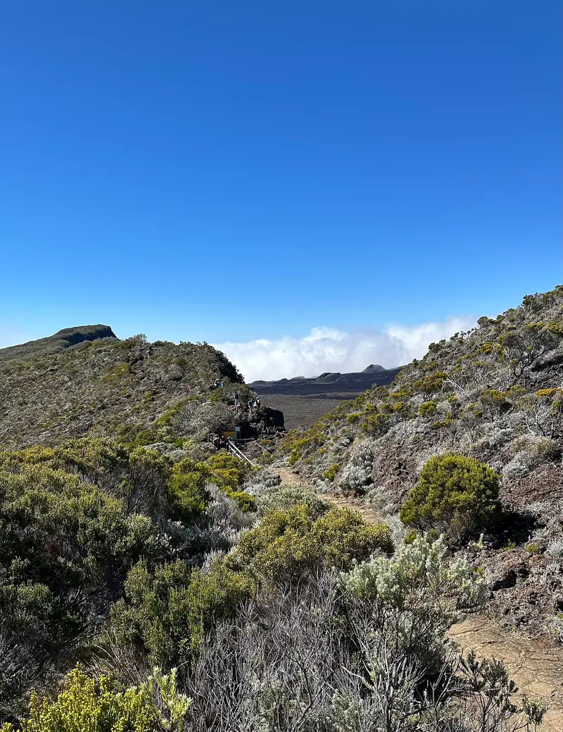
    Piton de la Fournaise is the active shield volcano in the southeast of La Réunion, 2,632 meters high and accessible via the Route du Volcan from Bourg-Murat in the highlands above Saint-Pierre. Since 1998, it erupts on average about twice a year, most recently from February to April 2026.The drive leads through heathland and the barren Plaine des Sables slag plain to the Pas de Bellecombe viewpoint. From there, you look into the Enclos Fouqué caldera and onto the summit cone. Those who start early can hike to the edge of the Cratère Dolomieu in clear visibility. The volcano belongs to the National Park and the UNESCO World Heritage site "Pitons, cirques et remparts."
    La Réunion travel guideRound trips in La RéunionPlan a trip with Piton de la Fournaise

    Contents

    • Places in the region
    • Culture
    • Getting around
    • Nearby

    More places in Piton de la Fournaise

    Le Tampon and Plaine des Cafres

    Rémih·CC BY-SA 4.0

    Le Tampon and Plaine des Cafres

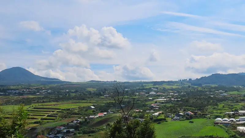
    Le Tampon is a town above Saint-Pierre, whose municipal area extends to the Plaine des Cafres and the Piton de la Fournaise. You drive here as a stopover on the Route du Volcan and for the view from the Belvédère de Bois Court of the village of Grand Bassin, which is only accessible on foot.The municipality has 81,964 inhabitants (2022). Its districts are partly named after the kilometer count from the sea, such as the Vingt-Troisième. On the high plateau lies Bourg-Murat with the Cité du Volcan and the volcano observatory.

    Sights in Piton de la Fournaise

    Discover the most important sights and attractions

    Pas de Bellecombe

    Olaf2 / Wikimedia Commons / CC BY-SA 4.0, mod.

    Natural Feature

    Pas de Bellecombe

    Viewpoint at approximately 2,350 meters on the rim of the Caldera with views over the Enclos Fouqué and the summit cone, parking at the road's end. Below the gate, a steep stepped path leads down into the rock to the Enclos; from there, trails to the crater begin. During eruptions and increased activity, the gate is closed.
    Open in Google Maps
    Formica Léo

    Rémih / Wikimedia Commons / CC BY-SA 4.0, mod.

    Point of Interest

    Formica Léo

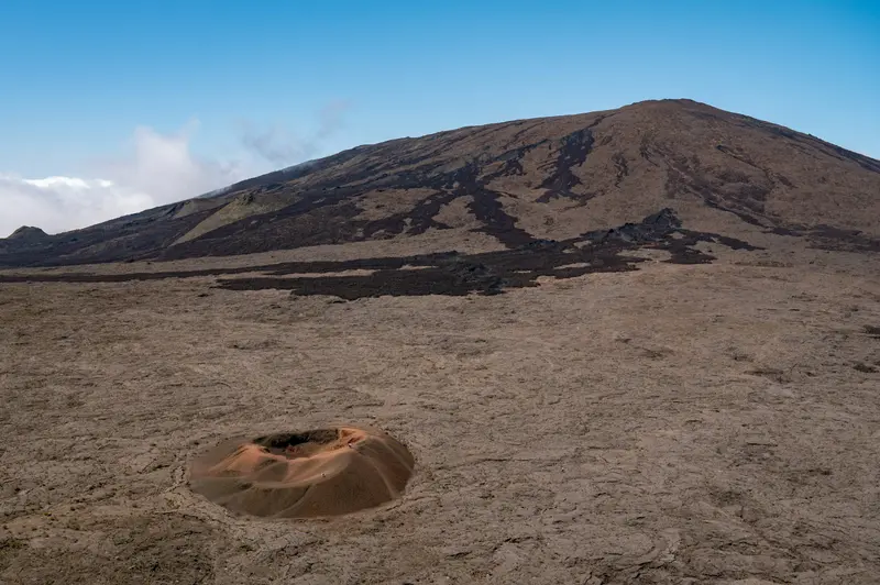
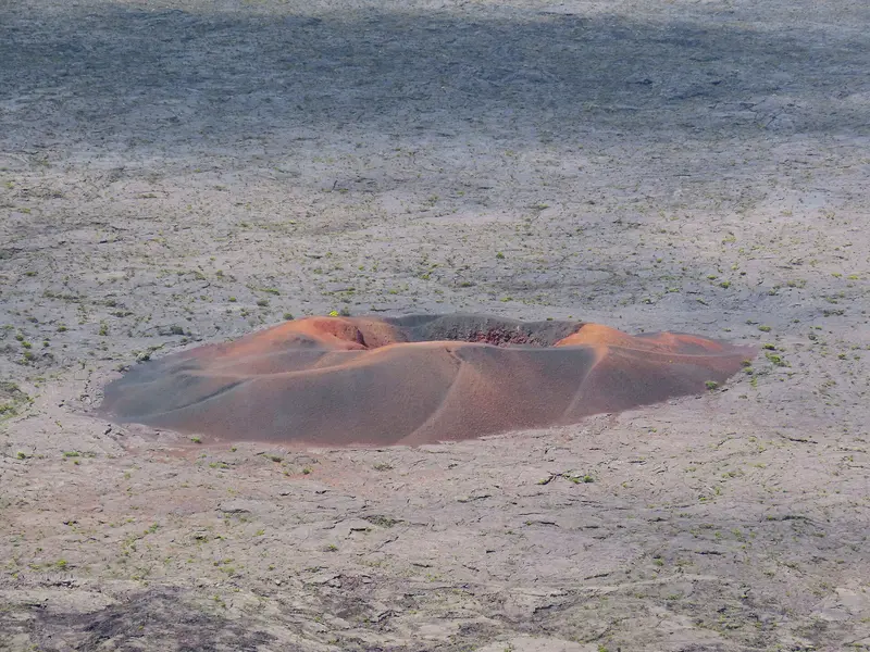
    Small red cinder cone in the Enclos Fouqué below the Pas de Bellecombe, reachable via a marked stepped path in about 20 minutes. A good short detour if you're not going all the way to the crater. Access, like the entire Enclos, depends on the current alert level.
    Open in Google Maps
    Museum

    Cité du Volcan

    Volcano Museum in Bourg-Murat, at the beginning of the Route du Volcan, opened in 1992 as Maison du Volcan. Exhibitions on Piton de la Fournaise and global volcanism, a 4D cinema, and a panoramic screen make it interesting for children as well. Ideal as an introduction or when the volcano is cloud-covered; it's open daily, Mondays only from noon.
    Open in Google Maps
    Plaine des Sables

    “Panorama - La plaine des sables” by Dval027 / Wikimedia Commons / CC BY-SA 3.0, mod.

    Attraction

    Plaine des Sables

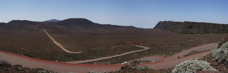
    A barren, approximately three-kilometer-long high plateau of red to black cinder along the Route du Volcan, shaped by Piton Chisny. At Pas des Sables, over 2,300 meters up, an orientation table offers views across the plain. It's clearest early in the morning; do not enter the plain on foot in fog.
    Open in Google Maps
    Cratère Dolomieu

    Geolina / Wikimedia Commons / CC BY-SA 4.0, mod.

    Natural Feature

    Cratère Dolomieu

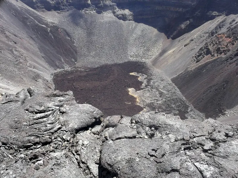
    Piton de la Fournaise's largest summit crater has been over 300 meters deep since its collapse in April 2007. The round-trip hike from Pas de Bellecombe is approximately 12 kilometers long, takes about 5 hours, and is white-marked; the Chapelle de Rosemont lies along the way. From the viewpoint, you look into the crater; remain behind the marking. Whether the path is open depends on the prefecture's current warning level.
    Open in Google Maps

    About Geology and History

    A Hotspot VolcanoPiton de la Fournaise is a hotspot volcano. The Enclos Fouqué is an east-open, horseshoe-shaped collapse basin, approx. 13 by 9 km, with 100-400m high walls. The Cratère Dolomieu, largest summit crater, is over 300m deep since its April 2007 collapse.MonitoringThe Observatoire volcanologique du Piton de la Fournaise (OVPF) was founded in 1979. It is located in Bourg-Murat and belongs to the Institut de physique du globe de Paris. For every eruption, the prefecture sets access rules and can decree the Enclos closed.Cité du VolcanThe museum in Bourg-Murat opened in 1992 as Maison du Volcan; volcanologists Maurice and Katia Krafft were instrumental in its establishment. Since 2011, it has been called Cité du Volcan.

    Getting Here and Practical Tips

    How to Get ThereThe Route du Volcan starts in Bourg-Murat on the RN3. From Saint-Pierre, you drive via Le Tampon to Plaine des Cafres, reaching Bourg-Murat in about 35 minutes. From there, it's a good 20 kilometers on a winding road to the parking lot at Pas de Bellecombe at around 2,350 meters; a total of about 1 hour and 25 minutes. Beyond Plaine des Sables, the road becomes a track with potholes. There is no public transport.Best Time to VisitDrive early in the morning. From late morning, clouds often shroud the volcano, and fog can roll in within minutes. Above 2,000 meters, it's cold. Bring warm, waterproof clothing, water, sun protection, and sturdy shoes. Stay on marked paths; do not enter Plaine des Sables in fog.Closures and Current SituationIn case of eruption or increased activity, the Pas de Bellecombe gate is closed. On 24 October 2026, due to a seismic crisis, the prefecture declared Alert Level 1 and closed the Enclos. Since 26 October, the Vigilance level has been in effect, after which only the ONF paths to Cratère Caubet and the Dolomieu viewpoint were open (latest notice found: 26 October 2026). Before visiting, check OVPF bulletins, prefecture alert level reports, and ONF path closure notices. For current safety advice, check the UK FCDO travel advice, linked on the country page.

    Nearby

    Saint-Philippe

    Saint-Philippe

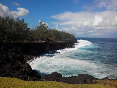
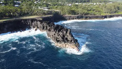
    Saint-Philippe is the southeasternmost commune of La Réunion, between Saint-Joseph and the Grand Brûlé at the foot of Piton de la Fournaise. You come here for the rugged basalt coast at Cap Méchant, the seawater pool at Baril, and the lava platforms the volcano pushed into the sea.The commune was founded in 1830 and has 5,093 inhabitants (2022). It includes Le Baril, Basse-Vallée, Mare Longue, and Le Tremblet. Fishing, Vacoa weaving, and the cultivation of palm hearts shape daily life.

    Nikkyo974·CC BY-SA 4.0

    La Plaine-des-Palmistes

    La Plaine-des-Palmistes

    La Plaine-des-Palmistes is a highland municipality situated at about 1,000 m on the Route des Plaines, between Saint-Benoît and Saint-Pierre, within the corridor separating Piton des Neiges and Piton de la Fournaise. From here, you can drive via the forest road into the Bébour and Bélouve forests. In 2023, the municipality had a population of 6,936.The town is named after the palm trees that once grew here; it has been an independent municipality since 1899. The climate is cool and very wet, with an average annual rainfall exceeding 4,000 mm.

    Pradigue·CC BY-SA 4.0

    Sainte-Rose

    Sainte-Rose

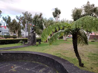
    Sainte-Rose is the southernmost commune on the east coast, situated between the Rivière de l'Est and the Grand Brûlé on the flank of Piton de la Fournaise. You come for its lava fields, the Notre-Dame-des-Laves church, and Anse des Cascades. In 2023, Sainte-Rose had a population of 6,557.Due to its numerous lava flows, the commune is known as the "land of lava." In April 1977, a flow destroyed parts of Piton Sainte-Rose and stopped just before the church. In 1809, British troops landed near Sainte-Rose but were repelled.

    Clémenceau Lauret·CC BY-SA 4.0

    South

    South

    The south of La Réunion stretches from Saint-Pierre, the region's largest town, via Petite-Île and Saint-Joseph to Saint-Philippe at the foot of Piton de la Fournaise. East of Saint-Pierre, the Sud sauvage, the wild south, begins with basalt cliffs, powerful surf, and lava flows.Saint-Pierre offers a supervised lagoon, one of the island's most famous markets, and the Saga du Rhum rum museum. Further east, you can swim in the rock pool of Grand Anse or in the pools of the Rivière Langevin, hike along Cap Méchant, and walk through Mare Longue, one of the last lowland rainforests of the Mascarenes.

    Paulina Kruminaite·CC BY-SA 4.0

    Saint-Joseph and Wild South

    Saint-Joseph and Wild South

    Saint-Joseph is a commune in the wild south, located between Saint-Pierre and Saint-Philippe, on the coast and the slopes of the volcano; National Road N2 runs through the area. This is where the rugged coast begins, with basalt cliffs, rock pools, and waterfalls.The Rivière Langevin valley features a series of pools and waterfalls, including the Cascade de Grand Galet. Manapany-les-Bains has a bathing pool set in basalt, and from Vincendo, a coastal path leads to the ocher cliff Cap Jaune, an hour's round trip. Further east are Cap Méchant and the Mare Longue forest in Saint-Philippe.

    Froscha·CC BY-SA 4.0

    Your next steps

    Piton de la Fournaise is in La Réunion. Ways to carry on from here.

    • More in La Réunion

      Highlights, areas, routes and the best time to travel for all of La Réunion.

      La Réunion travel guide
    • Round trips in La Réunion

      Ready-made routes through La Réunion, with stops, nights and a map.

      See the routes
    • Plan a trip with Piton de la Fournaise

      The Guide asks about season, length and who is coming, and suggests a trip with Piton de la Fournaise.

      Plan the trip

    Sources & method

    • Photos: Wikimedia Commons, Unsplash. Each photo carries its credit.
    • Place data such as addresses and ratings comes from Google Maps.
    • The content is based on web research from public, traceable sources. How the content is made · The role of AI