Fernweh: Home
ExploreGuideDestinationsMy tripsMy trip
de|en
All Places & RegionsRound tripsNight trains in EuropeAll highlightsAbout FernwehFAQPrivacy PolicyImprint
Download on the App StoreGet it on Google Play
ExploreGuideDestinationsMy tripsMy trip
    • Neighborhoods & highlights
    • Eat & drink
    • Culture
    • Getting around
    • Accommodation
    • Plan trip
    • Nearby
    Sainte-Rose

    Clémenceau Lauret / Wikimedia Commons / CC BY-SA 4.0, mod.

    La Réunion

    Sainte-Rose

    City

    Sainte-Rose is the southernmost commune on the east coast, situated between the Rivière de l'Est and the Grand Brûlé on the flank of Piton de la Fournaise.

    by Felix Gillen

    1. Home
    2. Destinations
    3. La Réunion
    4. Osten
    5. Sainte-Rose
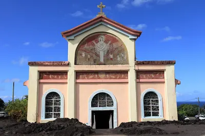
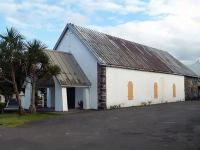
    Sainte-Rose is the southernmost commune on the east coast, situated between the Rivière de l'Est and the Grand Brûlé on the flank of Piton de la Fournaise. You come for its lava fields, the Notre-Dame-des-Laves church, and Anse des Cascades. In 2023, Sainte-Rose had a population of 6,557.Due to its numerous lava flows, the commune is known as the "land of lava." In April 1977, a flow destroyed parts of Piton Sainte-Rose and stopped just before the church. In 1809, British troops landed near Sainte-Rose but were repelled.
    La Réunion travel guideRound trips in La RéunionPlan a trip with Sainte-Rose

    Contents

    • Neighborhoods & highlights
    • Eat & drink
    • Culture
    • Getting around
    • Accommodation
    • Nearby

    Sights in Sainte-Rose

    Discover the most important sights and attractions

    Notre-Dame-des-Laves

    Rémih / Wikimedia Commons / CC BY-SA 4.0, mod.

    Church

    1Notre-Dame-des-Laves

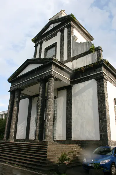
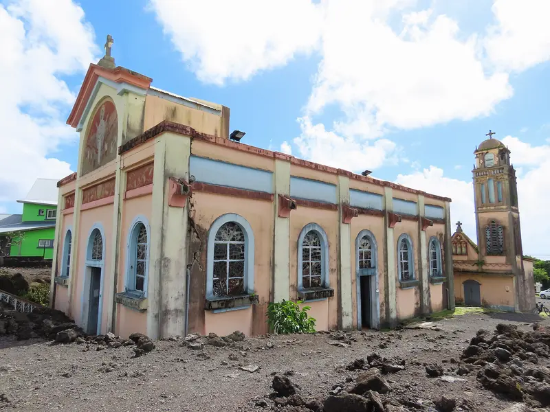
    Church in Piton Sainte-Rose, famous since 1977: A lava flow from Piton de la Fournaise devastated the village, reached the church, and stopped at it without destroying it. The solidified lava is still visible right next to the building today.

    Open in Google Maps
    Park

    2Anse des Cascades

    A small cove under coconut palms, where several waterfalls cascade from the cliff face. Colorful fishing boats lie on the shore. A shady spot for a picnic, but the sea here is too rough for swimming.
    Open in Google Maps

    Restaurants in Sainte-Rose

    Life on the Volcano

    Lava FieldsAlong RN 2 in the south of the municipality are lava flows from various eruptions. Several have crossed the road, leading to its route being changed repeatedly.The Navy and CorbettThe small harbour still holds fishing boats. A basalt column commemorates the British frigate captain Robert Corbett, who died in the 1809 battle off Sainte-Rose.

    Getting There & Around

    About the RN 2From Saint-Denis, take the RN 2 via Saint-André and Saint-Benoît to Sainte-Rose and continue towards Saint-Philippe. In case of eruptions, the road in Grand Brûlé may be closed; check the prefecture's announcements.On FootThe Sentier des Pêcheurs connects Piton Sainte-Rose with Anse des Cascades; the loop to Pointe des Cascades is an easy walk.

    Accommodations in Sainte-Rose

    Find perfect stay in Sainte-Rose

    Booking.com* (Affiliate link)
    Search Hotels
    Agoda* (Affiliate link)
    Search Hotels
    Airbnb
    Vacation Rentals

    * Affiliate link: if you book through it, we earn a small commission. The price stays the same for you.

    Plan your trip to Sainte-Rose

    Save places, build a route and plan your city trip, all in one place.

    1. 1
      Sunrise over alpine peaks and a sea of clouds
      1234

      Round trip

      12 days · 4 stops

      Saved

      Pick a route

      Pick a ready-made one or save places and plan your own.

      Open bookmarks
    2. 2

      Trip to Sainte-Rose

      Live
      • 1Notre-Dame-des-Laves3 days
      • 2Anse des Cascades4 days
      Budget

      Plan your trip

      The planner sorts stops, days and budget. Plan together in real time.

      Start trip planning
    3. 3
      9:41 No signal
      Sainte-Rose
      Available offline

      Clémenceau Lauret / Wikimedia Commons / CC BY-SA 4.0, mod.

      Use it on the road

      Download the guide to your phone and use it on site, even offline.

    Nearby

    Osten

    Osten

    The East is the rainier side of the island between Saint-Denis and the lava fields of Grand Brûlé. You visit for the coastal traces of Piton de la Fournaise, the vanilla growing regions, the waterfalls and bathing pools inland, and the Tamil temples.At Sainte-Rose, the Route des Laves follows cooled lava flows; the church of Notre-Dame-des-Laves was narrowly spared during the 1977 eruption. Further north, near Bras-Panon, are the pools of the Rivière des Roches, and in Saint-André, the Temple du Colosse. Inland, you reach the Bélouve cloud forest via the Plaine-des-Palmistes.

    Clémenceau Lauret·CC BY-SA 4.0

    Saint-Benoît

    Saint-Benoît

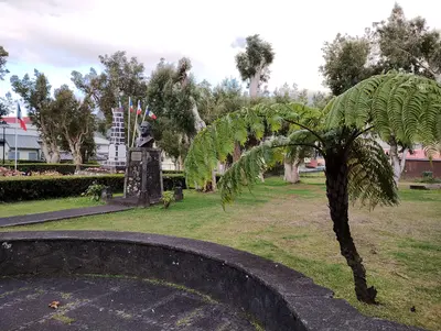
    Saint-Benoît ist eine der größten Gemeinden der Insel und liegt an der Mündung der Rivière des Marsouins an der Ostküste. Du nutzt den Ort als Ausgangspunkt für das Tal von Takamaka, den Grand Étang und die Route des Plaines ins Hochland. 2023 hatte die Gemeinde 38.604 Einwohner.Gegründet wurde Saint-Benoît 1733. Hier gewöhnte Joseph Hubert die Gewürze an, die Pierre Poivre mitgebracht hatte; später wurden Mango, Litschi und Vanille angebaut. Zur Gemeinde gehört auch der Ortsteil Sainte-Anne mit seiner reich verzierten Kirche.

    Thierry Caro·CC BY-SA 4.0

    Piton de la Fournaise

    Piton de la Fournaise

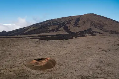
    Piton de la Fournaise is the active shield volcano in the southeast of La Réunion, 2,632 meters high and accessible via the Route du Volcan from Bourg-Murat in the highlands above Saint-Pierre. Since 1998, it erupts on average about twice a year, most recently from February to April 2026.The drive leads through heathland and the barren Plaine des Sables slag plain to the Pas de Bellecombe viewpoint. From there, you look into the Enclos Fouqué caldera and onto the summit cone. Those who start early can hike to the edge of the Cratère Dolomieu in clear visibility. The volcano belongs to the National Park and the UNESCO World Heritage site "Pitons, cirques et remparts."

    Oscar Brouchot·Unsplash

    La Plaine-des-Palmistes

    La Plaine-des-Palmistes

    La Plaine-des-Palmistes is a highland municipality situated at about 1,000 m on the Route des Plaines, between Saint-Benoît and Saint-Pierre, within the corridor separating Piton des Neiges and Piton de la Fournaise. From here, you can drive via the forest road into the Bébour and Bélouve forests. In 2023, the municipality had a population of 6,936.The town is named after the palm trees that once grew here; it has been an independent municipality since 1899. The climate is cool and very wet, with an average annual rainfall exceeding 4,000 mm.

    Pradigue·CC BY-SA 4.0

    Bras-Panon

    Bras-Panon

    Bras-Panon is a municipality on the east coast between Saint-André and Saint-Benoît and is considered the cradle of Bourbon vanilla. You come for the Provanille vanilla cooperative and the bathing pools of the Rivière des Roches. In 2023, Bras-Panon had a population of 13,012.The municipality is bordered by the Rivière du Mât to the north and the Rivière des Roches to the south. Bras-Panon has been an independent municipality since February 24, 1882; before that, it belonged to Saint-Benoît.

    WCOMFR Mireille GRUMBERG·CC BY-SA 4.0

    Your next steps

    Sainte-Rose is in La Réunion. Ways to carry on from here.

    • More in La Réunion

      Highlights, areas, routes and the best time to travel for all of La Réunion.

      La Réunion travel guide
    • Round trips in La Réunion

      Ready-made routes through La Réunion, with stops, nights and a map.

      See the routes

    Sources & method

    • Photos: Wikimedia Commons. Each photo carries its credit.
    • Place data such as addresses and ratings comes from Google Maps.
    • The content is based on web research from public, traceable sources. How the content is made · The role of AI