Fernweh: Home
ExploreGuideDestinationsMy tripsMy trip
de|en
All Places & RegionsRound tripsNight trains in EuropeAll highlightsAbout FernwehFAQPrivacy PolicyImprint
Download on the App StoreGet it on Google Play
ExploreGuideDestinationsMy tripsMy trip
    • Places & highlights
    • Eat & drink
    • Getting around
    • Accommodation
    • Nearby
    Calakmul

    Lugares INAH / Wikimedia Commons / CC BY-SA 4.0, mod.

    Mexico

    Calakmul

    Point of InterestCultureNatureUNESCO

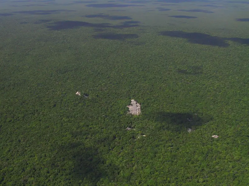
    The Mayan city of Calakmul is deep within the rainforest of Campeche state, southern Yucatán Peninsula.

    by Felix Gillen

    1. Home
    2. Destinations
    3. Mexico
    4. Yucatán Peninsula
    5. Calakmul
    The Mayan city of Calakmul is deep within the rainforest of Campeche state, southern Yucatán Peninsula. Its Biosphere Reserve dates to 1989, the site became a UNESCO World Heritage site in 2002, and a mixed natural and cultural heritage site in 2014. Structure II is around 55 meters high and, according to INAH, the second-highest Mayan pyramid after Toniná.From Federal Highway 186, a roughly 60-kilometer access road branches south at Ejido Conhuás; allow about 90 minutes. The Tren Maya stops in Xpujil and at the Calakmul halt near Conhuás; from there, you'll need a rental car or pre-booked transport.
    Mexico travel guideRound trips in MexicoPlan a trip with Calakmul

    Contents

    • Places & highlights
    • Eat & drink
    • Getting around
    • Accommodation
    • Nearby

    Sights in Calakmul

    Discover the most important sights and attractions

    Attraction

    1Calakmul Archaeological Zone with Structure II

    The archaeological site in the rainforest is managed by INAH. Its landmark is Structure II, approx. 55 meters high and, according to INAH, the second-highest Maya pyramid after Toniná. Per INAH, open daily 8 AM to 5 PM, last entry 4 PM; admission for foreign visitors is 210 Pesos plus CONANP fee.
    Open in Google Maps

    Restaurants in Calakmul

    Arrival & Essentials

    DirectionsFrom Federal Highway 186 (Chetumal to Escárcega), turn off at KM 95 and drive approx. 60 km south, about 1.5 hours. The Tren Maya stops in Xpujil and at Calakmul station; onward travel is only possible by rental car or pre-booked transport.Opening Hours and AdmissionThe zone is open daily from 8 AM to 5 PM, last entry 4 PM (INAH). Foreign visitors pay 210 Pesos for INAH admission, plus the CONANP fee for the Biosphere Reserve (2026: 215 Pesos). Verify information beforehand.

    Accommodations in Calakmul

    Find perfect stay in Calakmul

    Booking.com* (Affiliate link)
    Search Hotels
    Agoda* (Affiliate link)
    Search Hotels
    Airbnb
    Vacation Rentals

    * Affiliate link: if you book through it, we earn a small commission. The price stays the same for you.

    Nearby

    Tikal

    Tikal

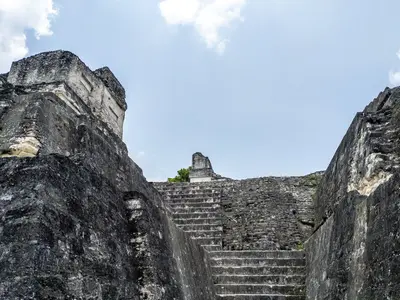
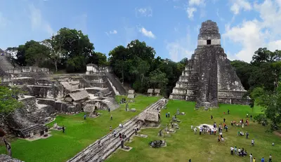
    Tikal is one of the largest ruined cities of the Maya and is located deep in the rainforest of Petén, approximately 63 kilometers northeast of Flores. Temple pyramids towering above the canopy, plazas filled with stelae, and diverse wildlife make the national park a highlight of many Guatemala trips.The city was inhabited from the 6th century BC until the 10th century AD. The national park has been a UNESCO World Heritage site since 1979 and was inscribed under both cultural and natural criteria.At its center lies the Gran Plaza with Temple I and Temple II; to the west, Temple IV, the tallest structure of the site, rises with views over the canopy. According to the Auswärtiges Amt, there is also a risk of robberies in Tikal.

    chensiyuan·CC BY-SA 4.0

    Yaxhá

    Yaxhá

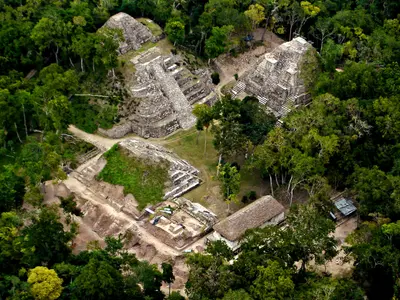
    Yaxhá is a classic Maya city on a hill between Yaxhá and Sacnab lakes in eastern Petén, about 30 km southeast of Tikal. The site is smaller and quieter than Tikal, renowned for its sunset over the forest and lake.Yaxhá, Nakum, and Naranjo form the Yaxhá-Nakum-Naranjo National Park. The younger Postclassic site Topoxté is on a lake island.

    Cafeyaxha·public domain

    Flores

    Flores

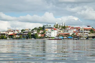
    Flores is the small island town in Lago Petén Itzá and the capital of the Petén Department, connected by a causeway to Santa Elena on the mainland. Colourful houses, cobblestone streets, and lakeside paths make it a popular base for Tikal, which is about an hour away.The island is only a few blocks wide, and in its centre stands the Cathedral Nuestra Señora de los Remedios y San Pablo Itzá. Santa Elena on the mainland is more utilitarian; it's home to the airport, bus station, and many accommodations. You can cross to San Miguel on the opposite peninsula by small boats.

    Edgouno·CC BY-SA 4.0

    Petén

    Petén

    Petén is Guatemala's northernmost and largest department, located between Mexico to the north and west, and Belize to the east. Due to the Maya cities in the rainforest, especially Tikal, this region is the primary destination for many travelers to Guatemala.Its main town is Flores, situated on an island in Lago Petén Itzá. From here, you can reach Tikal, Yaxhá with the neighboring sites Nakum and Naranjo, as well as Uaxactún. The forests are home to jaguars, toucans, howler monkeys, and macaws, among other animals.According to the German Foreign Office, there is a risk of robberies in Flores and Tikal.

    Matthias Stutzman·Pexels

    Bacalar

    Bacalar

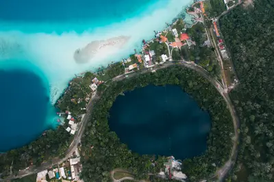
    Bacalar is a small town in southern Quintana Roo, about 40 kilometers north of Chetumal, on the shore of the lagoon of the same name. You come for the Lagoon of Seven Colors, whose water changes from turquoise to deep blue depending on the depth, and for the living stromatolites in its canals. Overlooking the shore is the 18th-century Spanish Fort San Felipe. Since 2006, the town bears the title Pueblo Mágico.

    Mikhail Nilov·Pexels

    Your next steps

    Calakmul is in Mexico. Ways to carry on from here.

    • More in Mexico

      Highlights, areas, routes and the best time to travel for all of Mexico.

      Mexico travel guide
    • Round trips in Mexico

      Ready-made routes through Mexico, with stops, nights and a map.

      See the routes
    • Plan a trip with Calakmul

      The Guide asks about season, length and who is coming, and suggests a trip with Calakmul.

      Plan the trip

    Sources & method

    • Photos: Wikimedia Commons. Each photo carries its credit.
    • Place data such as addresses and ratings comes from Google Maps.
    • The content is based on web research from public, traceable sources. How the content is made · The role of AI