Fernweh: Home
ExploreGuideDestinationsMy tripsMy trip
de|en
All Places & RegionsRound tripsNight trains in EuropeAll highlightsAbout FernwehFAQPrivacy PolicyImprint
Download on the App StoreGet it on Google Play
ExploreGuideDestinationsMy tripsMy trip
    • Neighborhoods & highlights
    • Eat & drink
    • Getting around
    • Accommodation
    • Plan trip
    • Nearby
    Maspalomas and Playa del Inglés

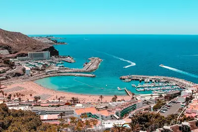
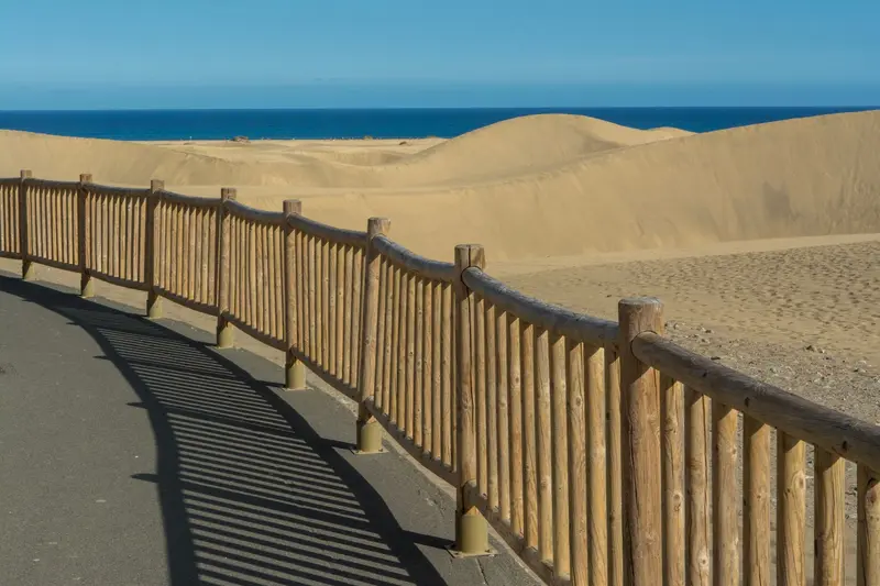
    Photo by Jan van der Wolf on Pexels

    Spain

    Maspalomas and Playa del Inglés

    CityBeachNature

    Maspalomas and the neighbouring Playa del Inglés in the south of Gran Canaria constitute the island's main holiday region.

    by Felix Gillen

    1. Home
    2. Destinations
    3. Spain
    4. Gran Canaria
    5. Maspalomas and Playa del Inglés
    Maspalomas and the neighbouring Playa del Inglés in the south of Gran Canaria constitute the island's main holiday region. Between these resorts and the sea, the Maspalomas dune landscape stretches out, a roughly 400-hectare nature reserve featuring sand made from pulverized corals and shells, a lagoon, and a palm grove.At the western end of the dunes stands the Maspalomas lighthouse, built in 1890. Along the beach, you'll find beach bars, and naturism is practiced in the quieter sections.
    Spain travel guideRound trips in SpainPlan a trip with Maspalomas and Playa del Inglés

    Contents

    • Neighborhoods & highlights
    • Eat & drink
    • Getting around
    • Accommodation
    • Nearby

    Sights in Maspalomas and Playa del Inglés

    Discover the most important sights and attractions

    1Dunes of Maspalomas

    The dune landscape between Playa del Inglés and the sea is protected as a special nature reserve and covers around 400 hectares. The light sand is of marine origin, consisting of ground coral and shells. You get the best overview from the viewpoint at the edge of Playa del Inglés with its information center; within the dunes themselves, the rule is: stay on the marked paths.

    Open in Google Maps
    Park

    2Pond of Maspalomas

    The lagoon between dunes, palm grove, and sea is one of the three ecosystems of the nature reserve. Migratory birds on their way between Europe and Africa rest here, and the Gran Canaria giant lizard lives in the palm grove.
    Open in Google Maps
    Historic Landmark

    3Faro de Maspalomas

    The 56-meter-high lighthouse at the western end of the dunes was built according to the plans of engineer Juan León y Castillo and first lit on February 1, 1890. It remains in operation to this day. Since February 2019, it has been open to visitors again, featuring exhibitions on traditional crafts and daily life on Gran Canaria.
    Open in Google Maps

    Restaurants in Maspalomas and Playa del Inglés

    Traveling in Maspalomas

    Getting HereGlobal Bus Line 66 runs from the airport to the southern resorts, reaching Maspalomas Lighthouse, along with lines 90 and 91. Line 5 also connects Maspalomas with the capital at night.Line 18 travels from Maspalomas via Tejeda to the Cruz de Los Llanos car park at Roque Nublo.In the DunesKeep to the marked paths; the dunes and lagoon are protected.The best view is from the viewpoint at the edge of Playa del Inglés, which also has an information center.

    Accommodations in Maspalomas and Playa del Inglés

    Find perfect stay in Maspalomas and Playa del Inglés

    Booking.com* (Affiliate link)
    Search Hotels
    Agoda* (Affiliate link)
    Search Hotels
    Airbnb
    Vacation Rentals

    * Affiliate link: if you book through it, we earn a small commission. The price stays the same for you.

    Campgrounds in Maspalomas and Playa del Inglés

    Find perfect campground in Maspalomas and Playa del Inglés

    Search via Google Maps
    Campgrounds nearby (15km)
    Camping.info
    Find Campgrounds
    Park4Night
    RV Parks & Camping

    Plan your trip to Maspalomas and Playa del Inglés

    Save places, build a route and plan your city trip, all in one place.

    1. 1
      Sunrise over alpine peaks and a sea of clouds
      1234

      Round trip

      12 days · 4 stops

      Saved

      Pick a route

      Pick a ready-made one or save places and plan your own.

      Open bookmarks
    2. 2

      Trip to Maspalomas and Playa del Inglés

      Live
      • 1Dunes of Maspalomas3 days
      • 2Pond of Maspalomas4 days
      • 3Faro de Maspalomas5 days
      Budget

      Plan your trip

      The planner sorts stops, days and budget. Plan together in real time.

      Start trip planning
    3. 3
      9:41 No signal
      Maspalomas and Playa del Inglés
      Available offline

      Photo by Jan van der Wolf on Pexels

      Use it on the road

      Download the guide to your phone and use it on site, even offline.

    Nearby

    Gran Canaria

    Gran Canaria

    Gran Canaria is often called a miniature continent: In the south are the dunes of Maspalomas and the major resorts; in the mountainous centre, Roque Nublo and the Risco Caído World Heritage Cultural Landscape; in the north, the capital Las Palmas with its old town Vegueta.

    Unsplash

    Las Palmas de Gran Canaria

    Las Palmas de Gran Canaria

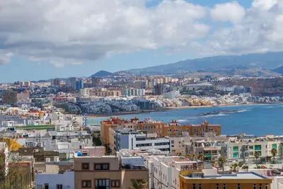
    Las Palmas de Gran Canaria, with approximately 380,000 inhabitants, is the largest city in the Canary Islands and shares the role of capital with Santa Cruz de Tenerife. It was founded in 1478 in what is now the old town district of Vegueta, where narrow streets, museums, Santa Ana Cathedral, and the Casa de Colón recall its beginnings; Columbus is said to have stopped here in 1492 on his first voyage.On the other side of the city lies Playa de Las Canteras, a four-kilometer-long urban beach where an offshore reef breaks the waves. Culture and beach holidays can therefore be easily combined in Las Palmas.

    Canary Vista ES·Pexels

    Canary Islands

    Canary Islands

    The Canary Islands are located about 100 kilometers off the northwest coast of Africa in the Atlantic. The seven main islands and La Graciosa are of volcanic origin and surprisingly diverse: lava fields and dunes in the east, laurel forests and deep gorges in the west, plus Teide, Spain's highest mountain.

    Boris Busorgin·Unsplash

    Santa Cruz de Tenerife

    Santa Cruz de Tenerife

    Santa Cruz de Tenerife is the island's capital and shares the role of Canary Islands capital with Las Palmas de Gran Canaria. The city's origins trace back to a military camp established by the troops of Alonso Fernández de Lugo on May 3, 1494; in 1797, Admiral Nelson's attack on the port here failed, and he lost his right arm in the process.Today, Santa Cruz is a vibrant port city with around 212,000 inhabitants. Its landmark is the Auditorio by Santiago Calatrava, and the city's Carnival is one of the largest in the world.

    Cristobal Garcia·Pexels

    San Cristóbal de La Laguna

    San Cristóbal de La Laguna

    San Cristóbal de La Laguna in northeastern Tenerife is the island's former capital and the Canary Islands' first World Heritage City. Founded by Alonso Fernández de Lugo between 1496 and 1497, its old town has been UNESCO-listed since December 2, 1999: Its unfortified street grid served as a model for many cities in Latin America.The city is located about 7 kilometers from Santa Cruz, with Tenerife North Airport right next door. The university, founded by royal decree in 1792 and opened in 1817, is the oldest in the Canary Islands and still shapes life in the alleys around Plaza del Adelantado.

    Diego Delso·CC BY-SA 4.0

    Your next steps

    Maspalomas and Playa del Inglés is in Spain. Ways to carry on from here.

    • More in Spain

      Highlights, areas, routes and the best time to travel for all of Spain.

      Spain travel guide
    • Round trips in Spain

      Ready-made routes through Spain, with stops, nights and a map.

      See the routes

    Sources & method

    • Photos: Pexels. Each photo carries its credit.
    • Place data such as addresses and ratings comes from Google Maps.
    • The content is based on web research from public, traceable sources. How the content is made · The role of AI