Fernweh: Home
ExploreGuideDestinationsMy tripsMy trip
de|en
All Places & RegionsRound tripsNight trains in EuropeAll highlightsAbout FernwehFAQPrivacy PolicyImprint
Download on the App StoreGet it on Google Play
ExploreGuideDestinationsMy tripsMy trip
    • Places in the region
    • Culture
    • Getting around
    • Round trips
    • Nearby
    Les Saintes

    Jonathan SALAÜN / Wikimedia Commons / CC BY-SA 4.0, mod.

    Guadeloupe

    Les Saintes

    Region

    The Îles des Saintes are a small archipelago south of Basse-Terre, which you can reach by ferry from Trois-Rivières in about 20 minutes.

    by Felix Gillen

    1. Home
    2. Destinations
    3. Guadeloupe
    4. Les Saintes
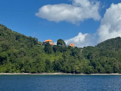
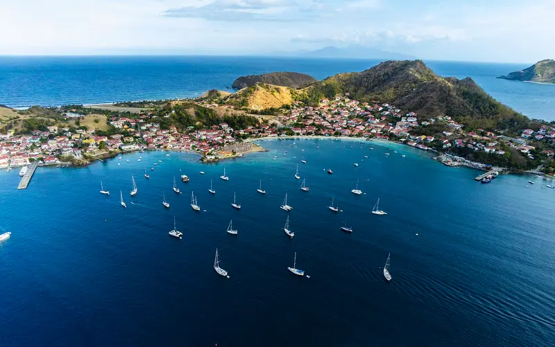
    The Îles des Saintes are a small archipelago south of Basse-Terre, which you can reach by ferry from Trois-Rivières in about 20 minutes. You come for the Bay of Saintes with Fort Napoléon, tranquil swimming coves, and an island almost free of car traffic.Only Terre-de-Haut and Terre-de-Bas are inhabited; Terre-de-Haut is 5.2 km² in size and has around 1,500 inhabitants. Due to low rainfall, people here primarily lived from fishing. The island has an observation mountain called Chameau, and Baie de Pompierre is a sheltered swimming cove.
    Guadeloupe travel guideSee the round tripPlan a trip with Les Saintes

    Contents

    • Places in the region
    • Culture
    • Getting around
    • Round trips
    • Nearby

    Sights in Les Saintes

    Discover the most important sights and attractions

    Fort Napoleon

    Filo gèn' / Wikimedia Commons / CC BY-SA 4.0, mod.

    Attraction

    Fort Napoleon

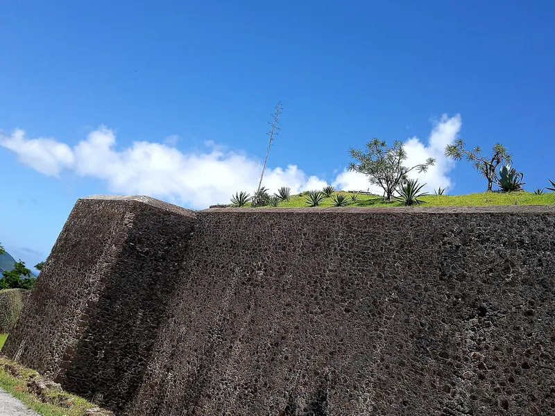
    The fort on Morne Mire above Saintes Bay was built between 1844 and 1867 and never saw combat. Today, it is a Monument historique, and a museum showcases the islands' history; cacti grow in its garden, and many iguanas live there. From the top, you gaze over the Baie des Saintes.
    Open in Google Maps
    Attraction

    Beach of Pompierre

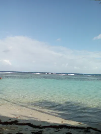
    The sheltered bay in the north of Terre-de-Haut has calm water for swimming and snorkeling, golden sand, and coconut palms; in the shade you often see iguanas. From the village, it's about a 20-minute walk. The beach is not supervised, and Sargassum seaweed occasionally washes ashore.
    Open in Google Maps
    Attraction

    Beach of the Sugarloaf

    Small, secluded bay with white sand and very clear water at the foot of the Pain de Sucre rock. Its seabed is excellent for snorkeling; you can reach it on foot via a path or by boat.
    Open in Google Maps
    Natural Feature

    Le Chameau

    Terre-de-Haut's southwestern forested peak, at just over 300 meters, is the archipelago's highest point. At the summit stands the Tour Modèle observation tower, offering island views. The area belongs to the Conservatoire du littoral.
    Open in Google Maps

    Fisher and Tourment d'amour

    Fisher IslandsThe ancestors of many inhabitants came from Brittany, Normandy, and Poitou and lived from fishing; only a few enslaved people were brought to the islands. The Battle of the Saintes took place off the islands in April 1782.SweetsTypical is the Tourment d'amour, a small tart with coconut filling, sold in several varieties.

    Traveling in Terre-de-Haut

    ArrivalThe ferry from Trois-Rivières on the south coast of Basse-Terre takes about 20 minutes to Terre-de-Haut. Check the schedule the day before.On SiteFew cars operate on the island; scooters, e-bikes, and golf carts are common. Explore the town center on foot; Baie de Pompierre is about a 20-minute walk from the village.

    Round trips through this region

    Guadeloupe in ten days: Beaches, Islands and Rainforest

    Guadeloupe in ten days: Beaches, Islands and Rainforest

    This tour connects the beaches of Grande-Terre with the two neighboring islands Marie-Galante and Les Saintes, ending on the green west coast of Basse-Terre. It's perfect for a first trip, allowing time for swimming, hiking, and island life.

    11 Days
    4 stops

    Filo gèn'·CC BY-SA 4.0

    Nearby

    Basse-Terre and National Park

    Basse-Terre and National Park

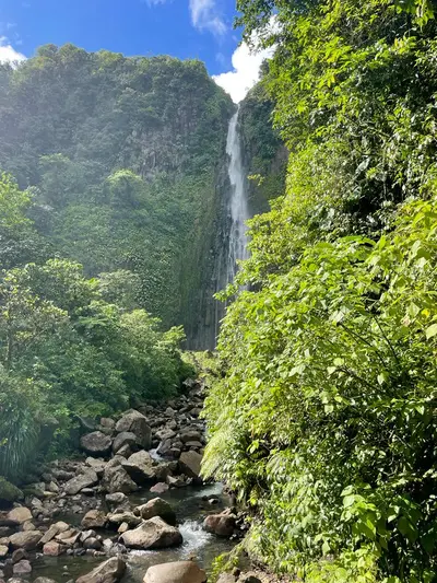
    Basse-Terre is Guadeloupe's volcanic, mountainous western half, whose interior is largely taken up by the National Park, founded in 1989. You come for the rainforest, waterfalls like the Chutes du Carbet, and the hike up the 1,467 m high Grande Soufrière, the island's active volcano.In the Soufrière Massif, 2,500 to over 6,000 mm of rain falls annually, depending on the location, which is why there are so many rivers and waterfalls here. On the calmer west coast lie Deshaies with Grande Anse beach and Bouillante, off whose coast the Réserve Cousteau invites you to snorkel. The Route de la Traversée connects the east and west coasts right through the forest, while the island capital, Basse-Terre, is located in the south at the foot of the volcano.
    Enrevseluj·CC BY-SA 4.0

    Marie-Galante

    Marie-Galante

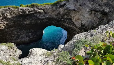
    Marie-Galante is a flat, round island southeast of Grande-Terre, reachable by ferry from Pointe-à-Pitre in 1 to 1.5 hours. You come for the white beaches, the rum distilleries, and the tranquil landscape of sugarcane fields and old windmills.The island is 158 km² and has around 10,700 inhabitants in three communes: Grand-Bourg, Capesterre-de-Marie-Galante, and Saint-Louis. Because of its many mills, it is called the "Island of a Hundred Windmills". Along the coast, sandy beaches like Plage de la Feuillère alternate with limestone cliffs in the north, where the sea has carved out the rock arch Gueule Grand Gouffre.

    Lornadream Croisière catamaran·Unsplash

    Portsmouth and Cabrits

    Portsmouth and Cabrits

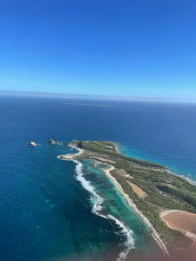
    Portsmouth in northwest Dominica is the starting point for a rowboat trip on the Indian River through mangroves and for Cabrits National Park on the peninsula north of the town, where the British built Fort Shirley between 1770 and 1815.The Waitukubuli National Trail ends at Cabrits; the Morne Diablotin National Park with the Syndicate Nature Trail lies inland.

    CareAhLine·CC0

    Grande-Terre: Pointe-à-Pitre to Saint-François

    Grande-Terre: Pointe-à-Pitre to Saint-François

    Grande-Terre is the flat, eastern half of Guadeloupe, featuring Pointe-à-Pitre, its economic center, and the seaside resorts along the south coast. You come for the lagoon beaches behind coral reefs, the Mémorial ACTe, and the rocky coastline at Pointe des Châteaux.Along the south coast, Le Gosier, Sainte-Anne, and Saint-François line up with tranquil lagoons. All the way in the east, the island ends at Pointe des Châteaux, which has been protected as a natural monument since 1997. On the Atlantic and north coasts, the landscape becomes rougher, with limestone cliffs like at Porte d'Enfer near Anse-Bertrand.

    Enrevseluj·CC BY-SA 4.0

    Le Gosier

    Le Gosier

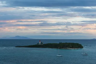
    Le Gosier, bordering Pointe-à-Pitre to the east, is Guadeloupe's largest seaside resort town. You come for the short distances from the airport, the city beach Plage de la Datcha with views of the Îlet du Gosier, and Marina Bas-du-Fort.On a hillside above the coast, the Fort Fleur d'Épée from 1759 recalls the battles with the English. The Îlet, with its lighthouse, lies just a few hundred meters off the beach and is accessible by boat or kayak.

    Alexey Komarov·CC BY-SA 4.0

    Your next steps

    Les Saintes is in Guadeloupe. Ways to carry on from here.

    • More in Guadeloupe

      Highlights, areas, routes and the best time to travel for all of Guadeloupe.

      Guadeloupe travel guide
    • Round trips with Les Saintes

      One route passes through Les Saintes, with stops, nights and a map.

      See the round trip
    • Plan a trip with Les Saintes

      The Guide asks about season, length and who is coming, and suggests a trip with Les Saintes.

      Plan the trip

    Sources & method

    • Photos: Wikimedia Commons. Each photo carries its credit.
    • Place data such as addresses and ratings comes from Google Maps.
    • The content is based on web research from public, traceable sources. How the content is made · The role of AI