Fernweh: Home
ExploreGuideDestinationsMy tripsMy trip
de|en
All Places & RegionsRound tripsNight trains in EuropeAll highlightsAbout FernwehFAQPrivacy PolicyImprint
Download on the App StoreGet it on Google Play
ExploreGuideDestinationsMy tripsMy trip
    • Places & highlights
    • Eat & drink
    • Getting around
    • Accommodation
    • Nearby
    Pulau Kapas

    Wiki Farazi / Wikimedia Commons / CC0

    Malaysia

    Pulau Kapas

    IslandBeach

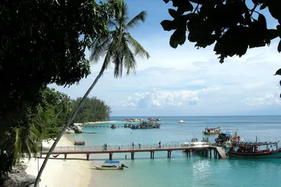
    Pulau Kapas lies six kilometers off Marang on Terengganu's coast, a 15-minute speedboat ride away. The island has no roads, just a manageable number of mostly simple accommodations, from chalets to dormitories.

    by Felix Gillen

    1. Home
    2. Destinations
    3. Malaysia
    4. East Coast
    5. Pulau Kapas
    Pulau Kapas lies six kilometers off Marang on Terengganu's coast, a 15-minute speedboat ride away. The island has no roads, just a manageable number of mostly simple accommodations, from chalets to dormitories. Kapas is quieter than Perhentian and Redang, ideal for snorkeling, kayaking, and relaxing. Off the island are rocks, coral fields, and some wrecks visited by dive centers.As on the entire east coast, the season is approximately from March to October. During the Northeast Monsoon, from approximately November to March, little snorkeling or diving takes place, and boat traffic is restricted.
    Malaysia travel guideRound trips in MalaysiaPlan a trip with Pulau Kapas

    Contents

    • Places & highlights
    • Eat & drink
    • Getting around
    • Accommodation
    • Nearby

    Sights in Pulau Kapas

    Discover the most important sights and attractions

    Natural Feature

    1Pulau Gemia

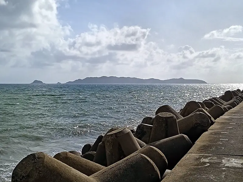
    The tiny neighboring island, a mere seven hectares, lies directly north of Kapas. From Kapas' north end, you can see it in the sea.
    Open in Google Maps
    Beach

    2Beaches of Pulau Kapas

    The white sand beaches gave the island its name; Kapas means cotton. In the clear waters there, you can snorkel over corals or kayak along the coast. The waters up to one nautical mile offshore are protected.
    Open in Google Maps

    Restaurants in Pulau Kapas

    Access

    Boats depart from the jetty in Marang several times daily, reaching Kapas in about 15 minutes. Departures depend on weather and season, and many accommodations organize the transfer. On the island, you can walk or kayak to the next bay.

    Accommodations in Pulau Kapas

    Find perfect stay in Pulau Kapas

    Booking.com* (Affiliate link)
    Search Hotels
    Agoda* (Affiliate link)
    Search Hotels
    Airbnb
    Vacation Rentals

    * Affiliate link: if you book through it, we earn a small commission. The price stays the same for you.

    Nearby

    Marang

    Marang

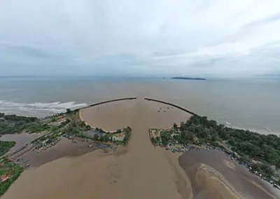
    Marang is a small fishing village at the mouth of the Marang River, just 20 kilometres south of Kuala Terengganu. Fishing boats of all sizes anchor in the middle of the river, and in the mornings, fish and Keropok Lekor are sold at the market.Most travellers come for the boats to Pulau Kapas, which depart from Marang jetty. Those who stay for a day will find simple eateries and plenty of peace and quiet here.

    mohd hasan·Pexels

    East Coast

    East Coast

    The East Coast of the Malaysian Peninsula is more rural and conservative than the West Coast. Off the coast lie islands with clear waters and coral reefs: the Perhentian Islands, Pulau Redang, Pulau Tioman, and the smaller Pulau Kapas. On land, you'll find fishing villages, long beaches, and the cities of Kota Bharu and Kuala Terengganu with their markets and craft traditions.The weather dictates travel planning: From approximately November to February or March, the Northeast Monsoon brings heavy rain and high waves. The islands are not officially closed, but many resorts shut down, boats run infrequently, and not at all in rough seas.

    Vyacheslav Argenberg·CC BY 4.0

    Kuala Terengganu

    Kuala Terengganu

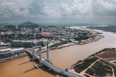
    Kuala Terengganu, the capital of the state of Terengganu, is located at the mouth of the river of the same name into the South China Sea. The city has a conservative-Muslim character and is noticeably quieter than the metropolises of the West Coast. At Pasar Payang you buy batik and songket, in Kampung Cina you sit in old coffee houses.On a river island, the glass Masjid Kristal reflects in the water. Many travelers pass through the city on their way to Pulau Redang.

    Pok Rie·Pexels

    Tasik Kenyir

    Tasik Kenyir

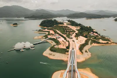
    The Tasik Kenyir in the Terengganu hinterland was formed in 1985 when the Kenyir River was dammed for a hydroelectric power plant. It is considered the largest man-made lake on mainland Southeast Asia, covering approximately 260 square kilometers. Around 340 forested islands, formerly hilltops, rise from the water. Since 2023, the area has been recognized as the Kenyir National Geopark.By boat, you can reach waterfalls, limestone caves, and secluded bays. Around the lake live hornbills, monkeys, and many fish species, including the Kelah (Malaysian Mahseer). Fishing is only permitted in designated zones.

    Pok Rie·Pexels

    Setiu Wetlands

    Setiu Wetlands

    The Setiu Wetlands in northern Terengganu are among the largest natural wetlands on the East Coast: a landscape of approximately 23,000 hectares, comprising mangroves, river channels, islands, and sandbanks between the coastal road and the sea. Fishing villages and fish farms characterize the area, which is hardly developed for tourism.By boat, you travel through the mangrove channels, observe birds, and see how the villagers live from the water. The critically endangered Callagur Terrapin (Painted Terrapin) lives in the area.

    Farishhamka·CC0

    Your next steps

    Pulau Kapas is in Malaysia. Ways to carry on from here.

    • More in Malaysia

      Highlights, areas, routes and the best time to travel for all of Malaysia.

      Malaysia travel guide
    • Round trips in Malaysia

      Ready-made routes through Malaysia, with stops, nights and a map.

      See the routes
    • Plan a trip with Pulau Kapas

      The Guide asks about season, length and who is coming, and suggests a trip with Pulau Kapas.

      Plan the trip
    Sources & method

    • Photos: Wikimedia Commons. Each photo carries its credit.
    • Place data such as addresses and ratings comes from Google Maps.
    • The content is based on web research from public, traceable sources. How the content is made · The role of AI