Fernweh: Home
    ExploreTravel GuidesPlan a tripMy tripLast visited
    de|en
    All Places & RegionsAll highlightsAbout FernwehFAQPrivacy PolicyImprint
    ExploreTravel GuidesPlan a tripMy tripLast visited
    • Neighborhoods & highlights
    • Recommendations
    • Eat & drink
    • Food culture
    • Culture
    • Nightlife
    • Getting around
    • Accommodation
    • Plan trip
    • Nearby
    Puerto Viejo de Talamanca

    Costa Rica

    Puerto Viejo de Talamanca

    City

    Puerto Viejo de Talamanca is a surf and beach town on Costa Rica's southern Caribbean coast, close to the Panama border and about four to four and a half hours' drive from San José.

    by Felix Gillen

    1. Home
    2. Destinations
    3. Costa Rica
    4. The Caribbean
    5. Puerto Viejo de Talamanca
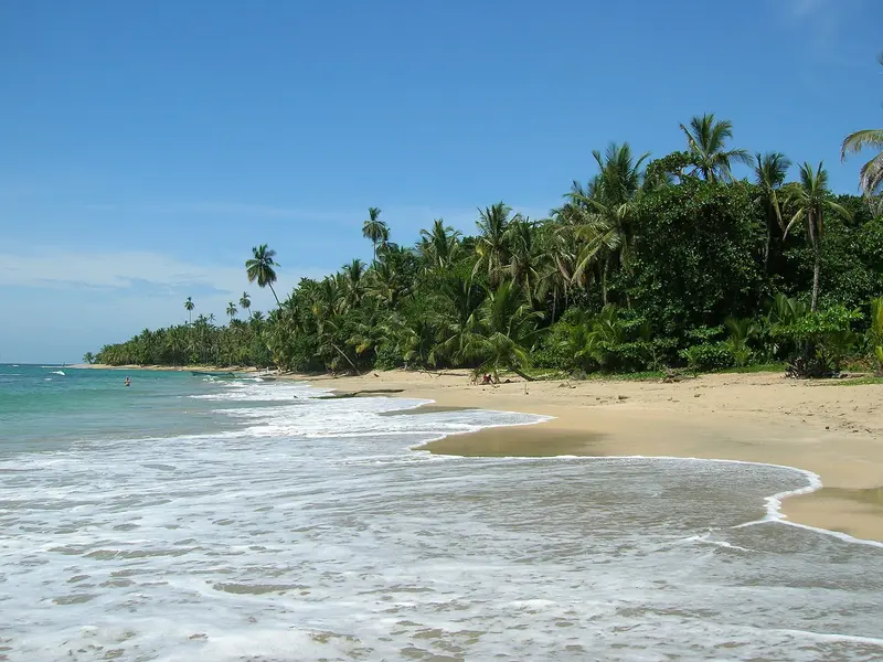
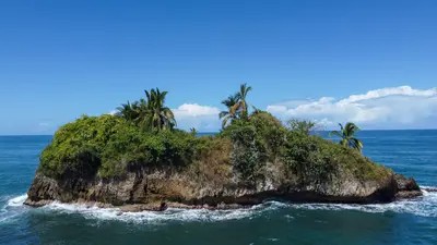
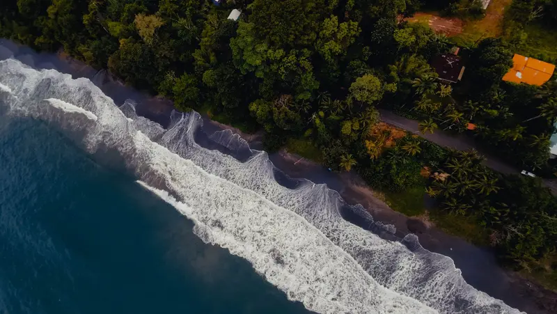
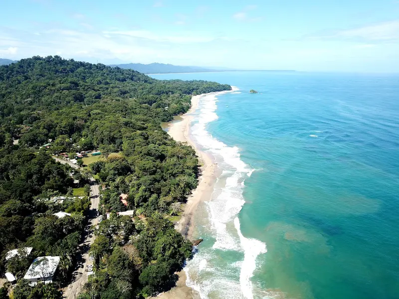
    Puerto Viejo de Talamanca is a surf and beach town on Costa Rica's southern Caribbean coast, close to the Panama border and about four to four and a half hours' drive from San José. You come here for the beaches between Cocles and Manzanillo, for rainforest right on the coast, and for the Afro-Caribbean influenced cuisine.The town belongs to the Talamanca canton in Limón Province. Locals usually just say "Puerto Viejo"; do not confuse it with Puerto Viejo de Sarapiquí in the north of the country. In front of the town center, the Salsa Brava wave breaks over a reef, considered one of the most powerful in the country and reserved for experienced surfers.To the southeast, Playa Cocles, Playa Chiquita, and Punta Uva line up, and at the end of the road lies the fishing village of Manzanillo on the edge of the Gandoca-Manzanillo Wildlife Refuge. The small town beach, Playa Puerto Viejo, with its natural rock pools, is suitable for families; some other beaches have strong currents. To the north lies Cahuita National Park.Beyond the beach, cocoa tours, a visit to the Jaguar Rescue Center, and excursions to Bribri communities in the hinterland are available. Many travelers stay for several days, and the range of accommodations, cafés, and bars is correspondingly wide.

    Sights in Puerto Viejo de Talamanca

    Discover the most important sights and attractions

    Playa Cocles
    Beach

    1Playa Cocles

    The beach starts a few kilometers southeast of the town and is the best-known surf beach in the area. Many surf schools give lessons here; the surf season with the best waves runs from December to March. Strong currents can occur in some sections.
    Open in Google Maps
    Punta Uva

    2Punta Uva

    The point with a light sandy beach lies between Puerto Viejo and Manzanillo. From Punta Uva, you can kayak up a tranquil river into the rainforest.
    Open in Google Maps
    Jaguar Rescue Center

    3Jaguar Rescue Center

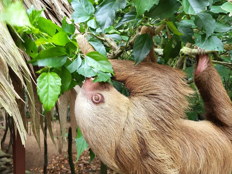
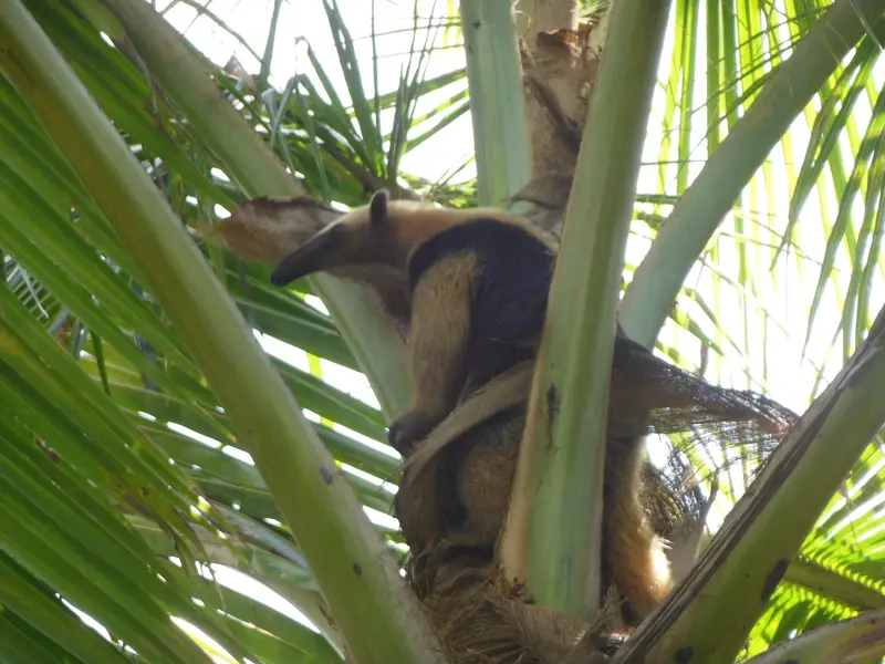
    The rescue center for injured, sick, and orphaned wild animals was founded by Sandro Alviani and Encar García and officially opened in 2008. It was named after its first animal, an ocelot, which its rescuer mistook for a jaguar. Visits are only possible with a guided tour; the approximately 90-minute tours take place mornings and are booked online. Touching and feeding the animals is not permitted.
    Open in Google Maps
    Gandoca-Manzanillo Wildlife and Nature Sanctuary
    National Park

    4Gandoca-Manzanillo Wildlife and Nature Sanctuary

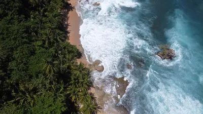
    The reserve starts at Manzanillo fishing village, at the end of the coastal road southeast of Puerto Viejo, stretching towards Panama. Guided hikes lead through coastal rainforest to coves and viewpoints. In 2014, the refuge's boundaries were changed, and settled coastal areas have since been excluded.
    Open in Google Maps

    Restaurants in Puerto Viejo de Talamanca

    1

    Bread & Chocolate

    Cafe and bakery on Calle 215 in the town center, known for breakfast and lunch: banana-coconut pancakes, waffles, a jerk chicken sandwich, and daily soups. For desserts, chocolate is made in-house from cocoa beans.
    Show on Google Maps
    2

    Marisquería Moprí

    A fish restaurant in town where many locals eat. The menu features whole fried fish, seafood with coconut rice, Caribbean lobster in season, as well as chicken, beef, and a traditional breakfast.
    Show on Google Maps
    3

    La NENA

    Playa Cocles eatery, traditional Caribbean fare. Rice and Beans in coconut milk with chicken and plantains is recommended; also Burritos and Fajitas.
    Show on Google Maps

    Food & Beverages

    The South Caribbean's cuisine is distinct from the rest of the country: coconut milk, thyme, and hot peppers feature in many dishes.

    Rice and Beans

    Rice and red beans, cooked in coconut milk with thyme and hot pepper, traditionally the Sunday meal, with chicken, fried plantains, and coleslaw.

    Rondón

    Vegetable and seafood stew in coconut milk, a classic of Afro-Caribbean cuisine from Limón Province.

    Patí

    Spiced pastry pocket with beef filling, sold as a snack in bakeries and at stalls.

    Agua de sapo

    Refreshing ginger and cane sugar drink.

    Culture of the Southern Caribbean

    Afro-Caribbean HeritageMany residents are descendants of Jamaican workers who came in the late 19th century for railway construction and banana plantations. They brought with them an English Creole, called Mekatelyu here, Calypso and Reggae, as well as a cuisine featuring coconut milk and chili. It wasn't until the 1949 constitution that Afro-Costa Ricans gained full civil rights, and a road connecting this coastal section to San José has only existed since 1987.Bribri and NewcomersBribri people live on the outskirts of the town and in the Talamanca mountains; guided visits, for example to waterfalls, offer insight into their communities. Additionally, Costa Ricans from other parts of the country and many newcomers from Europe operate cafés, surf schools, and accommodations.

    Nightlife

    1

    KOKi Beach

    Beachfront bar and restaurant on the main street in the town center. Daily Happy Hour, tropical cocktails & dishes like grilled octopus and shrimp ceviche; evenings often become lively and last longer.
    Show on Google Maps

    On the Road in Puerto Viejo

    Getting ThereFrom San José, the road leads through Braulio Carrillo National Park via Limón to the Southern Caribbean; by car, you'll need around four to four and a half hours. The MEPE public bus stops in Limón and takes approximately four and a half to six hours; shuttles are also available.Getting AroundThe center is small and can be explored on foot. For the beaches towards Cocles, Punta Uva, and Manzanillo, it's best to go by bicycle or e-bike, which are available for rent everywhere; a 50 km/h speed limit applies on the coastal road. For day trips to Cahuita or Manzanillo, a rental car is practical.
    Accommodations in Puerto Viejo de Talamanca

    Find perfect stay in Puerto Viejo de Talamanca

    Booking.com* (Affiliate link)
    Search Hotels
    Agoda* (Affiliate link)
    Search Hotels
    Airbnb
    Vacation Rentals

    * Affiliate link: if you book through it, we earn a small commission. The price stays the same for you.

    Plan your trip to Puerto Viejo de Talamanca

    Save places, build a route and plan your city trip, all in one place.

    1. 1
      Sunrise over alpine peaks and a sea of clouds
      1234

      Round trip

      12 days · 4 stops

      Saved

      Pick a route

      Pick a ready-made one or save places and plan your own.

      Open bookmarks
    2. 2

      Trip to Puerto Viejo de Talamanca

      Live
      • 1Playa Cocles3 days
      • 2Punta Uva4 days
      • 3Jaguar Rescue Center5 days
      Budget

      Plan your trip

      The planner sorts stops, days and budget. Plan together in real time.

      Start trip planning
    3. 3
      9:41 No signal
      Puerto Viejo de Talamanca
      Available offline

      Use it on the road

      Download the guide to your phone and use it on site, even offline.

    Nearby

    Cahuita

    Cahuita

    Cahuita is a small village on the southern Caribbean coast, approximately 40 minutes south of Limón and 20 minutes north of Puerto Viejo de Talamanca. You come here for Cahuita National Park, which starts right at the edge of the village, featuring rainforest, beaches, and an offshore coral reef.The village is quieter than nearby Puerto Viejo: a small grid of streets where many locals get around by bicycle. The Afro-Caribbean influence is clearly noticeable in the cuisine and music. Cahuita was home to calypso singer Walter Ferguson, whose 100th birthday in 2019 was declared a national Calypso Day.Around the village are three beaches. Playa Blanca, with its light sand, borders the park entrance and is best for swimming. Playa Negra, with dark sand, is just north of the village and less visited; further north still is the more secluded Playa Grande.The National Park has two entrances: Kelly Creek at the eastern end of the village, where entry is by donation, and Puerto Vargas further south on the main road, where foreigners pay a fee. A coastal path connects both entrances. It is open daily from 8 AM to 4 PM. You may only visit the reef as part of a guided snorkeling tour.
    The Caribbean

    The Caribbean

    The Caribbean coast encompasses the Limón province in eastern Costa Rica, from the Tortuguero canals in the north to the border with Panama in the south. This is where you go for rainforest that stretches right to the beach, for nesting sea turtles, and for an Afro-Caribbean culture that distinctly differs from the rest of the country.The city of Limón is located approximately 170 kilometers from San José; the road leads through the Zurquí Tunnel and Braulio Carrillo National Park. The north, around Tortuguero, is only accessible by boat or plane; you reach the Southern Caribbean, with Cahuita and Puerto Viejo, via the coastal road south of Limón.Many residents are descendants of Jamaican workers who arrived in the late 19th century for railway and banana plantations. Additionally, there are Chinese immigrants, and in the south, the indigenous Bribri and Cabécar people. Calypso, Reggae, and a cuisine featuring coconut milk define the region.
    Uvita

    Uvita

    Uvita is a small town on Costa Rica's southern Pacific coast and the main gateway to the Marino Ballena National Marine Park. You come here for the whale tail beach of Punta Uvita and for whale watching boat tours; from San José, you'll reach it via the Costanera Sur in about three and a half to four hours.The town itself is situated along the coastal road and stretches from the main road into the hilly hinterland. Supermarkets, cafés, restaurants, and tour operators are close to each other, so those staying centrally can reach many places on foot. The beach and national park are just a few minutes away.The sea off Uvita is part of the Marino Ballena National Park. Humpback whales migrate past the coast from approximately July to October and from December to April; you can book tours with local providers. The Punta Uvita Tombolo can only be accessed at low tide, as the tides dictate daily life here.Uvita also serves as a great base for excursions along the Costa Ballena, for example, to beaches like Playa Ventanas or to the Nauyaca Waterfalls, which are about an hour's drive away.
    Irazú Volcano National Park

    Irazú Volcano National Park

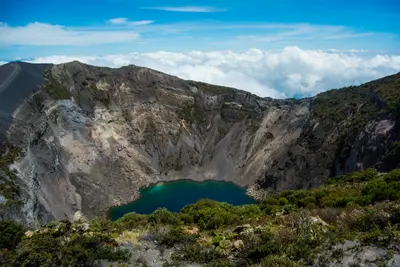
    Irazú Volcano National Park is located in the Cordillera Central above Cartago, in the east of the Central Valley. You come here to walk right up to the rim of several craters, which are among Costa Rica's most easily accessible volcanic landscapes.Irazú stands at 3,432 meters. The National Park was founded on August 9, 1955. An eruption, which began in March 1963 and lasted about two years, covered San José and large parts of the highlands with ash.At the summit are several craters, including the Main Crater, the Diego de la Haya Crater, and the small, ash-covered Playa Hermosa Crater. During the rainy season, water collects in the Main Crater and Diego de la Haya, forming colorful lagoons. On very clear days, both the Caribbean and the Pacific can be seen from the summit; such days are rare, as clouds usually hang over the peak from late morning.The park also includes the Prusia sector, a former forest reserve where reforestation has taken place and hiking trails lead through the mountain forest. Tickets are available exclusively online via the SINAC reservation system, with a fixed entry time slot. Before your visit, check there for current opening hours and whether all sectors are accessible.At over 3,000 meters, it is cold and windy, even in the tropics. Bring warm clothing and rain gear, and come early to see the craters before the clouds roll in.
    Tortuguero

    Tortuguero

    Tortuguero is a national park and a small village on Costa Rica's northern Caribbean coast, accessible only by boat or small plane. You come here for boat tours through a network of rainforest canals and lagoons, and for the sea turtles that lay their eggs on the beaches.The national park was founded in 1975 and covers approximately 312 square kilometers. On its beaches, Green Sea Turtles, Leatherback Sea Turtles, Hawksbill Sea Turtles, and Loggerhead Sea Turtles nest. The Green Sea Turtle is the most common and arrives from July to October, peaking in September and October; Leatherback Turtles nest less frequently and from March to May.The village, with around 1,200 inhabitants, is located on a narrow strip of land between the Caribbean and the canal. A car-free path connects the boat dock with the ranger station at the south end of the village. At the north end, the Sea Turtle Conservancy, which began its research in Tortuguero in 1959, operates a small visitor center with a museum.The park is best experienced via its waterways. Guided canoe or boat tours show you monkeys, sloths, birds, and caimans, which you often miss on your own; you can also rent kayaks yourself. On land, there are only a few, often muddy paths. Admission for foreign visitors costs 15 US dollars and is purchased online from SINAC; the ticket is valid for land and water trails.Turtle observation on the beach is only permitted at night with a certified guide. Cameras and white light are prohibited, and dark clothing is expected. Not far from the village rises the 119-meter-high Cerro Tortuguero, an old volcanic cone with panoramic views over canals and coastline.

    Sources & method

    • Photos: Wikimedia Commons, Pexels, Google Maps. Each photo carries its credit.
    • Place data such as addresses and ratings comes from Google Maps.
    • The content is based on web research from public, traceable sources. How the content is made · The role of AI