Fernweh: Home
    ExploreTravel GuidesPlan a tripMy tripLast visited
    de|en
    All Places & RegionsAll highlightsAbout FernwehFAQPrivacy PolicyImprint
    ExploreTravel GuidesPlan a tripMy tripLast visited
    • Neighborhoods & highlights
    • Recommendations
    • Eat & drink
    • Culture
    • Getting around
    • Accommodation
    • Plan trip
    • Nearby
    Uvita
    Melissa Guadalupe Huertas / Wikimedia Commons / CC BY-SA 4.0

    Costa Rica

    Uvita

    City

    Uvita is a small town on Costa Rica's southern Pacific coast and the main gateway to the Marino Ballena National Marine Park.

    by Felix Gillen

    1. Home
    2. Destinations
    3. Costa Rica
    4. South Pacific & Osa
    5. Uvita
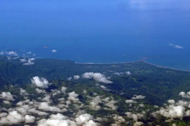
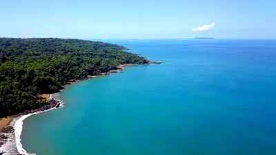
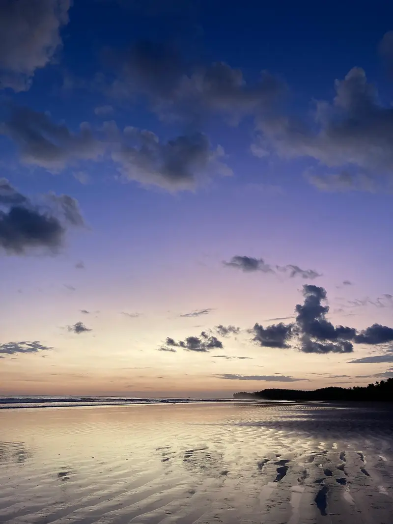
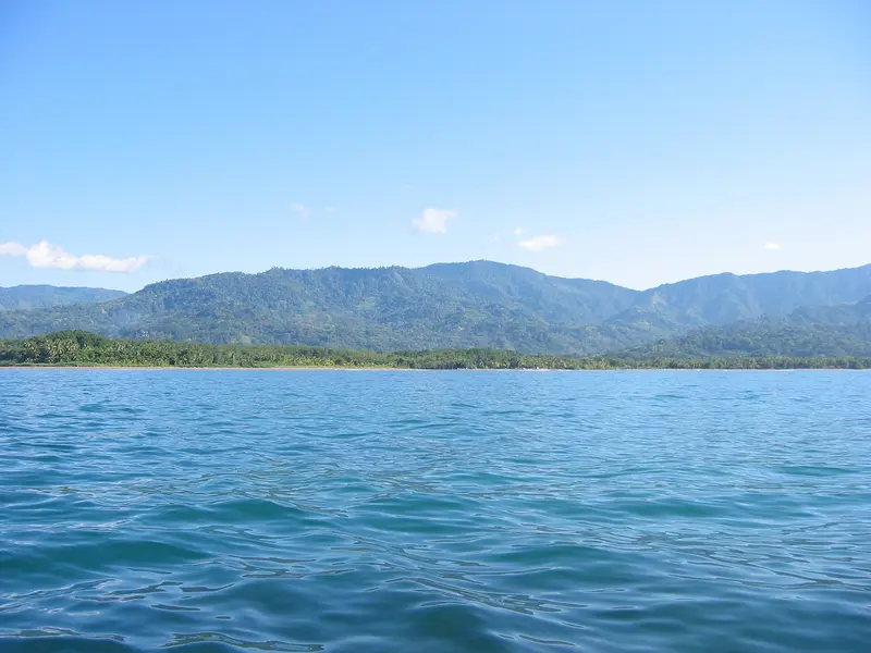
    Uvita is a small town on Costa Rica's southern Pacific coast and the main gateway to the Marino Ballena National Marine Park. You come here for the whale tail beach of Punta Uvita and for whale watching boat tours; from San José, you'll reach it via the Costanera Sur in about three and a half to four hours.The town itself is situated along the coastal road and stretches from the main road into the hilly hinterland. Supermarkets, cafés, restaurants, and tour operators are close to each other, so those staying centrally can reach many places on foot. The beach and national park are just a few minutes away.The sea off Uvita is part of the Marino Ballena National Park. Humpback whales migrate past the coast from approximately July to October and from December to April; you can book tours with local providers. The Punta Uvita Tombolo can only be accessed at low tide, as the tides dictate daily life here.Uvita also serves as a great base for excursions along the Costa Ballena, for example, to beaches like Playa Ventanas or to the Nauyaca Waterfalls, which are about an hour's drive away.

    Sights in Uvita

    Discover the most important sights and attractions

    Parque Nacional Marino Ballena
    Attraction

    1Parque Nacional Marino Ballena

    The Marine National Park, established in 1990, protects marine areas off Uvita's coast, divided into Uvita, Colonia, Ballena, and Piñuela sectors. A day ticket is valid for all four sectors, open daily from 7 AM to 6 PM. Humpback whales pass the coast roughly from July to October and December to April; boat tours leave from Uvita.
    Open in Google Maps
    Punta Uvita
    Park

    2Punta Uvita

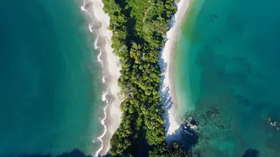
    The sand spit at Playa Uvita is the most famous feature of Marino Ballena National Park: A sandbank, a so-called tombolo, connects the beach with an offshore rock at low tide, forming the shape of a whale's tail fin from the air. It is only accessible at low tide, so check the tide calendar beforehand. Access is in the Uvita sector, and the park ticket is valid.
    Open in Google Maps
    Catarata Uvita
    Attraction

    3Catarata Uvita

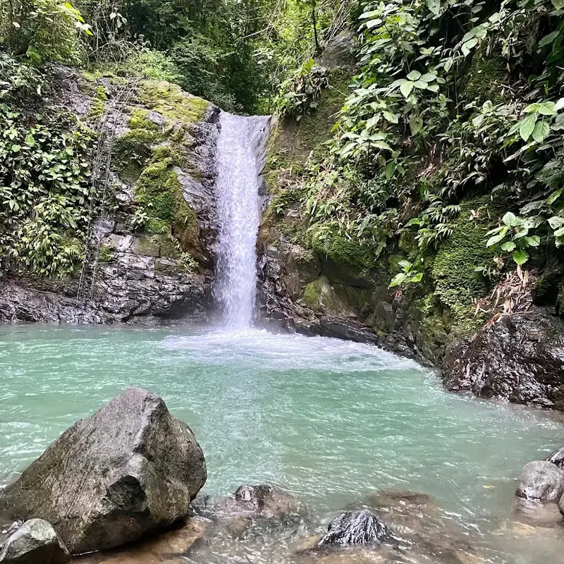
    A small waterfall above the town center, signposted from the main road. The water falls into several natural pools; you can slide into a pool via a smooth rock chute. Entry is minimal, parking is free, and it's open during the day.
    Open in Google Maps
    Playa Ventanas
    Attraction

    4Playa Ventanas

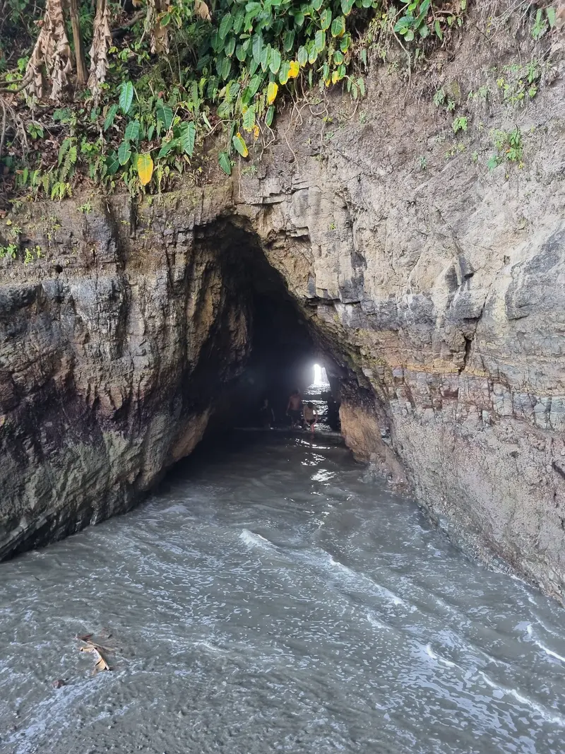
    A small cove with dark sand between Uvita and Ojochal, lined by palm trees and rocks. At the north end are two sea caves; you can walk into the larger one at low tide, but access is cut off with rising tide. The beach is outside the national park, and you pay a small daily fee for the guarded parking.
    Open in Google Maps

    Restaurants in Uvita

    1

    Kinsu Restaurante

    A casual restaurant in town, known for Casado and shrimp tacos. Portions are generous, prices are reasonable.
    Show on Google Maps
    2

    Indómitos Café & Bar

    Café and bar in town with vegetarian and vegan dishes, plus burgers. A good address if you want to eat meat-free.
    Show on Google Maps

    Living on the Costa Ballena

    A Place of ChangeUvita has grown significantly in recent years. Small sodas still serve Casado and fish, but now cafes with vegetarian and vegan options primarily attract travelers and new residents. Daily life follows the weather and tides, with many tours starting early.National Park and Marine ConservationMarino Ballena National Park, established in 1990, primarily covers marine areas. Whale watching is a key industry here. Follow park rules, take your trash, and bring your own drinks and snacks to the beach, as Playa Uvita has no beach bars.

    Arrival and getting around in Uvita

    Getting ThereDriving from San José, take Route 34 (Costanera Sur) via Jacó and Dominical; an AWD vehicle isn't needed. Tracopa buses run hourly from San José, with a journey time of four to five hours; tickets are cash only. Shared minibuses are slightly more expensive and can also pick you up at the airport.Getting AroundExplore the town center on foot. A rental car offers the most flexibility for the beaches along Costa Ballena and for excursions into the hinterland. For the final section to the Nauyaca Waterfalls, an AWD vehicle is recommended due to the gravel road.
    Accommodations in Uvita

    Find perfect stay in Uvita

    Booking.com* (Affiliate link)
    Search Hotels
    Agoda* (Affiliate link)
    Search Hotels
    Airbnb
    Vacation Rentals

    * Affiliate link: if you book through it, we earn a small commission. The price stays the same for you.

    Plan your trip to Uvita

    Save places, build a route and plan your city trip, all in one place.

    1. 1
      Sunrise over alpine peaks and a sea of clouds
      1234

      Round trip

      12 days · 4 stops

      Saved

      Pick a route

      Pick a ready-made one or save places and plan your own.

      Open bookmarks
    2. 2

      Trip to Uvita

      Live
      • 1Parque Nacional Marino Ballena3 days
      • 2Punta Uvita4 days
      • 3Catarata Uvita5 days
      Budget

      Plan your trip

      The planner sorts stops, days and budget. Plan together in real time.

      Start trip planning
    3. 3
      9:41 No signal
      Uvita
      Available offline

      Use it on the road

      Download the guide to your phone and use it on site, even offline.

    Nearby

    South Pacific & Osa

    South Pacific & Osa

    The South Pacific is Costa Rica's most remote coastal section: Between Uvita and the Osa Peninsula, the rainforest extends right to the beaches, and Corcovado National Park is home to one of the country's most biodiverse protected areas. You come here for wildlife viewing in the primary forest, whale watching off the coast, and an infrastructure that has deliberately remained simple.The region is divided into two parts. To the north lies the Uvita coast with the Marino Ballena National Marine Park, reachable from San José in about four hours via the Costanera Sur coastal road (Route 34). To the south follows the Osa Peninsula, with Drake Bay on the west side and Puerto Jiménez on Golfo Dulce, both starting points for tours into Corcovado.Plan more time than seems necessary on the map. Drake Bay is usually reached by boat from Sierpe or by small plane; the road there requires a four-wheel drive, and you may only enter Corcovado with a certified guide. During the rainy season, paths and tracks are significantly more arduous, and the Sirena station remains closed in October.
    Manuel Antonio

    Manuel Antonio

    Manuel Antonio is the small town on the Central Pacific coast south of Quepos, where the national park of the same name begins, approximately 157 road kilometers from San José. You come for the park, where rainforest borders directly on bright sandy coves and sloths, capuchin monkeys, and squirrel monkeys are often seen up close.The national park, founded in 1972, covers almost 2,000 hectares of land and a significantly larger marine area. Although it is one of the smallest national parks in the country, it attracts the most visitors: Between 2012 and 2022, approximately 4.4 million people visited. Four beaches are located within the park, including Playa Manuel Antonio and Playa Espadilla Sur, separated by a land bridge leading to the rock formation Punta Catedral.The town itself consists of hotels, restaurants, and tour operators along the winding road that leads from Quepos over the hill down to Playa Espadilla. You can visit the public Playa Espadilla in front of the park entrance without a ticket.Important for planning: The park is closed on Tuesdays and otherwise open from 7 AM to 4 PM; the beaches within the park close an hour earlier. Tickets are available exclusively online through the SINAC national park authority system and not at the entrance; they are limited and often sell out early on many days.
    Drake Bay

    Drake Bay

    Drake Bay (Bahía Drake) is a small bay on the northwest coast of the Osa Peninsula in Costa Rica's South Pacific. You come here for boat trips to Corcovado National Park and Isla del Caño, and for a place where rainforest and ocean meet directly.The main village is called Agujitas and has around 1,000 inhabitants. Accommodations, small sodas, and tour operators are spread along the bay and on the slopes above. According to tradition, the name originates from the English seafarer Francis Drake, who is said to have visited the bay in the 16th century.Most visitors stay for several nights and book guided tours: day trips by boat to Sirena Station or San Pedrillo in Corcovado, snorkeling and diving trips to Isla del Caño, and hikes through the forest. Note that Sirena Station is closed to visitors every year in October.A coastal path leads south from Agujitas, passing several coves until Playa San Josecito; en route, you cross the Punta Río Claro Wildlife Refuge. You should plan half a day for the entire route.
    Quepos

    Quepos

    Quepos is a port town on the Central Pacific coast, approximately 157 road kilometers south of San José, and the gateway to Manuel Antonio National Park. You come here as a more affordable, everyday base for the park and for the deep-sea fishing, for which Quepos is internationally known.The area was the settlement territory of the indigenous Quepoa, after whom the town is named. In 1563, Spanish conquerors under Juan Vázquez de Coronado founded the settlement of San Bernardino de Quepo here; the surviving Quepoa were relocated to a reserve in 1746.The center is compact, with a bus station, market, sodas, and small shops. On the southern edge lies Marina Pez Vela with yachts, restaurants, and the boarding points for fishing and catamaran tours. Along the water runs the Malecón, a simpler waterfront promenade.For anglers, the period from November to April is considered peak season for sailfish and marlin. The national park is about 25 minutes away by bus via the hillside road, along which many hotels are located.
    Corcovado National Park

    Corcovado National Park

    Corcovado National Park occupies about a third of Costa Rica's Osa Peninsula in the South Pacific, protecting rainforest, coastline, and lagoons across over 420 square kilometers. You come here to spot tapirs, monkeys, coatis, and scarlet macaws in a forest that has been protected since 1975.The wildlife includes Baird's tapirs, white-lipped peccaries, agoutis, and several cat species, including jaguars, though you'll rarely see them. The park hosts the country's largest population of Scarlet Macaws, especially along the coast. Crocodiles inhabit the river mouths.You can only enter the park with a certified guide, even for day tours. The guide typically handles reservations with the SINAC conservation system; visitor numbers are limited per station per day. Most tours depart from Drake Bay or Puerto Jiménez.At its heart is the Sirena biological station, offering basic accommodation and camping, accessible by boat or long hiking trails. Other access points include La Leona near Carate, San Pedrillo on the northwest coast, and Los Patos and El Tigre inland. Sirena, Los Patos, and El Tigre are closed to visitors every October, while San Pedrillo and La Leona remain open.The dry season from December to April offers the easiest conditions. During the rainy season, trails are muddy, and boat trips may be cancelled due to rough seas.

    Sources & method

    • Photos: Wikimedia Commons, Google Maps. Each photo carries its credit.
    • Place data such as addresses and ratings comes from Google Maps.
    • The content is based on web research from public, traceable sources. How the content is made · The role of AI