Fernweh: Home
    ExploreTravel GuidesPlan a tripMy tripLast visited
    de|en
    All Places & RegionsAll highlightsAbout FernwehFAQPrivacy PolicyImprint
    ExploreTravel GuidesPlan a tripMy tripLast visited
    • Neighborhoods & highlights
    • Eat & drink
    • Culture
    • Getting around
    • Accommodation
    • Plan trip
    • Nearby
    Quepos

    Costa Rica

    Quepos

    City

    Quepos is a port town on the Central Pacific coast, approximately 157 road kilometers south of San José, and the gateway to Manuel Antonio National Park.

    by Felix Gillen

    1. Home
    2. Destinations
    3. Costa Rica
    4. Central Pacific
    5. Quepos
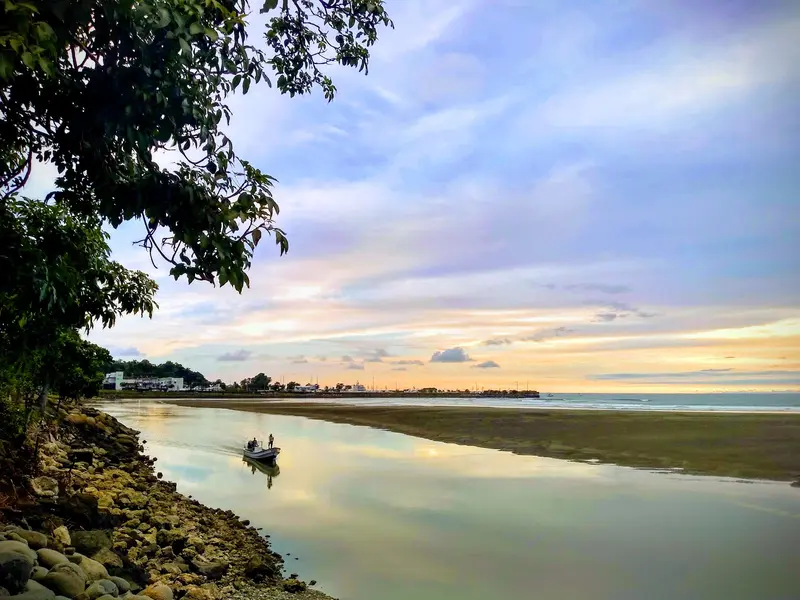
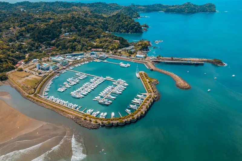
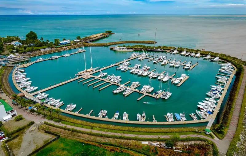
    Quepos is a port town on the Central Pacific coast, approximately 157 road kilometers south of San José, and the gateway to Manuel Antonio National Park. You come here as a more affordable, everyday base for the park and for the deep-sea fishing, for which Quepos is internationally known.The area was the settlement territory of the indigenous Quepoa, after whom the town is named. In 1563, Spanish conquerors under Juan Vázquez de Coronado founded the settlement of San Bernardino de Quepo here; the surviving Quepoa were relocated to a reserve in 1746.The center is compact, with a bus station, market, sodas, and small shops. On the southern edge lies Marina Pez Vela with yachts, restaurants, and the boarding points for fishing and catamaran tours. Along the water runs the Malecón, a simpler waterfront promenade.For anglers, the period from November to April is considered peak season for sailfish and marlin. The national park is about 25 minutes away by bus via the hillside road, along which many hotels are located.

    Sights in Quepos

    Discover the most important sights and attractions

    Marina Pez Vela

    1Marina Pez Vela

    The modern marina on the southern edge of Quepos is the starting point for deep-sea fishing tours for marlin, sailfish, and dorado, as well as catamaran cruises along the coast. The site features restaurants, bars, and shops; in the evenings, it's a quiet spot for a stroll with boat views.
    Open in Google Maps
    Malecón

    2Malecón

    The simple waterfront promenade at the edge of the center is the more relaxed, less glitzy counterpart to Marina Pez Vela. A short walk along the water, easily combined with a meal at one of the sodas in the center.
    Open in Google Maps
    Rainmaker

    3Rainmaker

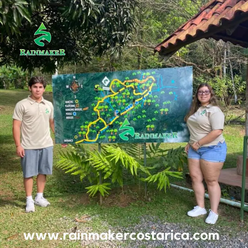
    Private rainforest reserve in the Quepos hinterland with around 600 hectares of forest, about ten kilometers of trails, suspension bridges, and waterfalls. Visit independently for an entrance fee or join guided day and night tours. For access, you need a car or a transfer.
    Open in Google Maps

    Restaurants in Quepos

    1

    Jiuberths

    Simple seafood eatery slightly outside the center, known as one of Quepos' top spots for fish and seafood.
    Show on Google Maps
    2

    Soda Eat Well

    Soda in central Quepos with Costa Rican cafeteria-style food: Choose from daily specials at the counter, like fish in tomato sauce, beef or chicken soup.
    Show on Google Maps

    Port City and Workplace

    Daily Life, Not a ResortUnlike neighboring Manuel Antonio, Quepos is a town primarily for Costa Ricans to live and work; its district had under 20,000 residents in 2011. The center has supermarkets, banks, and simple sodas with Costa Rican cuisine.Sport FishingMarina Pez Vela is a departure point for deep-sea fishing trips targeting marlin, sailfish, and dorado, and hosts international tournaments. If this matters to you, ask when booking if the operator releases caught fish.

    Arrival and Mobility

    Getting ThereBy car, you drive from San José via Route 27 and coastal Route 34 in about two and a half to three hours, passing Jacó. Buses from San José end at the bus station in the center. Domestic flights land at La Managua airstrip near Quepos; the flight time from San José is about half an hour.Getting AroundYou can walk to the center and marina. A city bus runs from the bus station to Manuel Antonio approximately every half hour during the day, taking about 25 minutes. Taxis operate without a meter, agree on the price beforehand.
    Accommodations in Quepos

    Find perfect stay in Quepos

    Booking.com* (Affiliate link)
    Search Hotels
    Agoda* (Affiliate link)
    Search Hotels
    Airbnb
    Vacation Rentals

    * Affiliate link: if you book through it, we earn a small commission. The price stays the same for you.

    Plan your trip to Quepos

    Save places, build a route and plan your city trip, all in one place.

    1. 1
      Sunrise over alpine peaks and a sea of clouds
      1234

      Round trip

      12 days · 4 stops

      Saved

      Pick a route

      Pick a ready-made one or save places and plan your own.

      Open bookmarks
    2. 2

      Trip to Quepos

      Live
      • 1Marina Pez Vela3 days
      • 2Malecón4 days
      • 3Rainmaker5 days
      Budget

      Plan your trip

      The planner sorts stops, days and budget. Plan together in real time.

      Start trip planning
    3. 3
      9:41 No signal
      Quepos
      Available offline

      Use it on the road

      Download the guide to your phone and use it on site, even offline.

    Nearby

    Manuel Antonio

    Manuel Antonio

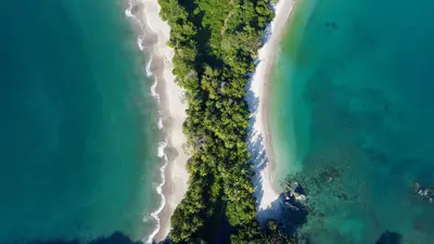
    Manuel Antonio is the small town on the Central Pacific coast south of Quepos, where the national park of the same name begins, approximately 157 road kilometers from San José. You come for the park, where rainforest borders directly on bright sandy coves and sloths, capuchin monkeys, and squirrel monkeys are often seen up close.The national park, founded in 1972, covers almost 2,000 hectares of land and a significantly larger marine area. Although it is one of the smallest national parks in the country, it attracts the most visitors: Between 2012 and 2022, approximately 4.4 million people visited. Four beaches are located within the park, including Playa Manuel Antonio and Playa Espadilla Sur, separated by a land bridge leading to the rock formation Punta Catedral.The town itself consists of hotels, restaurants, and tour operators along the winding road that leads from Quepos over the hill down to Playa Espadilla. You can visit the public Playa Espadilla in front of the park entrance without a ticket.Important for planning: The park is closed on Tuesdays and otherwise open from 7 AM to 4 PM; the beaches within the park close an hour earlier. Tickets are available exclusively online through the SINAC national park authority system and not at the entrance; they are limited and often sell out early on many days.
    Central Pacific

    Central Pacific

    The Central Pacific is the stretch of coast between the Tárcoles River and Quepos, the quickest to reach from San José. You come here for Manuel Antonio National Park with its rainforest right on the beach, the surf beaches around Jacó, and sport fishing off Quepos.Jacó is approximately 100 kilometers from San José, about a two-hour drive via Route 27 and coastal Route 34. You reach Quepos and Manuel Antonio by continuing further south on the same road, a journey of around 157 kilometers from San José.The region is more developed than the Nicoya Peninsula: Paved roads, regular bus services, and a domestic airport near Quepos make it practical even for short stays.
    Cartago

    Cartago

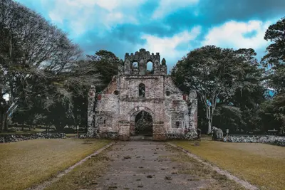
    Cartago is the first capital of Costa Rica, located in the east of the Central Valley, southeast of San José at the foot of Irazú Volcano. You visit here for the Basílica de los Ángeles, the country's most important sanctuary, and as a starting point for Irazú National Park.Juan Vásquez de Coronado founded the city in 1563, and it is considered the country's first permanent Spanish settlement. Cartago served as the capital until 1823, when the seat of government moved to San José. Earthquakes in 1822, 1841, and 1910 severely damaged the city, which is why little of its colonial cityscape remains.The city center can be explored on foot in half a day. To the east stands the Basilica with the Marian figure La Negrita; about seven blocks west, on the Plaza Mayor, are the Ruinas de Santiago Apóstol, a never-completed church whose walls now enclose a garden. In between, you'll find the Centro Cultural, housed in the neo-Gothic building of the former Banco Crédito Agrícola from 1924, and the municipal market with simple eateries.The city is situated at an elevation of approximately 1,435 meters, making it noticeably cooler than the coasts. From here, the road leads up to Irazú; southeast of the city lies the Lankester Botanical Garden.
    Jacó

    Jacó

    Jacó is the largest beach resort on the Central Pacific coast, about 100 kilometers and a two-hour drive from San José. You come here for surfing on a four-kilometer-long dark sand beach, for the nightlife, and as a base for Carara National Park with its wild macaws.The town is the main settlement of the Garabito canton in Puntarenas province and had just under 12,000 inhabitants in 2011. Life centers around Avenida Pastor Díaz, the main road running parallel to the beach, where bars, restaurants, surf shops, and tour operators are packed closely together.On the southern stretch of the beach, the waves are gentler and suitable for beginners; in the north, the sea is rougher. Experienced surfers head to Playa Hermosa a few kilometers south, where the waves break hard and fast.Jacó has a reputation as a party town, but in recent years, quieter accommodations and upscale restaurants have also emerged. From here, day trips can be made to Isla Tortuga, Carara, and the Crocodile Bridge on the Río Tárcoles.
    Uvita

    Uvita

    Uvita is a small town on Costa Rica's southern Pacific coast and the main gateway to the Marino Ballena National Marine Park. You come here for the whale tail beach of Punta Uvita and for whale watching boat tours; from San José, you'll reach it via the Costanera Sur in about three and a half to four hours.The town itself is situated along the coastal road and stretches from the main road into the hilly hinterland. Supermarkets, cafés, restaurants, and tour operators are close to each other, so those staying centrally can reach many places on foot. The beach and national park are just a few minutes away.The sea off Uvita is part of the Marino Ballena National Park. Humpback whales migrate past the coast from approximately July to October and from December to April; you can book tours with local providers. The Punta Uvita Tombolo can only be accessed at low tide, as the tides dictate daily life here.Uvita also serves as a great base for excursions along the Costa Ballena, for example, to beaches like Playa Ventanas or to the Nauyaca Waterfalls, which are about an hour's drive away.

    Sources & method

    • Photos: Pexels, Google Maps. Each photo carries its credit.
    • Place data such as addresses and ratings comes from Google Maps.
    • The content is based on web research from public, traceable sources. How the content is made · The role of AI