Fernweh: Home
    ExploreTravel GuidesPlan a tripMy tripLast visited
    de|en
    All Places & RegionsAll highlightsAbout FernwehFAQPrivacy PolicyImprint
    ExploreTravel GuidesPlan a tripMy tripLast visited
    • Overview
    • Places in the region
    • Round trips
    • Nearby
    Central Pacific
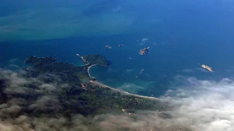
    Mariordo (Mario Roberto Durán Ortiz) / Wikimedia Commons / CC BY-SA 4.0

    Costa Rica

    Central Pacific

    Region

    The Central Pacific is the stretch of coast between the Tárcoles River and Quepos, the quickest to reach from San José.

    by Felix Gillen

    1. Home
    2. Destinations
    3. Costa Rica
    4. Central Pacific
    The Central Pacific is the stretch of coast between the Tárcoles River and Quepos, the quickest to reach from San José. You come here for Manuel Antonio National Park with its rainforest right on the beach, the surf beaches around Jacó, and sport fishing off Quepos.Jacó is approximately 100 kilometers from San José, about a two-hour drive via Route 27 and coastal Route 34. You reach Quepos and Manuel Antonio by continuing further south on the same road, a journey of around 157 kilometers from San José.The region is more developed than the Nicoya Peninsula: Paved roads, regular bus services, and a domestic airport near Quepos make it practical even for short stays.
    Just before Jacó lies Carara National Park, known for its wild Scarlet Macaws. A few minutes north of it, Route 34 crosses the Río Grande de Tárcoles, from whose pedestrian walkway you can observe American Crocodiles on the bank.Jacó is the region's largest beach resort, with a long dark sand beach, surf schools, and the liveliest nightlife on this coast. The adjoining Playa Hermosa to the south offers stronger waves for experienced surfers.Quepos is a port and working town with a marina, from which a short road leads over the hill to the town of Manuel Antonio and the national park entrance. The park is closed on Tuesdays; tickets are only available online in advance.
    Manuel Antonio

    Place 1 of 3

    Manuel Antonio

    Manuel Antonio is the small town on the Central Pacific coast south of Quepos, where the national park of the same name begins, approximately 157 road kilometers from San José.

    Discover
    Jacó

    Place 2 of 3

    Jacó

    Jacó is the largest beach resort on the Central Pacific coast, about 100 kilometers and a two-hour drive from San José.

    Discover
    Quepos

    Place 3 of 3

    Quepos

    Quepos is a port town on the Central Pacific coast, approximately 157 road kilometers south of San José, and the gateway to Manuel Antonio National Park.

    Discover

    Round trips through this region

    Pacific Coast from Guanacaste to Osa

    Pacific Coast from Guanacaste to Osa

    The route follows the Pacific coast from the dry beaches of Guanacaste, via the surf towns of the Nicoya Peninsula and Manuel Antonio National Park, to the rainforest of the Osa Peninsula. It is suitable for a 4x4 rental car and ends with a domestic flight back to San José.

    17 Days
    7 stops
    Open jaw
    The Classic Costa Rica in two weeks

    The Classic Costa Rica in two weeks

    The most popular circuit through Costa Rica connects the capital with the canal system of Tortuguero on the Caribbean, Arenal Volcano, the Monteverde cloud forest, and the beach coves of Manuel Antonio on the Pacific coast. It can be explored by rental car, tourist shuttles, or as an organized tour.

    14 Days
    5 stops

    Nearby

    Quepos

    Quepos

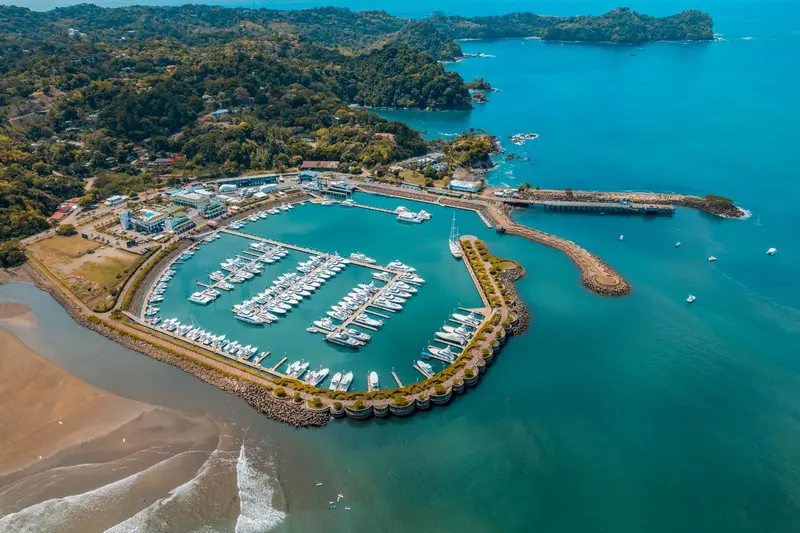
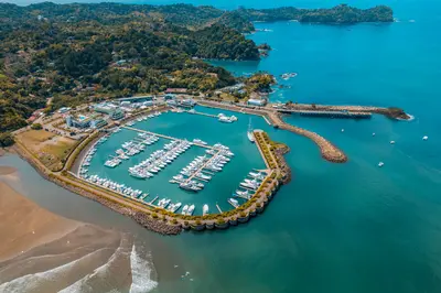
    Quepos is a port town on the Central Pacific coast, approximately 157 road kilometers south of San José, and the gateway to Manuel Antonio National Park. You come here as a more affordable, everyday base for the park and for the deep-sea fishing, for which Quepos is internationally known.The area was the settlement territory of the indigenous Quepoa, after whom the town is named. In 1563, Spanish conquerors under Juan Vázquez de Coronado founded the settlement of San Bernardino de Quepo here; the surviving Quepoa were relocated to a reserve in 1746.The center is compact, with a bus station, market, sodas, and small shops. On the southern edge lies Marina Pez Vela with yachts, restaurants, and the boarding points for fishing and catamaran tours. Along the water runs the Malecón, a simpler waterfront promenade.For anglers, the period from November to April is considered peak season for sailfish and marlin. The national park is about 25 minutes away by bus via the hillside road, along which many hotels are located.
    Manuel Antonio

    Manuel Antonio

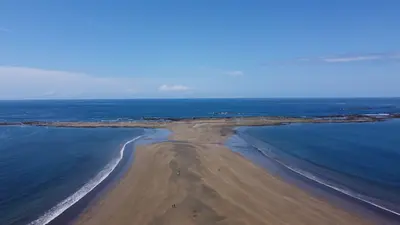
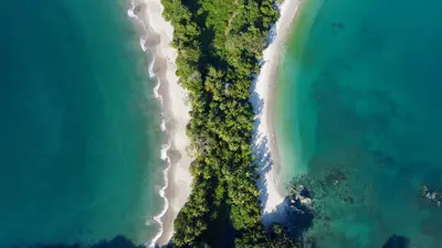
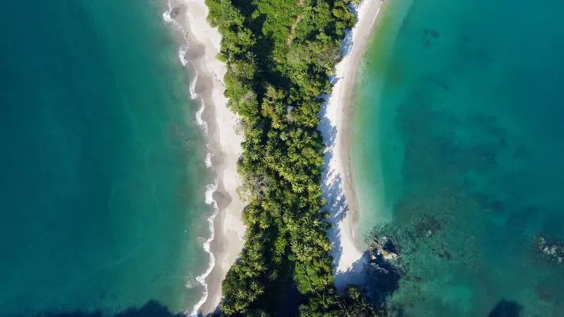
    Manuel Antonio is the small town on the Central Pacific coast south of Quepos, where the national park of the same name begins, approximately 157 road kilometers from San José. You come for the park, where rainforest borders directly on bright sandy coves and sloths, capuchin monkeys, and squirrel monkeys are often seen up close.The national park, founded in 1972, covers almost 2,000 hectares of land and a significantly larger marine area. Although it is one of the smallest national parks in the country, it attracts the most visitors: Between 2012 and 2022, approximately 4.4 million people visited. Four beaches are located within the park, including Playa Manuel Antonio and Playa Espadilla Sur, separated by a land bridge leading to the rock formation Punta Catedral.The town itself consists of hotels, restaurants, and tour operators along the winding road that leads from Quepos over the hill down to Playa Espadilla. You can visit the public Playa Espadilla in front of the park entrance without a ticket.Important for planning: The park is closed on Tuesdays and otherwise open from 7 AM to 4 PM; the beaches within the park close an hour earlier. Tickets are available exclusively online through the SINAC national park authority system and not at the entrance; they are limited and often sell out early on many days.
    Jacó

    Jacó

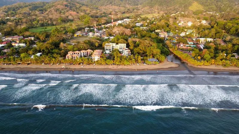
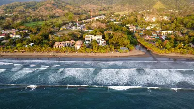
    Jacó is the largest beach resort on the Central Pacific coast, about 100 kilometers and a two-hour drive from San José. You come here for surfing on a four-kilometer-long dark sand beach, for the nightlife, and as a base for Carara National Park with its wild macaws.The town is the main settlement of the Garabito canton in Puntarenas province and had just under 12,000 inhabitants in 2011. Life centers around Avenida Pastor Díaz, the main road running parallel to the beach, where bars, restaurants, surf shops, and tour operators are packed closely together.On the southern stretch of the beach, the waves are gentler and suitable for beginners; in the north, the sea is rougher. Experienced surfers head to Playa Hermosa a few kilometers south, where the waves break hard and fast.Jacó has a reputation as a party town, but in recent years, quieter accommodations and upscale restaurants have also emerged. From here, day trips can be made to Isla Tortuga, Carara, and the Crocodile Bridge on the Río Tárcoles.
    Central Valley

    Central Valley

    The Valle Central is the highlands in the heart of Costa Rica, home to the capital San José and the cities of Alajuela, Heredia, and Cartago. Almost every trip begins here, as the international airport is located in Alajuela, and from here you can quickly reach active volcanoes, museums, and colonial churches.The valley lies at an altitude of about 800 to 1,500 meters. To the north, it is bounded by the Cordillera Central with the volcanoes Poás, Barva, Irazú, and Turrialba, and to the south by the Cordillera de Talamanca. Temperatures are mostly between 18 and 30 degrees, significantly milder than on the coasts.Almost three-quarters of the population lives in the Valle Central; consequently, roads, traffic, and services are dense. For travelers, this means: short distances to the Poás and Irazú Volcano Parks, a good day for the museums in San José, and a side trip to Cartago for the Basilica.
    San José

    San José

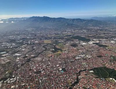
    San José is the capital of Costa Rica and the heart of the Central Valley. Almost all travelers arrive here. One to two days are sufficient to visit the museums of pre-Columbian gold and jade, the National Theater, and the market halls before continuing on to volcanoes and coasts. The city lies at an altitude of approximately 1,030 meters and has been the capital since 1823; Juan Santamaría International Airport is located a good 20 kilometers away in Alajuela.The center around the Plaza de la Cultura is compact and easily explored on foot. Here you'll find the Teatro Nacional, which opened in 1897, and below it the Museo del Oro Precolombino. A few blocks to the east are the Museo del Jade and the Museo Nacional, located in the former Bellavista army barracks. West of the Cathedral, the Mercado Central has occupied an entire block on Avenida Central since 1880, featuring over 200 stalls and simple sodas in narrow passageways.Barrio Amón, north of the center, emerged in the late 19th century as a residential quarter for the coffee oligarchy. Among low wooden houses with verandas and wrought-iron railings stand buildings like the 1930 Mudéjar-style Castillo del Moro or the prefabricated metal building from 1890, which has housed the Alianza Francesa since 1965. Many of the restored villas now accommodate small hotels, cafés, and galleries. Some streets are considered sparsely populated in the evenings, so you're better off taking a taxi at night there.Barrio Escalante in the east is the city's restaurant district. Around Calle 33, eateries have set up shop in old residential buildings: vegan cafés, specialty coffee, craft beer pubs, and cuisines ranging from Mediterranean to Mexican. This area is liveliest in the evenings, and accordingly, most of the city's bars are located in this neighborhood.

    Sources & method

    • Photos: Wikimedia Commons. Each photo carries its credit.
    • The content is based on web research from public, traceable sources. How the content is made · The role of AI