ExploreTravel GuidesMy Trips
    de|en
    All Places & RegionsAbout FernwehFAQPrivacy PolicyImprint
    ExploreTravel GuidesMy Trips
    The Catlins
    Natural Area

    The Catlins

    The Catlins are a sparsely populated coastal region in the southeast of the South Island between Invercargill and Balclutha.

    More
    1. Home
    2. Destinations
    3. New Zealand
    4. Otago
    5. The Catlins
    The Catlins are a sparsely populated coastal region in the southeast of the South Island between Invercargill and Balclutha. The Southern Scenic Route passes by waterfalls like the Purakaunui Falls, the rugged coastline of Nugget Point, and the petrified forest of Curio Bay, where Yellow-eyed penguins and Hector's dolphins live.

    Sights in The Catlins

    Discover the most important sights and attractions

    Historic Landmark

    1Nugget Point

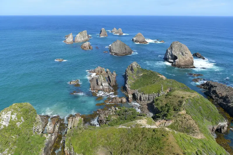
    A short path leads over a narrow ridge to the 1870 lighthouse, beneath which rock islands known as 'Nuggets' jut out of the sea. Fur seals live in the bay, and at the nearby Roaring Bay, there is an observation hide for yellow-eyed penguins.
    Open in Google Maps
    Attraction

    2Purakaunui Falls

    The three-tiered waterfall lies in a Podocarpus and Southern Beech forest. From the parking lot, it's about a ten-minute comfortable walk.
    Open in Google Maps
    Attraction

    3Cathedral Caves

    The over 30-meter-high sea caves at Waipati Beach are only accessible around low tide. Access requires a fee and is open seasonally; check tides and opening hours beforehand.
    Open in Google Maps
    Attraction

    4Curio Bay

    At low tide, fossilized tree stumps of a forest around 180 million years old are exposed on the bay's rock platform. In the neighbouring Porpoise Bay, Hector's dolphins are often seen, and in the evenings, yellow-eyed penguins come ashore.
    Open in Google Maps
    Attraction

    5McLean Falls

    One of the highest waterfalls in the Catlins, at approx. 22 meters. The forest trail to the falls' base takes approx. 20 mins each way.
    Open in Google Maps

    Restaurants in The Catlins

    The Wild Southeast Coast

    Wild Coast in the SoutheastThe Catlins are among the most sparsely populated coastal areas of the South Island. In the 19th century, whalers and loggers lived here, clearing a large part of the old-growth forest. The remaining forests of Rimu, Totara, and Southern Beeches are now mostly protected.The region is a sanctuary for rare species: Yellow-eyed penguins, Hector's dolphins, sea lions, and elephant seals. Places like Owaka and Papatowai are small, and supplies are accordingly limited.

    On the Road in the Catlins

    On the Road in the CatlinsThe Southern Scenic Route links Balclutha and Invercargill for about 170 kilometres through the Catlins. Plan at least one full day, preferably two. There is no public transport.Fuel up in Balclutha or Invercargill, as service stations are rare en routeSome turn-offs to beaches and waterfalls are gravel roadsCheck the tides for Cathedral Caves and Curio Bay

    Accommodations in The Catlins

    Find perfect stay in The Catlins

    Booking.com* (Affiliate link)
    Search Hotels
    Agoda* (Affiliate link)
    Search Hotels
    Airbnb
    Vacation Rentals

    * Affiliate link: if you book through it, we earn a small commission. The price stays the same for you.

    Nearby

    Invercargill

    Invercargill is New Zealand's southernmost city and the hub of the Southland agricultural region. Wide, grid-patterned streets, historic buildings on Dee and Tay Street, the large Queens Park, and vehicle collections centered around motorcycle racer Burt Munro characterize the city. The Catlins, Bluff, and Stewart Island are close.

    Bluff

    Bluff is a port town at the southern tip of the South Island, about 30 kilometers south of Invercargill. Here State Highway 1 ends, the ferry to Stewart Island departs, and the famous Bluff oyster comes from the Foveaux Strait.
    Dunedin

    Dunedin

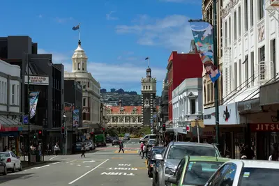
    Dunedin is the second largest city on the South Island and a university city with Scottish roots. Victorian buildings, the 1906 railway station, and the Otago Peninsula with albatrosses and penguins right on the city's doorstep make it a unique destination on the east coast.
    Otago

    Otago

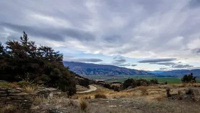
    Otago stretches from the Pacific coast near Dunedin to the lakes and peaks of the Southern Alps around Queenstown and Wanaka. In between lie the dry, golden highlands of Central Otago with its vineyards and the wild coast of the Catlins.
    Stewart Island (Rakiura)
    Khalaan at English Wikipedia / Wikimedia Commons / CC BY-SA 3.0

    Stewart Island (Rakiura)

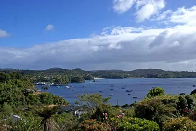
    Stewart Island lies approximately 30 kilometres south of Bluff, across Foveaux Strait. A good 80 percent of the island belongs to Rakiura National Park, and its only settlement is Oban on Halfmoon Bay. The island is one of the best places in New Zealand to see kiwis in the wild, and the offshore Ulva Island is a predator-free bird sanctuary.