Fernweh: Home
ExploreGuideDestinationsMy tripsMy trip
de|en
All Places & RegionsRound tripsNight trains in EuropeAll highlightsAbout FernwehFAQPrivacy PolicyImprint
Download on the App StoreGet it on Google Play
ExploreGuideDestinationsMy tripsMy trip
    • Places & highlights
    • Tours
    • Eat & drink
    • Culture
    • Getting around
    • Accommodation
    • Nearby
    Chirripó National Park

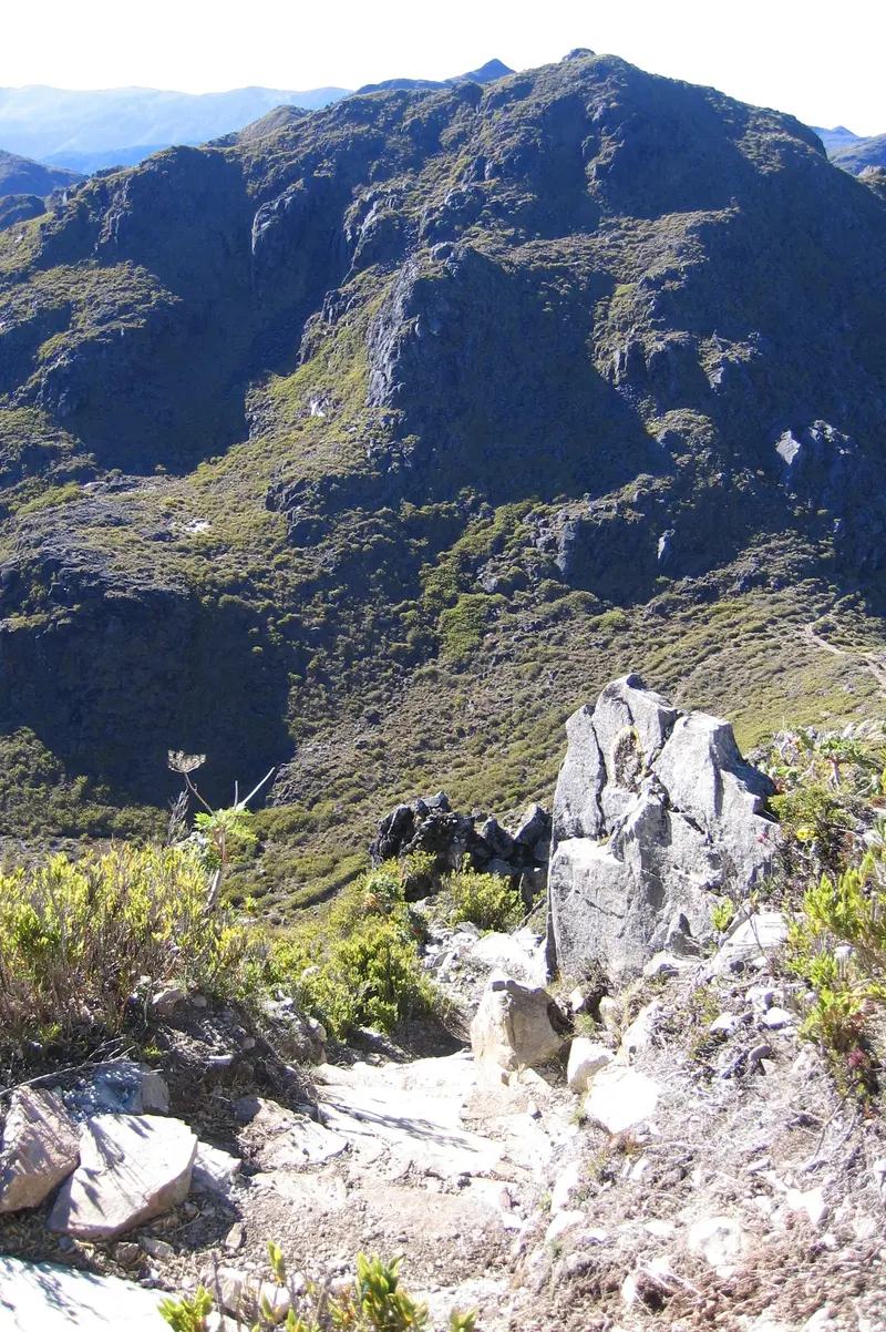
    “Cerro Chirripó” by Peter Andersen / Wikimedia Commons / CC BY-SA 3.0, mod.

    Costa Rica

    Chirripó National Park

    Point of Interest

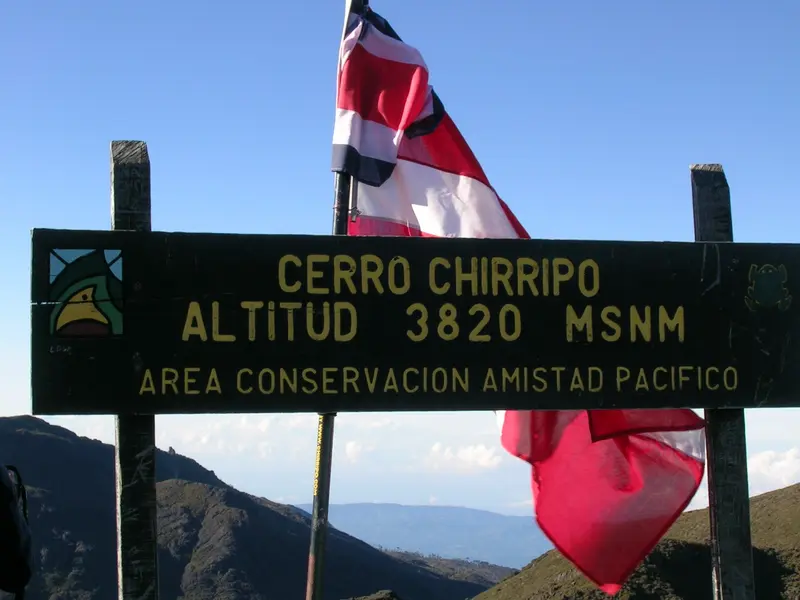
    Chirripó National Park protects Costa Rica's highest mountain, Cerro Chirripó (approx. 3,820 m). Starting point: the mountain village of San Gerardo de Rivas, northeast of San Isidro de El General.

    by Felix Gillen

    1. Home
    2. Destinations
    3. Costa Rica
    4. South Pacific & Osa
    5. Chirripó National Park
    Chirripó National Park protects Costa Rica's highest mountain, Cerro Chirripó (approx. 3,820 m). Starting point: the mountain village of San Gerardo de Rivas, northeast of San Isidro de El General. The ascent passes through mountain forest to the treeless Páramo landscape with glacial lakes.
    Costa Rica travel guideRound trips in Costa RicaPlan a trip with Chirripó National Park

    Contents

    • Places & highlights
    • Tours
    • Eat & drink
    • Culture
    • Getting around
    • Accommodation
    • Nearby

    Sights in Chirripó National Park

    Discover the most important sights and attractions

    Natural Feature

    1Cerro Los Crestones

    The rock formation reaches 3,721 m and is accessible from the Base Crestones hut in around 1.7 km and about an hour on foot.
    Open in Google Maps
    Cerro Chirripó

    “Picture 1191” by Peter Andersen / Wikimedia Commons / CC BY-SA 3.0, mod.

    Natural Feature

    2Cerro Chirripó

    The summit, at approximately 3,820 m, is Costa Rica's highest point. From the Base Crestones hut at about 3,400 m, it's still about 5 km to the top, the trail leading through treeless páramo landscape.
    Open in Google Maps

    Tours & experiences in Chirripó National Park

    Search tours for Chirripó National Park on GetYourGuide* (Affiliate link)On GetYourGuide, with reviews from other travellers

    * Affiliate link: if you book through it, we earn a small commission. The price stays the same for you.

    Restaurants in Chirripó National Park

    Park and Rules

    Protected AreaThe park was established in 1975 and covers about 50,000 hectares. Above the tree line lie glacial valleys such as the Valle de los Conejos and several glacial lakes.ReservationsVisitor numbers are limited. You reserve entry online with SINAC; overnight stays at Base Crestones are booked separately with the concessionaire. Reservations have been suspended and changed several times in recent years, so check the current status with SINAC well before your trip.For current health and safety advice, including on altitude, check the FCDO travel advice.

    Your Arrival and Ascent

    Getting There from San JoséHead via the Interamericana to San Isidro de El General, then via Rivas to San Gerardo de Rivas. The bus to San Isidro takes about 3 hours; from there, it's about 1 hour by local bus or around 30 minutes by taxi.The AscentFrom the starting point in San Gerardo de Rivas, it's about 14 km to Base Crestones at approx. 3,400 m, predominantly uphill. From the hut to the summit, it's another 5 km. Most plan at least two days.

    Accommodations in Chirripó National Park

    Find perfect stay in Chirripó National Park

    Booking.com* (Affiliate link)
    Search Hotels
    Agoda* (Affiliate link)
    Search Hotels
    Airbnb
    Vacation Rentals

    * Affiliate link: if you book through it, we earn a small commission. The price stays the same for you.

    Nearby

    Uvita

    Uvita

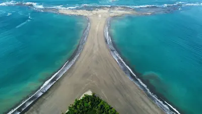
    Uvita is a small town on Costa Rica's southern Pacific coast and the main gateway to the Marino Ballena National Marine Park. You come here for the whale tail beach of Punta Uvita and for whale watching boat tours; from San José, you'll reach it via the Costanera Sur in about three and a half to four hours.The town itself is situated along the coastal road and stretches from the main road into the hilly hinterland. Supermarkets, cafés, restaurants, and tour operators are close to each other, so those staying centrally can reach many places on foot. The beach and national park are just a few minutes away.The sea off Uvita is part of the Marino Ballena National Park. Humpback whales migrate past the coast from approximately July to October and from December to April; you can book tours with local providers. The Punta Uvita Tombolo can only be accessed at low tide, as the tides dictate daily life here.Uvita also serves as a great base for excursions along the Costa Ballena, for example, to beaches like Playa Ventanas or to the Nauyaca Waterfalls, which are about an hour's drive away.

    Carlos Valverde Fonseca·Pexels

    Orosi Dell

    Orosi Dell

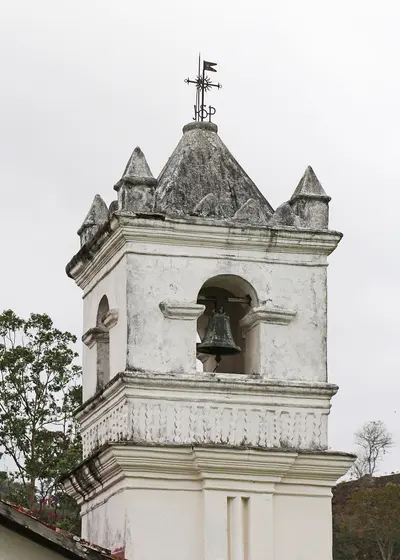
    The Orosi Valley, southeast of Cartago, is a coffee valley with colonial churches and the Cachí Reservoir. In Orosi stands the Iglesia de San José de Orosi, built from 1743 and the country's last preserved colonial church still in use. A roughly 60 km circuit from Paraíso connects the main stops.

    Bernard Gagnon·CC0

    Guayabo National Monument

    Near Turrialba lies the Monumento Nacional Arqueológico Guayabo, a pre-Columbian settlement of river stones, inhabited from approximately 1000 BC to 1400 AD. Preserved are stone mounds, paved paths, aqueducts, and water basins, through which a short interpretive trail leads.
    Cartago

    Cartago

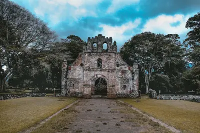
    Cartago is the first capital of Costa Rica, located in the east of the Central Valley, southeast of San José at the foot of Irazú Volcano. You visit here for the Basílica de los Ángeles, the country's most important sanctuary, and as a starting point for Irazú National Park.Juan Vásquez de Coronado founded the city in 1563, and it is considered the country's first permanent Spanish settlement. Cartago served as the capital until 1823, when the seat of government moved to San José. Earthquakes in 1822, 1841, and 1910 severely damaged the city, which is why little of its colonial cityscape remains.The city center can be explored on foot in half a day. To the east stands the Basilica with the Marian figure La Negrita; about seven blocks west, on the Plaza Mayor, are the Ruinas de Santiago Apóstol, a never-completed church whose walls now enclose a garden. In between, you'll find the Centro Cultural, housed in the neo-Gothic building of the former Banco Crédito Agrícola from 1924, and the municipal market with simple eateries.The city is situated at an elevation of approximately 1,435 meters, making it noticeably cooler than the coasts. From here, the road leads up to Irazú; southeast of the city lies the Lankester Botanical Garden.

    Luis Quintero·Pexels

    Irazú Volcano National Park

    Irazú Volcano National Park

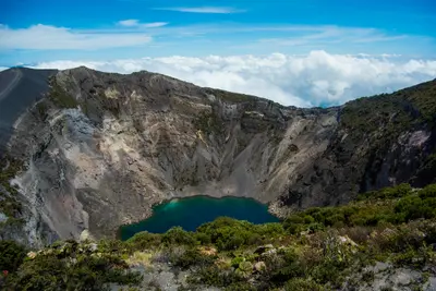
    Irazú Volcano National Park is located in the Cordillera Central above Cartago, in the east of the Central Valley. You come here to walk right up to the rim of several craters, which are among Costa Rica's most easily accessible volcanic landscapes.Irazú stands at 3,432 meters. The National Park was founded on August 9, 1955. An eruption, which began in March 1963 and lasted about two years, covered San José and large parts of the highlands with ash.At the summit are several craters, including the Main Crater, the Diego de la Haya Crater, and the small, ash-covered Playa Hermosa Crater. During the rainy season, water collects in the Main Crater and Diego de la Haya, forming colorful lagoons. On very clear days, both the Caribbean and the Pacific can be seen from the summit; such days are rare, as clouds usually hang over the peak from late morning.The park also includes the Prusia sector, a former forest reserve where reforestation has taken place and hiking trails lead through the mountain forest. Tickets are available exclusively online via the SINAC reservation system, with a fixed entry time slot. Before your visit, check there for current opening hours and whether all sectors are accessible.At over 3,000 meters, it is cold and windy, even in the tropics. Bring warm clothing and rain gear, and come early to see the craters before the clouds roll in.

    Juliana Barquero·Unsplash

    Your next steps

    Chirripó National Park is in Costa Rica. Ways to carry on from here.

    • More in Costa Rica

      Highlights, areas, routes and the best time to travel for all of Costa Rica.

      Costa Rica travel guide
    • Round trips in Costa Rica

      Ready-made routes through Costa Rica, with stops, nights and a map.

      See the routes
    • Plan a trip with Chirripó National Park

      The Guide asks about season, length and who is coming, and suggests a trip with Chirripó National Park.

      Plan the trip
    Sources & method

    • Photos: Wikimedia Commons. Each photo carries its credit.
    • Place data such as addresses and ratings comes from Google Maps.
    • The content is based on web research from public, traceable sources. How the content is made · The role of AI