Fernweh: Home
ExploreGuideDestinationsMy tripsMy trip
de|en
All Places & RegionsRound tripsNight trains in EuropeAll highlightsAbout FernwehFAQPrivacy PolicyImprint
Download on the App StoreGet it on Google Play
ExploreGuideDestinationsMy tripsMy trip
    • Places in the region
    • Getting around
    • Nearby
    Stubaital

    Pilote2022 / Wikimedia Commons / CC0

    Austria

    Stubaital

    RegionMountains

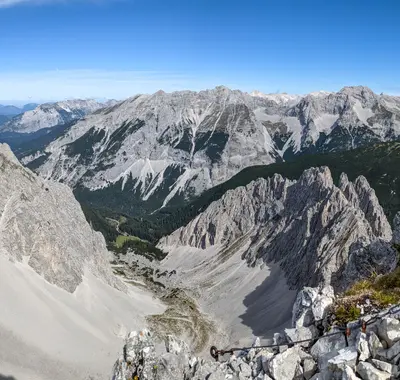
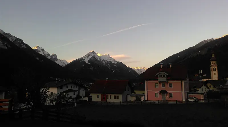
    The Stubai Valley branches off south of Innsbruck and stretches for about 35 kilometers to the Stubai Glacier, the destination for most visitors.

    by Felix Gillen

    1. Home
    2. Destinations
    3. Austria
    4. Stubaital
    The Stubai Valley branches off south of Innsbruck and stretches for about 35 kilometers to the Stubai Glacier, the destination for most visitors. From the Top of Tyrol platform at 3,170 meters, you can see over 100 peaks above 3,000 meters on a clear day. The valley is home to Schönberg, Mieders, Telfes, Fulpmes, and Neustift, along with the Grawa Waterfall and alpine paths for all fitness levels.
    Austria travel guideRound trips in AustriaPlan a trip with Stubaital

    Contents

    • Places in the region
    • Getting around
    • Nearby

    Sights in Stubaital

    Discover the most important sights and attractions

    Grawa Waterfall

    Jörg Braukmann / Wikimedia Commons / CC BY-SA 4.0, mod.

    Attraction

    Grawa Waterfall

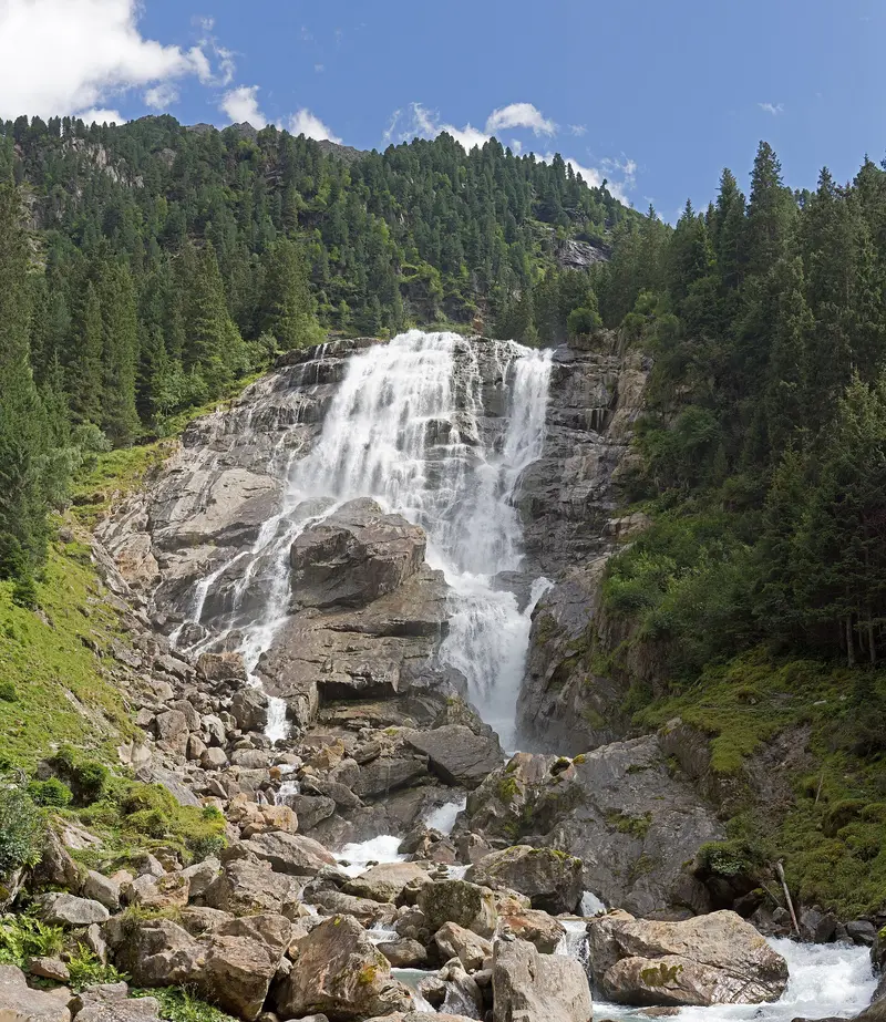
    In the back of the Stubaital, the Grawa Waterfall plunges over an approximately 180-meter-high cascade. The path to the foot of the falls is accessible; there are wooden loungers on a platform, and via the Himmelsstiege, you reach two further viewpoints. It is part of the WildeWasserWeg, which leads in stages up to the Sulzenauhütte and the Sulzenauferner.
    Open in Google Maps
    Attraction

    Stubai Glacier and Top of Tyrol

    At the valley head, cable cars take you from Mutterbergalm at 1697m to over 3000m. The Top of Tyrol viewing platform at Schaufeljoch is at 3170m and, in clear weather, offers views of 109 three-thousanders. In summer 2026, the lifts were open June 20th to September 27th; the Stubai Super Card includes the ride.
    Open in Google Maps

    Exploring Locally

    By Train and Bus from InnsbruckThe Stubaitalbahn, a meter-gauge railway opened in 1904, runs from Innsbruck Main Station via Natters, Mutters and Telfes to Fulpmes.Bus line 590 travels from Innsbruck into the valley, while line 595 connects the five villages with each other.Guests staying overnight receive a voucher for free arrival and departure by train or bus; in winter, the ski bus is free with a ski pass.Glacier and SeasonThe mountain lifts to the Stubai Glacier start at the end of the valley at almost 1,700 meters. The 2026 summer season ran from June 20 to September 27. Check current operating hours and the weather with the operator before your trip, as with clouds, you'll see little at the top.

    Nearby

    Innsbruck

    Innsbruck

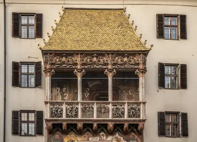
    The capital of Tyrol is located in western Austria right in front of the Alps. In the Old Town, the Golden Roof shines with its 2,657 gilded copper shingles; from there, the Hungerburgbahn, designed by Zaha Hadid, takes you up to the Nordkette.

    Wilfredor·CC0

    Innsbruck & Region

    Innsbruck & Region

    The Tyrolean state capital lies in the Inn Valley directly in front of the mountains. In the Old Town stand the Golden Roof with its copper shingles and the Hofburg; mountain railways lead from the city's edge into the high mountains.

    Ronny Siegel·Pexels

    Ötztal

    Ötztal

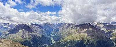
    Spanning approximately 65 kilometers, the Ötztal extends from the Inntal, west of Innsbruck, south into the glacier world of the Ötztal Alps. Along the route are Tyrol's highest waterfall near Umhausen, the thermal spa in Längenfeld, Sölden with its summit lifts, and at its far end, Vent and Obergurgl. The glacier mummy Ötzi was discovered at the Tisenjoch in 1991.

    Tiia Monto·CC BY 4.0

    Zugspitze

    Zugspitze

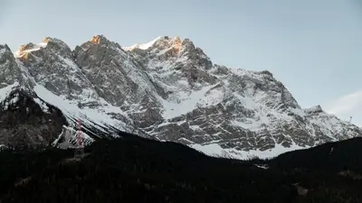
    The Zugspitze, at 2962 meters on its eastern peak, is Germany's highest mountain; the border with Austria runs over its western peak. A 4.88-meter-high summit cross stands on the peak, and below, on the Zugspitzplatt, lies the Nördliche Schneeferner, Germany's largest glacier.You can reach the top in two ways: The Bayerische Zugspitzbahn starts in Garmisch-Partenkirchen and reaches the glacier station at 2588 meters after approximately 45 minutes; the Seilbahn Zugspitze, opened in 2017, soars from Eibsee at 1000 meters directly to the summit.

    Bastian Riccardi·Pexels

    Zillertal

    Zillertal

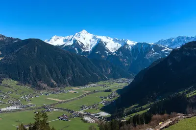
    The Zillertal in Tyrol branches off approximately 40 kilometers east of Innsbruck from the Inn Valley to the south, a holiday valley for hikers in summer and skiers in winter. Near Mayrhofen, it branches out into the high-alpine reaches of the Zillertal Alps.The Zillertalbahn runs from Jenbach to Mayrhofen, mountain lifts lead up to the alpine pastures, and scenic alpine roads take you to the Schlegeis Reservoir or over the Gerlospass to the Krimml Waterfalls.

    D-Kuru·CC BY-SA 4.0

    Your next steps

    Stubaital is in Austria. Ways to carry on from here.

    • More in Austria

      Highlights, areas, routes and the best time to travel for all of Austria.

      Austria travel guide
    • Round trips in Austria

      Ready-made routes through Austria, with stops, nights and a map.

      See the routes
    • Plan a trip with Stubaital

      The Guide asks about season, length and who is coming, and suggests a trip with Stubaital.

      Plan the trip

    Sources & method

    • Photos: Wikimedia Commons. Each photo carries its credit.
    • Place data such as addresses and ratings comes from Google Maps.
    • The content is based on web research from public, traceable sources. How the content is made · The role of AI