Fernweh: Home
ExploreGuideDestinationsMy tripsMy trip
de|en
All Places & RegionsRound tripsNight trains in EuropeAll highlightsAbout FernwehFAQPrivacy PolicyImprint
Download on the App StoreGet it on Google Play
ExploreGuideDestinationsMy tripsMy trip
    • Places in the region
    • Getting around
    • Nearby
    Nationalpark Mochima

    Warairarepano&Guaicaipuro / Wikimedia Commons / CC0

    Venezuela

    Nationalpark Mochima

    Region

    For this area, the FCDO advises against travel unless it is essential. Check the FCDO travel advice, linked on the country page, before planning.

    by Felix Gillen

    1. Home
    2. Destinations
    3. Venezuela
    4. Nationalpark Mochima
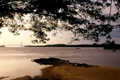
    For this area, the FCDO advises against travel unless it is essential. Check the FCDO travel advice, linked on the country page, before planning.Founded in 1973, Mochima National Park protects around 950 km² of coast, bays and islands between Puerto La Cruz and Cumaná; a good half of it is sea. Boat trips to island beaches such as Playa Blanca and Isla de Plata and snorkelling in clear water are the reasons to come.The western part belongs to Anzoátegui state, the eastern part to Sucre. Gateways are Puerto La Cruz, the village of Mochima and Santa Fe.
    Venezuela travel guideRound trips in VenezuelaPlan a trip with Nationalpark Mochima

    Contents

    • Places in the region
    • Getting around
    • Nearby

    Sights in Nationalpark Mochima

    Discover the most important sights and attractions

    Beach

    Playa Colorada

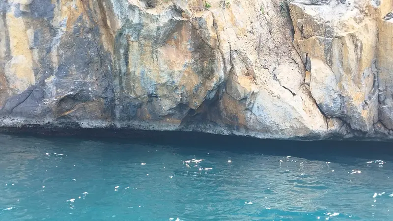
    The beach on the coastal road is one of the few in the park you can reach without a boat. Hiking trails connect it to the town of Santa Fe.
    Open in Google Maps
    Beach

    Playa Blanca

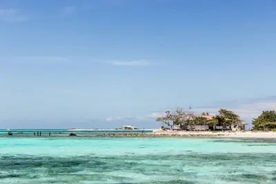
    The white sand beach, one of the park's most famous, is only accessible by boat, such as from Mochima village's pier.
    Open in Google Maps
    Natural Feature

    Isla de Plata

    The small island of the Picudas Group lies in the western part of the park near Puerto La Cruz and is a popular boating spot for swimming; dolphins are often seen nearby.
    Open in Google Maps

    Getting there and around

    Check the FCDO travel advice for this area before planning.GatewaysBoats to the islands and bays leave from Puerto La Cruz, Guanta and Lechería and from the pier in Mochima village; there are also boats in Santa Fe.CumanáOn the eastern edge of the park lies Cumaná, capital of Sucre state. It goes back to a first Spanish foundation in 1515 and is regarded as one of the oldest Spanish towns on the South American mainland; the Castillo San Antonio de la Eminencia stands above the town.

    Nearby

    Isla Margarita

    Isla Margarita

    For this area, the FCDO advises against travel unless it is essential. Check the FCDO travel advice, linked on the country page, before planning.At around 1,020 km², Isla Margarita is Venezuela's largest Caribbean island and, together with Coche and Cubagua, forms the state of Nueva Esparta. Beaches such as Playa El Agua in the north-east and the windsurfing spot of El Yaque in the south, colonial-era forts and the mangrove lagoon of La Restinga make it the country's classic beach destination.The capital is La Asunción, the largest town Porlamar, with Santiago Mariño airport nearby. Since late June 2026 the car ferry from Puerto La Cruz has been running to the island again.

    Wilfredor·CC0

    Ciudad Bolívar

    Ciudad Bolívar

    The FCDO advises against all travel to parts of this state. Check the FCDO travel advice, linked on the country page, before planning.Ciudad Bolívar on the south bank of the Orinoco was founded in 1764 as Angostura and is the starting point for flights to Angel Falls. In 1819 the Congress of Angostura met here and founded Gran Colombia; in 1846 the city received its present name.The city lies in Bolívar state, which borders Brazil and Guyana. The colonial old town is grouped around Plaza Bolívar with the cathedral and the Congress House, and the Paseo Orinoco runs along the river.

    LBM1948·CC BY-SA 4.0

    Caracas

    Caracas

    For this area, the FCDO advises against travel unless it is essential. Check the FCDO travel advice, linked on the country page, before planning.Venezuela's capital lies at around 900 m in a valley between the Caribbean coast and the Ávila massif. Of particular interest to travellers are Carlos Raúl Villanueva's Ciudad Universitaria, a UNESCO World Heritage Site since 2000, and the old town around Plaza Bolívar with the house where Simón Bolívar was born.The earthquakes of 24 June 2026 damaged several historic buildings in Caracas, including the cathedral, the Panteón Nacional and parts of the university city; the cable car up the Ávila has been out of service since then. Check what is open before you visit.

    Joaquim Pacheco·Pexels

    Orinoco Delta

    The FCDO advises against all travel to parts of this region. Check the FCDO travel advice, linked on the country page, before planning.In north-eastern Venezuela the Orinoco fans out before the Atlantic into a vast swampy delta of channels, mangroves and rainforest. This is the home of the Warao, whose culture is centred on the water; within the delta you can only travel by boat.Delta Amacuro state borders Guyana. UNESCO has listed the Delta del Orinoco Biosphere Reserve, covering around 1.1 million hectares, since 2009. The gateway is Tucupita on the Caño Manamo.
    Los Roques

    Los Roques

    For this area, the FCDO advises against travel unless it is essential. Check the FCDO travel advice, linked on the country page, before planning.The Los Roques archipelago lies in the Caribbean around 130 km off the coast north of Caracas and has been a national park since 1972. Dozens of islands and cays with white sand, lagoons and coral reefs make it a destination for swimming, snorkelling and sailing.The only permanently inhabited island is Gran Roque, with the airstrip, guesthouses and the village; boats take you to the other islands. Since 1996 the archipelago has also been listed as a Ramsar wetland of international importance.

    Fuka jaz·Pexels

    Your next steps

    Nationalpark Mochima is in Venezuela. Ways to carry on from here.

    • More in Venezuela

      Highlights, areas, routes and the best time to travel for all of Venezuela.

      Venezuela travel guide
    • Round trips in Venezuela

      Ready-made routes through Venezuela, with stops, nights and a map.

      See the routes
    • Plan a trip with Nationalpark Mochima

      The Guide asks about season, length and who is coming, and suggests a trip with Nationalpark Mochima.

      Plan the trip
    Sources & method

    • Photos: Wikimedia Commons. Each photo carries its credit.
    • Place data such as addresses and ratings comes from Google Maps.
    • The content is based on web research from public, traceable sources. How the content is made · The role of AI