Fernweh: Home
ExploreGuideDestinationsMy tripsMy trip
de|en
All Places & RegionsRound tripsNight trains in EuropeAll highlightsAbout FernwehFAQPrivacy PolicyImprint
Download on the App StoreGet it on Google Play
ExploreGuideDestinationsMy tripsMy trip
    • Neighborhoods & highlights
    • Tours
    • Eat & drink
    • Culture
    • Getting around
    • Accommodation
    • Plan trip
    • Round trips
    • Nearby
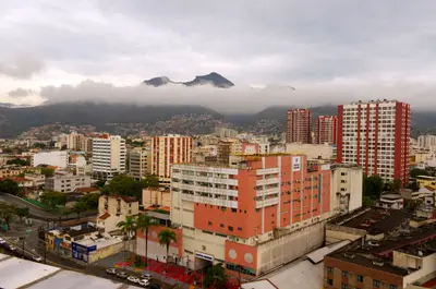
    Ciudad Bolívar

    LBM1948 / Wikimedia Commons / CC BY-SA 4.0, mod.

    Venezuela

    Ciudad Bolívar

    City

    The FCDO advises against all travel to parts of this state. Check the FCDO travel advice, linked on the country page, before planning.

    by Felix Gillen

    1. Home
    2. Destinations
    3. Venezuela
    4. Ciudad Bolívar
    The FCDO advises against all travel to parts of this state. Check the FCDO travel advice, linked on the country page, before planning.Ciudad Bolívar on the south bank of the Orinoco was founded in 1764 as Angostura and is the starting point for flights to Angel Falls. In 1819 the Congress of Angostura met here and founded Gran Colombia; in 1846 the city received its present name.The city lies in Bolívar state, which borders Brazil and Guyana. The colonial old town is grouped around Plaza Bolívar with the cathedral and the Congress House, and the Paseo Orinoco runs along the river.
    Venezuela travel guideSee the round tripPlan a trip with Ciudad Bolívar

    Contents

    • Neighborhoods & highlights
    • Tours
    • Eat & drink
    • Culture
    • Getting around
    • Accommodation
    • Round trips
    • Nearby

    Sights in Ciudad Bolívar

    Discover the most important sights and attractions

    1House of the Congress of Angostura

    The pink colonial building from the 1770s on the west side of Plaza Bolívar was the meeting place for the Congress of Angostura in 1819. Here Simón Bolívar delivered his famous speech, and the Congress decided to found Gran Colombia.
    Open in Google Maps
    Museum

    2Museo de Ciudad Bolívar (Casa del Correo del Orinoco)

    The museum on Paseo Orinoco displays the original printing press of the "Correo del Orinoco", the first newspaper of the young Republic, published 1818-1821, along with historical city maps and a petroglyph.
    Open in Google Maps
    Attraction

    3Puente de Angostura

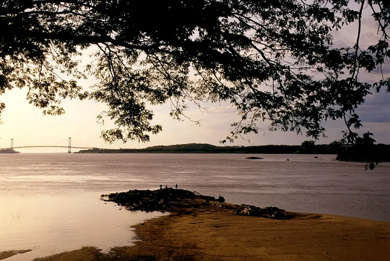
    Completed in 1967, the bridge west of the Old Town was the first across the Orinoco. From Paseo Orinoco, you can see it over the river.
    Open in Google Maps
    Attraction

    4Piedra del Medio

    The rocky island in the Orinoco opposite the old town has always served as a natural gauge: The river's water level can be read from the visible part of the rock. Legends of a river monster surround it. You see it best from the Paseo Orinoco.
    Open in Google Maps

    5Paseo Orinoco

    The Orinoco riverfront promenade is lined by old trading houses with arcades, zinc roofs, and cast-iron balconies. From here, you look out onto the river, the Piedra del Medio, and the Puente de Angostura; the Museo de Ciudad Bolívar is also located on the Paseo.
    Open in Google Maps

    Tours & experiences in Ciudad Bolívar

    Search tours for Ciudad Bolívar on GetYourGuide* (Affiliate link)On GetYourGuide, with reviews from other travellers

    * Affiliate link: if you book through it, we earn a small commission. The price stays the same for you.

    Restaurants in Ciudad Bolívar

    Culture and History

    AngosturaFounded in 1764, the city was called Angostura until 1846. In 1819, the congress that founded Gran Colombia convened here; the Congress House on Plaza Bolívar can be visited today. From 1818 to 1821, the “Correo del Orinoco,” the young republic’s first newspaper, was published here.

    Getting there and around

    Check the FCDO travel advice for Bolívar state first.Getting thereThe journey from Caracas takes 8 to 12 hours.The airport is within the city; small planes fly from here to Canaima.Night buses connect the city with Santa Elena de Uairén in the Gran Sabana.

    Accommodations in Ciudad Bolívar

    Find perfect stay in Ciudad Bolívar

    Booking.com* (Affiliate link)
    Search Hotels
    Agoda* (Affiliate link)
    Search Hotels
    Airbnb
    Vacation Rentals

    * Affiliate link: if you book through it, we earn a small commission. The price stays the same for you.

    Plan your trip to Ciudad Bolívar

    Save places, build a route and plan your city trip, all in one place.

    1. 1
      Sunrise over alpine peaks and a sea of clouds
      1234

      Round trip

      12 days · 4 stops

      Saved

      Pick a route

      Pick a ready-made one or save places and plan your own.

      Open bookmarks
    2. 2

      Trip to Ciudad Bolívar

      Live
      • 1House of the Congress of Angostura3 days
      • 2Museo de Ciudad Bolívar (Casa del Correo del Orinoco)4 days
      • 3Puente de Angostura5 days
      Budget

      Plan your trip

      The planner sorts stops, days and budget. Plan together in real time.

      Start trip planning
    3. 3
      9:41 No signal
      Ciudad Bolívar
      Available offline

      LBM1948 / Wikimedia Commons / CC BY-SA 4.0, mod.

      Use it on the road

      Download the guide to your phone and use it on site, even offline.

    Round trips with Ciudad Bolívar

    Angel Falls and Los Roques in 12 Days

    Angel Falls and Los Roques in 12 Days

    Important: the UK FCDO advises against all travel to parts of Venezuela, including border areas of Bolívar state, and against all but essential travel to the rest of the country (as of November 2026). Check the current advice before any planning. The route links the capital with Angel Falls in Canaima National Park and the coral beaches of Los Roques. From Caracas you take the bus to Ciudad Bolívar on the Orinoco (8 to 12 hours), then a small plane to Canaima. Back in Caracas you fly to Gran Roque.

    12 Days
    6 stops

    Joaquim Pacheco·Pexels

    Nearby

    Orinoco Delta

    The FCDO advises against all travel to parts of this region. Check the FCDO travel advice, linked on the country page, before planning.In north-eastern Venezuela the Orinoco fans out before the Atlantic into a vast swampy delta of channels, mangroves and rainforest. This is the home of the Warao, whose culture is centred on the water; within the delta you can only travel by boat.Delta Amacuro state borders Guyana. UNESCO has listed the Delta del Orinoco Biosphere Reserve, covering around 1.1 million hectares, since 2009. The gateway is Tucupita on the Caño Manamo.
    Canaima National Park and Angel Falls

    Canaima National Park and Angel Falls

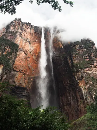
    The FCDO advises against all travel to parts of this region. Check the FCDO travel advice, linked on the country page, before planning.In Canaima National Park in south-eastern Venezuela, Angel Falls plunges 979 m from the Auyán-tepui table mountain; Guinness and Britannica list it as the highest waterfall on Earth. The park and its tepuis have been a UNESCO World Heritage Site since 1994 and cover around 30,000 km².There is no road to Canaima: visitors fly from Ciudad Bolívar or Puerto Ordaz to the village on the Laguna de Canaima. In 2009 the then president Hugo Chávez suggested naming the falls after the Pemón name Kerepakupai Merú; they were not renamed by decree.

    Stratokumulus·CC BY 4.0

    Nationalpark Mochima

    Nationalpark Mochima

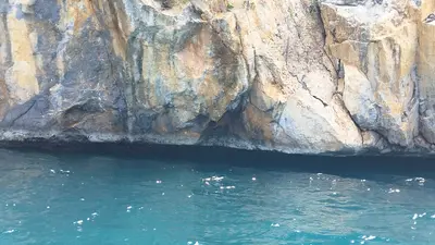
    For this area, the FCDO advises against travel unless it is essential. Check the FCDO travel advice, linked on the country page, before planning.Founded in 1973, Mochima National Park protects around 950 km² of coast, bays and islands between Puerto La Cruz and Cumaná; a good half of it is sea. Boat trips to island beaches such as Playa Blanca and Isla de Plata and snorkelling in clear water are the reasons to come.The western part belongs to Anzoátegui state, the eastern part to Sucre. Gateways are Puerto La Cruz, the village of Mochima and Santa Fe.

    Warairarepano&Guaicaipuro·CC0

    Isla Margarita

    Isla Margarita

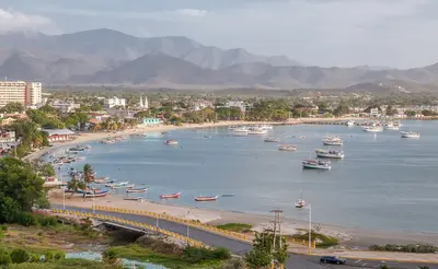
    For this area, the FCDO advises against travel unless it is essential. Check the FCDO travel advice, linked on the country page, before planning.At around 1,020 km², Isla Margarita is Venezuela's largest Caribbean island and, together with Coche and Cubagua, forms the state of Nueva Esparta. Beaches such as Playa El Agua in the north-east and the windsurfing spot of El Yaque in the south, colonial-era forts and the mangrove lagoon of La Restinga make it the country's classic beach destination.The capital is La Asunción, the largest town Porlamar, with Santiago Mariño airport nearby. Since late June 2026 the car ferry from Puerto La Cruz has been running to the island again.

    Wilfredor·CC0

    Los Llanos

    Los Llanos

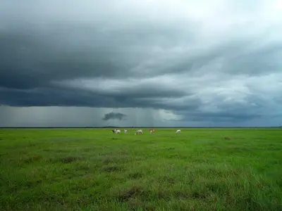
    The FCDO advises against all travel to parts of this region. Check the FCDO travel advice, linked on the country page, before planning.The Llanos are vast savannas in the interior between the Andes and the Orinoco, shaped by cattle ranching since colonial times. Capybaras, caimans, anacondas and large flocks of birds make them a well-known wildlife-watching area.The main gateway, San Fernando de Apure, lies in Apure state on the border with Colombia. In the rainy season, roughly April to November, parts of the plain are flooded and many roads become impassable.

    Crucifix Jean-Luc jlcrcfx·CC0

    Your next steps

    Ciudad Bolívar is in Venezuela. Ways to carry on from here.

    • More in Venezuela

      Highlights, areas, routes and the best time to travel for all of Venezuela.

      Venezuela travel guide
    • Round trips with Ciudad Bolívar

      One route passes through Ciudad Bolívar, with stops, nights and a map.

      See the round trip

    Sources & method

    • Photos: Wikimedia Commons. Each photo carries its credit.
    • Place data such as addresses and ratings comes from Google Maps.
    • The content is based on web research from public, traceable sources. How the content is made · The role of AI