Fernweh: Home
ExploreGuideDestinationsMy tripsMy trip
de|en
All Places & RegionsRound tripsNight trains in EuropeAll highlightsAbout FernwehFAQPrivacy PolicyImprint
Download on the App StoreGet it on Google Play
ExploreGuideDestinationsMy tripsMy trip
    • Places in the region
    • Getting around
    • Nearby
    Los Llanos

    Crucifix Jean-Luc jlcrcfx / Wikimedia Commons / CC0

    Venezuela

    Los Llanos

    Region

    The FCDO advises against all travel to parts of this region. Check the FCDO travel advice, linked on the country page, before planning.

    by Felix Gillen

    1. Home
    2. Destinations
    3. Venezuela
    4. Los Llanos
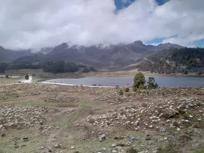
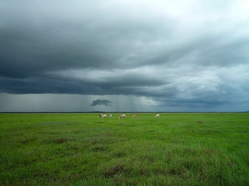
    The FCDO advises against all travel to parts of this region. Check the FCDO travel advice, linked on the country page, before planning.The Llanos are vast savannas in the interior between the Andes and the Orinoco, shaped by cattle ranching since colonial times. Capybaras, caimans, anacondas and large flocks of birds make them a well-known wildlife-watching area.The main gateway, San Fernando de Apure, lies in Apure state on the border with Colombia. In the rainy season, roughly April to November, parts of the plain are flooded and many roads become impassable.
    Venezuela travel guideRound trips in VenezuelaPlan a trip with Los Llanos

    Contents

    • Places in the region
    • Getting around
    • Nearby

    Sights in Los Llanos

    Discover the most important sights and attractions

    San Fernando de Apure

    The capital of Apure state is located on a bend of the Río Apure and serves as a transport hub for the southern Llanos. Alexander von Humboldt made a stop here in March 1800. Points of interest include the restored Palacio de los Barbarito on Plaza Camejo, now a museum with original tiles, and the Cathedral Nuestra Señora del Carmen, consecrated in 1969.
    Open in Google Maps
    National Park

    Aguaro-Guariquito National Park

    Established in 1974, the national park in the south of Guárico state protects approximately 5,860 km² of open savanna with rivers, lagoons, morichales, and slowly migrating white sand dunes. Its inhabitants include capybaras, giant anteaters, white-tailed deer, river dolphins, and giant otters. The dry season is approximately from November to March.
    Open in Google Maps
    National Park

    Santos Luzardo National Park (Cinaruco-Capanaparo)

    Founded in 1988, the National Park in southern Apure state covers about 5,840 km² of savanna between the Capanaparo and Cinaruco rivers, to their mouth into the Orinoco. It lies near the Colombian border; note the travel advisory from the Foreign Office.
    Open in Google Maps

    Getting there and when to go

    Check the FCDO travel advice for this region before planning.GatewaysBarinas is a transport hub with an airport; San Fernando de Apure on the Río Apure is the capital of Apure state.Best time for wildlifeIn the dry season the animals gather at the last waterholes and are easier to see. In the late rainy season, roughly July to November, many roads are impassable.

    Nearby

    Nationalpark Henri Pittier und Choroní

    For this area, the FCDO advises against travel unless it is essential. Check the FCDO travel advice, linked on the country page, before planning.Henri Pittier National Park in Aragua state was established in 1937 as Venezuela's first national park and covers around 1,078 km², from the cloud forests of the coastal range down to the Caribbean. With around 580 recorded bird species, it is regarded as one of the richest birding areas in the country.Roads cross the mountains from Maracay to the coast: to Choroní with its colonial village and the fishing village of Puerto Colombia, and to Bahía de Cata.
    Caracas

    Caracas

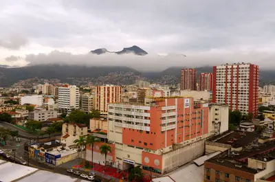
    For this area, the FCDO advises against travel unless it is essential. Check the FCDO travel advice, linked on the country page, before planning.Venezuela's capital lies at around 900 m in a valley between the Caribbean coast and the Ávila massif. Of particular interest to travellers are Carlos Raúl Villanueva's Ciudad Universitaria, a UNESCO World Heritage Site since 2000, and the old town around Plaza Bolívar with the house where Simón Bolívar was born.The earthquakes of 24 June 2026 damaged several historic buildings in Caracas, including the cathedral, the Panteón Nacional and parts of the university city; the cable car up the Ávila has been out of service since then. Check what is open before you visit.

    Joaquim Pacheco·Pexels

    Morrocoy National Park

    For this area, the FCDO advises against travel unless it is essential. Check the FCDO travel advice, linked on the country page, before planning.Morrocoy National Park on the Caribbean coast of Falcón state has protected cays, mangroves and coral reefs since 1974. It is about four hours by car from Caracas, which makes it the classic beach destination on the mainland.The gateways are Tucacas and Chichiriviche, from where boats run to cays such as Cayo Sombrero and Cayo Sal. Since February 2026 visitors have had to register via an app.
    Sierra Nevada de Mérida

    Sierra Nevada de Mérida

    For this area, the FCDO advises against travel unless it is essential. Check the FCDO travel advice, linked on the country page, before planning.The Sierra Nevada de Mérida is the high mountain range of the Venezuelan Andes, home to Pico Bolívar, the country's highest peak at almost 5,000 m. Páramo uplands, glacial lakes such as Laguna de Mucubají and remote mountain villages such as Los Nevados make it a hiking region.Sierra Nevada National Park was established in 1952 and covers around 2,760 km² in the states of Mérida and Barinas. The starting point is the university city of Mérida.

    TehFrog·CC BY-SA 4.0

    Mérida

    Mérida

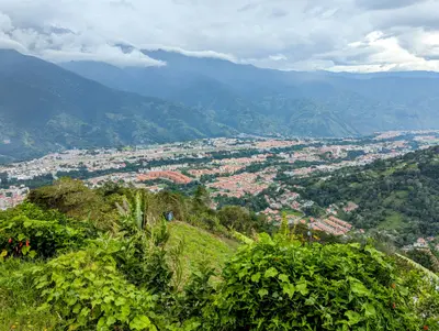
    For this area, the FCDO advises against travel unless it is essential. Check the FCDO travel advice, linked on the country page, before planning.Mérida in the Venezuelan Andes, founded in 1558, is a lively university city at just over 1,600 m and the gateway to the Sierra Nevada. From here the Mukumbarí cable car climbs to the 4,765 m Pico Espejo.The Universidad de Los Andes grew out of a seminary founded in 1785 and still shapes city life today. Around Plaza Bolívar and its cathedral are museums of pre-Columbian and colonial art.

    Jhon Vielma·Unsplash

    Your next steps

    Los Llanos is in Venezuela. Ways to carry on from here.

    • More in Venezuela

      Highlights, areas, routes and the best time to travel for all of Venezuela.

      Venezuela travel guide
    • Round trips in Venezuela

      Ready-made routes through Venezuela, with stops, nights and a map.

      See the routes
    • Plan a trip with Los Llanos

      The Guide asks about season, length and who is coming, and suggests a trip with Los Llanos.

      Plan the trip

    Sources & method

    • Photos: Wikimedia Commons. Each photo carries its credit.
    • Place data such as addresses and ratings comes from Google Maps.
    • The content is based on web research from public, traceable sources. How the content is made · The role of AI