Fernweh: Home
ExploreGuideDestinationsMy tripsMy trip
de|en
All Places & RegionsRound tripsNight trains in EuropeAll highlightsAbout FernwehFAQPrivacy PolicyImprint
Download on the App StoreGet it on Google Play
ExploreGuideDestinationsMy tripsMy trip
    • Places in the region
    • Recommendations
    • Getting around
    • Nearby
    Sierra Nevada de Mérida

    TehFrog / Wikimedia Commons / CC BY-SA 4.0, mod.

    Venezuela

    Sierra Nevada de Mérida

    Region

    For this area, the FCDO advises against travel unless it is essential. Check the FCDO travel advice, linked on the country page, before planning.

    by Felix Gillen

    1. Home
    2. Destinations
    3. Venezuela
    4. Sierra Nevada de Mérida
    For this area, the FCDO advises against travel unless it is essential. Check the FCDO travel advice, linked on the country page, before planning.The Sierra Nevada de Mérida is the high mountain range of the Venezuelan Andes, home to Pico Bolívar, the country's highest peak at almost 5,000 m. Páramo uplands, glacial lakes such as Laguna de Mucubají and remote mountain villages such as Los Nevados make it a hiking region.Sierra Nevada National Park was established in 1952 and covers around 2,760 km² in the states of Mérida and Barinas. The starting point is the university city of Mérida.
    Venezuela travel guideRound trips in VenezuelaPlan a trip with Sierra Nevada de Mérida

    Contents

    • Places in the region
    • Recommendations
    • Getting around
    • Nearby

    More places in Sierra Nevada de Mérida

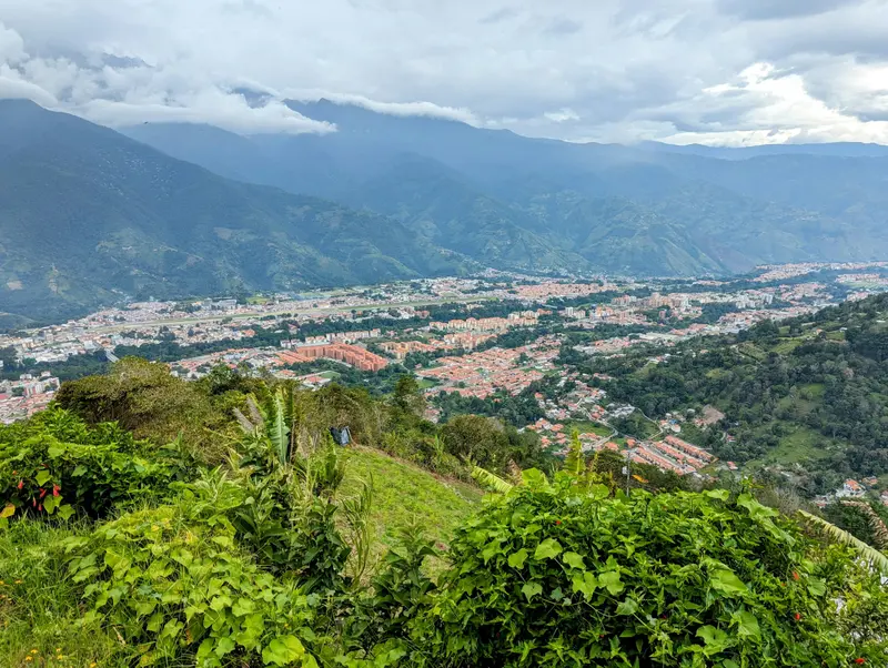
    Mérida

    Jhon Vielma·Unsplash

    Mérida

    For this area, the FCDO advises against travel unless it is essential. Check the FCDO travel advice, linked on the country page, before planning.Mérida in the Venezuelan Andes, founded in 1558, is a lively university city at just over 1,600 m and the gateway to the Sierra Nevada. From here the Mukumbarí cable car climbs to the 4,765 m Pico Espejo.The Universidad de Los Andes grew out of a seminary founded in 1785 and still shapes city life today. Around Plaza Bolívar and its cathedral are museums of pre-Columbian and colonial art.

    Sights in Sierra Nevada de Mérida

    Discover the most important sights and attractions

    Natural Feature

    Pico Bolívar

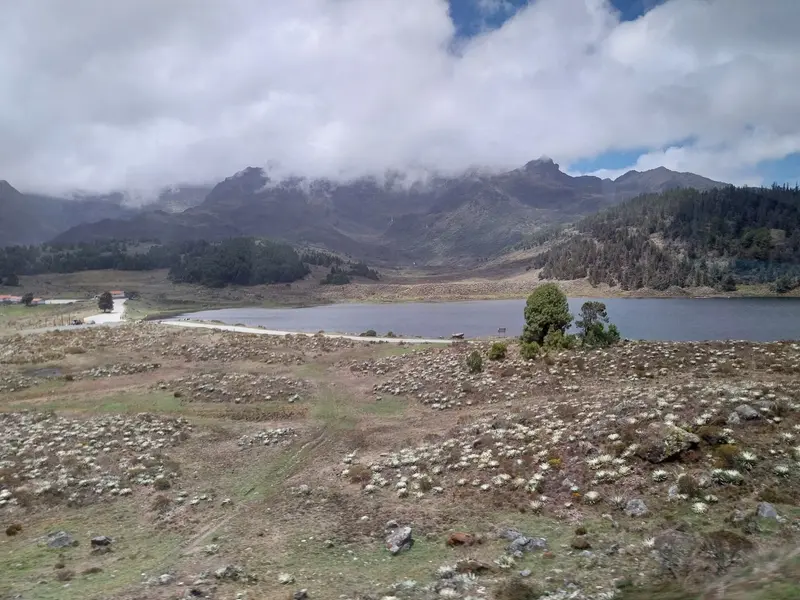
    At almost 5,000 m (Britannica: 4,978 m), Pico Bolívar is Venezuela’s highest peak, situated in Sierra Nevada National Park above Mérida. Its final glaciers vanished around 2012.
    Open in Google Maps
    National Park

    Laguna de Mucubají

    The glacier lake is in the National Park's Páramo, 2 km from Apartaderos on the Barinas road. A visitor center and hiking trails open up the area, where five lakes lie.
    Open in Google Maps

    Los Nevados

    The remote mountain village, formerly a Spanish outpost, offers simple posadas. A classic tour from Loma Redonda cable car station descends by mule or horse in four to five hours, with a return to Mérida by Jeep.
    Open in Google Maps
    Natural Feature

    Pico Humboldt

    Venezuela's second-highest peak is over 4,900 m high. Its remnant glacier was deemed too small to be a glacier in 2024, and Venezuela has had no glaciers since.
    Open in Google Maps

    Jají

    The mountain village west of Mérida is a popular excursion destination. It dates back to the 16th century and was reconstructed as a colonial village from 1968 to 1971.
    Open in Google Maps

    Arrival and On the Go

    By Cable Car to the High MountainsThe Mukumbarí cable car runs from Mérida in four sections via La Montaña, La Aguada, and Loma Redonda (4,045 m) to Pico Espejo (4,765 m). From Loma Redonda, it's a four-to-five-hour journey by mule or horse to Los Nevados; the return to Mérida is usually by Jeep.On the TransandinaLaguna de Mucubají is situated about 2 km from Apartaderos, on the road to Barinas, and offers a visitor center with hiking trails. Bring warm clothing for the Páramo; in the high mountains, it's cold even in the tropics.

    Nearby

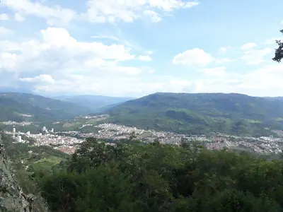
    Coro

    Coro

    For this area, the FCDO advises against travel unless it is essential. Check the FCDO travel advice, linked on the country page, before planning.Coro in north-western Venezuela, founded in 1527 as Santa Ana de Coro, has a colonial old town built of earth: some 600 historic buildings combine local building traditions with Mudéjar style and Dutch techniques. Coro and its port La Vela have been a UNESCO World Heritage Site since 1993, and the sand dunes of Médanos de Coro National Park begin right outside the city.Since 2005 the site has been on the List of World Heritage in Danger because rain and groundwater damage the earthen buildings. The Paraguaná Peninsula lies to the north.

    Waskyria Miranda·Pexels

    Santander

    Santander

    Santander is in the northeast of Colombia, its capital is Bucaramanga. Visitors come for the Chicamocha Canyon, for rafting and canyoning around San Gil, and the colonial town of Barichara.

    TUTO PATALV·Pexels

    San Gil

    San Gil

    San Gil is in Santander, about 300 kilometers north of Bogotá and 95 kilometers south of Bucaramanga. The city is the base for rafting, canyoning, and paragliding in the region, and the gateway to Barichara and the Chicamocha Canyon. Founded in 1689 on the Río Fonce, it is home to around 60,000 residents; El Gallineral Park lies in the heart of the city.

    Pedro Alejandro Ariza Rubiano·CC BY-SA 4.0

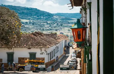
    Barichara

    Barichara

    Barichara is a colonial town in the mountains of Santander Department, northeastern Colombia, 21 km from the adventure town of San Gil. You come for its yellow sandstone houses, cobblestone streets, and the hike on the Camino Real to Guane. Founded in 1705, the town is at around 1,300m; its historic center is a National Monument since 1978.

    Robert Acevedo·Pexels

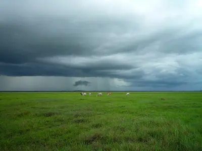
    Los Llanos

    Los Llanos

    The FCDO advises against all travel to parts of this region. Check the FCDO travel advice, linked on the country page, before planning.The Llanos are vast savannas in the interior between the Andes and the Orinoco, shaped by cattle ranching since colonial times. Capybaras, caimans, anacondas and large flocks of birds make them a well-known wildlife-watching area.The main gateway, San Fernando de Apure, lies in Apure state on the border with Colombia. In the rainy season, roughly April to November, parts of the plain are flooded and many roads become impassable.

    Crucifix Jean-Luc jlcrcfx·CC0

    Your next steps

    Sierra Nevada de Mérida is in Venezuela. Ways to carry on from here.

    • More in Venezuela

      Highlights, areas, routes and the best time to travel for all of Venezuela.

      Venezuela travel guide
    • Round trips in Venezuela

      Ready-made routes through Venezuela, with stops, nights and a map.

      See the routes
    • Plan a trip with Sierra Nevada de Mérida

      The Guide asks about season, length and who is coming, and suggests a trip with Sierra Nevada de Mérida.

      Plan the trip
    Sources & method

    • Photos: Wikimedia Commons. Each photo carries its credit.
    • Place data such as addresses and ratings comes from Google Maps.
    • The content is based on web research from public, traceable sources. How the content is made · The role of AI