Fernweh: Home
    ExploreTravel GuidesPlan a tripMy tripLast visited
    de|en
    All Places & RegionsAll highlightsAbout FernwehFAQPrivacy PolicyImprint
    ExploreTravel GuidesPlan a tripMy tripLast visited
    • Neighborhoods & highlights
    • Walking tours
    • Eat & drink
    • Culture
    • Getting around
    • Accommodation
    • Plan trip
    • Nearby
    Gällivare

    Sweden

    Gällivare

    City

    Gällivare, located north of the Arctic Circle in Swedish Lapland, has been a mining town since the construction of the ore railway in the late 19th century.

    by Felix Gillen

    1. Home
    2. Destinations
    3. Sweden
    4. Swedish Lapland (Lapland)
    5. Gällivare
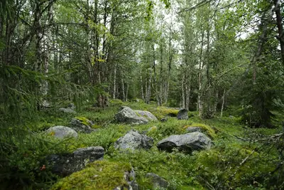
    Gällivare, located north of the Arctic Circle in Swedish Lapland, has been a mining town since the construction of the ore railway in the late 19th century. Here you'll experience the nature of the fells, Sámi culture, and a community undergoing change: The neighbouring town of Malmberget is largely being abandoned due to ore mining. From Dundret, its local mountain, you can see the midnight sun in summer, and in winter, the chances for the Northern Lights are good.

    Sights in Gällivare

    Discover the most important sights and attractions

    1Dundret

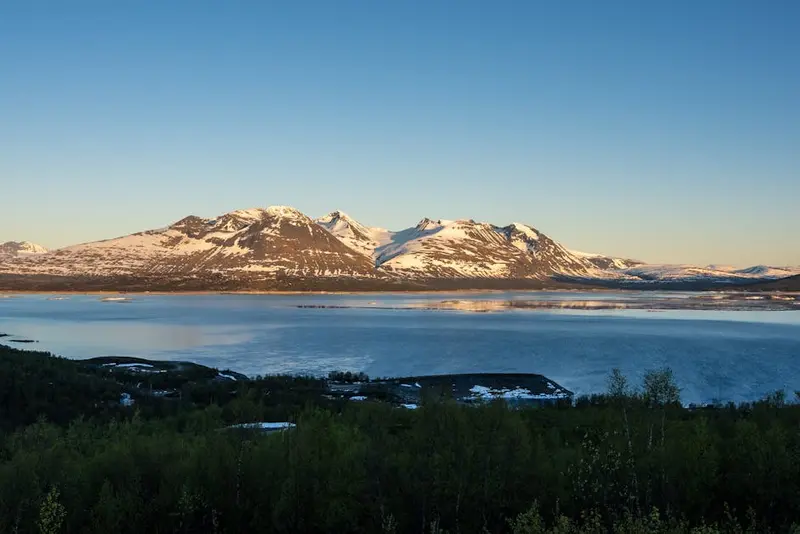
    The local mountain Dundret, south of Gällivare, has been a nature reserve since 1970. In winter, usually from early November to late April, you can ski downhill and cross-country here, and in summer, hike. A road leads to the summit; from there, you can see the Midnight Sun from early June to mid-July and, in clear weather, far across the land.
    Open in Google Maps

    2Gällivare Hembygdsområde

    At Gällivare's Heritage Area (Hembygdsområde), traditional buildings display earlier life in Lapland. Opening hours are seasonal; please inquire ahead.
    Open in Google Maps

    3Gällivare Museum

    The Gällivare Museum on Storgatan is dedicated to the history of the region, including mining, nature, and Sámi culture. A visit helps to put the development of Gällivare and Malmberget into context.
    Open in Google Maps

    City walks in Gällivare

    Curated walking tours through the city's highlights, handpicked by experienced travel journalists.

    Gällivare: Station and Churches

    The short tour begins at the station on the Erzbahn Malmbanan and leads to the Ettöreskyrkan from 1744 on the Vassara älv. Via the Gällivare kyrka, the community's main church, you walk to the Cultural Museum on Storgatan.

    Open in Google Maps
    Stops (4)

    Restaurants & Cafes

    Restaurant Hemma Hos

    Das "Hemma Hos" (Zu Hause bei) macht seinem Namen alle Ehre und empfängt Dich mit einer gemütlichen, einladenden Atmosphäre. Die Küche ist bekannt für ihre bodenständigen, aber raffinierten Gerichte, die oft schwedische Klassiker neu interpretieren. Es ist der perfekte Ort für ein entspanntes Abendessen in freundlicher Umgebung.
    Show on Google Maps

    Kafé & Restaurang Koppar

    Für eine entspannte Kaffeepause oder ein leichtes Mittagessen bist Du im Kafé & Restaurang Koppar genau richtig. Hier findest Du eine Auswahl an frischen Backwaren, Sandwiches und einfachen, aber schmackhaften Gerichten. Die ungezwungene Atmosphäre macht es zu einem beliebten Treffpunkt für Einheimische und Besucher gleichermaßen.
    Show on Google Maps

    Vassara Restaurang

    Das Vassara Restaurang ist eine weitere solide Wahl für eine gute Mahlzeit in Gällivare. Es bietet eine vielfältige Speisekarte mit Fokus auf schwedische Hausmannskost und internationale Gerichte, oft mit lokalen Produkten. Es ist ein zuverlässiger Ort, um Deinen Hunger zu stillen, egal ob zum Mittag- oder Abendessen.
    Show on Google Maps

    Gällivare: History, Culture and Sami Heritage

    Sámi Land and MiningThe area around Gällivare is traditional Sámi reindeer herding land. With the completion of the Iron Ore Line in 1888, iron ore mining in Malmberget grew significantly, and a housing shortage led workers to build simple homes themselves: thus the Kåkstan settlement emerged.A Community MovesBecause the mine is expanding, the Malmberget district is largely being abandoned. Many houses were demolished or relocated to safe ground.LaponiaWest of the town begins the UNESCO World Heritage site Laponia, inscribed in 1996 as a mixed natural and cultural heritage site. It encompasses four national parks and two nature reserves in the municipalities of Gällivare, Jokkmokk, and Arjeplog. Sámi communities still move here every summer with their reindeer herds into the Fjäll and manage the area jointly with authorities. Duodji (handicrafts) and Joik (traditional Sámi singing) are living parts of this culture.

    Exploring Locally

    Walking and CyclingGällivare's town centre is compact and easily explored on foot. In summer, a bicycle is a good option for the surrounding area; in winter, snow and ice hinder progress, so plan extra time.Bus, Train and TaxiBuses from Länstrafiken Norrbotten connect Gällivare with Malmberget and the surrounding towns. Gällivare is located on the Iron Ore Line. Taxis can be ordered by phone; ride-sharing services play a minor role. A road leads to the summit of Dundret.

    Accommodations in Gällivare

    Find perfect stay in Gällivare

    Booking.com* (Affiliate link)
    Search Hotels
    Agoda* (Affiliate link)
    Search Hotels
    Airbnb
    Vacation Rentals

    * Affiliate link: if you book through it, we earn a small commission. The price stays the same for you.

    Campgrounds in Gällivare

    Find perfect campground in Gällivare

    Search via Google Maps
    Campgrounds nearby (15km)
    Camping.info
    Find Campgrounds
    Park4Night
    RV Parks & Camping

    Plan your trip to Gällivare

    Save places, build a route and plan your city trip, all in one place.

    1. 1
      Sunrise over alpine peaks and a sea of clouds
      1234

      Round trip

      12 days · 4 stops

      Saved

      Pick a route

      Pick a ready-made one or save places and plan your own.

      Open bookmarks
    2. 2

      Trip to Gällivare

      Live
      • 1Dundret3 days
      • 2Gällivare Hembygdsområde4 days
      • 3Gällivare Museum5 days
      Budget

      Plan your trip

      The planner sorts stops, days and budget. Plan together in real time.

      Start trip planning
    3. 3
      9:41 No signal
      Gällivare
      Available offline

      Use it on the road

      Download the guide to your phone and use it on site, even offline.

    Nearby

    Swedish Lapland (Lapland)

    Swedish Lapland (Lapland)

    Swedish Lapland is the Arctic part of Sweden: vast forests, fells and lakes, plus the Sámi culture. In winter, Northern Lights chances are good from September to March; in summer, the sun doesn't set from late May to mid-July. Highlights include the ICEHOTEL, the Treehotel, the Kungsleden and the UNESCO World Heritage Site Laponia.
    Jokkmokk

    Jokkmokk

    Jokkmokk, just north of the Arctic Circle in Swedish Lapland, is a centre of Sámi culture. At Ájtte, the Swedish Fjäll and Sámi Museum, you can learn about the Sámi way of life and the nature of the mountain region. The town is known for the Jokkmokk Winter Market, which has been held for over 400 years, always starting on the first Thursday in February and lasting three days; in 2027, the 422nd market will take place from February 4th to 6th. In winter, dog sledding tours and the Northern Lights are a draw; in summer, the Midnight Sun and hiking. For the market period, you should book your accommodation early.
    Kiruna

    Kiruna

    Kiruna is located far north of the Arctic Circle and is inextricably linked to iron ore: The mine of the state-owned LKAB corporation in Mount Kiirunavaara is considered the world's largest and most modern underground iron ore mine. As mining operations advance beneath the city, a new center is emerging approximately three kilometers east of the old downtown, to which historical buildings will also be relocated. In summer, you can experience the Midnight Sun here; in winter, chances of seeing the Northern Lights are good, and the ICEHOTEL in Jukkasjärvi is just a short drive away.
    Treehotel

    Treehotel

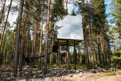
    The Treehotel in Harads, Boden municipality, is a hotel of treehouses nestled in the forest. The individual rooms are designed by Scandinavian architectural firms, including the mirrored Mirrorcube, the Bird’s Nest, the UFO, and the 7th Room designed by Snøhetta. Besides the tree rooms, there is also a guesthouse with a restaurant and activities available all year round.
    Torneträsk

    Torneträsk

    At approximately 330 square kilometers, Lake Torneträsk (Sami Duortnosjávri) is Sweden's sixth-largest lake and is considered Scandinavia's largest fell lake. The lake, approximately 69 kilometers long, reaches depths of up to 168 meters and lies nestled among the mountains north of Kiruna. Along its southern shore lie Abisko, Björkliden, and views of the Lapporten. In winter, observe the Northern Lights here; in summer, hike under the Midnight Sun.

    Sources & method

    • Photos: Pexels. Each photo carries its credit.
    • The content is based on web research from public, traceable sources. How the content is made · The role of AI