Fernweh: Home
ExploreGuideDestinationsMy tripsMy trip
de|en
All Places & RegionsRound tripsNight trains in EuropeAll highlightsAbout FernwehFAQPrivacy PolicyImprint
Download on the App StoreGet it on Google Play
ExploreGuideDestinationsMy tripsMy trip
    • Places in the region
    • Culture
    • Getting around
    • Nearby
    Big Island (Hawaiʻi)

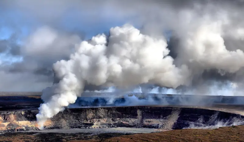
    Photo by Marc Szeglat on Unsplash

    United States

    Big Island (Hawaiʻi)

    RegionNatureCulture

    The island of Hawaiʻi, often called Big Island, is the archipelago's largest. Hawaiʻi Volcanoes National Park features the active volcanoes Kīlauea and Mauna Loa.

    by Felix Gillen

    1. Home
    2. Destinations
    3. United States
    4. Hawaii
    5. Big Island (Hawaiʻi)
    The island of Hawaiʻi, often called Big Island, is the archipelago's largest. Hawaiʻi Volcanoes National Park features the active volcanoes Kīlauea and Mauna Loa. To the north, Maunakea, over 4,200 meters tall, stands as Hawaii's highest point, with summit observatories.The Kona and Kohala west coast is dry and sunny, featuring cultural sites such as the Puʻuhonua o Hōnaunau Place of Refuge and Puʻukoholā Heiau temple. On the humid east side near Hilo, ʻAkaka Falls plunges through the rainforest.
    United States travel guideRound trips in United StatesPlan a trip with Big Island (Hawaiʻi)

    Contents

    • Places in the region
    • Culture
    • Getting around
    • Nearby

    Sights in Big Island (Hawaiʻi)

    Discover the most important sights and attractions

    Hawaiʻi Volcanoes National Park

    “Sulfur dioxide emissions from the Halemaumau vent 04-08-1 1” by Brocken Inaglory / Wikimedia Commons / CC BY-SA 3.0, mod.

    National Park

    Hawaiʻi Volcanoes National Park

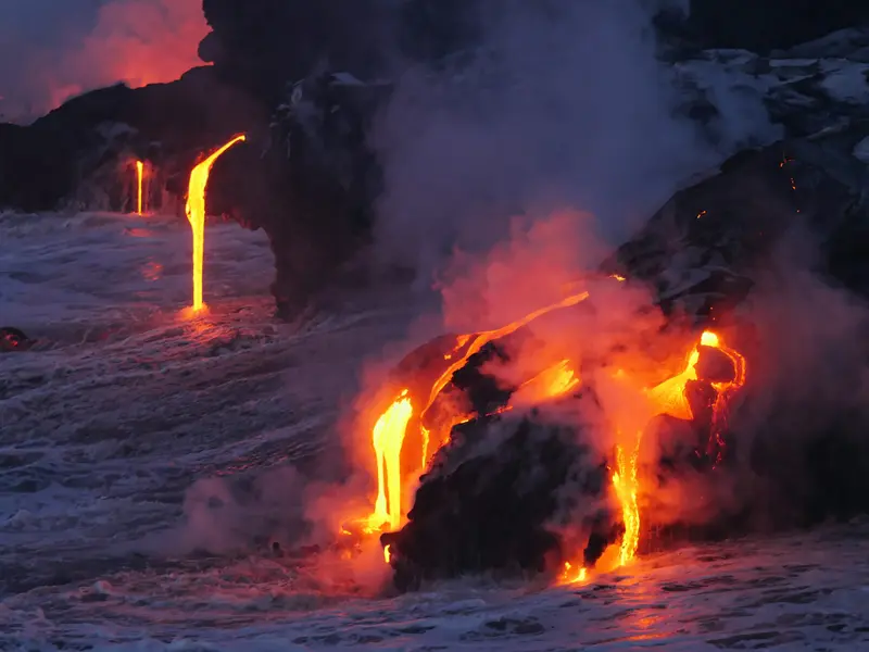
    The park, founded in 1916, encompasses the Kīlauea and Mauna Loa volcanoes and extends from the sea up to over 13,000 feet, nearly 4,000 meters, through six climate zones from rainforest to alpine tundra. Since December 2024, Kīlauea has been erupting in episodes with high lava fountains in the Halemaʻumaʻu crater. Crater Rim Drive and Chain of Craters Road lead to viewpoints, sulfur fields, lava tubes, and the Puʻuloa petroglyph field. The park gives daily updates on lava visibility.
    Open in Google Maps
    Maunakea and Visitor Information Station

    Generic1139 / Wikimedia Commons / CC BY 4.0, mod.

    Point of Interest

    Maunakea and Visitor Information Station

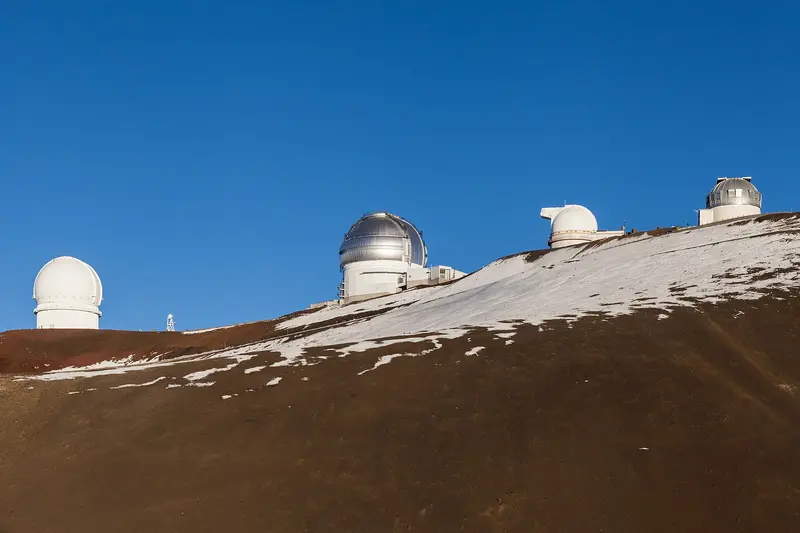
    The volcano, dormant for approximately 4,000 years, is Hawaii's highest point at over 4,200 meters and the most sacred mountain for Hawaiians, with over a dozen large telescopes on its summit. The visitor station at around 2,800 meters is open daily from 9 AM to 9 PM and offers free stargazing in the evening. Above this point, access is only by 4WD vehicle; operators advise against children under 13, pregnant women, and those with health conditions traveling beyond the station due to the altitude.
    Open in Google Maps
    Park

    ʻAkaka Falls State Park

    North of Hilo, the ʻAkaka Falls plunges 442 feet, or about 135 meters, into a rainforest gorge. A nearly 650-meter loop trail leads through dense vegetation to the viewpoint. Open daily 8:30 AM to 5:00 PM; non-Hawaii residents pay a $5 entrance fee and $10 for parking, card payment only, preferably online in advance, as cell reception is weak.
    Open in Google Maps
    Puʻuhonua o Hōnaunau National Historical Park

    Carol M. Highsmith / Wikimedia Commons / public domain

    Park

    Puʻuhonua o Hōnaunau National Historical Park

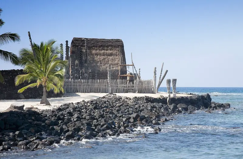
    The sanctuary at Hōnaunau Bay on Kona's south coast offered protection until the Kapu system was abolished in 1819, for all who had broken a taboo or were fleeing; after absolution by priests, they were permitted to leave. Across 170 hectares, you'll see the sacred district, fishponds, a royal palm grove, and remnants of Kiʻilae village, to which an approximately 1.6-kilometer path over lava leads.
    Open in Google Maps
    Historic Landmark

    Puʻukoholā Heiau National Historic Site

    Kamehameha the Great had the temple built from 1790 for the war god Kūkāʻilimoku; it is one of the last great sanctuaries before the arrival of the Europeans. The stones are said to have been passed along a human chain of about 30 kilometers from the Pololū Valley, and the mortarless walls are up to six meters high. A circular path just under a kilometer long leads past this and the Mailekini Heiau.
    Open in Google Maps
    Park

    Kaloko-Honokōhau National Historical Park

    North of Kailua-Kona, the park protects about 450 hectares of coast and ocean, encompassing centuries-old fishponds, lava rock fish traps, wetlands for native birds, and resting places for Green Sea Turtles. An about five-kilometer coastal path leads past petroglyphs, the ʻAimakapā Pond, the restored ʻAiʻōpio fish trap, and Kaloko Pond. Keep your distance from the turtles.
    Open in Google Maps

    Culture

    Sacred Sites and the Kapu SystemUntil 1819, the Kapu system, with its taboos, regulated life on the islands. Anyone who broke a taboo could seek refuge at a sanctuary like Puʻuhonua o Hōnaunau and be absolved there by priests. Maunakea is considered by Hawaiians to be the most sacred mountain, the realm of the gods.Kamehameha's TempleFrom 1790, Kamehameha the Great had the Puʻukoholā Heiau temple built on the Kohala coast for the war god Kūʻkāʻilimoku. The stones are said to have been passed along a human chain stretching about 30 kilometers from the Pololū Valley; it was built without mortar and within a year.Fishponds and Ancient PathsOn the Kona coast, the fishponds of Kaloko-Honokōhau show how Hawaiians sourced their food from the sea. The historic Ala Kahakai trail follows over 280 kilometers of old coastal paths between settlements, but is only accessible in sections.

    Exploring locally

    By Rental CarThe destinations are far apart; you'll hardly get around without a rental car. Plan separate days for the west side (Kona and Kohala) and the east side (Hilo and the Volcanoes National Park).MaunakeaThe Visitor Station at around 2,800 meters is open daily from 9 AM to 9 PM, with free stargazing in the evening.Above the station, the road is unpaved and steep; only four-wheel drive vehicles are permitted. Depart with at least a half-full tank.Children under 13, pregnant women, and individuals with health limitations are advised by operators not to drive beyond the station. Current and binding health advisories can be found from the Federal Foreign Office.Volcanoes National ParkWhether lava is currently visible at Kīlauea is reported daily by the park on nps.gov. Eruptions occur in episodes with lava fountains up to around 200 meters, with Episode 56 beginning on November 5, 2026.

    Nearby

    Maui

    Maui

    Maui is Hawaii's second-largest island, stretching from the volcanic summit of Haleakalā at over 3,000 meters to the beaches of Kīhei, Wailea and Kāʻanapali. Between the two volcanic massifs lies the flat Central Valley with Kahului, home to the airport, and the older town of Wailuku. In the east, the Road to Hāna winds through rainforest and past waterfalls, while lavender and protea grow in the Upcountry highlands.Lahaina after the fireOn August 8, 2023, a wildfire destroyed the historic town of Lahaina on the west coast, killing more than 100 people. Rebuilding is underway. Since August 1, 2026, Front Street has been open to traffic again, while some side streets and the harbor are still construction sites. Stay out of fenced-off areas and off private property, and treat the town with respect. Maui County posts current updates at mauirecovers.org.Best time to visitMaui is warm year-round. From December to April, humpback whales come to calve in the shallow waters between Maui, Lānaʻi and Molokaʻi, and you often see them breaching from the shore. In winter, North Pacific swells bring big waves to the north coast. The north and east sides are wetter, the south and west drier and sunnier.SafetyMany beaches have no lifeguards, and currents and surf can be dangerous. Only go in where you can judge the conditions. For general safety and entry advice for the USA, see the UK Foreign Office (FCDO) travel advice.
    Michal Vaško·Pexels

    Hawaii

    Hawaii

    Hawaii is an island chain in the Pacific, approximately 3,200 km southwest of the US mainland, and has been the 50th state since August 21, 1959. You travel here for the beaches, active volcanoes, and tropical sea cliffs, spread across several very distinct islands.Oʻahu is home to Honolulu, Waikīkī, and Pearl Harbor. Maui features Haleakalā and the Road to Hana, while Kauaʻi offers the Waimea Canyon and the Nā-Pali Coast. On the largest island, Hawaiʻi or Big Island, Maunakea rises more than 4,200 m above sea level.Two national parks protect volcanic landscapes: Hawaiʻi Volcanoes on Big Island, featuring Kīlauea and Mauna Loa, and Haleakalā on Maui, which is home to more endangered species than any other US national park. Kīlauea has been in a phase of recurring lava fountains in the Halemaʻumaʻu crater since December 2024; its 56th episode began on November 5, 2026.

    Christian Joudrey·CC0

    Honolulu

    Honolulu

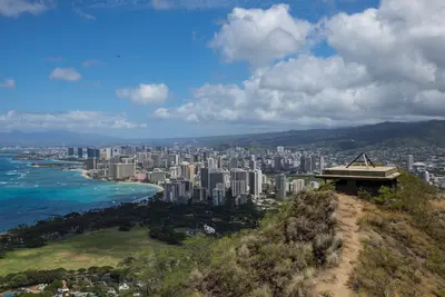
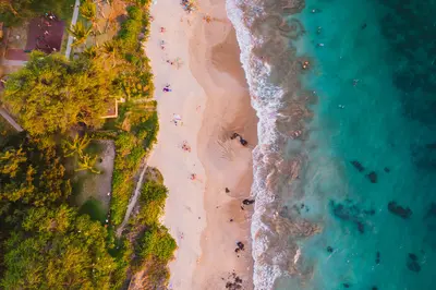
    Honolulu on the island of O‘ahu has been Hawaii's capital since 1845, first of the Kingdom, now of the US state, and has around 350,000 residents (2020 Census). You come for Waikīkī with its city beach in front of the volcanic cone Diamond Head (Lē‘ahi), for the Pearl Harbor Memorial, the ‘Iolani Palace and the Bishop Museum, and as a starting point for tours across O‘ahu to the North Shore.In Waikīkī, between the Ala Wai Canal and the Pacific, most of the island's hotels are located. West of it lie the Ala Moana shopping center, Kaka‘ako, Downtown with its government district, and Chinatown.Good to knowReservations: For Diamond Head (visitors without Hawaii residency), Hanauma Bay, and the USS Arizona Memorial in Pearl Harbor, you need advance tickets with a time slot. They are often quickly booked up.Climate: It's warm all year round; most rain falls from October to early April.Taxes: As of January 2026, the state transient accommodations tax is 11 percent, plus county tax, sales tax, and often resort fees.

    Stephen Leonardi·Pexels

    Kauaʻi

    Kauaʻi

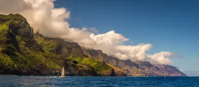
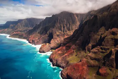
    Kauaʻi, the northernmost of the main Hawaiian Islands, is known for its landscapes: the Waimea Canyon, considered the Grand Canyon of the Pacific, and the roadless Nā Pali Coast in the northwest, which you can experience on foot, by boat, or from the air. The Wailua is the islands' only navigable river.Following Hurricane Lowell in autumn 2026, many parks have reopened, but some trails and campgrounds remain closed. Before every outing, check Hawaii State Parks' advisories.

    Roberto Nickson·Pexels

    Big Sur & Highway 1

    Big Sur & Highway 1

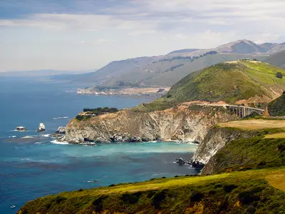
    Big Sur is the roughly 70-mile stretch of California coast between Carmel and San Simeon where the Santa Lucia Mountains drop straight into the Pacific. You come for Highway 1, which winds along sheer cliffs, over concrete arch bridges and past redwood canyons.There are no towns here. About 2,000 people live on the coast year-round, plus a few small clusters of lodges, restaurants, gas stations and campgrounds. The biggest is Big Sur Village in the Big Sur River valley, about 26 miles south of Carmel. There are no supermarkets or chains, so stock up in Carmel or Monterey.Don't treat Big Sur as a two-hour drive-through. Bixby Creek Bridge, Pfeiffer Beach, McWay Falls and a short hike fill a whole day, and a night in the valley makes the trip far more relaxed. It's busiest on summer weekends and holiday weekends like Memorial Day and Labor Day, quietest on spring and fall weekdays. In summer, thick fog often sits on the coast until around midday.After the 2026 firesIn August 2026 two large wildfires burned in the mountains above the coast in the Los Padres National Forest: the Timber Fire (from August 8) in the north around the Big Sur valley, and the Plaskett Fire (from August 26) in the south. About 40 miles of Highway 1 closed on August 27; the northern section reopened September 3, and the full road has been open again since mid-September. Pfeiffer Big Sur State Park reopened October 16. Many trails in the mountains east of Highway 1 remain closed until further notice.

    Calilover·public domain

    Your next steps

    Big Island (Hawaiʻi) is in United States. Ways to carry on from here.

    • More in United States

      Highlights, areas, routes and the best time to travel for all of United States.

      United States travel guide
    • Round trips in United States

      Ready-made routes through United States, with stops, nights and a map.

      See the routes
    • Plan a trip with Big Island (Hawaiʻi)

      The Guide asks about season, length and who is coming, and suggests a trip with Big Island (Hawaiʻi).

      Plan the trip

    Sources & method

    • Photos: Wikimedia Commons, Unsplash. Each photo carries its credit.
    • Place data such as addresses and ratings comes from Google Maps.
    • The content is based on web research from public, traceable sources. How the content is made · The role of AI