ExploreTravel GuidesPlan a trip
    de|en
    All Places & RegionsAbout FernwehFAQPrivacy PolicyImprint
    ExploreTravel GuidesPlan a trip
    • Places in the region
    • Getting around
    • Nearby
    Hawaii

    United States

    Hawaii

    Region

    Hawaii is an island chain in the Pacific, approximately 3,200 kilometers southwest of the US mainland, and since 1959, the 50th US state.

    1. Home
    2. Destinations
    3. United States
    4. Hawaii
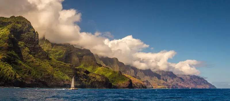
    Hawaii is an island chain in the Pacific, approximately 3,200 kilometers southwest of the US mainland, and since 1959, the 50th US state. You travel here for the beaches, active volcanoes, and tropical cliffs, spread across several very distinct islands.Oʻahu is home to the capital Honolulu and Pearl Harbor, where the Japanese attack on December 7, 1941, drew the US into World War II. Maui is called the “Valley Isle,” Kauaʻi the “Garden Isle,” and the largest island is Hawaiʻi or “Big Island.” There, Mauna Kea rises 4,205 meters above sea level.The two national parks protect volcanic landscapes: Hawaiʻi Volcanoes on Big Island includes Kīlauea and Mauna Loa, which are among the world's most active volcanoes. Haleakalā on Maui protects more endangered species than any other US National Park. On Kauaʻi, the Nā-Pali Coast cliffs drop up to 1,200 meters to the sea.

    Sights in Hawaii

    Discover the most important sights and attractions

    Hawaiʻi Volcanoes National Park
    National Park

    Hawaiʻi Volcanoes National Park

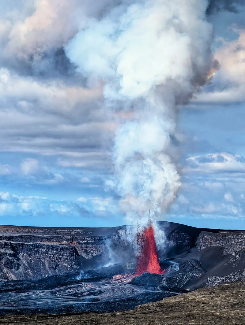
    On Big Island, the park includes the Kīlauea and Mauna Loa volcanoes, two of the world's most active. The Crater Rim Drive and Chain of Craters Road pass by lava fields, steam vents, and lava tubes to the coast. The park reports daily on lava visibility.
    Open in Google Maps
    Haleakalā National Park
    National Park

    Haleakalā National Park

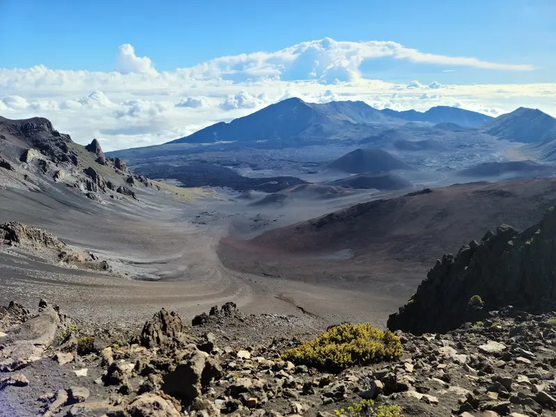
    Maui's 3,055m-high volcano is famous for sunrises above a sea of clouds. You need a pre-booked online permit for summit access between 3 and 7 AM. Up top, it gets very cold, so bring warm clothes.
    Open in Google Maps
    Pearl Harbor National Memorial
    Museum

    Pearl Harbor National Memorial

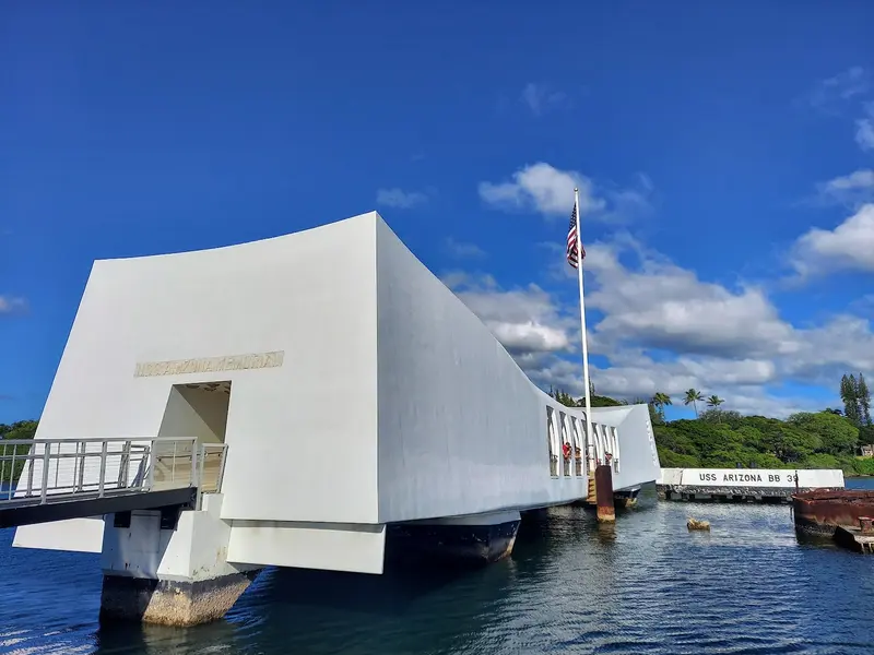
    Memorial on Oʻahu commemorating the Japanese attack of December 7, 1941, featuring a museum and the USS Arizona Memorial above the sunken battleship. Admission is free; advance online booking is highly recommended for the boat trip to the Memorial.
    Open in Google Maps
    Waikīkī Beach
    Attraction

    Waikīkī Beach

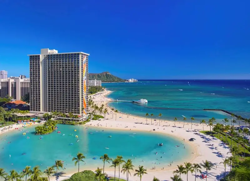
    Honolulu's famous city beach, fringed by palms and hotels, with gentle waves perfect for learning to surf. At Kuhio Beach, a statue commemorates surf legend Duke Kahanamoku.
    Open in Google Maps
    Diamond Head State Monument
    Attraction

    Diamond Head State Monument

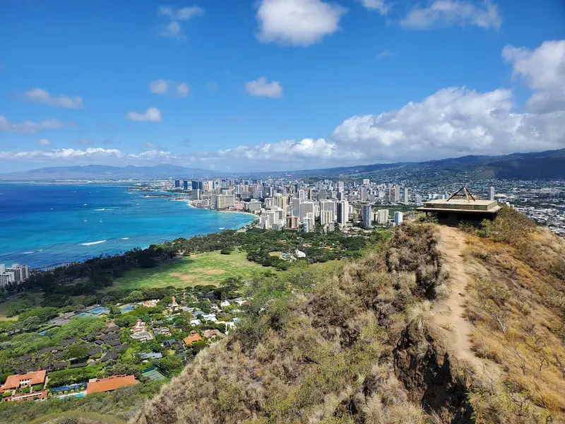
    The tuff crater at the east end of Waikīkī is Honolulu's landmark. A steep path with stairs and a tunnel leads up to old military fortifications and a panoramic view over the city. Non-resident visitors must reserve online in advance.
    Open in Google Maps

    Arrival and Moving About

    International flights and most flights from the mainland land in Honolulu. Between the islands, you travel by plane, then by rental car on each island.Airports: Daniel K. Inouye International in Honolulu (HNL) and Kahului on Maui (OGG).Na Pali Coast: By land, it is only accessible via the 18-kilometer-long Kalalau Trail; an overnight permit is required. Boat tours depart from Port Allen and Hanalei Bay.Time: Hawaii does not observe daylight saving time.Travel Season: year-round. The dry season lasts from May to October, the rainy season from October to April.
    Nearby

    San Francisco

    San Francisco

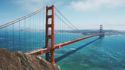
    San Francisco lies in Northern California at the northern tip of a peninsula between the Pacific and San Francisco Bay. The city, founded in 1776 with around 874,000 residents, is known for its steep hills, the Cable Cars, and the Golden Gate Bridge.Opened in 1937, the 2.7-kilometer-long Golden Gate Bridge connects the city with Marin County. The Cable Cars, a National Historic Landmark since 1964, operate on three lines, the two Powell lines running from Market Street to Fisherman's Wharf. Chinatown is considered North America's oldest Chinatown. Ferries to the former prison island Alcatraz depart from Pier 33; day tickets for adults cost 47.95 dollars and can be booked up to 90 days in advance.BART, Caltrain, light rail, and buses serve the city and region. Expect fog and cool winds from the Golden Gate: In summer, San Francisco is one of the coolest major cities in the USA; a jacket is advisable even in July.
    Malibu

    Malibu

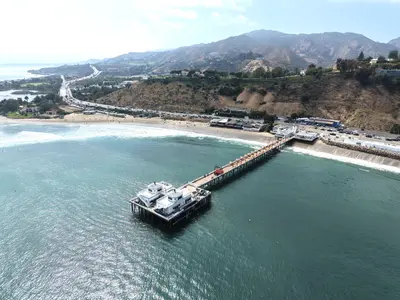
    Malibu is not a city with a central core, but rather a 34-kilometer-long stretch of coastline along the Pacific Coast Highway, nestled between the Santa Monica Mountains and the Pacific Ocean. Officially, Malibu lies outside the city of Los Angeles, only establishing itself as its own municipality in 1991. It is known for its surf beaches, rocky coves, and rugged cliffs.The fires of December 2024 and January 2025 hit Malibu hard; the Palisades Fire destroyed a large portion of the beach houses in the eastern part of the area. The Pacific Coast Highway has been open to all traffic again since May 2025, reconstruction is ongoing, and many restaurants have only gradually reopened.On the eastern edge of the coastline lies the Getty Villa, a recreation of the Roman Villa dei Papiri from Herculaneum, housing around 44,000 Greek, Roman, and Etruscan antiquities. Further west, Point Dume juts into the sea, a headland at the northern end of Santa Monica Bay. From February into spring, you can often spot gray whales and humpback whales on their migration from here. Approximately 16 kilometers west of the center, paths and stairs lead down to El Matador State Beach, a small cove nestled beneath the cliffs.For Malibu, you'll need a full day and preferably a car. The beaches are emptier in the mornings, and a sunset at El Matador or on Point Dume makes for a perfect end to the day.
    California

    California

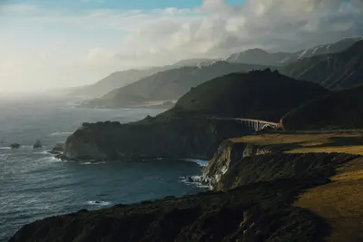
    California stretches along the Pacific coast between Oregon and Mexico, and with around 39.4 million inhabitants, it is the most populous state in the USA. You come here for its approximately 1,350 kilometers of coastline, for metropolises like Los Angeles, San Francisco, and San Diego, and for high mountains, deserts, and redwood forests that lie close to each other.In the east, the Sierra Nevada stretches through the state. Its highest peak is Mount Whitney at 4,421 meters, the highest mountain in the USA outside Alaska. Just over 100 kilometers away lies Death Valley: Badwater Basin is located around 85 meters below sea level, and in 1913, 56.7 °C was measured here. On the coast, Highway 1 in Big Sur follows the steep cliffs above the Pacific for 114 kilometers.California has nine National Parks. In Sequoia National Park stands the General Sherman Tree; Redwood National Park in the north protects almost half of the remaining coast redwoods; and Joshua Tree is located at the transition of the Mojave and Colorado Deserts. Approximately 90 percent of US wine comes from California.
    Yosemite National Park

    Yosemite National Park

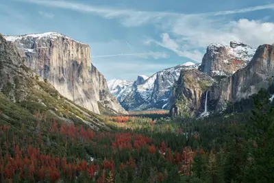
    The Yosemite National Park is located in the Sierra Nevada in California, about 300 km east of San Francisco. You go there for the Yosemite Valley with its steep rock faces, high waterfalls, and the giant sequoias in the south of the park.Above the valley, El Capitan rises about 914 m, and the Yosemite Falls plunge 739 m in total over three tiers. Near the south entrance, the Mariposa Grove hosts over 500 mature giant sequoias; a shuttle connects the parking lot and the grove. The park has existed since 1890 and has been a UNESCO World Heritage site since 1984.Admission costs 35 US dollars per car for 7 days. Visitors not residing in the USA pay an additional 100 US dollars per person from age 16, unless they have the America the Beautiful annual pass (250 US dollars). An entry reservation is not required in 2026. Tioga Road and Glacier Point Road are usually closed from November until the end of May or early June.
    Santa Monica

    Santa Monica

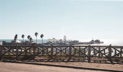
    Santa Monica is a city by the sea in its own right, but for most visitors, it's where Los Angeles meets the Pacific. Wide sandy beaches, a bike path along the water, palm trees on the bluff above the coastal road. The center is compact and easily explored on foot, which is rare in LA.At its heart is the Santa Monica Pier. The Municipal Pier opened in 1909, and in 1916, the Looff family's amusement pier was added to its south. The Looff Hippodrome features a 1922 carousel, and the pier is home to Pacific Park amusement park with its solar-powered Pacific Wheel Ferris wheel. Since 2009, the 'End of the Trail' sign has stood here, a photo op for everyone who has driven Route 66. Officially, however, the road ended at the intersection of Lincoln and Olympic Boulevard. Route 66 celebrates its 100th birthday in 2026.A few blocks inland, the Third Street Promenade runs between Wilshire Boulevard and Broadway, a pedestrian zone since 1965, featuring street musicians and dinosaur-shaped topiary hedges. On Wednesdays and Saturdays, a Farmers Market is held there. South of the pier is the Original Muscle Beach, where gymnasts and bodybuilders like Jack LaLanne trained from the 1930s onwards.The pier is most beautiful at sunset, when the Ferris wheel begins to glow. For the beach and bike path, mornings are quieter.