Fernweh: Home
ExploreGuideDestinationsMy tripsMy trip
de|en
All Places & RegionsRound tripsNight trains in EuropeAll highlightsAbout FernwehFAQPrivacy PolicyImprint
Download on the App StoreGet it on Google Play
ExploreGuideDestinationsMy tripsMy trip
    • Places in the region
    • Culture
    • Getting around
    • Nearby
    Kauaʻi

    Photo by Roberto Nickson on Pexels

    United States

    Kauaʻi

    RegionNatureBeach

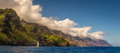
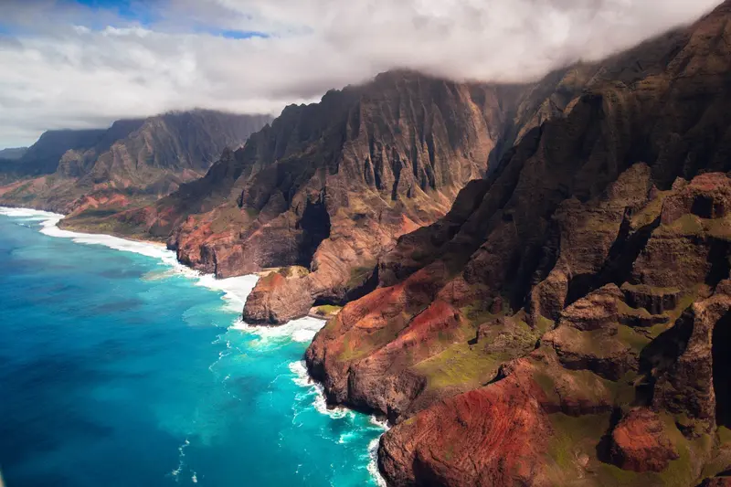
    Kauaʻi, the northernmost of the main Hawaiian Islands, is known for its landscapes: the Waimea Canyon, considered the Grand Canyon of the Pacific, and the roadless Nā Pali Coast in the northwest, which you can experience on foot, by boat…

    by Felix Gillen

    1. Home
    2. Destinations
    3. United States
    4. Hawaii
    5. Kauaʻi
    Kauaʻi, the northernmost of the main Hawaiian Islands, is known for its landscapes: the Waimea Canyon, considered the Grand Canyon of the Pacific, and the roadless Nā Pali Coast in the northwest, which you can experience on foot, by boat, or from the air. The Wailua is the islands' only navigable river.Following Hurricane Lowell in autumn 2026, many parks have reopened, but some trails and campgrounds remain closed. Before every outing, check Hawaii State Parks' advisories.
    United States travel guideRound trips in United StatesPlan a trip with Kauaʻi

    Contents

    • Places in the region
    • Culture
    • Getting around
    • Nearby

    Sights in Kauaʻi

    Discover the most important sights and attractions

    Waimea Canyon

    Frank Schulenburg / Wikimedia Commons / CC BY-SA 4.0, mod.

    Attraction

    Waimea Canyon

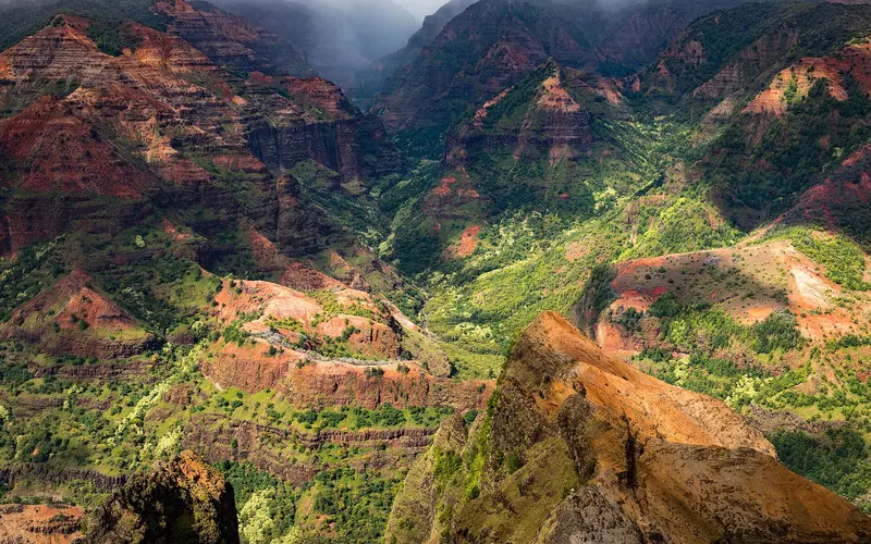
    The canyon in the west of the island is called the Grand Canyon of the Pacific: approximately 16 kilometers long, a good one and a half kilometers wide, and more than 1,000 meters deep. The Waimea Canyon Lookout is the first major viewpoint on the road up to Kōkeʻe. Following Hurricane Lowell, the State Park and its lookouts reopened on November 7, 2026, with limited service. Non-Hawaii residents pay $5 per person and $10 for parking.
    Open in Google Maps
    Park

    Kōkeʻe State Park

    The mountain park is located above the Waimea Canyon. As of November 7, 2026, viewpoints to Pihea are reopened, along with trails like Pihea, Nuʻalolo, Waimea Canyon Trail, Iliau Nature Loop, and the Awaʻawapuhi Trail's first mile. Still closed: campground, several trails. Lodge restaurant and museum open earliest late November.
    Open in Google Maps
    Park

    Hāʻena State Park and Kalalau Trail

    At the northern end of the road, the Kalalau Trail begins at Keʻe Beach along the roadless Nā-Pali Coast. Following Hurricane Lowell, the park reopened on October 15, 2026: Day hikes to Hanakāpīʻai Beach and Valley and to the Hanakāpīʻai Falls are possible; camping and the trail beyond the two-mile mark remain closed. Entry requires a reservation with Hawaii State Parks.
    Open in Google Maps
    Attraction

    Wailua River and Fern Grotto

    The Wailua is the only navigable river in the Hawaiian Islands. A few kilometers upstream lies the Fern Grotto, a lava rock amphitheater with hanging ferns, popular for Hawaiian weddings. As of late October 2026, only Smith's tour boats are permitted to visit the grotto; kayakers may use the river and landing, but the path to Uluwehi Falls is closed.
    Open in Google Maps
    Park

    Kīlauea Point National Wildlife Refuge

    At the northernmost point of the main Hawaiian Islands stands the 1913 lighthouse, surrounded by a seabird sanctuary. Open Wednesday to Saturday from 10 AM to 4 PM; visitors aged 16 and over require a reservation via recreation.gov. Admission: $10 US plus a $1 US fee. Guided tours inside the lighthouse are currently suspended, but the grounds and visitor center are accessible.
    Open in Google Maps
    Park

    Spouting Horn

    On the South Coast near Poʻipū, the sea shoots through a lava tube up to ten meters high into the air, most impressively at high tide and a strong south swell. The viewpoint is free; stay behind the railing, the rocks are slippery.
    Open in Google Maps

    Culture

    Taro and Old River ValleysTaro fields are cultivated to this day in the Hanalei River valley, which you can overlook from the Hanalei Valley Lookout. On the Wailua, the islands' sole navigable river, the Fern Grotto is a popular site for Hawaiian weddings.Protected NatureMany destinations in State Parks or protected areas have reservation requirements and visitor limits, including Hāʻena on the Nā Pali Coast or Kīlauea Point Bird Sanctuary with its 1913 lighthouse. Keep to paths and away from animals.

    Exploring Locally

    Rental Cars and Island LogisticsA road circles most of the island; the Nā-Pali Coast in the northwest is roadless. You can experience the coast on foot from Keʻe Beach, by boat, or from the air; summer is best for calm seas.After Hurricane Lowell (As of November 2026)Waimea Canyon and Kōkeʻe have been reopened since November 7, 2026; the campsite and some trails remain closed.Hāʻena has been open for day hikes up to Hanakāpīʻai since October 15, 2026; camping and the Kalalau Trail beyond the two-mile mark are closed.On the Wailua River, only Smith's tour boats are permitted to Fern Grotto; the Uluwehi Falls are closed.Before any outing, check the current Park Notices from Hawaii State Parks.ReservationsWaimea Canyon: $5 per person and $10 for parking for non-Hawaii residents.Kīlauea Point: Wednesday to Saturday, reservations required for ages 16 and up via recreation.gov.

    Nearby

    Honolulu

    Honolulu

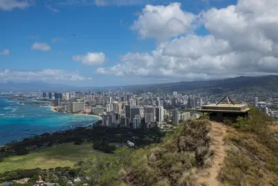
    Honolulu on the island of O‘ahu has been Hawaii's capital since 1845, first of the Kingdom, now of the US state, and has around 350,000 residents (2020 Census). You come for Waikīkī with its city beach in front of the volcanic cone Diamond Head (Lē‘ahi), for the Pearl Harbor Memorial, the ‘Iolani Palace and the Bishop Museum, and as a starting point for tours across O‘ahu to the North Shore.In Waikīkī, between the Ala Wai Canal and the Pacific, most of the island's hotels are located. West of it lie the Ala Moana shopping center, Kaka‘ako, Downtown with its government district, and Chinatown.Good to knowReservations: For Diamond Head (visitors without Hawaii residency), Hanauma Bay, and the USS Arizona Memorial in Pearl Harbor, you need advance tickets with a time slot. They are often quickly booked up.Climate: It's warm all year round; most rain falls from October to early April.Taxes: As of January 2026, the state transient accommodations tax is 11 percent, plus county tax, sales tax, and often resort fees.

    Stephen Leonardi·Pexels

    Hawaii

    Hawaii

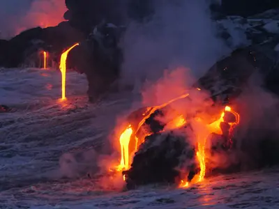
    Hawaii is an island chain in the Pacific, approximately 3,200 km southwest of the US mainland, and has been the 50th state since August 21, 1959. You travel here for the beaches, active volcanoes, and tropical sea cliffs, spread across several very distinct islands.Oʻahu is home to Honolulu, Waikīkī, and Pearl Harbor. Maui features Haleakalā and the Road to Hana, while Kauaʻi offers the Waimea Canyon and the Nā-Pali Coast. On the largest island, Hawaiʻi or Big Island, Maunakea rises more than 4,200 m above sea level.Two national parks protect volcanic landscapes: Hawaiʻi Volcanoes on Big Island, featuring Kīlauea and Mauna Loa, and Haleakalā on Maui, which is home to more endangered species than any other US national park. Kīlauea has been in a phase of recurring lava fountains in the Halemaʻumaʻu crater since December 2024; its 56th episode began on November 5, 2026.

    Christian Joudrey·CC0

    Maui

    Maui

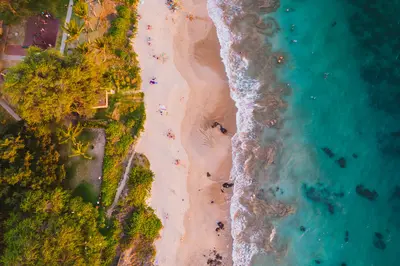
    Maui is Hawaii's second-largest island, stretching from the volcanic summit of Haleakalā at over 3,000 meters to the beaches of Kīhei, Wailea and Kāʻanapali. Between the two volcanic massifs lies the flat Central Valley with Kahului, home to the airport, and the older town of Wailuku. In the east, the Road to Hāna winds through rainforest and past waterfalls, while lavender and protea grow in the Upcountry highlands.Lahaina after the fireOn August 8, 2023, a wildfire destroyed the historic town of Lahaina on the west coast, killing more than 100 people. Rebuilding is underway. Since August 1, 2026, Front Street has been open to traffic again, while some side streets and the harbor are still construction sites. Stay out of fenced-off areas and off private property, and treat the town with respect. Maui County posts current updates at mauirecovers.org.Best time to visitMaui is warm year-round. From December to April, humpback whales come to calve in the shallow waters between Maui, Lānaʻi and Molokaʻi, and you often see them breaching from the shore. In winter, North Pacific swells bring big waves to the north coast. The north and east sides are wetter, the south and west drier and sunnier.SafetyMany beaches have no lifeguards, and currents and surf can be dangerous. Only go in where you can judge the conditions. For general safety and entry advice for the USA, see the UK Foreign Office (FCDO) travel advice.
    Michal Vaško·Pexels

    Big Island (Hawaiʻi)

    Big Island (Hawaiʻi)

    The island of Hawaiʻi, often called Big Island, is the archipelago's largest. Hawaiʻi Volcanoes National Park features the active volcanoes Kīlauea and Mauna Loa. To the north, Maunakea, over 4,200 meters tall, stands as Hawaii's highest point, with summit observatories.The Kona and Kohala west coast is dry and sunny, featuring cultural sites such as the Puʻuhonua o Hōnaunau Place of Refuge and Puʻukoholā Heiau temple. On the humid east side near Hilo, ʻAkaka Falls plunges through the rainforest.

    Marc Szeglat·Unsplash

    Trinidad

    Trinidad

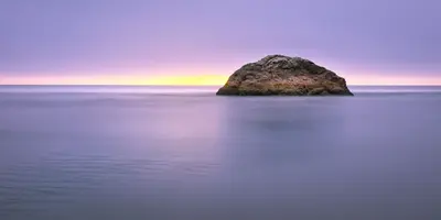
    Trinidad is a small harbor town of about 300 people on California's North Coast, right off US 101 about 15 miles north of Arcata. It's a quiet base for Redwood National and State Parks, whose old-growth groves start about 20 miles north, with a rocky coastline at your doorstep.The town sits on a bluff above a small bay sheltered by the headland of Trinidad Head. The harbor and pier are below, and gray whales pass offshore in winter and spring. There's a handful of restaurants, B&Bs and vacation rentals; for bigger grocery stores and more choice, head to Arcata or McKinleyville.Good to knowWeather: even in summer the coast is often foggy and cool. Pack a jacket.Drive times: the Kuchel Visitor Center near Orick is about half an hour away, the Prairie Creek Visitor Center about 40 minutes.

    Joey Kyber·Pexels

    Your next steps

    Kauaʻi is in United States. Ways to carry on from here.

    • More in United States

      Highlights, areas, routes and the best time to travel for all of United States.

      United States travel guide
    • Round trips in United States

      Ready-made routes through United States, with stops, nights and a map.

      See the routes
    • Plan a trip with Kauaʻi

      The Guide asks about season, length and who is coming, and suggests a trip with Kauaʻi.

      Plan the trip

    Sources & method

    • Photos: Wikimedia Commons, Pexels. Each photo carries its credit.
    • Place data such as addresses and ratings comes from Google Maps.
    • The content is based on web research from public, traceable sources. How the content is made · The role of AI