Fernweh: Home
    ExploreTravel GuidesPlan a tripMy tripLast visited
    de|en
    All Places & RegionsAll highlightsAbout FernwehFAQPrivacy PolicyImprint
    ExploreTravel GuidesPlan a tripMy tripLast visited
    • Neighborhoods & highlights
    • Eat & drink
    • Culture
    • Getting around
    • Accommodation
    • Plan trip
    • Nearby
    Trinidad
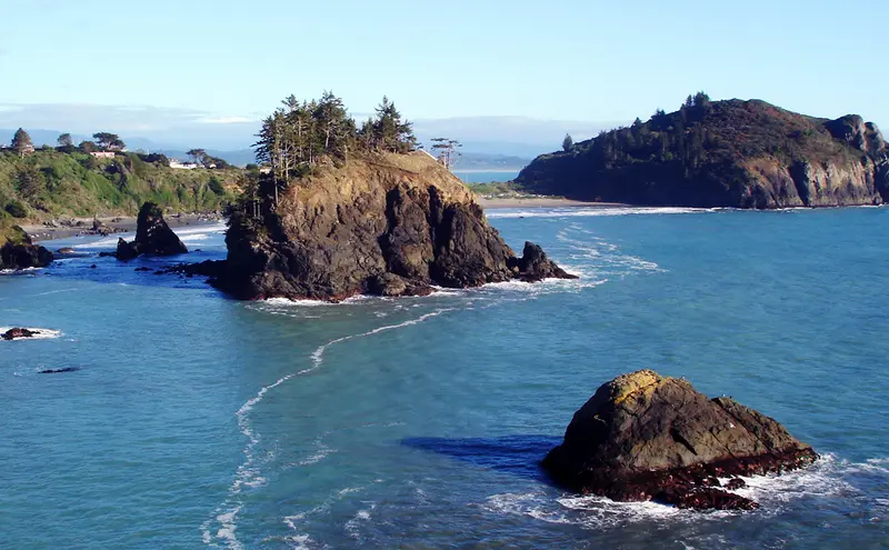
    Tony Webster / Wikimedia Commons / CC BY 2.0

    United States

    Trinidad

    City

    Trinidad is a small harbor town of about 300 people on California's North Coast, right off US 101 about 15 miles north of Arcata.

    by Felix Gillen

    1. Home
    2. Destinations
    3. United States
    4. California
    5. Trinidad
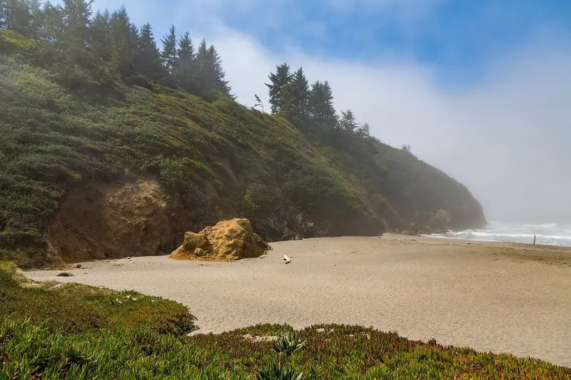
    Trinidad is a small harbor town of about 300 people on California's North Coast, right off US 101 about 15 miles north of Arcata. It's a quiet base for Redwood National and State Parks, whose old-growth groves start about 20 miles north, with a rocky coastline at your doorstep.The town sits on a bluff above a small bay sheltered by the headland of Trinidad Head. The harbor and pier are below, and gray whales pass offshore in winter and spring. There's a handful of restaurants, B&Bs and vacation rentals; for bigger grocery stores and more choice, head to Arcata or McKinleyville.Good to knowWeather: even in summer the coast is often foggy and cool. Pack a jacket.Drive times: the Kuchel Visitor Center near Orick is about half an hour away, the Prairie Creek Visitor Center about 40 minutes.

    Sights in Trinidad

    Discover the most important sights and attractions

    Trinidad Head
    Attraction

    1Trinidad Head

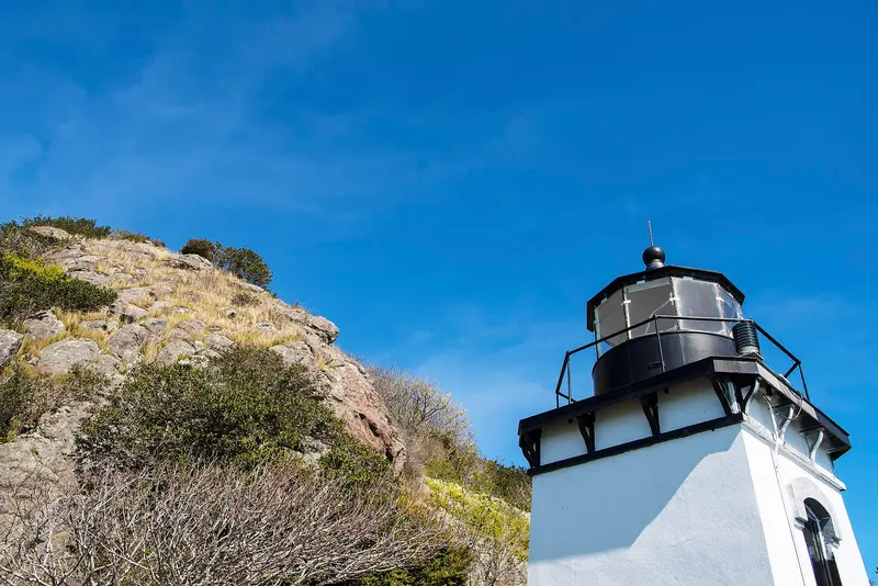
    The wooded headland closes off Trinidad Bay to the south. A 1.5-mile loop trail with about a 300-foot ascent leads from the parking lot at the end of Lighthouse Road (by the pier) around the summit, past the still-active 1871 lighthouse and viewpoints for sea lions, seabirds, and sea stacks. From December to January and March to April, you might be lucky enough to spot gray whales. In foggy conditions, visibility is often limited; it's better to go in the afternoon when it often clears. Allow about an hour.
    Open in Google Maps
    Sue-meg State Park (formerly Patrick's Point)
    Park

    2Sue-meg State Park (formerly Patrick's Point)

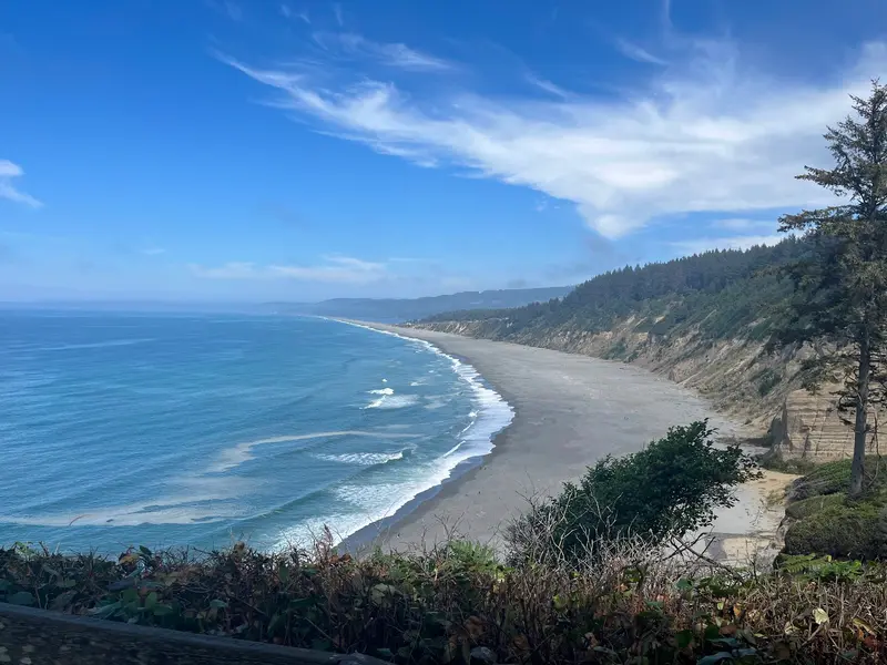
    Wooded headland just under six miles north of Trinidad on US 101, called Patrick's Point State Park until 2021. The approximately two-mile long Rim Trail follows the bluffs to viewpoints like Wedding Rock and Patrick's Point. To the north, a steep path leads down to Agate Beach, where you can collect agates at low tide. In the park is Sumêg, a reconstructed Yurok village with plank houses. The day-use entrance fee per car is paid at the entrance; current prices are on the park's website.
    Open in Google Maps
    Trinidad State Beach and College Cove
    Attraction

    3Trinidad State Beach and College Cove

    The beach between Trinidad Head and Elk Head, separated by the rocky Pewetole Island. You reach the South Cove from the parking lot at the end of Lighthouse Road; the quieter College Cove to the north via a short forest path from the Elk Head parking lot. Go best at low tide; the coves are safest then, and tide pools exposed. The water is cold for swimming, and the surf treacherous.
    Open in Google Maps

    Restaurants in Trinidad

    1

    Moonstone Grill

    Restaurant at 100 Moonstone Beach Road, three miles south of Trinidad, above Moonstone Beach. The menu features fish, seafood, and steaks; through large windows, you can enjoy sunset over the Pacific on clear days. OpenTable lists evenings Mon-Sat from 4 PM (Happy Hour till 6 PM), lunch Wed-Sat; Sundays closed. $31-50 per person. Reserve a window table.
    Show on Google Maps
    2

    Larrupin' Cafe

    Long-established restaurant on Patrick's Point Drive north of town, a North Coast institution since the 1980s. Sunset described it as a playful spot focusing on fish and seafood, also known for ribs and marinated Cornish game hens. Upscale, creative cuisine using regional ingredients, primarily for dinner. Reservations are recommended.
    Show on Google Maps
    3

    Seascape Restaurant

    A simple eatery at 1 Bay Street, right on the pier, with views of the bay and Trinidad Head. According to PlanetWare, freshly caught fish is served here daily, and breakfast is available in the mornings. Convenient before or after the loop around Trinidad Head, which starts right next door.
    Show on Google Maps

    History and culture

    Long before settlers arrived, the Yurok lived around the bay; their village of Tsurai, on the bluffs above Trinidad Bay, was occupied for thousands of years until 1916. It's now a protected landmark. You can visit a reconstructed Yurok village, Sumêg Village, in Sue-meg State Park, which took back its Yurok name in 2021.In 1850 American settlers arrived on the ship James R. Whitting and founded the town, which was incorporated as a city in 1870. With about 300 residents (2020 census), Trinidad is one of the smallest cities in California. The 1871 lighthouse on Trinidad Head still operates, and a replica stands above the harbor.

    Getting there and around

    Trinidad sits right on US 101, about 15 miles north of Arcata. Arcata-Eureka Airport (ACV) in McKinleyville is only about 8 miles away, with United Express flights to San Francisco, Los Angeles and Denver. You'll need a car for the redwood parks.To the redwood parksHead north on US 101 along the coast through Orick: the Thomas H. Kuchel Visitor Center is about half an hour away, and the Newton B. Drury Scenic Parkway and Prairie Creek Visitor Center about 40 minutes. For Jedediah Smith in the north, Crescent City is the better base.Traveling by RVThe town is tiny, the streets down to the pier and Lighthouse Road are narrow, and the harbor lots fill up on summer weekends. Leave a big rig at your campground on Patrick's Point Drive, which runs along the coast parallel to US 101 and leads to the campgrounds and Sue-meg State Park.
    Accommodations in Trinidad

    Find perfect stay in Trinidad

    Booking.com* (Affiliate link)
    Search Hotels
    Agoda* (Affiliate link)
    Search Hotels
    Airbnb
    Vacation Rentals

    * Affiliate link: if you book through it, we earn a small commission. The price stays the same for you.

    Campgrounds in Trinidad

    Find perfect campground in Trinidad

    Search via Google Maps
    Campgrounds nearby (15km)
    Camping.info
    Find Campgrounds
    Park4Night
    RV Parks & Camping

    Plan your trip to Trinidad

    Save places, build a route and plan your city trip, all in one place.

    1. 1
      Sunrise over alpine peaks and a sea of clouds
      1234

      Round trip

      12 days · 4 stops

      Saved

      Pick a route

      Pick a ready-made one or save places and plan your own.

      Open bookmarks
    2. 2

      Trip to Trinidad

      Live
      • 1Trinidad Head3 days
      • 2Sue-meg State Park (formerly Patrick's Point)4 days
      • 3Trinidad State Beach and College Cove5 days
      Budget

      Plan your trip

      The planner sorts stops, days and budget. Plan together in real time.

      Start trip planning
    3. 3
      9:41 No signal
      Trinidad
      Available offline

      Use it on the road

      Download the guide to your phone and use it on site, even offline.

    Nearby

    Redwood National and State Parks

    Redwood National and State Parks

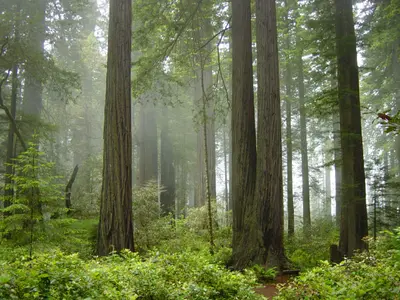
    On California's far north coast, Redwood National Park and three state parks, Jedediah Smith Redwoods, Del Norte Coast Redwoods and Prairie Creek Redwoods, together protect the tallest trees on Earth. The national park was created in 1968, the area became a UNESCO World Heritage Site in 1980, and since 1994 the National Park Service and California State Parks have managed it jointly.About 96 percent of the world's old-growth coast redwood forest has been logged; these parks hold roughly 45 percent of what's left. The tallest known tree, Hyperion, stands about 380 feet, and its location is deliberately kept secret and off-trail. Beyond the forests, the parks take in prairies with Roosevelt elk herds, rivers and about 37 miles of coastline.Good to knowFees: The national park is free, with no entrance stations, and the scenic drives through the state parks are free too. You only pay at some state park areas, such as $12 per vehicle for Gold Bluffs Beach and Fern Canyon (waived with an America the Beautiful pass).Permits: Fern Canyon requires a free parking permit in summer, and Tall Trees Grove a free permit year-round. Both are online only and released up to 24 hours ahead.Time: With about 200 miles of trails, four campgrounds and five visitor centers, the parks deserve two or three days, not just a quick stop off US 101.Summer often brings fog and cool temperatures under the trees. Pack a rain jacket whatever the season.
    Presidio, Marina & Lands End

    Presidio, Marina & Lands End

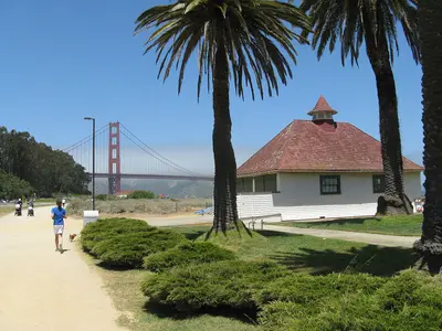
    The Presidio, the Marina and Lands End cover San Francisco's northwest corner, between the Golden Gate Bridge and the Pacific. This is where you spend time outdoors: on the beach at Crissy Field, on wooded trails in the Presidio and along the Lands End coastal trail with views of the Golden Gate.The Marina is an affluent waterfront neighborhood with the Palace of Fine Arts, the Fort Mason cultural center and Chestnut Street for restaurants and bars. Just west is the Presidio, an Army post from 1776 to 1994 and now part of the Golden Gate National Recreation Area, with museums in old barracks, the Tunnel Tops park and Fort Point under the bridge. Farthest west, the Lands End trail winds through cypress groves to the ruins of the Sutro Baths.Plan your day: Walk from the Palace of Fine Arts across Crissy Field to Fort Point (about 3 miles), then take the bus out to the Lands End Lookout.Weather: Fog and wind hit here first. Summer mornings are often gray, so bring a jacket.
    Fisherman's Wharf, North Beach & Chinatown

    Fisherman's Wharf, North Beach & Chinatown

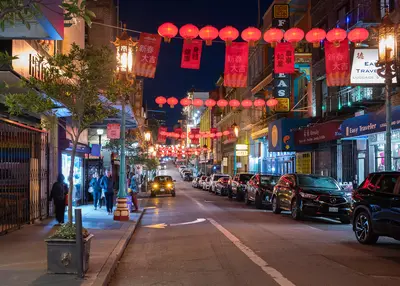
    Fisherman's Wharf, North Beach and Chinatown sit side by side in San Francisco's northeast corner, between the bayfront and the Financial District. On foot, you can work your way from Chinatown's dim sum bakeries through North Beach's espresso bars down to the piers in half a day.Chinatown starts at the Dragon Gate on Grant Avenue, the stretch of souvenir shops and restaurants. For everyday Chinatown, with produce stands and fish markets, walk one block over to Stockton Street. North Beach is the old Italian neighborhood around Columbus Avenue and Washington Square, full of pizzerias, delis and the bars where the Beat writers drank in the 1950s. Above it rises Telegraph Hill and Coit Tower. Fisherman's Wharf is the most touristy part of town: crab stands, T-shirt shops, Pier 39 and the Alcatraz ferry.Plan your day: Chinatown in the morning, lunch in North Beach, then up to Coit Tower in the afternoon and down to the Wharf. From the Dragon Gate to Pier 39 is about 1.5 miles.The Wharf: An hour is plenty for Pier 39 and the sea lions. You'll eat better in North Beach or Chinatown than at the waterfront places that live off foot traffic.
    Oregon

    Oregon

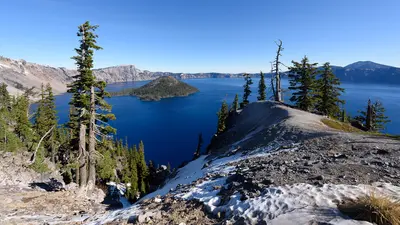
    Oregon runs along the Pacific between California and Washington, packing rugged coast, volcanoes, waterfalls, and Crater Lake, the deepest lake in the country, into a single road trip. Most trips start in Portland, the state's largest city.East of Portland, the Columbia River Gorge cuts inland between basalt cliffs, with Multnomah Falls on its south wall and Mount Hood, at 11,249 feet the state's highest peak, rising above it all. About 80 miles west is Cannon Beach and Haystack Rock, and down in the southern Cascades, Crater Lake fills the caldera of a volcano that collapsed some 7,700 years ago.South of Portland, the Willamette Valley is known for its Pinot Noir. July through September is the best window for a loop, when even the high country around Crater Lake is free of snow.
    Nob Hill, Russian Hill and Fillmore

    Nob Hill, Russian Hill and Fillmore

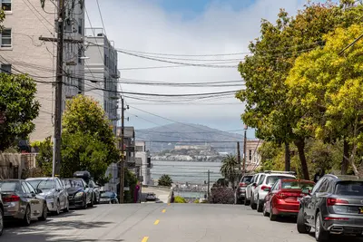
    Nob Hill, Russian Hill and the Fillmore are the hilltop neighborhoods west of Chinatown and North Beach: the railroad barons' grand hotels and cathedral on top, steep residential streets with stairways and gardens to the north, and Japantown and the old Fillmore Street jazz corridor to the west. Come for the cable cars, the views from the hills and Lombard Street, and stay for a drink at the Nob Hill hotel bars.Cable cars are the most practical way around here: the Powell-Hyde line climbs over Nob Hill to Lombard Street, and the California line crosses Nob Hill to Van Ness Avenue. Give Nob Hill and Russian Hill half a day, and save an afternoon for Japantown, Fillmore Street and Alamo Square with the Painted Ladies, a few blocks south.Nob Hill: Grace Cathedral, the Cable Car Museum, Huntington Park and the Fairmont and Mark Hopkins hotels.Russian Hill: Lombard Street, Macondray Lane and stairways with bay views.Japantown and the Fillmore: Japan Center and the Peace Pagoda, ramen and sushi, and on Fillmore Street, boutiques, restaurants and live jazz.The hills are seriously steep. If you're walking, allow extra time going up, and take the cable car or bus back.

    Sources & method

    • Photos: Wikimedia Commons, Google Maps. Each photo carries its credit.
    • Place data such as addresses and ratings comes from Google Maps.
    • The content is based on web research from public, traceable sources. How the content is made · The role of AI