Fernweh: Home
    ExploreTravel GuidesPlan a tripMy tripLast visited
    de|en
    All Places & RegionsAll highlightsAbout FernwehFAQPrivacy PolicyImprint
    ExploreTravel GuidesPlan a tripMy tripLast visited
    • Neighborhoods & highlights
    • Eat & drink
    • Food culture
    • Culture
    • Nightlife
    • Getting around
    • Accommodation
    • Plan trip
    • Nearby
    Presidio, Marina & Lands End
    Yair-haklai / Wikimedia Commons / CC BY-SA 4.0

    United States

    Presidio, Marina & Lands End

    City

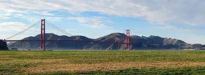
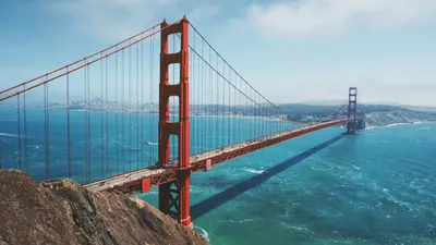
    The Presidio, the Marina and Lands End cover San Francisco's northwest corner, between the Golden Gate Bridge and the Pacific.

    by Felix Gillen

    1. Home
    2. Destinations
    3. United States
    4. San Francisco
    5. Presidio, Marina & Lands End
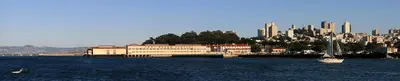
    The Presidio, the Marina and Lands End cover San Francisco's northwest corner, between the Golden Gate Bridge and the Pacific. This is where you spend time outdoors: on the beach at Crissy Field, on wooded trails in the Presidio and along the Lands End coastal trail with views of the Golden Gate.The Marina is an affluent waterfront neighborhood with the Palace of Fine Arts, the Fort Mason cultural center and Chestnut Street for restaurants and bars. Just west is the Presidio, an Army post from 1776 to 1994 and now part of the Golden Gate National Recreation Area, with museums in old barracks, the Tunnel Tops park and Fort Point under the bridge. Farthest west, the Lands End trail winds through cypress groves to the ruins of the Sutro Baths.Plan your day: Walk from the Palace of Fine Arts across Crissy Field to Fort Point (about 3 miles), then take the bus out to the Lands End Lookout.Weather: Fog and wind hit here first. Summer mornings are often gray, so bring a jacket.

    Sights in Presidio, Marina & Lands End

    Discover the most important sights and attractions

    Palace of Fine Arts
    Point of Interest

    1Palace of Fine Arts

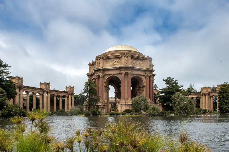
    Bernard Maybeck designed the rotunda with colonnades on a lagoon for the 1915 Panama-Pacific International Exposition; it's the only exhibition structure remaining on site. Built of wood and plaster, the structure decayed, was demolished in 1964, and rebuilt in concrete by 1974. The grounds are freely accessible; early mornings offer ideal light and tranquility. The rotunda also features in Hitchcock's "Vertigo".
    Open in Google Maps
    Crissy Field
    Park

    2Crissy Field

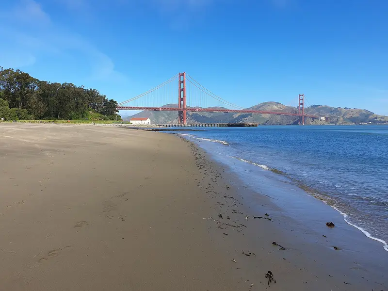
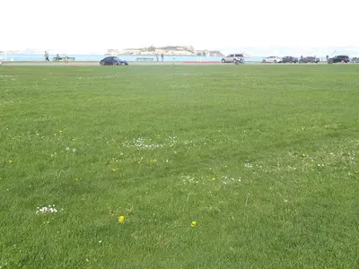
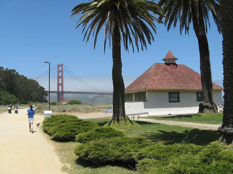
    The former army airfield on the north bank was transformed by 2001 into a park with a beach, dunes, and restored salt marsh. On the flat Golden Gate Promenade, you can walk or cycle with the bridge in sight, reaching the Warming Hut, a small café with a shop at the west end. From there, the path continues to Fort Point under the bridge. Wear a jacket; it's often windy by the water.
    Open in Google Maps
    Presidio Tunnel Tops
    Attraction

    3Presidio Tunnel Tops

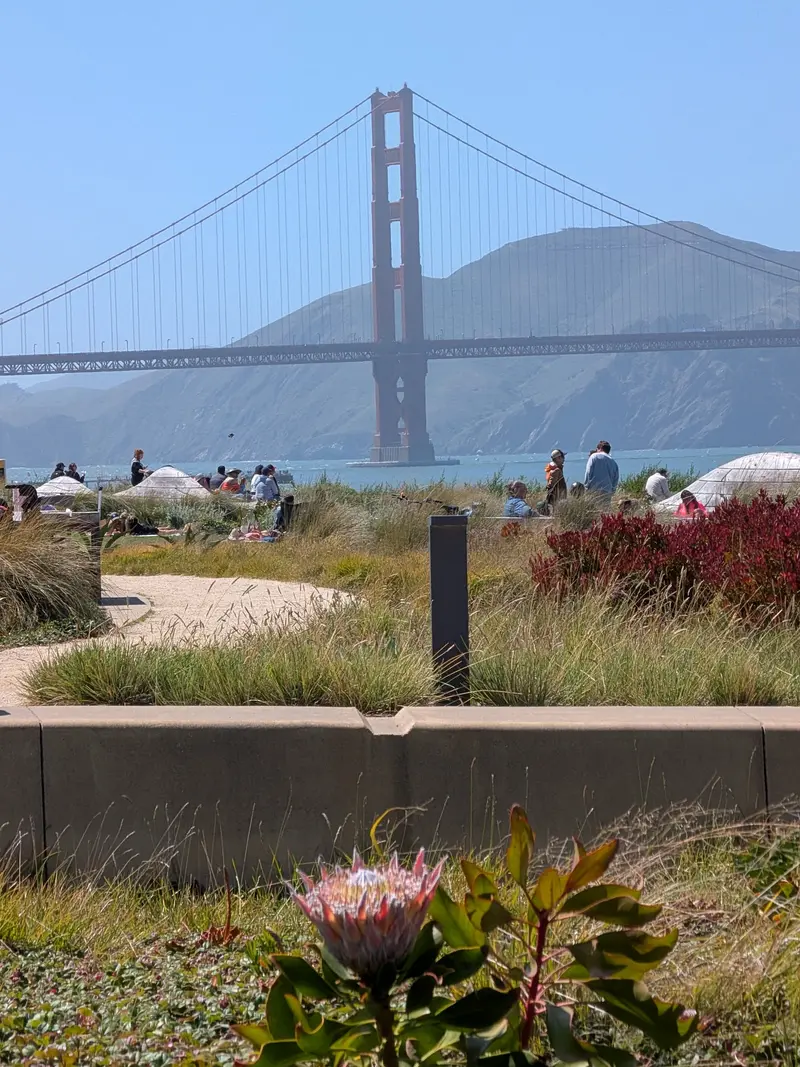
    The 5.7-hectare park, opened July 2022 on Golden Gate Bridge approach tunnels, was designed by the High Line team. From meadows, paths, and viewpoints, gaze over Crissy Field to the Bridge and Bay. 2025 sees Outpost Meadow added, with Café Il Parco at its edge. Admission is free. Reach it via the free PresidiGo Shuttle from Downtown (Drumm Street near Embarcadero).
    Open in Google Maps
    Fort Point
    Historic Landmark

    4Fort Point

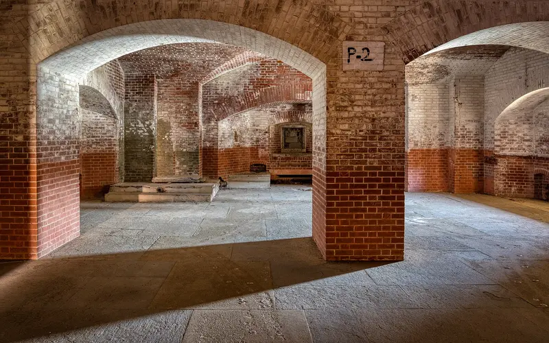
    The US Army built this brick fortress directly under the Golden Gate Bridge's south end from 1853, with first cannons by 1861. Bridge engineer Joseph Strauss curved the roadway over the fort instead of demolishing it. From the roof, you get an unusual upward view of the bridge's structure. Inside, according to NPS, it's open Thursday-Monday 10 AM-5 PM (roof until 4:30 PM), outdoor area daily. In "Vertigo," Kim Novak jumps into the bay here.
    Open in Google Maps
    Lands End and Sutro Baths
    Historic Landmark

    5Lands End and Sutro Baths

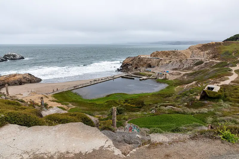
    In the far northwest of the city, the coastal trail from Lands End leads through cypress forest above the cliffs, with views of the Golden Gate and the Marin Headlands. At the south end lie the concrete remains of the Sutro Baths, an 1894 bathhouse with seven saltwater pools, which burned down in 1966. A good starting point is the Lands End Lookout Visitor Center from 2012 on Point Lobos Avenue. Access is free. Stay on the paths; the cliffs are steep and slippery.
    Open in Google Maps

    Restaurants in Presidio, Marina & Lands End

    1

    Greens Restaurant

    One of the oldest vegetarian restaurants in the USA, in Building A of Fort Mason, right on the water. Seasonal cuisine draws global influences, with large windows offering bay views. Evening reservations for a window seat are recommended.
    Show on Google Maps
    2

    A16

    Southern Italian restaurant at 2355 Chestnut Street, named after the highway that leads from Naples to Campania and Puglia. The menu features Neapolitan pizza, homemade pasta, and a long wine list with wines from Southern Italy. One of the Marina's most popular spots, reserve for the evening.
    Show on Google Maps
    3

    Lucca Delicatessen

    Italian delicatessen at 2120 Chestnut Street, in business since 1929. At the counter, you can get sandwiches filled with salami, mortadella, and provolone, plus there's cheese and wine. Ideal for grabbing something for a picnic at Marina Green or Crissy Field.
    Show on Google Maps

    Food and drink

    Waterfront picnic

    Waterfront picnic

    Grab sandwiches at a deli on Chestnut Street and eat on the Marina Green or the lawns at Crissy Field, with the Golden Gate Bridge in view.
    Vegetarian at Fort Mason

    Vegetarian at Fort Mason

    Greens at Fort Mason is a pioneer of vegetarian cooking in the U.S., with a seasonal menu built on Northern California produce.
    Coffee at the Warming Hut

    Coffee at the Warming Hut

    The little café at the west end of Crissy Field is the last stop before Fort Point, good for a hot coffee when the wind off the Golden Gate turns cold.

    Culture and history

    Spanish soldiers founded the Presidio in 1776 at the mouth of the bay. It became a Mexican and then, from 1846, a U.S. military post until the Army left in 1994 and the land joined the Golden Gate National Recreation Area.The 1915 world's fair: The Marina waterfront was built out for the Panama-Pacific International Exposition. Only the Palace of Fine Arts survives from it.Forts: Civil War-era Fort Point is a reminder of how strategic the Golden Gate once was.Sutro Baths: Entrepreneur and later mayor Adolph Sutro opened a bathhouse at Lands End in 1894, with seven pools at different temperatures. A fire destroyed what was left in 1966, and the ruins have been part of the national recreation area since 1973.

    Nightlife

    1

    The Interval at Long Now

    Café and bar of the Long Now Foundation in Fort Mason's Building A, right next to Greens. Coffee by day, cocktails and gin from a long bottle wall by night, plus exhibits and lectures from the foundation, dedicated to long-term thinking. Quieter than Chestnut Street bars.
    Show on Google Maps
    2

    California Wine Merchant

    Wine bar and wine shop at 2113 Chestnut Street, a fixture in the Marina for over 50 years. Sample wines by the glass from California and around the world, or buy a bottle to take home. A relaxed alternative to the louder bars on the street.
    Show on Google Maps

    Getting around the Presidio, Marina & Lands End

    The area is spread out. The waterfront is easy on foot or by bike; for the Presidio and Lands End, take the bus or the shuttle.PresidiGo shuttle: Free. The Downtown route runs about 25 minutes from Drumm Street (near Embarcadero BART) to the Presidio Transit Center, 6 a.m. to 7 p.m. on weekdays and 9 a.m. to 6 p.m. on weekends. The South Hills route loops through the park to Baker Beach and the overlooks.Muni: The 30 Stockton runs from SoMa through Union Square and North Beach, across the Marina to Crissy Field. The 28 is the only Muni line that stops at the Golden Gate Bridge toll plaza. For Lands End, buses run out along the Geary corridor; check a transit app for the best connection.On foot and by bike: The flat waterfront path from Fort Mason to Fort Point is about 3 miles, with the bridge ahead of you the whole way.Driving: The Presidio has paid parking; on weekends the lots at Crissy Field and Lands End fill early. Don't leave anything visible in the car.
    Accommodations in Presidio, Marina & Lands End

    Find perfect stay in Presidio, Marina & Lands End

    Booking.com* (Affiliate link)
    Search Hotels
    Agoda* (Affiliate link)
    Search Hotels
    Airbnb
    Vacation Rentals

    * Affiliate link: if you book through it, we earn a small commission. The price stays the same for you.

    Campgrounds in Presidio, Marina & Lands End

    Find perfect campground in Presidio, Marina & Lands End

    Search via Google Maps
    Campgrounds nearby (15km)
    Camping.info
    Find Campgrounds
    Park4Night
    RV Parks & Camping

    Plan your trip to Presidio, Marina & Lands End

    Save places, build a route and plan your city trip, all in one place.

    1. 1
      Sunrise over alpine peaks and a sea of clouds
      1234

      Round trip

      12 days · 4 stops

      Saved

      Pick a route

      Pick a ready-made one or save places and plan your own.

      Open bookmarks
    2. 2

      Trip to Presidio, Marina & Lands End

      Live
      • 1Palace of Fine Arts3 days
      • 2Crissy Field4 days
      • 3Presidio Tunnel Tops5 days
      Budget

      Plan your trip

      The planner sorts stops, days and budget. Plan together in real time.

      Start trip planning
    3. 3
      9:41 No signal
      Presidio, Marina & Lands End
      Available offline

      Use it on the road

      Download the guide to your phone and use it on site, even offline.

    Nearby

    Haight-Ashbury & Golden Gate Park

    Haight-Ashbury & Golden Gate Park

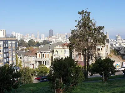
    Haight-Ashbury and Golden Gate Park sit on San Francisco's west side, where the old hippie neighborhood around Haight and Ashbury runs right into the park's eastern entrance. Come for Victorian houses, vintage clothing and record stores, then spend a full day in the park with its museums, gardens and lakes.Haight Street was ground zero for the 1967 Summer of Love and still trades on it: thrift stores, smoke shops, murals and street musicians. The side streets are lined with brightly painted Victorians. Golden Gate Park stretches about three miles from here to the Pacific. The de Young Museum, the California Academy of Sciences and the Japanese Tea Garden are clustered together on the east side; farther west it gets quieter, with lakes, meadows and the windmills at Ocean Beach.Time: A morning is enough for the Haight. Give the park a full day if you want to do two museums.Car-free: The eastern stretch of JFK Drive is closed to cars, so it's easy to explore on foot or by bike.
    Nob Hill, Russian Hill and Fillmore

    Nob Hill, Russian Hill and Fillmore

    Nob Hill, Russian Hill and the Fillmore are the hilltop neighborhoods west of Chinatown and North Beach: the railroad barons' grand hotels and cathedral on top, steep residential streets with stairways and gardens to the north, and Japantown and the old Fillmore Street jazz corridor to the west. Come for the cable cars, the views from the hills and Lombard Street, and stay for a drink at the Nob Hill hotel bars.Cable cars are the most practical way around here: the Powell-Hyde line climbs over Nob Hill to Lombard Street, and the California line crosses Nob Hill to Van Ness Avenue. Give Nob Hill and Russian Hill half a day, and save an afternoon for Japantown, Fillmore Street and Alamo Square with the Painted Ladies, a few blocks south.Nob Hill: Grace Cathedral, the Cable Car Museum, Huntington Park and the Fairmont and Mark Hopkins hotels.Russian Hill: Lombard Street, Macondray Lane and stairways with bay views.Japantown and the Fillmore: Japan Center and the Peace Pagoda, ramen and sushi, and on Fillmore Street, boutiques, restaurants and live jazz.The hills are seriously steep. If you're walking, allow extra time going up, and take the cable car or bus back.
    Fisherman's Wharf, North Beach & Chinatown

    Fisherman's Wharf, North Beach & Chinatown

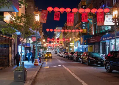
    Fisherman's Wharf, North Beach and Chinatown sit side by side in San Francisco's northeast corner, between the bayfront and the Financial District. On foot, you can work your way from Chinatown's dim sum bakeries through North Beach's espresso bars down to the piers in half a day.Chinatown starts at the Dragon Gate on Grant Avenue, the stretch of souvenir shops and restaurants. For everyday Chinatown, with produce stands and fish markets, walk one block over to Stockton Street. North Beach is the old Italian neighborhood around Columbus Avenue and Washington Square, full of pizzerias, delis and the bars where the Beat writers drank in the 1950s. Above it rises Telegraph Hill and Coit Tower. Fisherman's Wharf is the most touristy part of town: crab stands, T-shirt shops, Pier 39 and the Alcatraz ferry.Plan your day: Chinatown in the morning, lunch in North Beach, then up to Coit Tower in the afternoon and down to the Wharf. From the Dragon Gate to Pier 39 is about 1.5 miles.The Wharf: An hour is plenty for Pier 39 and the sea lions. You'll eat better in North Beach or Chinatown than at the waterfront places that live off foot traffic.
    San Francisco

    San Francisco

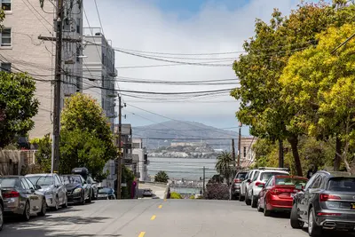
    San Francisco sits on the hilly northern tip of a peninsula in Northern California, between the Pacific and the Bay, with about 874,000 people. You come for the Golden Gate Bridge, the old prison on Alcatraz, cable cars clanking up steep hills and walkable neighborhoods like Chinatown and the Mission.Give it at least three full days: one for the waterfront from Fisherman's Wharf to the Ferry Building, one for Alcatraz and the Golden Gate Bridge, and one for Chinatown, North Beach, the Mission and Haight-Ashbury.The neighborhoods at a glanceFisherman's Wharf, North Beach & Chinatown: Piers and sea lions, the old Italian quarter and the oldest Chinatown in North America, all linked on foot.Union Square, SoMa & the Embarcadero: Downtown, with hotels, department stores, SFMOMA and the Ferry Building on the water.Nob Hill, Russian Hill & the Fillmore: Cable cars, Grace Cathedral and Lombard Street up on the hills, plus Japantown and the old Fillmore Street jazz corridor.Mission District & the Castro: Murals, taquerias, Dolores Park and the country's best-known gay neighborhood, often sunnier than the rest of town.Haight-Ashbury & Golden Gate Park: Hippie history, Victorian houses and the big park with its museums and Japanese Tea Garden.Presidio, Marina & Lands End: Beach, bayfront path and coastal trail around the Golden Gate Bridge.Book ahead: Alcatraz tickets are sold only through Alcatraz City Cruises, up to 90 days out. For summer, weekends and holiday weekends like Memorial Day or Labor Day, book early; walk-up spots are rare.Weather: Summer fog pours through the Golden Gate, and the waterfront gets cold and windy. Dress in layers and pack a jacket, even in July.Driving: You don't need a car downtown, and parking is expensive. Never leave anything visible in a parked car.
    Union Square, SoMa & the Embarcadero

    Union Square, SoMa & the Embarcadero

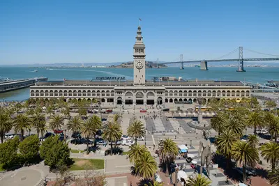
    Union Square, SoMa and the Embarcadero make up downtown San Francisco along Market Street, from the shopping district around Union Square to the Ferry Building on the bay. This is where many visitors stay, where BART and the cable cars stop, and where you'll find the big art museums and the waterfront farmers market.Union Square is the hotel and shopping district, with department stores and the cable car turnaround at Powell and Market. South of Market Street, SoMa has SFMOMA, Yerba Buena Gardens and Moscone Center by day and bars and clubs in old warehouses by night. The Embarcadero is the bayfront boulevard that replaced the elevated freeway torn down after 1989, now lined with palms, a bike path and the F-line's vintage streetcars. Its centerpiece is the 1898 Ferry Building.Plan your day: Hit the Saturday farmers market at the Ferry Building in the morning, walk along the water, then head up Market Street to SFMOMA.Heads-up: Between Union Square, Civic Center and the Tenderloin, the street scene can change within a few blocks. For current safety information, see the UK FCDO Travel Advice.

    Sources & method

    • Photos: Wikimedia Commons, Google Maps. Each photo carries its credit.
    • Place data such as addresses and ratings comes from Google Maps.
    • The content is based on web research from public, traceable sources. How the content is made · The role of AI